Tag Archives: Maps

Street View turns 15 with a new camera and fresh features

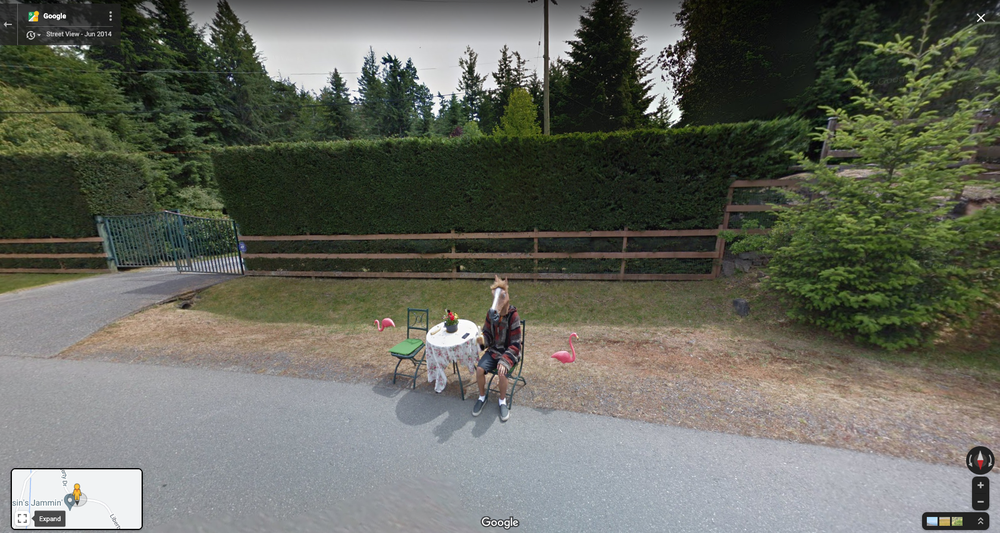
Fifteen years ago, Street View began as a far-fetched idea from Google co-founder Larry Page to build a 360-degree map of the entire world. Fast forward to today: There are now over 220 billion Street View images from over 100 countries and territories — a new milestone — allowing people to fully experience what it’s like to be in these places right from their phone or computer. And Street View doesn't just help you virtually explore, it’s also critical to our mapping efforts — letting you see the most up-to-date information about the world, while laying the foundation for a more immersive, intuitive map.

While that’s all worth celebrating, we aren’t stopping there. Today, we’re unveiling Street View’s newest camera, giving you more ways to explore historical imagery, and taking a closer look at how Street View is powering the future of Google Maps.

Bringing Street View to more places with our newest camera

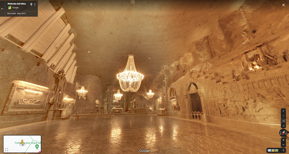
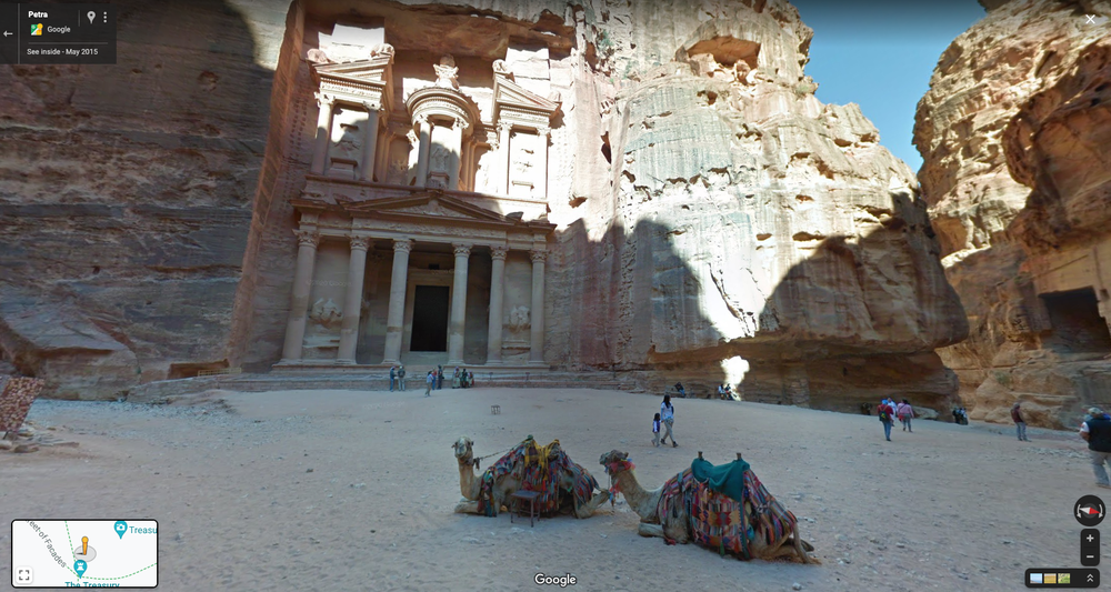
From the back of a camel in the Arabian desert to a snowmobile zipping through the Arctic, we’ve gotten creative with the ways we’ve used Street View cameras to capture imagery. And if there’s one thing we’ve learned, it’s that our world changes at lightning speed. Our hardware is one way we’re able to keep up with the pace.

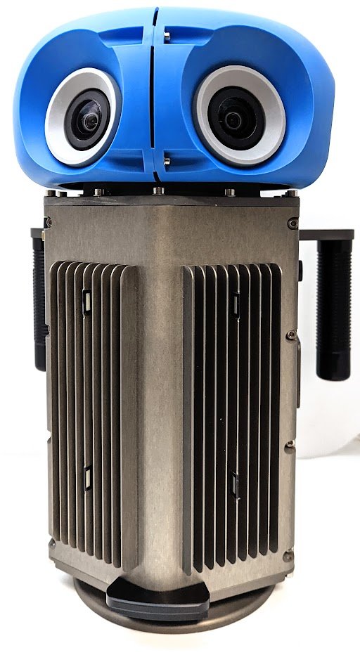
In addition to our Street View car and trekker, we’re piloting a new camera that will fully roll out next year to help us collect high-quality images in more places. This new camera takes all the power, resolution and processing capabilities that we’ve built into an entire Street View car, and shrinks it down into an ultra-transportable camera system that’s roughly the size of a house cat. But unlike house cats, it’s ready to be taken to remote islands, up to the tops of mountains or on a stroll through your local town square.

Street View’s newest camera featuring a blue top and two camera lenses and a metallic bottom with vents

Here’s a quick look at our new camera system:

  • It weighs less than 15 pounds. This means it can be shipped anywhere. This is especially handy when we work with partners around the world to capture imagery of traditionally under-mapped areas — like the Amazon jungle.
  • It’s extremely customizable. Previously, we needed to create an entirely new camera system whenever we wanted to collect different types of imagery. But now, we can add on to this modular camera with components like lidar — laser scanners — to collect imagery with even more helpful details, like lane markings or potholes. We can add these features when we need them, and remove them when we don’t.
  • It can fit on any car. Our new camera can be attached to any vehicle with a roof rack and operated right from a mobile device — no need for a specialized car or complex processing equipment. This flexibility will make collections easier for partners all over the world, and allow us to explore more sustainable solutions for our current fleet of cars — like plug-in hybrids or fully electric vehicles. You’ll start seeing our new camera in fun Google colors alongside our iconic Street View cars and trekkers next year.

Traveling back in time with Street View ?️

Street View is all about capturing the world as it changes, and it’s also a powerful way to reminisce about the past. Starting today on Android and iOS globally, it’s now easier than ever to travel back in time right from your phone. Here’s how it works:

When you’re viewing Street View imagery of a place, tap anywhere on the photo to see information about the location. Then tap "See more dates" to see the historical imagery we’ve published of that place, dating back to when Street View launched in 2007. Browse each of the images to see a digital time capsule that shows how a place has changed — like how the Vessel in New York City’s Hudson Yards grew from the ground up.

A gif of a mobile phone scrolling through historical Street View imagery of The Vessel in New York on Google Maps

Building a more helpful, immersive map ?️

Street View is also an essential part of how we map the world. Here’s a look at how imagery helps us do that:

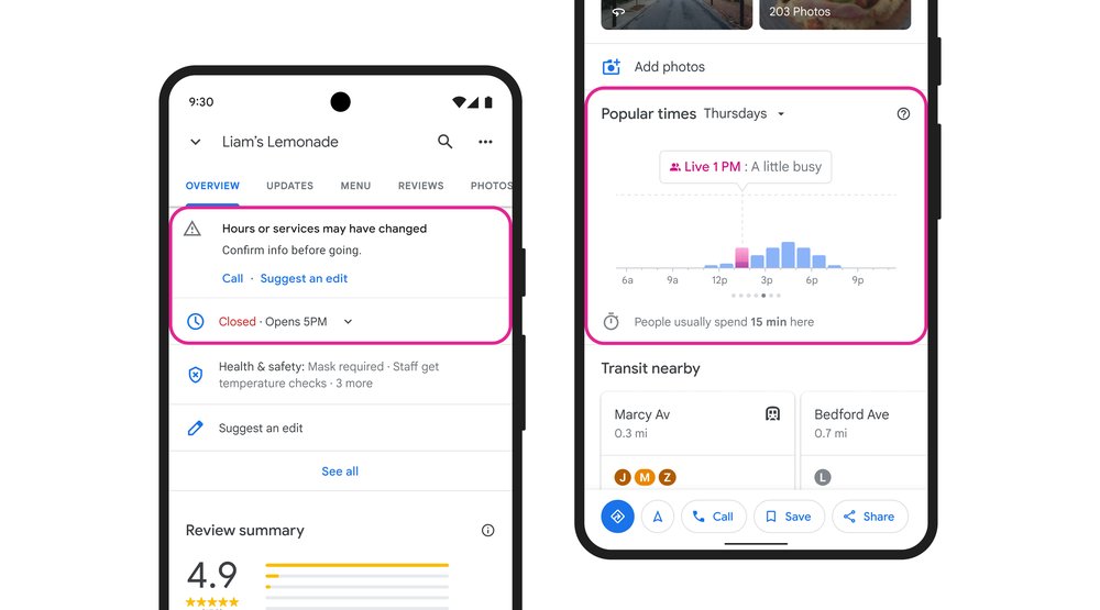
  • Updates to business information that reflect your changing world. We use Street View imagery coupled with AI to make helpful updates to Google Maps — such as adding newly opened businesses, surfacing new hours at your favorite restaurants and updating speed limit information. In fact, over the last three years, AI has helped us make over 25 billion updates to Maps so you can be confident that the information you’re seeing is as fresh and up-to-date as possible.
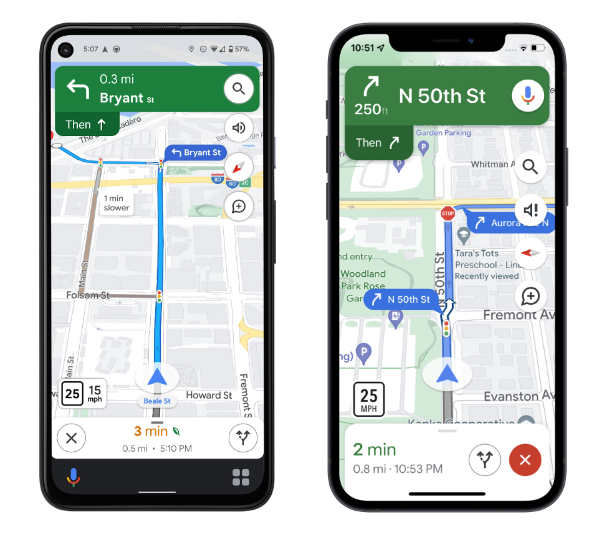
  • Easier than ever navigation, indoors and out. Street View imagery powers popular features like Live View, which allows you to use your phone’s camera to overlay navigation instructions on top of the real world so you can walk to your destination in a snap.
  • Immersive view helps you know before you go. Thanks to advances in computer vision and AI over the last several years, we’re able to fuse together billions of Street View and aerial images to create a rich, digital model of places around the world. With our new immersive view launching later this year, you can easily glide down to street level on Maps and even check out the inside of a business as if you were walking around.

In celebration of Street View’s birthday, you’ll have the opportunity to make your navigation icon a celebratory Street View car – just tap the chevron when you’re in driving navigation. And on desktop, our beloved Pegman – who you can pick up and drop anywhere in Maps to see Street View – will be dressed up in a birthday hat and balloons for the celebration.

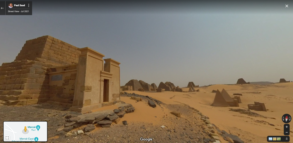
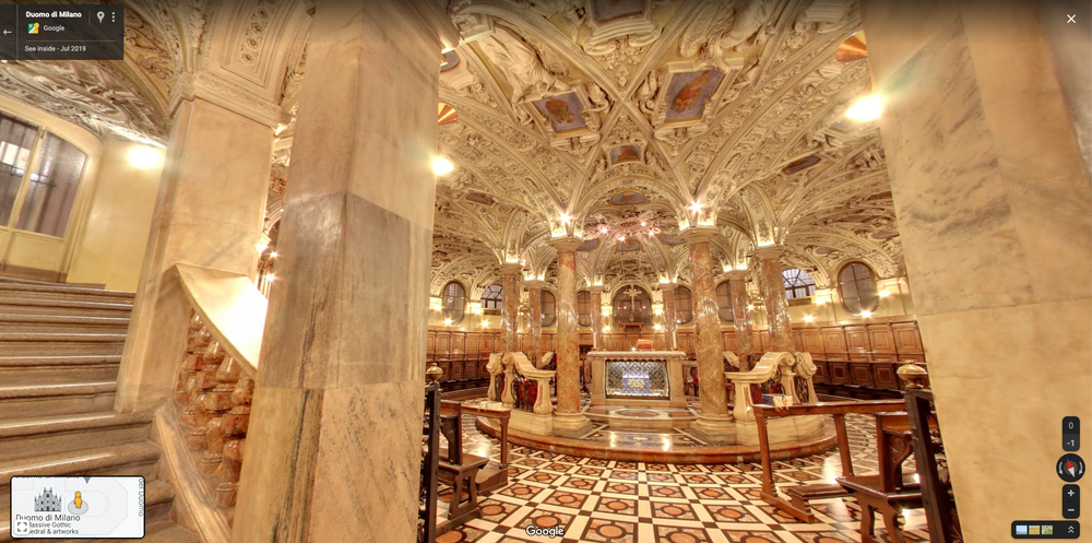
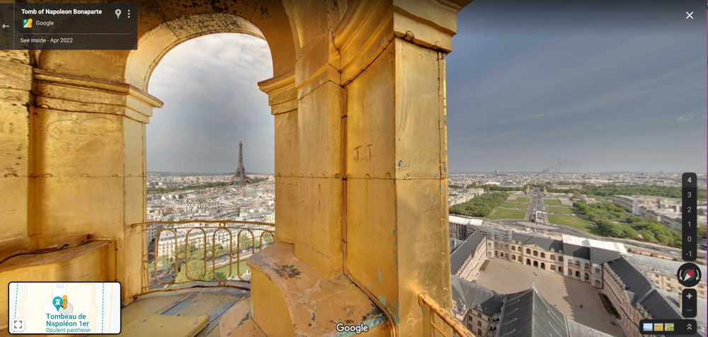
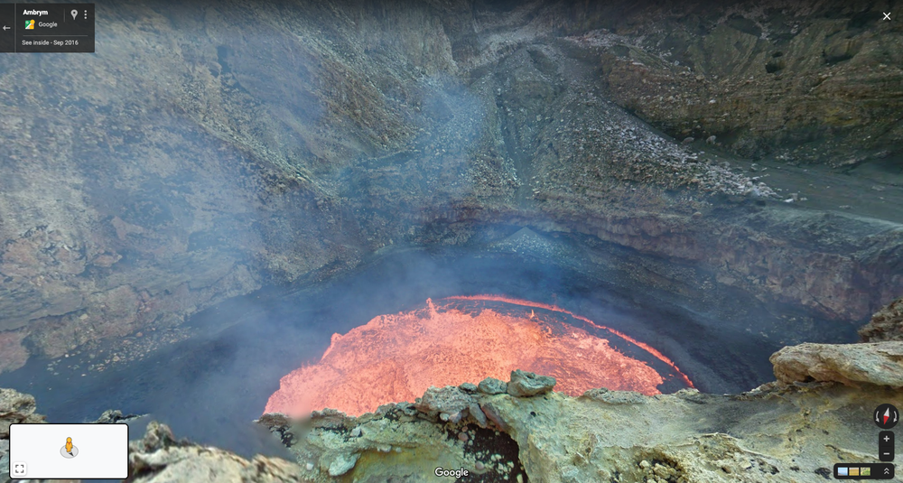
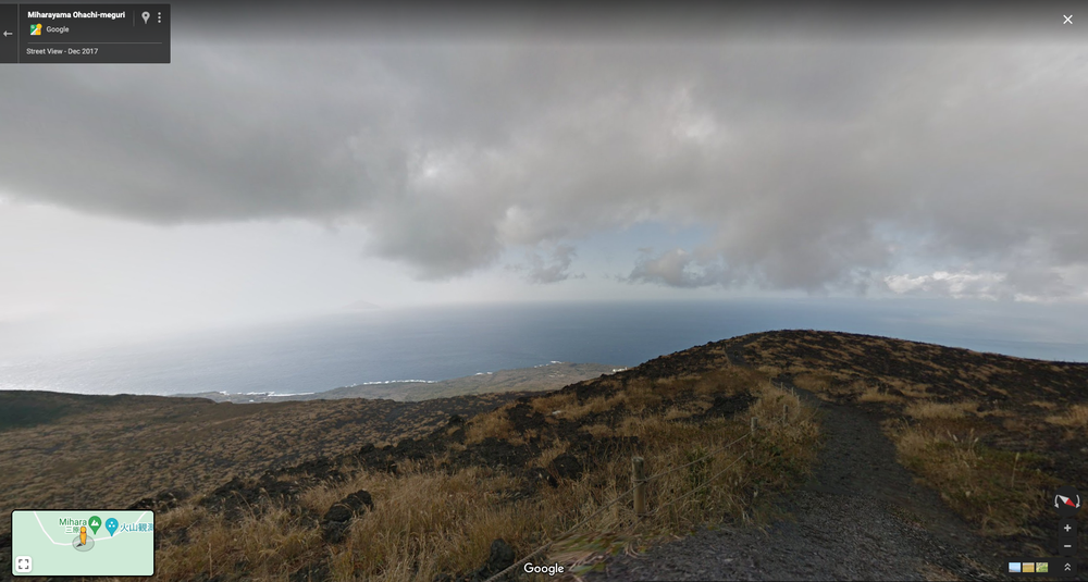
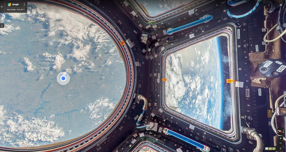
To keep the celebration going, check out our newest collections of places like The Pyramids of Meroë in Sudan and Les Invalides in France, popular spots to explore with Street View and some of our all-time favorite Street View images to date. Oh the places you’ll go! ?

HBD to us! Let’s celebrate with Street View adventures

Street View is turning 15, and the birthday nostalgia is hitting us hard.

In 2007, we published our first Street View images of San Francisco, New York, Las Vegas, Miami and Denver. Since then, Street View cars equipped with cameras have captured and shared more than 220 billion Street View images and mapped 10 million miles — the equivalent of circling the globe more than 400 times! We’ve also captured Street View imagery inside cultural landmarks, high up in space and deep under the ocean.

To celebrate Street View’s 15th birthday, we’re sharing 15 amazing Street View collections — including three places the world’s been loving lately, four new collections (consider this our party favor to you), and Street View images that make us feel some kind of way. So raise your glasses — er, cursors — and let's cheers to exploring the world together.

Where you’ve been exploring and new places to go

With so many places and landmarks at your fingertips, three spots in particular piqued your interest over the past year. Here are the three most popular places to explore on Street View: head up to the 154th floor of the Burj Khalifa in the United Arab Emirates, which was named the world’s tallest building; the iconic Eiffel Tower in France, complete with dazzling views of Paris from the top; and our special collection of imagery from the Taj Mahal in India.

And for your next Street View excursions, we’ve started rolling out four new collections that we think will become all-time favorites.

A Street View image of the Pyramids of Meroë in Sudan

The Pyramids of Meroë in Sudan: Thanks to new panoramic imagery, explore the ancient pyramids that are home to tombs of the kings and queens of the Kushite Kingdom.

A Street View image of the Crypt in the Duomo in Milan

The Duomo in Milan: The Duomo is the largest cathedral in Italy and the third-largest cathedral in Europe. Not to mention, it boasts one of the best views of Milan. We’ve been working with Google Arts & Culture and the Duomo of Milan since 2019 to bring imagery from inside the Duomo to Street View so that everyone can get a behind-the-scenes look at this architectural and cultural gem — and it’s now live!

A Street View image of Paris from Les Invalides’ golden dome

Les Invalides in Paris: Before the Eiffel Tower, Les Invalides’ golden dome was the highest point in Paris. New images of the historic Hôtel des Invalides buildings let you explore its museums and monuments. Learn more about French military history viaa virtual tour.

Sydney Ferries in Australia: The iconic Sydney Ferries will soon be digitally preserved as a result of our work with Transport for New South Wales and Transdev. Later this year, we’ll bring this collection onto Street View so that people around the world can take a virtual tour of Sydney Ferries and get a glimpse of the journey along Sydney’s stunning harbor.

8 Street View images we love

With endless places to explore, it’s difficult to pick favorites — really, you should have seen the list we narrowed this down from — but we gave it our best shot. Here are eight Street View images we love.

Street View image of the active Ambrym Volcano Marum Crater

Does the thought of visiting an active volcano scare you? Us too! A New Zealand-based Googler took a trekker into the active Ambrym Volcano Marum Crater in Vanuatu so you don’t have to.

Street View image of a Greek town next to the ocean

Monemvasia is a Greek town that’s name is derived from two Greek words meaning “single entry.” Fittingly, there is only one way into this rock fortress. Explore the town on Street View without the headache of getting there.

Street View image of an empty chamber with a large chandelier

The Wieliczka Salt Mine in Poland is a UNESCO site with a chamber where all decorative elements are made of salt.

Street View image of a grassy hill overlooking the ocean

Calling all scary movie buffs! Can you guess which 1998 horror film this active volcano in Japan served as a backdrop for? (Hint: the title rhymes with “The Wing.”)

Street View image of two camels in front of a castle in the rocks

Does Petra, Jordan look familiar? How about here? The filming location has made cameos in a number of movies, including “Aladdin,” “The Mummy Returns,” “Indiana Jones and the Last Crusade” and “Transformers: Revenge of the Fallen.”

Street View image inside the International Space Station looking down at Earth.

Thanks to a collaboration with NASA, Street Viewers can get a taste of what it’s like to be an astronaut. Ditch the gravity and float through the International Space Station.

Street View image of sea lions swimming underwater.

Dive into the Pacific Ocean and swim with sea lions off the shore of the Galapagos Islands.

Street View image of a  person in a horse mask eating a banana next to a table on the side of the road

And if there’s one Street View image that lives in our heads rent free… it's this horse eating a banana on the side of the road in Canada.

We’re proud of the work we’ve done to capture so much of the world’s wonder, history and quirkiness in Street View. But we’d be remiss if we didn’t give a shout out to all of the Maps users around the world who have captured and shared their own Street View imagery. To help make exploring the world together even easier, we’re launching Street View Studio — a new platform with all the tools you need to publish 360 image sequences quickly and in bulk. Check out more ways we’re advancing Street View so we can explore together for another 15 years.

Step into the Meroë pyramids with Google

When you think of pyramids does your mind wander to the Pyramids of Giza in Egypt or the Mayan Temples of Guatemala? Great civilizations built each of these pyramids and inscribed their stories onto the walls of them, offering glimpses into their daily life.

The Pyramids of Meroë in Sudan, while lesser known, are no different. Today, you can explore these stunning pyramids, which are a UNESCO World Heritage site, on Google Arts & Culture.

Over 200 pyramids were constructed in Meroë, the third and final capital of the Kushite Kingdom, an ancient African civilization that ruled the lands of Nubia for over 3000 years. Now you can take a virtual walk through the Pyramids of Meroë and explore the inscriptions using Street View’s panoramic imagery. You can also learn more about the Kushite Kingdom, their royalty and the architecture behind the pyramids in an immersive web experience that’s available in a range of languages including Arabic, English, French, German and Spanish.

If you want to get even more up close and personal, you can visualize the pyramids using augmented reality — no matter where you are. You can also listen to acclaimed Sudanese-American poet Emi Mahmood share evocative rhymes that are a beautiful ode to her homeland and to this project that shares Sudan’s rich heritage with others.

We’ve also partnered with the United Nations Economic and Social Council (UNESCO) to bring you more information about Meroë, Gebel Barkal and Napatan region and Sudan’s Sanganeb Marine National Park.

Immersive view coming soon to Maps — plus more updates

Google Maps helps over one billion people navigate and explore. And over the past few years, our investments in AI have supercharged the ability to bring you the most helpful information about the real world, including when a business is open and how crowded your bus is. Today at Google I/O, we announced new ways the latest advancements in AI are transforming Google Maps — helping you explore with an all-new immersive view of the world, find the most fuel-efficient route, and use the magic of Live View in your favorite third-party apps.

A more immersive, intuitive map

Google Maps first launched to help people navigate to their destinations. Since then, it’s evolved to become much more — it’s a handy companion when you need to find the perfect restaurant or get information about a local business. Today — thanks to advances in computer vision and AI that allow us to fuse together billions of Street View and aerial images to create a rich, digital model of the world — we’re introducing a whole new way to explore with Maps. With our new immersive view, you’ll be able to experience what a neighborhood, landmark, restaurant or popular venue is like — and even feel like you’re right there before you ever set foot inside. So whether you’re traveling somewhere new or scoping out hidden local gems, immersive view will help you make the most informed decisions before you go.

Say you’re planning a trip to London and want to figure out the best sights to see and places to eat. With a quick search, you can virtually soar over Westminster to see the neighborhood and stunning architecture of places, like Big Ben, up close. With Google Maps’ helpful information layered on top, you can use the time slider to check out what the area looks like at different times of day and in various weather conditions, and see where the busy spots are. Looking for a spot for lunch? Glide down to street level to explore nearby restaurants and see helpful information, like live busyness and nearby traffic. You can even look inside them to quickly get a feel for the vibe of the place before you book your reservation.

The best part? Immersive view will work on just about any phone and device. It starts rolling out in Los Angeles, London, New York, San Francisco and Tokyo later this year with more cities coming soon.

Immersive view lets you explore and understand the vibe of a place before you go

An update on eco-friendly routing

In addition to making places easier to explore, we want to help you get there more sustainably. We recently launched eco-friendly routing in the U.S. and Canada, which lets you see and choose the most fuel-efficient route when looking for driving directions — helping you save money on gas. Since then, people have used it to travel 86 billion miles, saving more than an estimated half a million metric tons of carbon emissions — equivalent to taking 100,000 cars off the road. We’re on track to double this amount as we expand to more places, like Europe.

Still image of eco-friendly routing on Google Maps

Eco-friendly routing has helped save more than an estimated half a million metric tons of carbon emissions

The magic of Live View — now in your favorite apps

Live View helps you find your way when walking around, using AR to display helpful arrows and directions right on top of your world. It's especially helpful when navigating tricky indoor areas, like airports, malls and train stations. Thanks to our AI-based technology called global localization, Google Maps can point you where you need to go in a matter of seconds. As part of our efforts to bring the helpfulness of Google Maps to more places, we’re now making this technology available to developers at no cost with the new ARCore Geospatial API.

Developers are already using the API to make apps that are even more useful and provide an easy way to interact with both the digital and physical worlds at once. Shared electric vehicle company Lime is piloting the API in London, Paris, Tel Aviv, Madrid, San Diego, and Bordeaux to help riders park their e-bikes and e-scooters responsibly and out of pedestrians’ right of way. Telstra and Accenture are using it to help sports fans and concertgoers find their seats, concession stands and restrooms at Marvel Stadium in Melbourne. DOCOMO and Curiosity are building a new game that lets you fend off virtual dragons with robot companions in front of iconic Tokyo landmarks, like the Tokyo Tower. The new Geospatial API is available now to ARCore developers, wherever Street View is available.

DOCOMO and Curiosity game showing an AR dragon, alien and spaceship interacting on top of a real-world image, powered by the ARCore Geospatial API.

Live View technology is now available to ARCore developers around the world

AI will continue to play a critical role in making Google Maps the most comprehensive and helpful map possible for people everywhere.

Road tripping on Route 66

Ninety-six years ago on April 30th, one of the original highways in the U.S. Highway System was assigned its numerical designation of 66, creating what we know today as Route 66. But to say Route 66 is just a highway is a grave understatement. After all, it is the most-searched U.S. highway of all time.

One of the perks of working as a Doodler (I promise, it’s a real job) was getting to drive the 2,448-mile journey from Chicago to Los Angeles in my ‘72 Chevelle. I got to experience this captivating road trip firsthand, to create a Doodle celebrating Route 66.

This Doodle, which is essentially an animated sketchbook of various historic spots along the route, is the product of more than 100 paintings and sketches I created from the side of the road and countless U-turns. I remember being utterly lost one day, driving further and further down an old dirt road, when I finally saw an old man sitting on a lawn mower. “Is this Route 66?” I enquired. “Boy, this isn’t even Route 6!” he responded. Even the dead ends were interesting.

If this Doodle has you feeling inspired to take a trip across Route 66, we also caught up with a member of Google Maps’ Local Guides community who has some tips of his own to help you hit the road and explore.

Local tips from a Local Guide

Rhys Martin is a Level 6 Local Guide from Tulsa, Oklahoma who also serves as the President of the Oklahoma Route 66 Association. Having driven all 2,400 miles of the existing route, Rhys is passionate about adding photos and reviews to Google Maps that help raise awareness for the variety of experiences — from big cities and rural communities, to farmland, mountains, deserts, mom-and-pop motels and kitschy roadside attractions — a road trip down the historic highway provides. We asked him to share his best tips, tricks and recommendations to discover and experience his favorite spots along the route.

  • Discover local businesses along the route: By searching for something like “U.S Route 66 Restaurants” on Google Maps you can virtually explore restaurants or other businesses across all eight states along the route. This way, you can familiarize yourself with attractions, view how much certain restaurants cost, read reviews and even see popular menu items to help you choose places you want to visit.
  • Plan your road trip with Lists in Google Maps: Once you discover the places you’re interested in visiting, save them to a list that can serve as an itinerary so you can support local businesses — and help preserve history – along the route. You can even share your list with others, or make them collaborative so you can plan together!
  • A picture is worth a thousand words: Photographing the details of a place — like the decades-old neon signage or the original menus hanging behind the counter — and sharing them through reviews on Google Maps helps capture the essence of an establishment and helps others discover places they want to visit.

While Oklahoma has the most drivable miles of Route 66, Rhys says there’s so much to see in all eight states along the route. If you’re itching to plan the perfect summer road trip, check out a list of his must-see spots across Route 66 from Illinois to California.

Ease back into your office routine with Google

As many people start returning to the office, we know there’s a lot to (re)figure out — like what to wear on the first day back, how long your commute will take and how to stay productive. So we’re sharing some tips for getting back into the office groove with a little help from Google products.

Rebuild a routine

Google Assistant Routines can help you automate tasks so you have less to do and think about before you head to work. Just say "Hey Google, good morning" and your Assistant can share news, weather or traffic updates, tell you what’s on your calendar, and even get your smart coffee maker started on your morning brew. You can create a Routine based on a specific schedule or when the sun rises or sets every day.

Commute with confidence

Whether you usually hop on public transit, get behind the wheel or hit the pavement, your commute may have changed since the pandemic — or, like me, you might have just forgotten how long it takes. Check Google Maps to find the ideal time to commute and the greenest route for an eco-friendlier way to get to work.

Trying to get to the office by a certain time? Set the time you’re departing or want to arrive by to see how long it’ll take you to get to your destination (and to avoid getting stuck in traffic). The “Leave on Time” feature in Google Assistant Routines can also remind you when to leave, giving you the extra nudge to head out the door.

Find your new food spot

Once you get there, Google Maps can help you find the best (and most efficient) lunch options near your office.

Use Maps’ popular times and live busyness information to see when restaurants are most crowded and which spots are likely to seat you immediately. To save even more time, you can also scan popular dishes and photos on the restaurant’s Business Profile in advance.

If you’re getting takeout, no need to miss a meeting waiting around for your delivery in your office lobby or at the restaurant. Live takeout and delivery status information lets you see the expected wait time, delivery fee and status of your order right from the Maps app — so you can make the most of your workday.

A phone screen shows the arrival time of a food delivery for a restaurant through Google Maps.

Style comfortably

Heading back to the office but not ready to dust off your work clothes? You’re not alone. In fact, “how to style sweatpants” and “work-appropriate leggings” have both been trending on Google.

Search on Google Shopping and filter by style, like joggers or leggings, to find your own office-ready sweats. Pair that with “comfortable shoes for work,” currently the most-searched shoe query, and you’ll find the perfect blend of your work-from-home and office styles.

Meanwhile, this season’s hottest work accessories are right at your fingertips. Nails are in the top-five fashion searches for back-to-the-office shopping. Check out the manicure options yourself on Google Shopping.

How AI and imagery build a self-updating map

Building a map is complex, and keeping it up-to-date is even more challenging. Think about how often your city, town or neighborhood changes on a day-to-day basis. Businesses and shops open and close, stretches of highway are added, and roadways change. In today’s Maps 101 installment, we’ll dive into two ways Google Maps uses advancements in AI and imagery to help you see the latest information about the world around you every single day.

Automatically updating business hours

Over the past few years, businesses have experienced a lot of change — including constantly updating operating hours based on changing pandemic-related restrictions. To keep up with this pace of change, we developed a machine learning model that automatically identifies if business hours are likely wrong, then instantly updates them with AI-generated predictions.

Let’s look at Liam’s Lemonade Shop as an example. To start, our systems consider multiple factors — such as when Liam last updated their business profile, what we know about other shops' hours, and the Popular Times information for the shop, which uses location trends to show when it tends to be busiest. Since it appears that Liam’s business profile hasn’t been updated in over a year and its busiest hours are typically Thursday afternoons — even though Google Maps says that it's closed at that time — Liam’s business hours are likely out of date.

Still images of a business' hours and Popular Times information on Google Maps

To see if business hours need updating, we check a store’s Popular Times information and when its business profile was last updated.

So what’s next? Our algorithms analyze the business hours of other nearby lemonade shops, information from Liam’s website, and Street View images of Liam’s storefront that look specifically for business hour signs to determine the most accurate business hour prediction. At the same time, we enlist the help of the Google Maps community — including Local Guides and even the business owners themselves through their Google Business Profile — to verify the information we predicted. In Argentina, Australia, Chile, France, Japan, Mexico, New Zealand, Peru, and the United States, we also use Duplex conversational technology to call businesses just like Liam’s and ask for their hours directly. With this new AI-first approach, we’re on track to update the hours for over 20 million businesses around the globe in the next six months - helping you know exactly when your favorite store, restaurant or cafe is open for business .

Road information that reflects the real world

We’re also experimenting with ways we can use imagery to make updates to other helpful information. For instance, starting in the U.S., we’re launching a third-party imagery pilot to let you see the most up-to-date speed limit information in your town, which can help keep you safe while driving. Here’s how it works:

Say our systems think that the speed limit information on a particular highway needs to be updated. With the help of third-party imagery partners that already gather roadway imagery to improve delivery routes, we can request a photo of the specific stretch of road that also includes a speed limit sign. If the partner has this photo available, we then use a combination of AI and help from our operations team to identify the sign in the image, extract the new speed limit information, and update Google Maps.

Picture of an intersection that has a speed limit sign

Representative imagery featuring a speed limit sign, with license plates blurred

Over time, this technology will bring more details to the map that can help make your drives safer and more efficient — like where potholes and school zones are or where new construction is happening. And as with all Google Maps features, we designed this pilot with privacy top of mind. For instance, we only reference images taken on public roads, and partners are required to blur information (like faces and license plates) to avoid potentially identifying someone. For an extra layer of privacy, we blur the photo again when we receive it and delete the photo after we use it to update the map.

AI, imagery and Duplex technology will continue to play a critical role in helping make Google Maps the most comprehensive and useful map possible. For more behind-the-scenes looks at the technology that powers Google Maps, check out the rest of our Maps 101 blog series.

Google Maps burrito trends to guac your world

April 7 is National Burrito Day in the U.S. So get ready to roll over to your favorite burrito joint and treat yourself to the extra guac. Whether you like your burrito in a bowl or rolled, take a bite out of these Google Maps trends we’ve served up for you — from the most popular national and local burrito places to which state has the most burritos and much more.

For the love of the burrito

Nationally, we found that the most popular burrito chains in the U.S. are Chipotle, Qdoba and Moe’s. Lettuce take a look at which of these is the top-searched burrito chain in each state on Google Maps!

  • Chipotle is the most popular burrito chain, ranking first among the three most popular national chains in 30 states and Washington D.C.
  • Qdoba is the second most popular burrito chain, ranking first among the three most popular burrito chains in 13 states.
  • Moe’s is the third most popular burrito chain, ranking first among the three most popular burrito chains in 7 states.
A map showing the top national burrito chain in each state

A burrito state of mind

We guess it's true what they say, everything’s bigger in Texas – including the number of burrito restaurants per capita! For every 10,000 residents, Texas has 4.5 burrito restaurants (or restaurants that serve burritos.) Want to know the other states that are truly burrito-ful? New Mexico comes in as a close second place for most burrito restaurants per capita, and California in third.

But having the most burrito restaurants doesn’t guarantee you the title of Google Maps’ most burrito-loving state. In fact, it's Coloradans that turn to Google Maps to search for burritos the most, with Oregon, New Mexico, Illinois and California rounding out the top five states.

Each state has its own burrito flair. If you’ve been craving something a little more authentic, we’re serving up some of the top-rated Mexican and Burrito Restaurants that identify as Latino-owned on Google Maps:

And for those days you’re on the hunt for something more unique, like California’s fry-filled burritos in San

Diego or a slathering of green chiles in New Mexico, we’re spilling the beans on the most popular local burrito spot in each state.

Alabama: El Compa Taco Truck - Birmingham, AL

Alaska: El Dorado Mexican Restaurant - Anchorage, AK

Arizona: Cocina Madrigal Tacos + Tequila - Phoenix, AZ

Arkansas: Los Ruvalcaba Mexican Restaurant - Texarkana, AR

California: La Puerta - San Diego, CA

Colorado: La Loma Bonita - Denver, CO

Connecticut: Agave Grill - Hartford, CT

Delaware: Atexquita Restaurant Mexican Grill & Bar - Newark, DE

District of Columbia: El Sol Restaurante & Tequileria - Washington, DC

Florida: Dulce Vida Mexican Restaurant - Miami, FL

Georgia: No Mas! Cantina - Atlanta, GA

Hawaii: Oahu Mexican Grill (OMG) - Honolulu, HI

Idaho: Barrigas Mexican Restaurant - Boise, ID

Illinois: La Cantina - Chicago, IL

Indiana: Loco Mexican Restaurant and Cantina - Indianapolis, IN

Iowa: Cancun Grill and Cantina - Urbandale, IA

Kansas: El Fogon - Overland Park, KS

Kentucky: Mi Casita on 4th - Louisville, KY

Louisiana: Taqueria Guerrero Mexico Inc - New Orleans, LA

Maine: Guerrero Maya - Portland, ME

Maryland: Daily Special Authentic Mexican Grill - Baltimore, MD

Massachusetts: Maria’s Taqueria - Boston, MA

Michigan: Donkey Taqueria - Grand Rapids, MI

Minnesota: Andale Taqueria - Richfield, MN

Mississippi: Los Parrilleros - Forest, MS

Missouri: Mas Tequila Cantina - St. Louis, MO

Montana: Ramires Mexican Food - Bozeman, MT

Nebraska: El Chaparro - Lincoln, NE

Nevada: El Dorado Cantina - Las Vegas, NV

New Hampshire: El Rincon Zacatecano Taqueria - Manchester, NH

New Jersey: Taqueria Downtown - Jersey City, NJ

New Mexico: Chico's Tortas y Piñas Lokas - Santa Rosa, NM

New York: Vida Verde - New York, NY

North Carolina: San Jose Tacos & Tequila - Raleigh, NC

North Dakota: Vinyl Taco - Sioux Falls, ND

Ohio: Maria’s Mexican Restaurant - Lancaster, OH

Oklahoma: Elote Cafe & Catering - Tulsa, OK

Oregon: Victorico’s Mexican Food - Hillsboro, OR

Pennsylvania: El Rey - Philadelphia, PA

Rhode Island: Caliente Mexican Grill - Kingston, RI

South Carolina: Taqueria Rocio - Ridgleand, SC

South Dakota: Que Pasa Cantina - Rapid City, SD

Tennessee: El Soñador Mexican Restaurant - Gatlinburg, TN

Texas: Granny’s Tacos - Austin, TX

Utah: Red Iguana - Salt Lake City, UT

Vermont: Gringo Jacks - Manchester Center, VT

Virginia:Tacos Los Primos - Arlington, VA

Washington: Fogón Cocina Mexicana - Seattle, WA

West Virginia: Mi Degollado Mexican Restaurant - Charles Town, WV

Wisconsin: Margarita’s of Green Bay - Green Bay, WI

Wyoming: Corona Village - Laramie, WY

However you choose to celebrate National Burrito Day, Google Maps makes it extra ch-easy to support local favorites and discover new places to explore. That’s a wrap! ?

Make Google Maps your copilot with these new updates

Say goodbye to road trip and vacation planning woes with new updates to Google Maps ? . Whether you’re driving around a new city or heading out on a weekend road trip, we’re launching new improvements including toll prices, a more detailed navigation map, and iOS updates to help you plan your drive, save money and explore a new place.

To toll or not to toll? Pick the best route with new toll prices

Long-distance drives, poor road conditions, and heavy traffic can dampen the mood of any road trip. In those moments, you might want to take a toll road. To help make the choice between toll roads and regular roads easier, we’re rolling out toll prices on Google Maps for the first time.

Soon, you’ll see the estimated toll price to your destination before you start navigating thanks to trusted information from local tolling authorities. We look at factors like the cost of using a toll pass or other payment methods, what the day of the week it is, along with how much the toll is expected to cost at the specific time you’ll be crossing it.

Not a fan of toll roads? No problem. When a toll-free route is available, we’ll still show you that route as an option. Like always, you can choose to avoid seeing routes with toll roads completely. Simply tap on the three dots at the top right corner of your directions in Google Maps to see your route options and select ‘Avoid tolls.’

You’ll start seeing toll prices on Android and iOS this month for nearly 2000 toll roads in the U.S., India, Japan and Indonesia — with more countries coming soon.

Phone screen showing new toll prices in Google Maps

New toll prices in Google Maps will help you decide the best route for you.

A more detailed map so you can navigate new roads with ease

Driving on unfamiliar roads can be stressful — especially when you’re driving at night or with a car full of people. We’re adding rich new details to Google Maps’ navigation experience so you can explore with confidence. You’ll soon see traffic lights and stop signs along your route, along with enhanced details like building outlines and areas of interest. And, in select cities, you’ll see even more detailed information, like the shape and width of a road, including medians and islands–you can better understand where you are, and help decrease the odds of making last-minute lane changes or missing a turn.

The new navigation map starts rolling out to select countries in the coming weeks on Android, iOS, Android Auto and CarPlay.

A Pixel phone and an iPhone showing updated navigation featuring stop signs and traffic lights

Google Maps will soon show traffic lights and stop signs along your route, as well as other enhanced details

Easier ways to explore on iOS

When you’re out and about, efficiency matters — whether you want to be unattached to your iPhone, use Siri to look up directions while behind the wheel, or quickly search within Google Maps. We’re rolling out new iOS updates that make Google Maps easier to use on the go.

  • Access Google Maps from your home screen with new widgets: Our new pinned trip widget lets you access trips you’ve pinned in your Go Tab right from your iOS home screen — making it even easier to get directions. You can see your arrival time, the next departure for your transit trip, and even a suggested route if you’re driving. And because good things come in small packages, we’re also making the existing Google Maps search widget smaller so you can search for your favorite places or navigate to frequent destinations with one tiny tap. Make sure you have the latest version of the Google Maps app downloaded to see these widgets in the coming weeks.
  • Navigate from your Apple Watch: If you have an Apple Watch and constantly find yourself away from home — and away from your phone — you’ll soon be able to get directions on Google Maps directly from your Watch. Starting in a few weeks, you’ll no longer need to begin navigation from your iPhone. Simply tap on the Google Maps shortcut in your Apple Watch app, and the navigation will start automatically on your Apple Watch. You can also add the “Take me home” complication to your watch and tap it to start the navigation home on Google Maps.
  • Search and get directions with Siri and Spotlight: Google Maps is integrating directly into Spotlight, Siri, and the Shortcuts app on iOS. Once you’ve set up the shortcuts, just say “Hey Siri, get directions” or “Hey Siri, search in Google Maps” to access Google Maps’ helpful information instantly. You’ll start seeing this feature in the coming months, with enhanced Siri search functionality coming later this summer.

We’re always looking for more ways to bring new information to Maps to help you explore. For more on how to use Maps as your copilot for road trip travel, check out these tips.

Plan your next getaway with these 8 Google Maps tips

The longer days in the U.S. have us chasing that windows-down-music-up-breeze-blowing kind of road trip feeling. Whether you’re planning a getaway to the coast to get a dose of Vitamin D or a weekend reunion to see friends and family, here are 8 Google Maps tips for your next road trip — which include some brand new features — so you can save money, coordinate with friends and family and plan your trip like a pro.

Save $ on the go

  • Get the best gas deal near you: With gas prices skyrocketing, even the smallest difference per gallon helps! When you need to make a pit stop, use Google Maps to search for nearby gas stations and see their prices to get the best deal.
  • Increase your fuel efficiency: Google Maps can help you keep your tank full a little longer by recommending the most fuel-efficient route. To turn on fuel efficient routes, tap the three dots on the directions screen, then tap ‘Route options’ and turn ‘Prefer fuel-efficient routes’ on.
  • Avoid tolls: Avoid high-priced toll roads and highways when navigating to your destination. To steer clear of tolls completely, simply tap on the three dots at the top right corner of your directions in Google Maps to see your route options and select ‘Avoid tolls.’ And soon, we’ll start showing you the estimated toll price before you start navigating to help you compare and select the best route for you.

Use your vacation time wisely

  • Figure out the best time to leave: Traffic to popular destinations, like the beach on a perfect summer day, can be unpredictable. To make sure you don’t get stuck in traffic for most of your drive, set the time you’d like to depart or arrive by to see how long it’ll take you to get to your destination.
  • Find helpful information and save precious time: Once you arrive at your vacation destination, use the Popular Times and Live Busyness information to see when restaurants are most crowded so you can know which places are likely to seat you immediately. You can also use the popular dishes feature to quickly find out what the must-try items and local favorites on the menu are.
  • Get directions quicker with new widgets: Our new pinned trip widget lets you access frequent trips that are pinned in your Go Tab directly from your iOS home screen — so you can see your estimated arrival time at the destination, next departures for transit trips, and a suggested route for driving trips. To add a widget, first make sure you have the latest Google Maps app. Then, touch and hold a widget or an empty area on your home screen until your apps jiggle, then tap ‘Add button’ in the upper-left corner. Once you find the Google Maps app, tap it, swipe to select a widget, then tap ‘Add widget.’

Plan like a pro

  • Plan activities as a group: With group lists in Google Maps, planning with friends or family is simple and efficient, giving you the ability to create a vacation activity itinerary together by adding places to go and things to do as a group. Bonus tip: You can also share your real-time location with your group to make it easier to meet up or find one another if you get separated.
  • Access directions offline: No service? No problem. You can still find your way even if you have spotty reception or an expensive data plan. Download a map of an area in advance so you can still access directions and turn-by-turn navigation even if you can’t get online. To do this, tap on your profile picture in Maps, tap Offline maps, then Select your own map. From here, adjust the map to cover the area you'd like to download and that will be available for you to reference on your adventures.