Tag Archives: Google Maps

We’re #AllForSmallBiz This National Small Business Week

We’ve all been there: It’s Taco Tuesday and you promised to bring that new smoky hot sauce everyone’s talking about, but you have no idea where to find it. Ten years ago, you would have had to drive home and search for a store on your desktop computer or call a friend for help. Today, you can solve the problem just by grabbing your phone and saying “OK Google…”

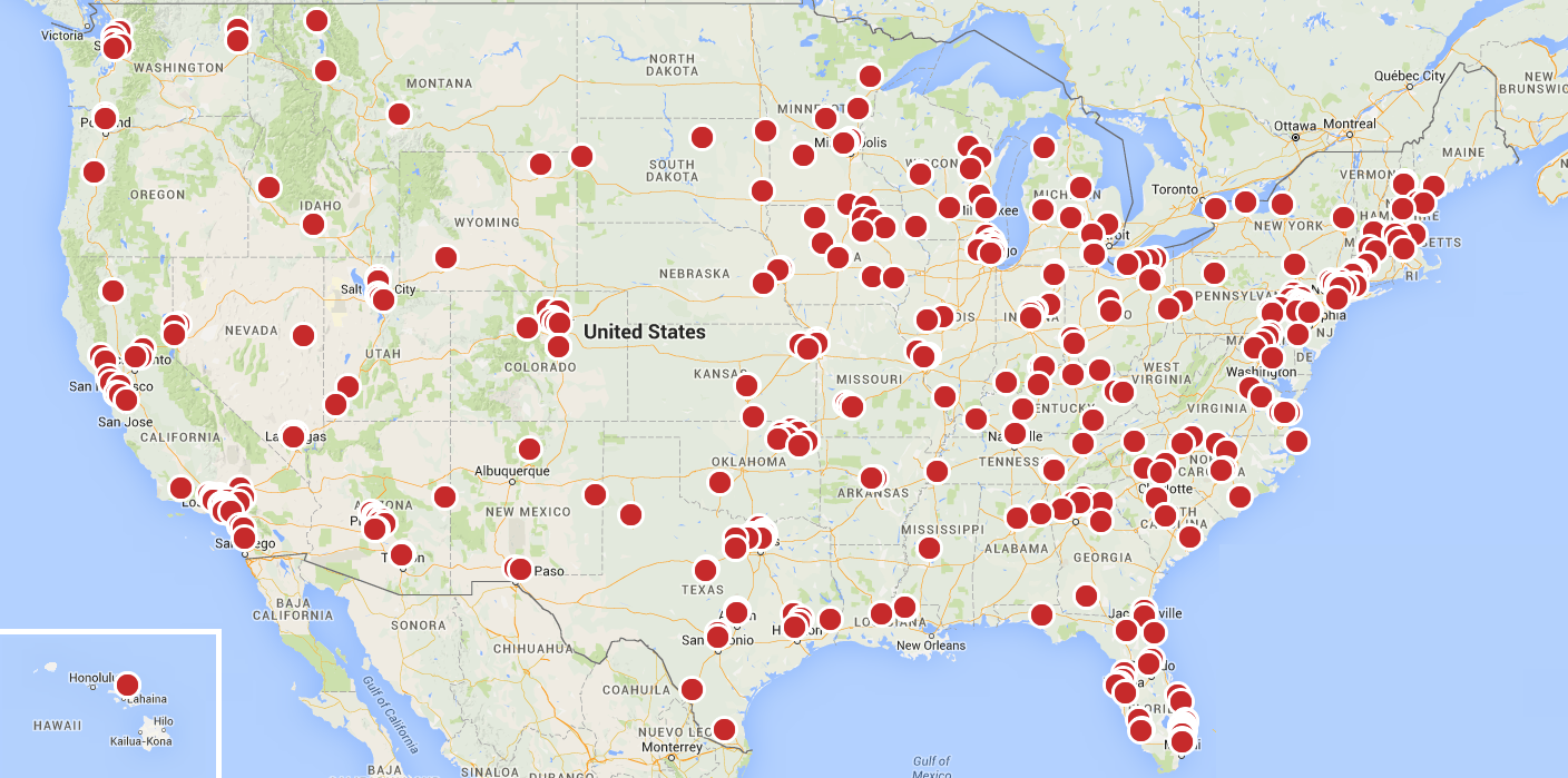
As a result, you shop differently now, and so do your customers. Most people research online before buying anything – and 93% of people who search on their phone go on to make a purchase.1 As a small business owner, you want your customers to be able to find you, so you need to be there during the moments when they’re looking for something you have to offer. And we’re here to help. During National Small Business Week (May 1-7), Google is excited to help every business get online and every community show they’re #AllForSmallBiz. We’re partnering with organizations all over the country – from Alaska to Iowa to Puerto Rico – to host hundreds of workshops to help you learn how to get your business online and you’re invited: google.com/smallbusinessweek.


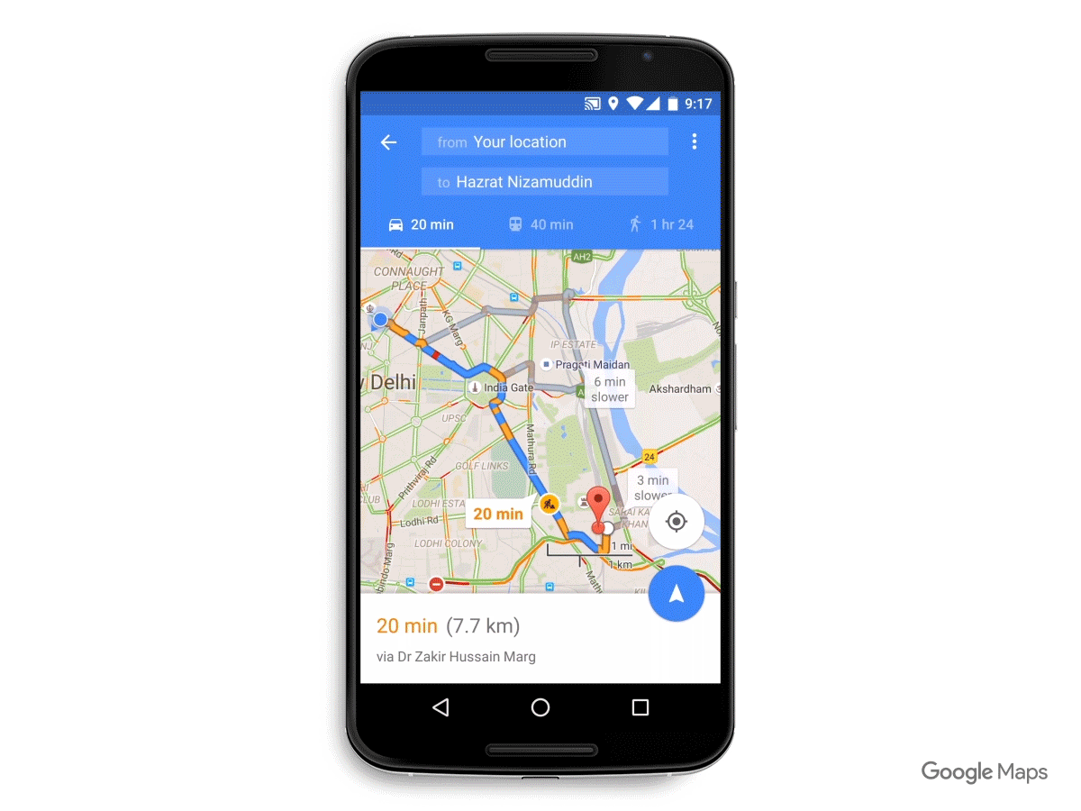
In these local workshops, we’ll show you how you can reach your customers in those important moments. You’ll learn how to update your information on Google Search and Maps, build a no-charge mobile-optimized website and more, so that you can connect with people no matter where they are or on which device they’re searching.


Can’t make a workshop in person? Starting May 1, Google will offer a collection of online resources to help small business owners learn how to get on the web and in front of customers who are searching online and on the go.

The time is now. Consumer behavior is changing quickly, but more than half of all small businesses don’t have a website.2 Join us and learn how to get your business online so that you can be found when customers are searching and shopping – no matter what device they use. Sign up for a workshop at google.com/smallbusinessweek. From our team to yours, Happy Small Business Week!

Claire Mudd, Head of Americas SMB Marketing

1. Google/Nielsen, "Mobile Path to Purchase" study, November 2013
2. Google/Ipsos, "Survey of businesses with under 250 employees", October 2013

Environmental Defense Fund finds methane leaks and helps slow climate change using Google Maps APIs


Editor's note: This is the third post in our “Mapping a Better World” series, highlighting organizations using location data to affect positive local and global change. Today’s guest blogger is Cassie Ely, Manager in the Office of Chief Scientist for the Environmental Defense Fund. Read how the organization uses Google Maps APIs to help combat climate change by locating methane leaks underneath city streets.


The Environmental Defense Fund (EDF) works to solve the world’s biggest environmental problems through innovative public policies, robust science and cross-cutting partnerships with leading voices in the business community. Our partnership with Google reflects all three approaches.

Most people don’t realize that a major contributor to global warming is methane, the primary component of natural gas. It’s an extremely powerful greenhouse gas: 84 times as impactful as carbon dioxide over a 20-year timeframe. We still need to reduce carbon dioxide emissions, but cutting the amount of methane emitted into the atmosphere has the power to reduce the rate of global warming when time is of the essence.

EDF staff analyze the methane leak maps for Boston

About 25 percent of the warming we face right now is due to methane. It can be released from biological sources like landfills and cow pastures, but can also come from leaky pipes underneath city streets, delivering the natural gas that heats our homes and provides cooking fuel. We thought that if we could reduce those gas leaks, we could help slow climate change.

To address this issue, we joined forces with Google Earth Outreach to put methane analyzers on Google Street View cars. While the cars drive to capture 360-degree Street View imagery, the analyzers measure the concentration of the methane gas in the air.

The team is also working with a scientist and professor at Colorado State University, Joe von Fischer, to analyze the spikes in methane levels and detect leaks in the underground pipes. We do multiple drive-passes and combine the readings with methane plume lengths and environmental factors to identify the severity of the leaks. We’ve conducted this research in 10 cities, where we’ve mapped over 4,000 methane leaks.
Anyone can visit edf.org/methanemaps to view leak maps of several U.S. cities, such as Boston, MA.


We chose to use Google Maps APIs because they have the design features and flexibility we needed to visualize the data in a way that can be easily understood. Google Maps APIs allow us to map the invisible. We use the Javascript API to build the base layer for our maps and then on top of that, layer the roads where Street View cars drive and the locations where our analyzers detected methane leaks.

With layered mapping, we've shown that there's an average of one leak per mile (in Boston) to one leak every 200 miles (in Indianapolis), demonstrating the effectiveness of techniques like using plastic piping instead of steel for pipeline construction. We hope utilities can use this data to prioritize the replacement of gas mains and service lines (like New Jersey’s PSE&G announced last fall).

Global warming is a huge global threat to all of our ecosystems, our livelihood and our health. It affects everything we do. By making information about methane leaks transparent, we’re providing a unique way for utilities, regulators and the public to work together and invest in infrastructure improvement and repairs — helping us reach our ultimate goal of combatting climate change.

If you are a nonprofit and interested in staying up to date on grants offerings for Google products like Google Maps APIs, apply to join Google for Nonprofits today.

Google releases new traffic alerts on Google Maps

Summer is here and for many of us that means heading out for a road trip to the nearest hill station. The only thing that might slow you down? Traffic. Luckily, Google Maps can help you find the most ideal route to your destination with the least delays. Just in time for you to hit the road, we’ve updated Google Maps with new traffic alerts to help you avoid jams.


Now when you input your destination, you’ll get a spoken alert for upcoming traffic conditions that helps you identify the quickest route. While you’re on the road, Google Maps will give you a heads up if congestion lies ahead, and how long you’ll be stuck in a jam. You’ll also get the option to take alternate routes, including explanations for why one is recommended—whether it’s the fastest or just avoids traffic.
Once you’re in navigation mode on your Android or iOS mobile, you’ll see these updates automatically.
Whether you’re headed out of town this summer, or staying closer to home, Google Maps is here to smooth the way to your destination.

Posted by Sanket Gupta, Product Manager, Google Maps

Get your favorite places on the map with Local Guides

Looking for a quiet weekend getaway with family, planning a night out with friends, or exploring a new neighbourhood coffee shop - picking the right place to go to can be tough. To help make these decisions easier, we’ve recently expanded the Local Guides program in India on Google Maps. The Local Guides feature gives you the chance to share your discoveries and experiences directly to the map, making it more useful and easier for everyone.


We held our first ever India Local Guides event in Bangalore on April 6th and these Guides join a global community of people that are exploring the world and making Google Maps more useful for everyone while at the same time earning perks.


Every place a Local Guide contributes to on Google Maps earns them points towards unlocking something new—from early access, to new products, to exclusive contests and event invites, to bonus Drive storage, and more.  You can earn points and level up by writing reviews, uploading photos, adding new places, fixing outdated information, and answering simple questions. Each contribution type is worth one point, so you can earn up to five points per place.
The more you contribute as a Local Guide, the more benefits you’ll enjoy. Here’s an overview of what you’ll unlock at each level:
  • Level 1 (0 - 4 points): Enter exclusive contests (think new Google devices!) in select countries.
  • Level 2 (5 - 49 points): Get early access to new Google products and features.
  • Level 3 (50 - 199 points): Show up in the Google Maps app with your official Local Guides badge.
  • Level 4 (200 - 499 points): Receive a free 1 TB upgrade of your Drive storage, allowing you to keep all the stories, photos, and videos from your travels in one safe place.
  • Level 5 (500+ points): The very top Local Guides will become eligible to apply to attend our inaugural summit in 2016, where you’ll be able to meet other top Guides from around the world, explore the Google campus, and get the latest info about Google Maps. Look out for details early next year.
Screen Shot 2016-04-07 at 1.35.16 PM.png

You can sign up here. Once you do, you can download the latest Google Maps for Mobile app on Android or iOS to follow your progress on the “Your Contributions” tab in the left hand panel of the app. Your total points, level, and to-do list—suggestions for places to contribute to—conveniently appear together in one place. And when you share photos, you'll now see view counts, giving you an idea of how many people your image may have helped. To learn more about how to contribute and unlock benefits, visit our website or Help Center.

Posted by Aradhana Biradar, Community Manager - Local Guides

Your Cab has arrived: More ways to get around with Google Maps


[Cross posted from Official Google Maps Blog]

Navigating around big cities is never easy—it can take precious minutes to figure out whether it’s best to drive and deal with traffic and parking, hop on a train or bus, or take a cab. Starting today, that's a little easier. When you search for directions using the latest version of Google Maps on your mobile, we’ll show you a dedicated tab with information for cab services—in addition to the existing driving, public transport, or walking options you’re familiar with. Next time you’re leaving work to meet a friend for dinner, or heading to a client meeting in a new city, you’ll be able to compare all your commuting options right from within the Google Maps app.


From today, if you’re looking for a cab service in major cities in India, you’ll be able to choose from Uber or Ola cab services. If you have a provider’s app installed, you’ll be able to see fare estimates and pick up times and if a car is available near you. Uber users will be able to choose from uberGO and uberX services, while Ola customers can choose from Ola Mini, Ola Micro and Ola Sedan options.
Once you select a service, we’ll take you directly to the Uber or Ola app for you to request your ride with one tap. Having all your commuting options in one place makes it easier to make quick comparisons about the best route and get an estimated fare. When it makes sense, we’ll also show cab availability when viewing the map in walking or transit directions.


We’re rolling out this new feature on the Google maps app for Android starting today, and it will be coming very soon to iOS. So next time you’re looking to zip around a city, open Google Maps on your phone to figure out your most convenient mode of transport to get where you’re headed.

Posted by Roli Agarwal, Strategic Partnerships, India Lead, Google Maps and Sanket Gupta, Product Manager, Google Maps

Quicker pit stops with Google Maps

You’re on a road trip and realize you’re running low on fuel, but you’re not sure whether it’s best to turn back to the last petrol station you saw, or see if you can make it to the next one. With today’s update to Google Maps for Android, making that decision just got a little easier. You can now search for and add an extra stop to your route, without having to exit navigation mode in Google Maps. That way you make quicker pit stops and fewer long detours.


Now when you're driving in navigation mode and you get that call from your spouse to pick up some groceries on your drive home, or if you're on a road trip and want to find a great restaurant option along your route, simply tap the magnifying glass at the top right corner of the screen. You’ll see a drop-down menu with helpful options, like petrol pumps, grocery stores, or restaurants. If the drop-down options aren’t what you need, you can always add a detour to your favorite coffee shop by tapping the search icon or by using voice commands.

So whether you're low on fuel, need cash and looking for the closest ATM, or just really need a coffee to get through your next appointment, Google Maps is here to help make stressful times easier.

Posted by Sanket Gupta, Google Maps Product Manager

B Mine Canada! Share your Romantic Street View Locations with #SVHeartCanada

While Canadians may be romantics at heart, when it comes to planning February 14th, we’re stumped. Searches for Valentine’s Day Date Ideas are at an all-time high in Canada.

So, let’s help out our fellow love-struck Canadians with some ideas inspired by - what else - Canada! Here’s your challenge: find the most romantic places on Street View and share on social media using #SVHeartCanada. Let’s give Canadians searching for a great date some inspiration.

To get you started, we’ve put together a map of some of the most romantic locations in the country. From Polar Bear Watching on Canada’s Tundra, riding the Maid of the Mist at Niagara Falls to exploring the Cape Breton Highlands, enjoy some of Canada’s most interesting, remote and romantic locations with stunning Street View imagery.
Canada-Vday-mobile-love.png

Or how about Love, Saskatchewan? This aptly named village in Saskatchewan has received international recognition as people from around the world send their wedding invitations, Valentine’s Day cards and more to be stamped with the romantically oriented postmark before being forwarded to their final destinations.
Canada-Vday.png

And there’s also Old Quebec City. Dating back to 1608, this historic French colonial neighbourhood is like a little slice of Europe in Canada with its cobblestone streets lined with bistros and boutiques.

These are just a few romantic locals we came up with and we’ve mapped out even more hotspots here (create your own custom map using My Maps). But we’re just getting started.

This Valentine’s Day, let’s help our fellow Canadians out with some ideas for romantic destinations in Street View.

Make sure to share yours using #SVHeartCanada and we’ll re-post our favourites.

Love, Google Canada.

A look back at Google Maps in 2015

2016 is just around the corner. Before we pop champagne and ring in the New Year, let’s take a look back at the enhancements we’ve made to Google Maps over the past year. From using Google Maps offline to discovering new places with Explore, we’re proud to not only get you from point A to point B quickly and easily, but to also help you explore the world around you with confidence.

Below is a list of the new features you might’ve missed, along with a handy chart showing you where you’ll find them. If you got a new phone this holiday season, now’s the time to give the Google Maps app a go.

2015 Google Maps New Features
  1. 2015 is ticking away, but you can take a look back at the places you’ve traveled with Your Timeline.
  2. Always know when your favorite stores are open with up-to-date holiday hours and alerts.
  3. Whether you’re in a parking garage with no signal or traveling in country with expensive data, search for places, get directions, and turn-by-turn navigation–all offline.
  4. Always stay on the fastest route and beat bumper-to-bumper traffic with real-time traffic updates and dynamic re-routing.
  5. Never run low on fuel with up-to-date gas prices in search results and on the map.
  6. Make quick pit stops without long detours–search for places along your route without leaving navigation mode.
  7. Find the best local spots to eat and drink with curated recommendations.
  8. Get all your travel options and compare ETAs across driving, walking, biking and transit–all on one screen.
  9. Get the scoop on when the lines are shortest and shops least crowded by checking businesses’ most popular times–by day, by hour.
  10. Get the lay of the land before you arrive by using Street View thumbnail.
  11. Never miss a bus or train with real-time transit information (schedules, fares, updates) in more than 18,000 cities across 64 countries.
  12. Get directions, turn-by-turn navigation and real-time traffic updates from your wrist with the Google Maps app on Android Wear and Apple Watch.
To see these new features in action, take a look back at our Maps Minutes Holiday Hacks series.

2015 New Features by iOS and Android Availability


Join us in a virtual toast to a New Year of helping you explore and navigate your far away travels as well as your everyday life.


Posted by the Google Maps team


Source: Google LatLong


Maps Minutes Hack #8: Set your home and work addresses for easy navigation

Part of our series on how to save time this holiday season with Google Maps.

It’s crunch time. There are holiday parties to attend and last-minute gifts to be bought and wrapped. When the holidays are only days away even the small things can make a difference. So here’s another helpful trick for how you can save a few extra minutes every time you use Google Maps for directions or navigation.

You can save your home and work addresses in Google Maps, and then select “home” or “work” rather than typing the locations every single time. Just go to “your places” on the side menu and you’ll see “home” and “work” under “labeled places”. Enter the address for each and next time you’re navigating to or from home or work, you can get your directions a little quicker and easier than before.


Every minute matters. Save more every day with Maps Minutes Hacks. Next up: how to get home fast and safe on New Year’s Eve.

Posted by Olga Suvorova, Product Marketing Manager, Google Maps

Source: Google LatLong