Tag Archives: Google Earth

The Journey of Us: A Voyage through Black History

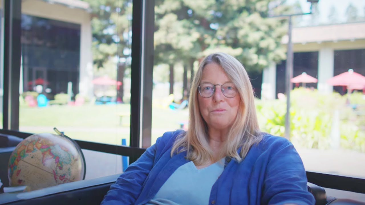
Like Black history itself, my journey contains multitudes. It began in New York City, where I grew up during the rise of the civil rights movement. The social politics of the time didn’t encourage me—a woman of color--to pursue a career in science, technology or math. But thankfully my father did. He built me my first chemistry set, encouraging me to build, create and fix things even as my childhood lab experiments went awry.

This empowerment pushed me to earn a PhD, land my first job at AT&T Bell Laboratories, and eventually come to Google. Along the way, I kept trying to fix whatever problems I faced.  At AT&T, I patented inventions that helped create Voice Over Internet Protocol (or VoIP, the technology behind communication like text messages), and the technology behind text donations that were popular during the 2010 Haiti earthquake. At Google, I’ve worked with teams to find ways to bring internet connections to more places with things like Project Loon and the deployment of Wi-Fi across India’s railway system.

There were no shortcuts to these challenges, but I forged ahead inspired by two things: my passion for fixing things and knowing that others before me had taken similar paths (and succeeded!).

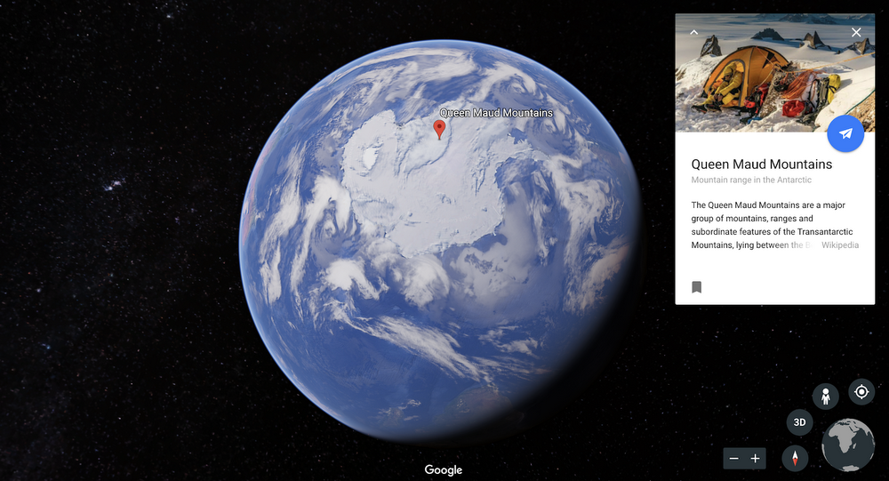
Black history is filled with stories of people like myself who set out on journeys to challenge the status quo and make things better. Today, in collaboration with the Schomburg Center for Research in Black Culture and The Moorland-Spingarn Research Center at Howard University, we celebrate some of these historic and contemporary journeys. Take a guided tour with Google Earth’s "The Journey of Us" collection to explore how Black history has shaped the American experience and continues to move us forward across themes like advocacy, business, dance, education, film, TV and technology.

My story is a single pin in a sea of many. The stories include generations of people who pushed boundaries and resisted limiting ideologies as they paved the way for the next generation. While we hope to make their journey a little better than ours, it mostly certainly won’t be easy. People will doubt us, and at times we will doubt ourselves, but through it all we will push forward.

The movement to power Puerto Rico with the sun

On September 16, 2017, Hurricane Maria, the worst natural disaster on record to affect Puerto Rico, left people without homes or electricity. Eight months later, over 1,000 households were still without power. So communities across the island set out to find creative ways to generate electricity.


Image 1

After the disaster, the government of Puerto Rico committed to ambitious plans to transform its hurricane-battered electric grid to rely entirely on renewable energy by 2050. Project Sunroof maps the solar potential for buildings, in an effort to support the world’s transition to a renewable energy future. After the hurricane, we worked quickly to integrate Project Sunroof data covering Puerto Rico with Sunrun, a residential solar, storage and energy services company. Sunrun streamlined designs and installations across local installers to offer solar-as-a-service and home battery solutions to households, local fire stations and small businesses in Puerto Rico. For example, Maximo Solar, one of the leading solar installers on the west side of the island, used Project Sunroof data to support over 100 installations.

6

Of the 44,000 Puerto Rico rooftops that were surveyed by Project Sunroof, 90% of them were viable for solar—showing the longer term opportunity for island residents to harness renewable energy from the sun. By identifying the best locations to install solar panels, Project Sunroof data puts actionable insights in the hands of communities working towards energy independence, enables critical cost savings and reduces some of the complexities in the installation process.

Image 3

Responding to any crisis of the magnitude of Hurricane Maria is a complex endeavor, but Puerto Rico is a powerful example of how communities can respond rapidly to deploy solutions that improve and protect the livelihood of people. When put in the hands of local installers, solar information for Puerto Rico helped meet the urgent short term need for electricity and the movement towards a long term renewable energy future. Our work on Project Sunroof demonstrates one of Google’s many ongoing efforts to continue investing for the benefit of Puerto Rican residents and economic recovery efforts on the island.

Parent helpline answers: How do I keep my family safe from opioid addiction?

Editor’s Note: This Saturday, October 27 is National Prescription Drug Take Back Day. Across the nation, people are disposing of their leftover, unneeded prescription drugs at local Take Back events to prevent drug misuse. Google has partnered with the DEA to make these locations easier to find. Visit g.co/rxtakeback to find a location near you and make a plan to bring back your prescriptions.

Earlier this year, Google.org gave $750,000 to the Partnership for Drug-Free Kids to expand and improve our Parent Helpline that supports parents and other caregivers of young people struggling with substance use. As the mother of a child in recovery, I’ve seen firsthand how opioid addiction hurts our loved ones, families and our communities. I also work with the Partnership to help educate about opioid use and addiction, and I volunteer as a Parent Coach – providing peer-to-peer support to other families.

Today I'm sharing some of the most frequently asked questions I hear from parents about opioid addiction.

Aren’t opioids legally prescribed by doctors, and therefore safe?

Even though opioid pain relievers can be prescribed by doctors to manage pain, opioids have high risks of addiction and dependence. While other pain relief options should be explored before taking opioids, when taken as prescribed for short periods of time, opioid pain relievers may generally be safe for most adults. But because opioid pain relievers (which have the same properties as heroin) can produce a sensation of euphoria in addition to pain relief, some people take them for longer stretches and increase the dosage over time – which can lead to addiction.

What can I do, right now, to keep my family safe?

  1. Ask your doctor about alternatives to opioids to manage pain.
  2. Secure all of the medication in your home.
  3. Make sure that medications for you and your loved ones are used only as prescribed, and not shared with anyone else,
  4. Dispose of unused or expired medications at a Take Back location this weekend. Enter your zip code or address into the map here and find a local take-back facility.
takebackmap

But my child isn’t using opioid drugs – why do I need to clean my medicine cabinet?

When surveyed, more than half of teens say that it’s easy to get prescription drugs from their parent’s medicine cabinet, and two-thirds of teens who report misusing Rx medication get it from friends, family and acquaintances. While it’s tempting to keep old prescriptions around “in case you need them later,” it’s safer to dispose of them when the immediate need is over. Proper medication storage and disposal can help prevent misuse even beyond your own family.

How can I talk to my child about drug misuse?

While a majority of kids report that their parents have talked to them about avoiding alcohol (81%) or marijuana (80%), only 18% of kids say that their parents have talked to them about prescription drug use. Kids who learn about the dangers of drug use early and often are much less likely to develop addiction than those who do not receive these important messages at home. Conversations about the importance of using medications as prescribed, including not sharing medications or taking anything that hasn’t been prescribed to oneself, are critical messages to convey. Learn more tips for talking about medication misuse.

What signs should I be on the lookout for?

Signals range from the obvious, like missing prescriptions and empty pill bottles, to subtler signs like sudden mood changes, isolating from family or friends, and losing interest in hobbies that used to bring joy. Early use can sometimes bring about positive behavior and moods, like being overly motivated or having lively conversations.

Opioid addiction can also manifest in physical ways: Look for signs of fatigue and drowsiness, pinpoint pupils and dark circles under the eyes, and rapid weight loss. Learn more about opioid medication, including common signs of misuse.  

What do I do if I find out my child is misusing or abusing opioids?

It can be scary to learn that your child is misusing opioids, but there are steps you can take to help:

  • Learn about tools to help motivate your child to get treatment.
  • Start a conversation, not a confrontation, and always remember to listen.
  • Consider your treatment options, including medications that can help reduce cravings associated with opioids.
  • As a safety precaution, you can talk to your doctor or pharmacist about getting Naloxone (known by the brand name Narcan) which is used to reverse an opioid overdose.

When I found out my child was misusing opioids, I was scared and felt alone—and felt like I had nowhere to turn. But parents and families don’t have to face this alone. Compassionate, one-on-one support and guidance are within reach. You can connect with a Helpline Specialist at the Partnership for Drug-Free Kids by calling 1-855-DRUGFREE. You can also contact us by text (send a message to 55753) or email at our website at drugfree.org.

If you are an adult who is personally struggling with addiction, or you’d like information on how to help a loved one, you can find opioid addiction resources through the Federal SAMHSA Helpline: 1-800-662-HELP. 

Finding my way back to Antarctica with the help of Google Earth

Editor’s note: This guest post comes from a rock climber and adventurer who used Google Earth to aid his quest to explore Antarctica's remote Queen Maud Land with other athletes from The North Face team.


Nearly twenty-two years ago, my late friend Alex Lowe, Jon Krakauer and I huddled over a stack of tattered Norwegian maps from the“International Geophysical Year, 1957 - 58.” These were the first maps of Antarctica's remote Queen Maud Land, a stark glacial landscape dotted with impossibly jagged granite spires protruding from thousands of feet of ice. As we scanned the only detailed account of this faraway land, the complex and cryptic landscape made it blatantly obvious why these were some of the last unclimbed peaks on earth.


Back in ‘98, our paper maps were a static window into this dynamic land. We peeked in with trepidation, knowing that once we arrived on the ice cap, our lives would depend on rough estimations and ballpark figures, which still left a lot to chance. How many days would it take to reach the towers from our base camp? What if a storm pinned us down? What if we were unable to cross a dangerously crevassed part of the glacier?


Two decades later,  the same thirst for pushing limits in the face of the unknown is calling  me back to Queen Maud Land. This time the adventure began with my family in the comfort of our living room in Bozeman, Montana—our paper maps are replaced with smartphones and laptops. With Google Earth, my family was able to explore Queen Maud Land with me before my boots ever touched the ground. Together, we flew over snow covered glaciers and found our way up the massive granite walls I hoped to scale with my fellow teammates who are climbing with me as a part of an expedition put together by The North Face. We understood the complexity and enormity of the expedition together.

North Face image 1

I always tell my family that the most important part of the mission is coming home—a goal that requires obsessive preparation, planning and training. Google Earth allowed us to drop pins on potential landing zones suitable for the fixed wing aircraft we were going to travel in. With the ability to visually assess the landscape in 3D, we could better see hazards and challenges before embarking on the expedition. Climate change has dramatically altered the landscape of the Antarctica I explored in the nineties and looking at up-to-date satellite imagery helped me come up with a new approach to navigating the terrain.

NF

When we finally touched down on the ice, my fellow climber Cedar Wright aptly mentioned that “it was pretty surreal to recognize a place you had never physically been by your time spent exploring it remotely using Google Earth.” And he was right. After we got our bearings, we were able to confidently and strategically explore dozens of never-before-climbed peaks in this lunar landscape. The challenges of climbing in the frozen landscape were ever present, but the gift of being able to successfully put up so many stunning new climbs with a team of this caliber was an unforgettable privilege.

NF

Conrad Anker working his way up Ulvetanna, “The Wolf’s Tooth,” in the Drygalski Mountain Range, in Antarctica. Photo by Savannah Cummins.


On expeditions like these we are reminded of why we explore. They’re a physical and mental challenge that demonstrate how we are capable of succeeding in places we never before thought possible. The spirit of exploration is alive and well across our society–and technology like Google Earth opens up even more possibilities to explore ... so, what will your next adventure be?


Learn more about the expedition and check out all of the photos & videos from The North Face expedition to Antarctica.


The more you know: Turning environmental insights into action

This week, thousands of leaders from cities, states, businesses, investors, and environmental organizations—including representatives from Google—will gather in San Francisco, CA at theGlobal Climate Action Summit to commit to raising the level of ambition in the fight against climate change. National governments around the world have committed to take action, but cities and businesses have an equally critical role to play in reaching a zero-carbon future. That's one reason we're excited about today's announcement of a new tool aimed at helping cities lower emissions.


Cities as diverse as New York, Berlin, Oslo, and Rio de Janeiro have committed to reducing their carbon footprint by 80 percent within the next 30 years. These cities rely on huge carbon data sets as a measuring stick to help identify where they may be able to cut emissions.  But many cities lack the resources to gather data such as building emissions, making it hard for them to set firm carbon commitments of their own.

The Environmental Insights Explorer (EIE), a new online tool we created in collaboration with the Global Covenant of Mayors for Climate & Energy (GCoM), is designed to make it easier for cities to access, and act upon, new climate-relevant datasets.  By analyzing Google’s comprehensive global mapping data together with standard greenhouse gas (GHG) emission factors,  EIE estimates city-scale building and transportation carbon emissions data, as well as renewable energy potential, leading to more globally-consistent baselines from which to build policies, guide solutions, and measure progress.

Introducing The Environmental Insights Explorer

To date, more than 9,000 cities have made commitments to comply with the Paris Agreement, which presents a formal plan and timeline to phase out reliance on fossil fuels. But less than 20% have been able to complete, submit or monitor greenhouse gas inventories.

The process for building out a baseline emissions inventory can take hundreds of thousands of dollars and months or even years. “The vast majority of cities aren’t in the position to finance a process that will take time and might be cost prohibitive, especially the small to medium cities in developing areas of the world. And that’s where most of the action will take place in relation to the Paris Agreement on climate change,” explains Amanda Eichel, the executive director for the global secretariat at GCoM, an international alliance of nearly 10,000 cities and local governments committed to fighting climate change.

With EIE, data sets that once required onsite measurements and many months to compile can now be assessed virtually, reducing cost and time investment that prevents cities from taking action.

Data packaged to prompt action

On the EIE site, data is freely available in four categories: building emissions, transportation emissions, energy offset potential, and 20-year climate projections. Clicking on “Building emissions,” for example, brings up detailed maps visualizing the emissions impact for both homes and non-residential buildings.

In each category, you can drill down into more specific statistics, including percentage breakdowns of emissions, the time period from which the data was culled, key assumptions made. You can also find links to other critical information, such as ways to reduce emissions.

BA

Emissions data gets more specific the deeper you get into the site.“This tool will provide us with much more precise data on the flow of transport emissions and the potential of the City to generate solar energy,” says Buenos Aires Mayor Horacio Rodríguez Larreta. “It is a key input to design policies that reduce emissions and make Buenos Aires a smarter, greener and more sustainable and resilient city.”

In addition to helping policy makers, planners, and researchers set city-wide emissions policies, the data can inform specific projects like new investments in solar, public transit, or mobility alternatives to reduce vehicle traffic. For example, a city could track a new transportation line’s potential impact on the city’s emissions profile before deciding whether to move forward and scale the project. Or a city could explore how transitioning some percentage of short car trips to bicycle trips would lower the overall carbon footprint. "Now we can bring data analytics to conversations about renewable energy and show people that they’re able to generate enough solar power for their entire city," says Brad Petry, Head of Data Analytics, Victorian Centre for Data Insights. Victoria's state government has set targets for 25 percent renewable energy by 2020 and 40 percent renewable energy by 2025.

Melbourn

EIE estimates total solar potential for rooftops to show how much renewable power could be generated, helping cities evaluate ways to reduce overall building energy emissions.

Filling an information gap, collaboratively

EIE arose from a decade’s worth of climate-related projects at Google, including Project Sunroof, a tool that measures rooftop solar energy potential, and Earth Engine, a platform for geospatial analysis. Collectively these projects in conjunction with other Google data sources like building and transportation data, were pulled together to reveal valuable insights about cities' carbon impact—information that we realized could play a critical role in encouraging action by policy makers, city officials, and others.  But to be effective, the information needed to be packaged for easier absorption and more importantly, action.

We started by partnering with GCoM, founded by global city networks and supported by Bloomberg Philanthropies and the European Union,  which has been gathering the same comprehensive data we wanted to surface in our tool through other sources and methodologies. GCoM also has detailed knowledge of the intricacies of environmental policy and the political hurdles hindering change and action.

We shared our data inventories with one another, and GCoM helped connect us to different cities around the world to get their input on what they’d find most useful to help reach their emission goals. The methodology used to source, aggregate and distill the EIE data sets can be reviewed on the site. To ensure quality, we initiated a rigorous quality-assurance process months before launch.

Building

A work in progress

We're introducing EIE in beta today, covering a handful of pilot cities including Melbourne, Australia; Buenos Aires, Argentina; Victoria, Canada; Pittsburgh, Pennsylvania; and Mountain View, California. But in time, we plan to make this environmental information available to thousands of cities, towns, and regions around the world. As more cities use this data, and as science evolves, we plan to iterate and expand on the tool, methodologies and datasets.  

Even providing thousands of cities with comprehensive, action-oriented datasets is just one piece of the emissions mitigation puzzle. Still, we’re excited to take this first step today with GCoM and pilot cities on a journey to accelerate global ambition and action toward a low-carbon future.

Learn more about Google’s other sustainability efforts in our 2018 Environmental Report and on sustainability.google.


Source: Google LatLong


On your mark, get set, go! Stay up to speed with the 2018 Asian Games

After 56 years, the Asian Games are coming back to Indonesia. This Saturday, thousands of athletes from 45 nations in Asia will go for gold in Jakarta and Palembang, the two cities hosting the games this year. Here are some ways you can get in on the action.


Track your country’s victories with Search

When you search for Asian Games on Google Search, you’ll find up-to-date information at the top of Search results. Sprint through the medal tally rankings and recent results to see if your country is in the lead. You can also watch videos of highlights and catch up on top news related to the Asian Games.

asiangamessearch2

Up your Games on Google Maps and Google Earth

If you’re lucky enough to catch the action live in Indonesia, Atung, one of the friendly Asian Games mascots, will show you the best route on Maps when you search for directions. Wondering where your seat in the stadium is? You can sail through the gantries and find it quickly with indoor maps of event venues. And even if you aren’t in Indonesia for the games, you can explore its amazing archipelago, and get inspiration on where to go on Voyager in Google Earth to make the most of your trip.

Can I Play, too? Yes you can.

Head to the Google Play Store and check out selected Asian Games content and deals from Google Play.

asiangames-play

Judo-n’t want to miss out on the 18th Asian Games, and with a few helpful tools from Google you will stay close to the action.

Source: Search


Test your knowledge of natural wonders in Google Earth

In Google Earth’s Voyager, we’ve climbed aboard the ISS, simulated eclipses, and gone deep into the Amazon. Now, with the help of our friends at Atlas Obscura, we're adding something new to the mix. In a multiple choice quiz, Atlas Obscura takes you to some of the most beautiful—and intriguing—places on the planet. Know where Morning Glory Pool is? Or the hot springs of Dallol? See how well you know your planet, and explore these  places in Google Earth. If you get stuck, look out for a hint or two on Twitter.

p

Coming up: We don't know about you, but we're hearing royal wedding bells. Check back in Google Earth mid-May to test your knowledge of magnificent castles and palaces around the world.

Shellebrating Christmas Island’s extraordinary nature with Street View and Google Earth

In December, we took the Street View trekker to Christmas Island, a remote tropical territory of Australia just south of Indonesia. With Parks Australia, we joined the island’s red crabs as they marched in the millions from the forest to the sea for their annual migration.


Now it’s time to shellebrate. Starting today on Google Maps Street View and Google Earth, you can explore Christmas Island and Cocos (Keeling) Islands’ unique wildlife, dazzling ocean vistas and lush rainforests, including the grand finale of the red crab migration—the spawning. The red crabs wait all year for this very moment—and the precise alignment of the rains, moon and tides—to release their eggs at the coastal waters.

Christmas Island’s remote location makes it home to a wild and diverse ecosystem—including 600 species of tropical fish, 14 species of terrestrial crabs, more than 100 bird species and four native reptile species. Exploring its wetlands and blowholes and coastline, you can see for yourself why the island is often called “Australia’s Galapagos.”

Christmas Island’s nature and wildlife is so treasured and protected that the crabs have right of way. Roads are often closed during the migration, and Parks Australia have erected fences to direct the crabs to safe crossing points with under-road passes, or fly-over bridges. Now you can join the island’s 45 million red crabs as they crawl along the forest floor, climb the cliffs and finally, spawn at the water’s edge.

Scuttle over to Street View and Google Earth to experience the wonderland of wildlife on Christmas Island and the white sand beaches of Cocos (Keeling) Islands. And as you step into this moment in time, we welcome you to join the crabs as they lead this magnificent dance of nature.

I’m Feeling Earthy: Earth Day trends and more

It’s Earth Day—take a walk with us.

First, let’s dig into issues taking root in Search. Ahead of Earth Day, “solar energy,” “drought” and “endangered species” climbed in popularity this week. Meanwhile, people are looking for ways their own actions can make a positive impact. The top “how to recycle” searches were for plastic, paper, batteries, plastic bags, and styrofoam. And around the world, trending queries about Earth Day were “how many trees will be saved by recycling?” and “which type of plastic is more friendly to the environment?”  

To explore some of the other searches that are blooming for Earth Day, take a look at our trends page.

ed

In our corner of the world, Earth Day celebrations started on Google Earth’s first birthday (tweet at @googleearth with #ImFeelingEarthy and see where it takes you!). The party continues today with a special tribute to Jane Goodall in today’s Doodle, and kids inspired by the Doodle can create their own Google logo, thanks to our partnership with World Wildlife Fund. And while we’re feeling extra Earthy this week, the environment is important to our work all year long—here’s what we’re doing for our operations, our surroundings, our customers, and our community.

How we explored the whole wide world with Google Earth in the past year

From polar bears in Canada to the highest peaks on the planet, hundreds of millions of people searched to the edge of the world and beyond with Google Earth in the last year.


On Earth Day 2017, we shared a brand new version of Google Earth that works on the web, Android and iOS. Since then, hundreds of millions of people, big and small, took a spin on the globe; armchair explorers everywhere followed along with more than 300 Voyager stories in 8 languages; and we learned that you can have too much of a good thing ?.To celebrate the past year of whizzing around the globe, here’s a look at what made Google Earth go round over the last 365 days.

earth

1.  Home is where the searches start. But they don’t stay there.

The first place most people search for on Google Earth is home. But that’s only the beginning. From there, you search most for natural wonders and famous landmarks of the world, like Times Square, Taj Mahal, Eiffel Tower, Mount Everest and Niagara Falls. Many of you have an out-of-this-world fascination with Area 51. And, yes, we recently saw a bump in searches for Wakanda.
3

When it came to physically leaving home, many people stuck with classic travel destinations like New York City and Paris. But you also had dreams of oceanside views and crystal waters—our next most popular travel itinerary was for Santorini, Greece.

2. Three billion people got an updated view of their neighborhood.

We’re updating the imagery you see in Google Earth and Google Maps all the time. Within the past 12 months, we’ve added enough new 3D and 2D imagery to cover 3 billion people, or about 40 percent of the world’s population. New York City, Stockholm and Hakodate, Japan are just some of the more than 400 cities and metro areas that got a makeover with new high-resolution 3D imagery.
g

3. Yahtzee! You’ve rolled the dice 190 million times.

I’m Feeling Lucky is now one of Earth’s most popular features. It’s simple: Click the dice icon and fly to a random, awesome place on the globe. Since launch, you’ve rolled the dice 190 million times, or about six rolls per second. And because it’s almost our favorite day of the year, Earth Day, we’re feeling extra Lucky—Earthy, even. Tweet #ImFeelingEarthy to @googleearth and see where it takes you.
e

4. You’ve got mail! The world created $50 million worth of postcards.

We’ve all been there: Daydreaming about that next great adventure. That’s why we built the Postcards feature for our Android and iOS apps, so that once you found that beautiful place—Lagos, Portugal, anyone?—you could share with a friend and get them dreaming too. Last year, you created more than 40 million postcards—in postage that’s about $50 million, €39 million or ¥3 billion.

5. You got the warm fuzzies watching 18 live animal cams.

Thanks to Explore.org’s network of live nature cams in Earth, you could observe brown bears fishing for salmon in Alaska and polar bears poking around the Tundra Buggy Lodge in Churchill, Canada. Even when Charlotte and Charlie’s osprey nest was empty, we couldn’t look away! Stay tuned for puffin and guillemot action in the next few weeks.
ex

Cute animal photos courtesy of Explore.org


6. Voyager stories took you from home to space, and everywhere in between.  

From the Great Sphinx to Mars to a crater in Mexico, millions of you followed along with more than 300 interactive tours in Voyager. Our most popular stories introduced new cultures and habitats: This is Home, I Am Amazon and BBC Earth’s Natural Treasures. Teachers and students explored the solar system with Japan’s Miraikan and investigated the end of the dinosaur age with HHMI Biointeractive. And some stories were just great eye candy: Earth View and NASA’s Earth at Night.
ecl

We built an eclipse generator for the coolest event of 2017.

It’s been a busy first year for the new Google Earth! Here’s to another 365 days of exploring the world.