Tag Archives: Google Earth

Space out with Google Earth on mobile

Stars are magical. Van Gogh painted them. Shakespeare wrote about them. We make wishes on them. 

On the Google Earth team, we understand people’s desire to see stars just as much as they want to see Planet Earth. The Google Earth mobile app now offers wide views of our starry universe, just as Earth for the web and Earth Pro have done for some time.

As smartphones and tablets have become more powerful, we’ve been able to bring the quality of Earth’s web and Pro versions to most smartphones. You can now see a view of the stars as you zoom out from Earth on your phone. Rotate the globe and you’ll see images of the beautiful Milky Way, collected from the European Southern Observatory, depicting the stars as they’d appear to a space explorer at a point some 30,000 miles above the planet. 

Stars in Google Earth on a tablet device.png

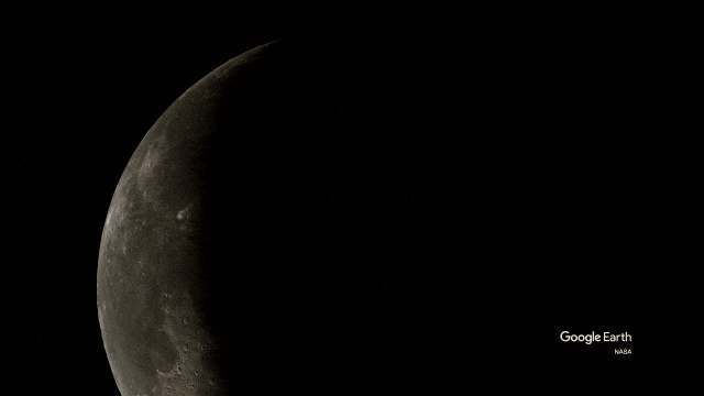
Before we added the star imagery, the sky around the “big blue marble” view in Google Earth was simply black, which wasn’t very realistic. Realism is important to us—we want people using Google Earth to see our planet in context with our place in the universe. 

That’s also why we recently added animated clouds that show weather patterns around the globe, and feature space themes, like Scenes from Space and Visit the International Space Station, in our guided tours on Google Earth’s storytelling platform, Voyager.

All kinds of people use Google Earth: scientists, environmentalists, government and nonprofit workers, and global citizens who simply love exploring the planet. Whether they want to zoom in and explore Earth close-up or zoom out and see the big picture, we hope people using the Google Earth app will enjoy this new opportunity to stargaze. 

Stars in Google earth mobile -portrait.png

Using AI to find where the wild things are

According to the World Wildlife Fund, vertebrate populations have shrunk an average of 60 percent since the 1970s. And a recent UN global assessment found that we’re at risk of losing one million species to extinction, many of which may become extinct within the next decade. 

To better protect wildlife, seven organizations, led by Conservation International, and Google have mapped more than 4.5 million animals in the wild using photos taken from motion-activated cameras known as camera traps. The photos are all part of Wildlife Insights, an AI-enabled, Google Cloud-based platform that streamlines conservation monitoring by speeding up camera trap photo analysis.

With photos and aggregated data available for the world to see, people can change the way protected areas are managed, empower local communities in conservation, and bring the best data closer to conservationists and decision makers.

Wildlife managers at Instituto Humboldt take advantage of a new AI-enabled tool for processing wildlife data.

Wildlife managers at Instituto Humboldt take advantage of a new AI-enabled tool for processing wildlife data

Ferreting out insights from mountains of data

Camera traps help researchers assess the health of wildlife species, especially those that are reclusive and rare. Worldwide, biologists and land managers place motion-triggered cameras in forests and wilderness areas to monitor species, snapping millions of photos a year. 


But what do you do when you have millions of wildlife selfies to sort through? On top of that, how do you quickly process photos where animals are difficult to find, like when an animal is in the dark or hiding behind a bush? And how do you quickly sort through up to 80 percent of photos that have no wildlife at all because the camera trap was triggered by the elements, like grass blowing in the wind?


Processing all these photos isn’t only time consuming and painstaking. For decades, one of the biggest challenges has been simply collecting them. Today, millions of camera trap photos languish on the hard drives and discs of individuals and organizations worldwide.


Illuminating the natural world with AI

With Wildlife Insights, conservation scientists with camera trap photos can now upload their images to Google Cloud and run Google’s species identification AI models over the images, collaborate with others, visualize wildlife on a map and develop insights on species population health.


It’s the largest and most diverse public camera-trap database in the world that allows people to explore millions of camera-trap images, and filter images by species, country and year.


Wildlife Insights

Seven leading conservation organizations and Google released Wildlife Insights to better protect wildlife.

On average, human experts can label 300 to 1,000 images per hour. With the help of Google AI Platform Predictions, Wildlife Insights can classify the same images up to 3,000 times faster, analyzing 3.6 million photos an hour. To make this possible, we trained an AI model to automatically classify species in an image using Google’s open source TensorFlow framework. 

Even though species identification can be a challenging task for AI, across the 614 species that Google’s AI models have been trained on, species like jaguars, white-lipped peccaries and African elephants have between an 80 to 98.6 percent probability of being correctly predicted. Most importantly, images detected to contain no animals with a very high confidence are removed automatically, freeing biologists to do science instead of looking at empty images of blowing grass. 

With this data, managers of protected areas or anti-poaching programs can gauge the health of specific species, and local governments can use data to inform policies and create conservation measures. 

Wildlife Insights Animal Classifier

The Wildlife Insights Animal Classifier tool helps researchers classify 614 species.

Acting before it’s too late

Thanks to the combination of advanced technology, data sharing, partnerships and science-based analytics, we have a chance to bend the curve of species decline.

While we’re just at the beginning of applying AI to better understand wildlife from sensors in the field, solutions like Wildlife Insights can help us protect our planet so that future generations can live in a world teeming with wildlife. 

Learn more about Wildlife Insights and watch the documentary film Eyes in the Forest: Saving Wildlife In Colombia Using Camera Traps and AI. The film tells the story of a camera trapper who uses Wildlife Insights to document and preserve the biological diversity in Caño Cristales, a reserve in Colombia’s remote upper Amazon region. 

Wildlife Insights is a collaboration between Conservation International, Smithsonian’s National Zoo and Conservation Biology Institute, North Carolina Museum of Natural Sciences, Map of Life, World Wide Fund for Nature, Wildlife Conservation Society, Zoological Society of London, Google Earth Outreach,  built by Vizzuality, and supported by the Gordon and Betty Moore Foundation and Lyda Hill Philanthropies. 

How we power climate insights and action

This week, governments and NGOs from across the globe are convening at COP25, the United Nations climate conference in Madrid, to discuss the latest efforts to fight climate change. Addressing this pressing issue on a global scale requires urgent action from countries, communities and businesses. At COP25 we shared how Google is focused on building sustainability into everything that we do and making it possible for everyone to build a more sustainable world.

As cities now account for more than 70 percent of global emissions, we believe that empowering city governments with comprehensive, climate-relevant data and technology can play a critical role in igniting action. 

One way we are doing this is with partners like the Global Covenant of Mayors for Climate and Energy. We’ve brought our online tool, the Environmental Insights Explorer (EIE),to cities across the world, providing high-resolution data to measure greenhouse gas emissions (GHG) and take informed action to reduce CO2 emissions.  As of today, EIE has now expanded to more than 100 cities worldwide.

Environmental Insights Explorer: Now available in 100+ cities worldwide

Empowering local action in cities worldwide

As we look beyond our latest efforts to equip cities with more comprehensive data, we’re also exploring how we can help communities turn these insights into action at the local level.

To further accelerate climate action, Google.org is launching a new $4 million fund in collaboration with ICLEI - Local Governments for Sustainability.Grants from the fund will support nonprofits and academic institutions in Europe and Latin America that are leading data-driven climate action efforts.

The first grantee is Iniciativa Climática de México (ICM), a Mexico-based nonprofit organization that catalyzes international climate policy at the national and city levels to reduce emissions of GHGs and promotes low carbon growth in Mexico. Grant funds will be allocated to their “Hogar Solar” program. This program channels government spending on electricity towards the installation of solar panels to help increase access to power for those facing energy poverty, provide cleaner energy sources and reduce overall electricity costs. 

Data-driven initiatives like this are essential to addressing climate change and are needed at a global scale. As we fund more grantees, we will share what we learn on how to best engage in data-backed sustainability planning and action.


Translating global insights

EIE relies on anonymous, highly aggregated mapping data and standard GHG emission factors to estimate city building and transportation carbon emissions, as well as solar energy potential. We’re already seeing the early impacts of cities putting the power of EIE data behind climate plans, from bike-friendly initiatives to solar programs.

While EIE has officially published data for 100 cities, the EIE team has processed climate-relevant data across an initial sample of 3,000 cities to produce emission insights from approximately 95 million buildings and nearly 3 trillion kilometers traveled. 

Our analysis found that cities can have a huge impact in protecting our climate:

Making environmental information available will continue to be critical as cities, communities and companies worldwide band together to address climate change. We’re committed to doing our part, and want to extend our thanks to the forward-looking city officials and climate leaders collaborating with us on this project.

If you’d like to request EIE data for your city, let us know. And learn more about Google’s other sustainable efforts at sustainability.google.

Source: Google LatLong


Live from the North Pole, it’s Santa’s Village!

Good day from Santa Tracker HQ! I’m Dimplesticks the Elf, news anchor for the North Pole Broadcasting Channel. This year, our candy-cane broadcast antenna extends beyond Santa’s Village with Google as our official global rebroadcast partner.

Every day over the next three weeks, you can ask your Google Assistant for my reports from the top of the world. Just say, “Hey Google, what’s new at the North Pole?” You’ll also catch my daily North Pole Newscast alongside other minty-fresh NPBC programming like PMZ, the Reindeer Report, and Good Sleigh Today, on Google’s social channels.

What’s new in Santa’s village

And now for our top headline: Santa’s Village has a big makeover this year. Scroll down from the snowy scene up top to discover Santa’s new toy factory, his greenhouse and the reindeer gym. Just click or tap your way to over two dozen games and learning activities—including a new 3D snowbox where you can build your own wintery scene. 

Santa's Village

There are two kinds of scoops in my world: mint chocolate chip ice cream, and stories nobody else has reported. So here's some breaking news: holiday cheer is spilling over from the North Pole, and into a bunch of different Google products.

More ways to be merry 

On Google Earth, test your knowledge of holiday traditions around the world, or take a tour of the tasty treats people eat in various countries this time of year. Then jingle all the way to Image Search (best on mobile) or Tenor and look for Santa Tracker GIFs to make all your messages merry and bright. And it turns out my reporting isn’t the only sweet treat from the Google Assistant. Just ask, “Hey Google, give me a Santa joke" for some good ol’ ho-ho-ho, or say, “Hey Google, call Santa” to help him solve a wacky problem—coming up with a musical genre for his new band. Parents who want their kids to use the Google Assistant can create an account for their kids under 13—or the applicable age in your country—through Family Link.

Some of you eagle-eyed jollymakers may have observed that a few of the activities in the village are still hidden. Mrs. Claus gave me an exclusive overview of what’s to come, but because I promised to keep everything she told me under wraps, all I can say is that in a few more sleeps, there’ll be even more ways to play. Gotta keep you on your mistle-toes! 

We’re sticking with this story tighter than an elf’s tongue on a frozen pole. (Ow!) So follow me and my esteemed colleagues from the North Pole Broadcasting Channel on Google’s social accounts. Or you can search for Santa Tracker on Google for a link to a daily dose of delight.

With your Elfwitness News, I’m Dimplesticks at the North Pole!

Ladies of Landsat builds inclusivity in the geosciences

Editor’s note:Today’s post is by Morgan Crowley, a Ph.D. candidate at McGill University who studies wildfire progressions. This post is based on her recent appearance on the podcast Scene From Above. Above photo courtesy of McGill University.

Ladies of Landsat stickers

Working and studying in the geosciences can be lonely sometimes. I didn’t realize how lonely I was, and that this loneliness was tied to my identity as a woman, until I spent several days at a conference without seeing anyone else in the ladies’ room. Groups like Ladies of Landsat, which I help coordinate, connect us to fellow scientists who are gender and other minority peers so we can reach out about everything from finding research partners to starting a family.  By building up each other’s confidence and celebrating our wins, we lift, retain and attract women in the field. 

In our case, most connections happen on Twitter, although we do come together at events like the 2018 Google Earth Engine summit in Dublin. Google provided a space for us to connect while also teaching us technical skills in Google Earth and Earth Engine, so we were equipped to answer pressing scientific questions like where and when do wildfires spread in Canada, and how much air pollution does a fire produce in India

At the September 2019 Geo for Good Summit, we teamed up with Women in Geospatial, another online group promoting gender equality in geosciences, to discuss shared interests, challenges and skills. 

In 2018, I went to the ForestSAT conference and heard women like Dr. Jody Vogelerand Dr. Joanne White talk about forestry with an incredible level of depth. I got chills. It was the first time I’d talked to more than one woman at a time about this type of science. Dr. Kate Fickas, a research faculty member at the University of Utah and the brains behind Ladies of Landsat, set up a women’s networking event at a local bar. Dr. Monika Moskal brought her ground-based LiDAR unit, a surveying device, to take a picture of us. So many people came up to us and said, “I’ve never been with this many women in the field. This is incredible.”

A LiDAR selfie of the Ladies of Landsat members

A LiDAR selfie of the Ladies of Landsat members standing in a circle around the laser scanning sensor at our 2018 ForestSAT meet up at the University of Maryland. (Image credit: Dr. Monika Moskal)

It’s encouraging to see that Ladies of Landsat and Women in Geospatial are not the only groups working to make geospatial sciences more inclusive. There are amazing groups all over the world like Women in GIS, Women in GIS - Kenya, WinGRSS and She Maps. There’s also GeoLatinas, Black Girls Mapp, GeoChicas and Indigenous Maps, who support people of color in the field. And in spite of our name, Ladies of Landsat, we’re not just about lifting up women; we’re inclusive to all genders and identities. 

The work of making geosciences more inclusive is just starting—and you can play a role, too. If you read a research paper whose authors are all men, ask why. If you go to a scientific event and every panel member is a white person, speak up. Invite gender and racial minority scientists to share their work and nominate them for grants and speaking slots. The burden to change this status quo rests on people in power.

Create your own maps and stories in Google Earth

As humans, we've always bonded by sharing stories about the places that matter to us. It likely started around a campfire—elders recounting tales of sites sacred to their people. Today, we use technology to celebrate our ancestry, raise awareness about places we care about, and rekindle memories of home.


For nearly 15 years, people have turned to Google Earth for a comprehensive view of our planet. But our mission has never been to just show you a static picture of the planet; we want to bring the world to life. With new creation tools now in Google Earth, you can turn our digital globe into your own storytelling canvas, and create a map or story about the places that matter to you.

See how a teacher, conservationist and family are using the new creation tools

See how a teacher, conservationist and family are using the new creation tools

With creation tools in Google Earth, you can draw your own placemarks, lines and shapes, then attach your own custom text, images, and videos to these locations. You can organize your story into a narrative and collaborate with others. And when you’ve finished your story, you can share it with others. By clicking the new “Present” button, your audience will be able to fly from place to place in your custom-made Google Earth narrative.

See what people are making with the new creation tools:

Two years ago when we rewrote Google Earth for modern browsers and devices, we launched the Voyager program to start to infuse the globe with stories from the world's best storytellers. Today, we’re taking the next and most significant step forward: turning the power of mapmaking and storytelling over to you. 

Creation tools are now available in Google Earth on web. You can view your projects on mobile and tablet devices using the latest version of our iOS or Android app. Thanks to an integration with Google Drive, you can share your stories with your audience and they can view it anywhere—their phone, tablet or laptop. Best of all, you can invite others to collaborate and co-author projects with you. 

Check out what you can do with the new creation tools:

We're excited to see the stories you tell in Google Earth, and we'll continue to build out this new capability with your help and feedback.

Follow the journey of 13 Latino Trailblazers

Fondly referred to as “El Barrio,” East Harlem is home to one of the largest Latino communities in New York City. It was here that I grew up learning about and celebrating my Puerto Rican and Dominican heritage. From the vibrant murals depicting Latino legends to the salsa music playing from apartment windows, a walk through the neighborhood was a constant reminder of the pride my community felt for our culture. 

MuralKeyword

At my bilingual elementary school, our teachers taught us about Latino artists, scientists, athletes and other cultural icons. We learned about how Roberto Clemente, an Afro-Boricua who played for the Pittsburgh Pirates, was not only one of the most accomplished baseball players of all time, but was also well known for his philanthropic and humanitarian efforts. And how Celia Cruz, whose music was often played at my family gatherings, brought Latin music to the mainstream with her powerful voice and Afro-Latino rhythms.

laptopvoyager

The societal contributions of Latinos reach far beyond East Harlem. To celebrate this diversity during Hispanic Heritage Month, members and allies of HOLA, the Hispanic Googler Network, partnered with Google Earth to show the impact Latinos have made around the world. Get a glimpse of how Roberto Clemente, Celia Cruz and 11 other Trailblazing Latinos have broken barriers and paved the way in industries from fashion to medicine. 

Indigenous speakers share their languages on Google Earth

Of the 7,000 languages spoken around the globe, 2,680 Indigenous languages—more than one third of the world's languages—are in danger of disappearing. The United Nations declared 2019 the International Year of Indigenous Languages to raise awareness about these languages and their contribution to global diversity. To help preserve them, our new Google Earth tour, Celebrating Indigenous Languages, shares audio recordings from more than 50 Indigenous language speakers.

“It is a human right to be able to speak your own language,” says Tania Haerekiterā Tapueluelu Wolfgramm, a Māori and Tongan person who works as an educator and activist in Aotearoa--the Māori name for New Zealand--and other Pacific countries. “You don’t have a culture without the language.”

Tania is one of several dozen Indigenous language speakers, advocates and educators who helped create the tour. Thanks to their contributions, people can click on locations meaningful to Indigenous speakers and hear people offer traditional greetings, sing songs, or say common words and phrases in their languages. 

“Hundreds of languages are a few days away from never being spoken or heard again,” says Tania. “By putting Indigenous languages on the global stage, we reclaim our right to talk about our lives in our own words. It means everything to us
Indigenous Voyager

Listen to more than 50 Indigenous language speakers globally in Google Earth


The healing power of speaking one’s own language

The people who recorded audio in their languages and connected Google with Indigenous speakers each have their own story about why revitalizing Indigenous languages strikes a chord for them. 


For Arden Ogg, director of Canada’s Cree Literacy Network, and Dolores Greyeyes Sand, a Plains Cree person and Cree language teacher, the focus is on providing resources for language learners. For Brian Thom, a cultural anthropologist and professor at the University of Victoria in British Columbia, the interest grew out of his work helping Indigenous communities map their traditional lands


Brian asked yutustanaat, a member of the Snuneymuxw First Nation and a language teacher in British Columbia, to record the hul’q’umi’num’ language. “Our language is very healing,” says yutustanaat. “It brings out caring in our people and helps our students be strong, because the language comes from the heart.” In her recording, yutustanaat speaks the traditional hul’q’umi’num’ greeting: ‘i ch ‘o’ ‘uy’ ‘ul’ or “How are you?”

By using their languages—and sharing them with the rest of the world—Indigenous people create closer connections to a culture that is often endangered or has outright disappeared. 

Wikuki Kingi, a Māori Master Carver, recorded traditional chants in Te Reo Māori, an Eastern Polynesian language indigenous to New Zealand. He says, “Speaking Te Reo Māori connects me to my relatives, to the land, rivers, and the ocean, and it can take me to another time and place.” 

Ensuring that generations to come will hear their languages

“I do this not for myself, but for my children and grandchildren, so that in the future, they’ll hear our language,” says Dolores, who recorded audio in her native Plains Cree

To ensure that future generations hear and speak Indigenous languages, more needs to be done to support their revitalization. Tania Wolfgramm suggests checking out how her nonprofit organization, Global Reach Initiative & Development Pacific, uses technology to connect far-flung Indigenous people to their traditional communities—like bringing Google Street View to the remote island of Tonga. Arden Ogg directs people interested in Indigenous languages to the Cree Literacy Network, which publishes books in Cree and English to facilitate language learning. And a video from the University of Victoria suggests five ways to support Indigenous language revitalization, such as learning words and phrases using smartphone apps, and learning the names of rivers, mountains and towns in the local Indigenous language.

Meet Indigenous Speakers and Learn How They're Keeping Their Languages Alive

This initial collection of audio recordings in Google Earth only scratches the surface of the world’s thousands of Indigenous languages. If you’d like to contribute your language to this collection in the future, please share your interest.    

Celebrate 50 years of space exploration in Google Earth

This week marks the 50th anniversary of the historic Apollo 11 mission that first put a man on the moon. To honor that achievement and the other countless strides in space exploration, we’re bringing you new tours, another way to explore the moon and an out-of-this-world quiz--all in Google Earth. And for those who are still dreaming about the stars, we’re sharing even more stories about the lunar mission on Search.

First up, we join NASA to learn how the Apollo 11 mission came to be. From President John F. Kennedy’s challenge to put a man on the moon to the astronaut training facilities to mission control, the countdown to launch started long before June 16, 1969.

Space Screenshot

Explore the history of the Apollo 11 mission to the moon.

Next, go inside a flame trench with the popular radio broadcast Science Friday. We’ll explore how NASA is upgrading existing launch sites for future missions and how they’re dealing with the threat of sea level rise for these coastal facilities. If you’re a teacher, we’re also sharing ideas for how to explore these tours with students

Launchpad Gif

See how NASA is preserving rocket launchpads like the site of the Apollo 1 launch.

We’re also launching a new way to explore the Moon in Google Earth Studio, an animation tool for Google Earth’s satellite and 3D imagery imagery. Starting today, you’ll be able to create animations of the Moon and Mars using the tool, opening up a whole new world for video creators. Simply use the World menu from the new project page or go to your project settings page to get started.

Moon Gif

Learn how to animate the moon in Google Earth Studio

Finally, we’re honoring 10 iconic space explorers—the men, women and robots who have advanced our understanding of the world beyond our planet through research and space travel. Once you think you’re ready to command your own mission, test your knowledge in our space quiz. We’ll even give you a hint: The French were the first to send a feline named Félicette into space. 

SpaceAlt

Clockwise from top: Yuri Gagarin, the first man in space; Mae Jemison, the first African-American woman in space; Sally Ride, the first LGBTQ astronaut to travel to space; Carl Sagan, the astrophysicist who helped popularize science through his television series "Cosmos: A Personal Voyage.”

Visit Google Earth all week long to explore the wonders of space. 

Carmen Sandiego is back for a final assignment in Google Earth

Nothing gets past you, super sleuth! You helped Carmen Sandiego recover the stolen Crown Jewels of England and Tutankhamun’s Mask. Now we need you for a third and final assignment: Recover the Keys to the Kremlin in Google Earth.

We’ve teamed up with Carmen Sandiego and learning company Houghton Mifflin Harcourt once again to track down a new VILE operative—Paperstar, master origamist—and return this treasure to the people of Moscow.  

Carmen Sandiego: Keys to the Kremlin Caper

To get your assignment, look for the special edition Pegman icon in Google Earth for Chrome, Android and iOS. And catch us next week at ISTE 2019 in Philadelphia, where we’ll be talking with teachers about how to use these educational capers in the classroom.