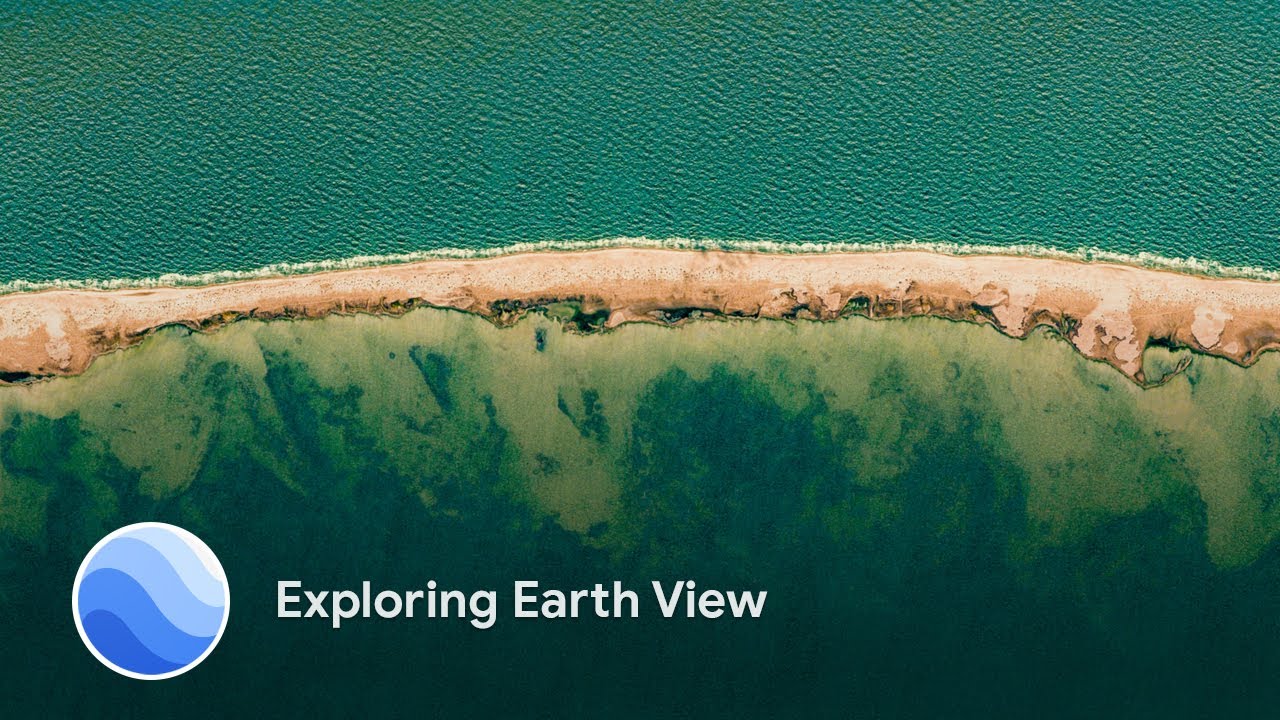
We’ve always said that if Google Maps is about finding your way, Google Earth is about getting lost. With Google Earth, you can see our planet like an astronaut from space, then travel anywhere on it in seconds with a click or tap. Even after an entire afternoon exploring cities, landscapes and stories on Google Earth, you'll have barely scratched the surface.
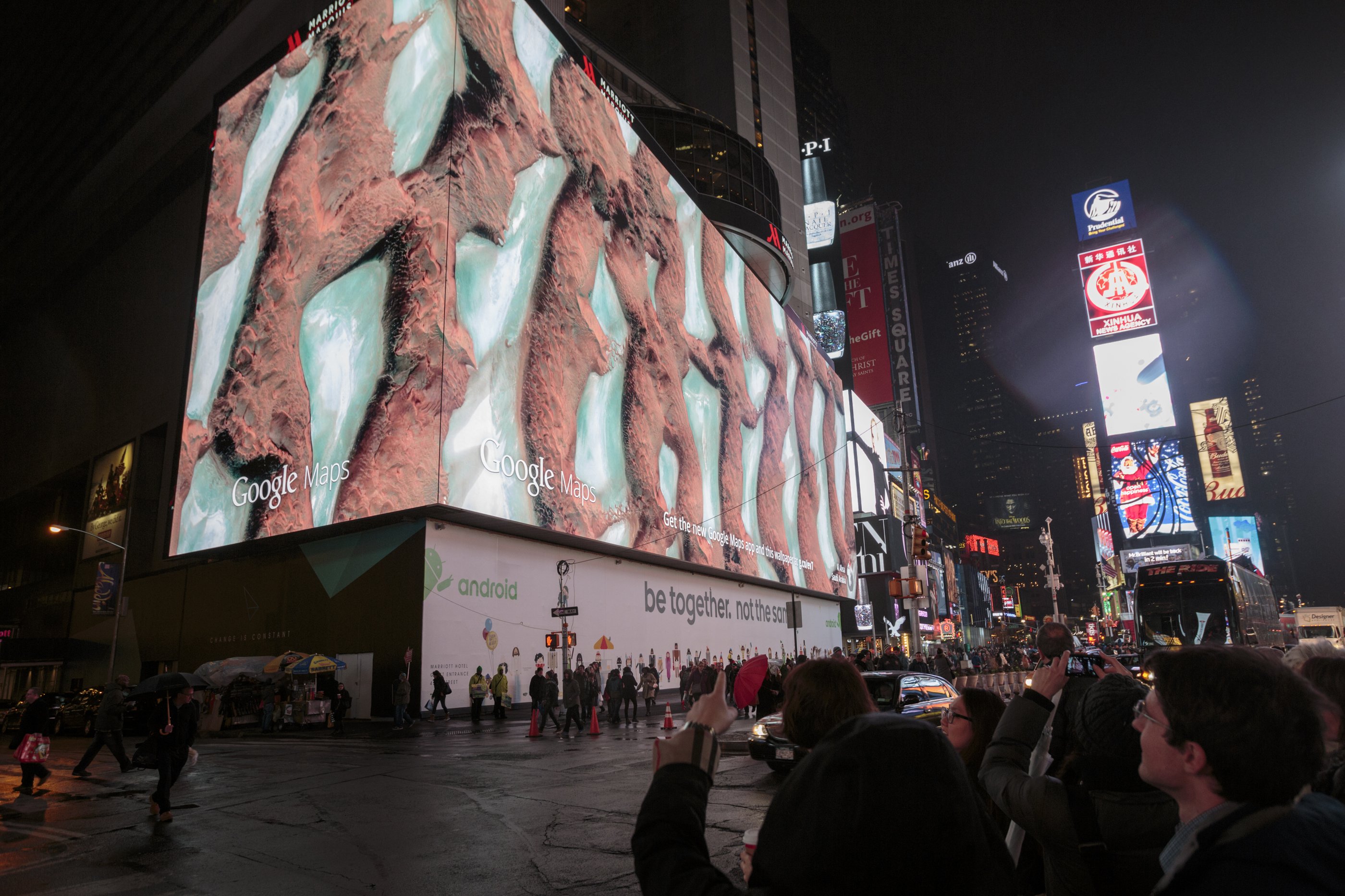
Now 15 years old, Google Earth is still the world’s biggest publicly accessible repository of geographic imagery. It combines aerial photography, satellite imagery, 3D topography, geographic data, and Street View into a tapestry you can explore. But Google Earth is much more than a 3D digital globe. The underlying technology has democratized mapmaking allowing anyone to better understand our world, and take action to create positive change.
Of the billions of people who have used Google Earth over the years, here are 15 stories that have inspired us:
1. Responding to natural disasters. Two months after Google Earth launched, we quickly realized that people were not just using it to plan their vacations. Hurricane Katrina hit the Gulf Coast in August 2005, and the Google Earth team quickly worked with the National Oceanic and Atmospheric Administration (NOAA) to make updated imagery available to first responders on the ground to support rescue efforts, relief operations and understand the hurricane’s impact.
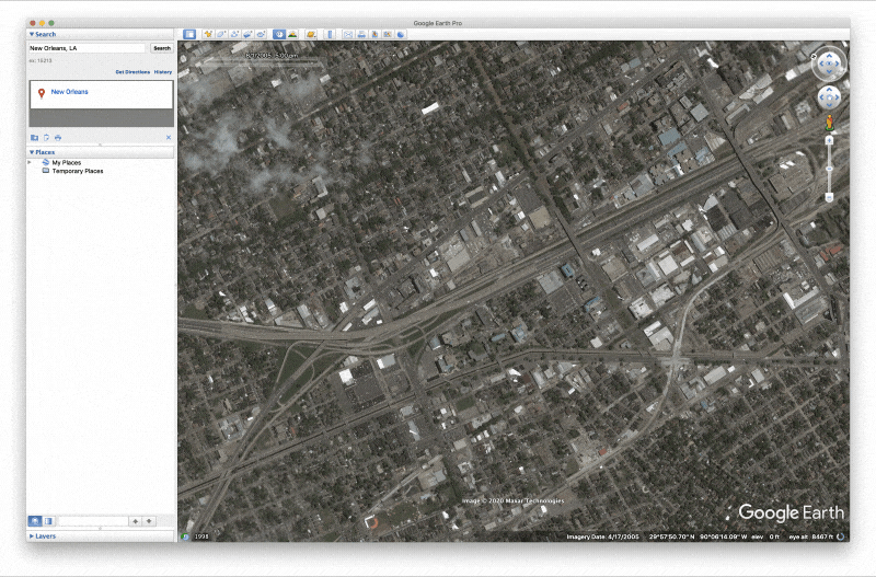
Hurricane Katrina imagery in Google Earth helped support rescue efforts, relief operations and understand the hurricane’s impact.
2. Taking virtual field trips. In 2006, former English teacher, Jerome Burg, first used Google Earth to create Lit Trips, tours that follow the journeys of literature’s well-known characters. Today the project includes more than 80 Lit Trips for teachers and students of all grade levels. Each tour includes thought-provoking discussion starters, classroom resources and enrichment activities.
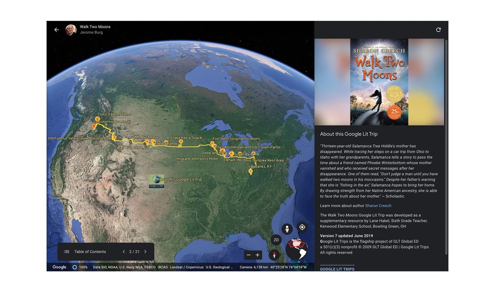
This Lit Trip brought the classic young adult novel, Walk Two Moons, to life in Google Earth.
3. Protecting culture. When Chief Almir of the Suruí people first glimpsed Google Earth on a visit to an Internet cafe, the indigenous leader immediately grasped its potential as a tool for conserving his people’s traditions. In 2007, Chief Almir traveled thousands of miles from the Brazilian Amazon to Google headquarters to invite Google to train his community to use Google Earth. The Suruí people went on to build their Cultural Map on Google Earth which included hundreds of cultural sites of significance in their rainforest.
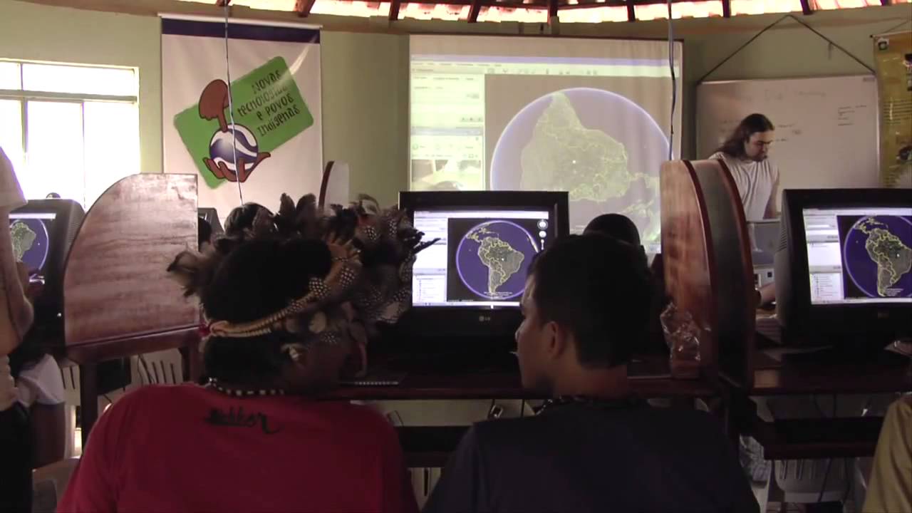
The Surui Cultural Map shows the Surui tribe of the Amazon's vision of their forest, including their territory and traditional history.
4. Decoding animal behaviors. In 2008, German and Czech researchers used Google Earth to look at 8,510 domestic cattle in 308 pastures across six continents. The images led them to make the amazing discovery that certain species of cattle and deer align themselves to the magnetic poles while grazing or resting.

Scientists used Google Earth to find which species of cattle and deer align themselves to the magentic poles
5. Reuniting families. Saroo Brierley was accidentally separated from his family at the age of five and ended up in an orphanage. Luckily, Saroo was adopted by a loving family in Australia. As an adult, Saroo was curious about his origins and painstakingly traced his way back home to India using the satellite imagery in Google Earth. He was able to reunite with his biological mother in 2011 after 25 years apart. View the story in Google Earth.
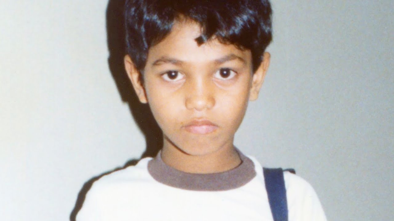
Saroo Brierley found his childhood home after being lost for 25 years. Follow along as Saroo walks through just how he did it.
6. Helping communities impacted by war. The HALO Trust—the world's oldest, largest and most successful humanitarian landmine clearance agency—uses Google Earth to identify and map mined areas. The HALO Trust has cleared 1.8 million landmines, 11.9 million items of other explosive remnants of war and 57.2 million of small arms munitions in 26 countries and territories around the world.

Two HALO staff in Nagorno Karabakh studying minefields with Google Earth.
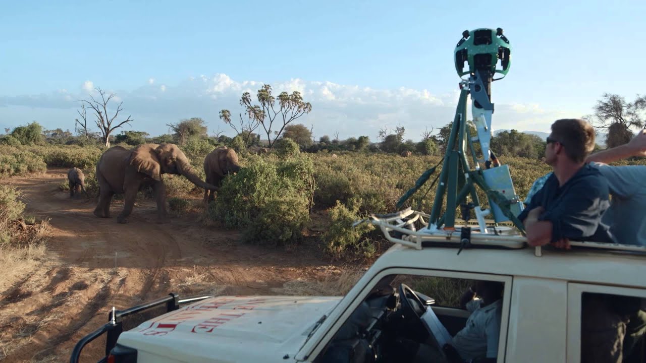
7. Protecting elephants from poachers:To protect elephants from poachers seeking their ivory tusks, Save the Elephants built an elephant tracking system. Starting in 2009, they have outfitted hundreds of elephants with satellite collars to track their movements in real time on Google Earth. Their partner organizations, including rangers at the Lewa Wildlife Conservancy, use Google Earth in the fight against elephant poachers across the conservancy and privately owned rangelands in Kenya.
8. Discovering unknown forests. Dr. Julian Bayliss used Google Earth to explore high-altitude rainforests in Africa. For almost as long as Google Earth has existed, Dr. Bayliss has been systematically flying over northern Mozambique in Google Earth and scanning the satellite imagery. One day he came across what appeared to be a mountaintop rainforest. His virtual discovery set off a chain of events that led to the discovery of an untouched rainforest ecosystem atop Mount Lico in 2018.
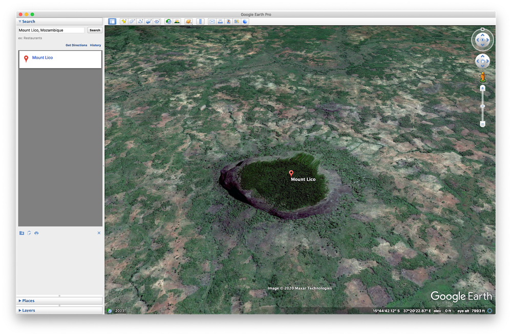
An untouched, mountain-top rainforest ecosystem is discovered with Google Earth.
9. Supporting students in rural classrooms. Padmaja Sathyamoorthy and others who work at the India Literacy Project (ILP) use Google Earth to build interactive content for rural classrooms, helping improve literacy for 745,000 students across India. Padmaja says, “ILP has made history and geography come alive with new tools and media content that capture the imagination of young minds. The project expands students’ horizons. It’s not just about learning curriculum from a textbook. I believe it creates a curiosity and a love for learning that will last a lifetime.”

10. Inspiring positive environmental change. The nonprofit organization, HAkA, used Google Earth to show threats to the Leuser Ecosystem, the last place on Earth where orangutans, rhinos, elephants and tigers coexist in the wild. This Google Earth tour helped raise awareness about the region and incited positive changes in the area.

HAkA's Google Earth tours have helped raise awareness about ecosystem threats in Indonesia.
11. Falling more in love with our planet. Google Earth VR, which was released in 2016, gave people the chance to see the Earth from a new perspective. Whether they experienced the overview effect or toured far flung locations, one thing remained constant — people couldn’t get enough.

You can soar over mountains with Google Earth VR.
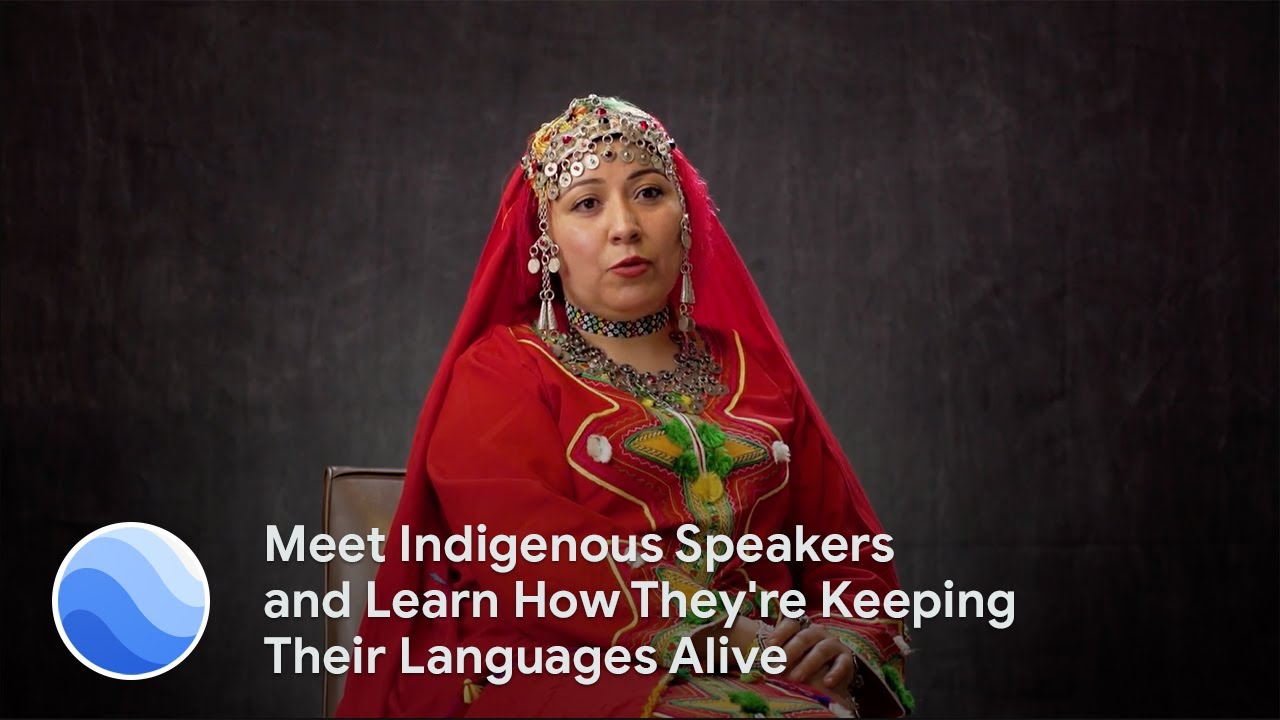
12. Celebrating global language diversity. In 2019, Tania Haerekiterā Tapueluelu Wolfgramm, a Māori and Tongan woman traveled across the Pacific ocean to interview and record the speakers of 10 different Indigenous languages for Google Earth. The project featured 50 Indigenous language speakers from around the world in honor of the 2019 International Year of Indigenous Languages.

Hear 50 indigenous language speakers in Google Earth.
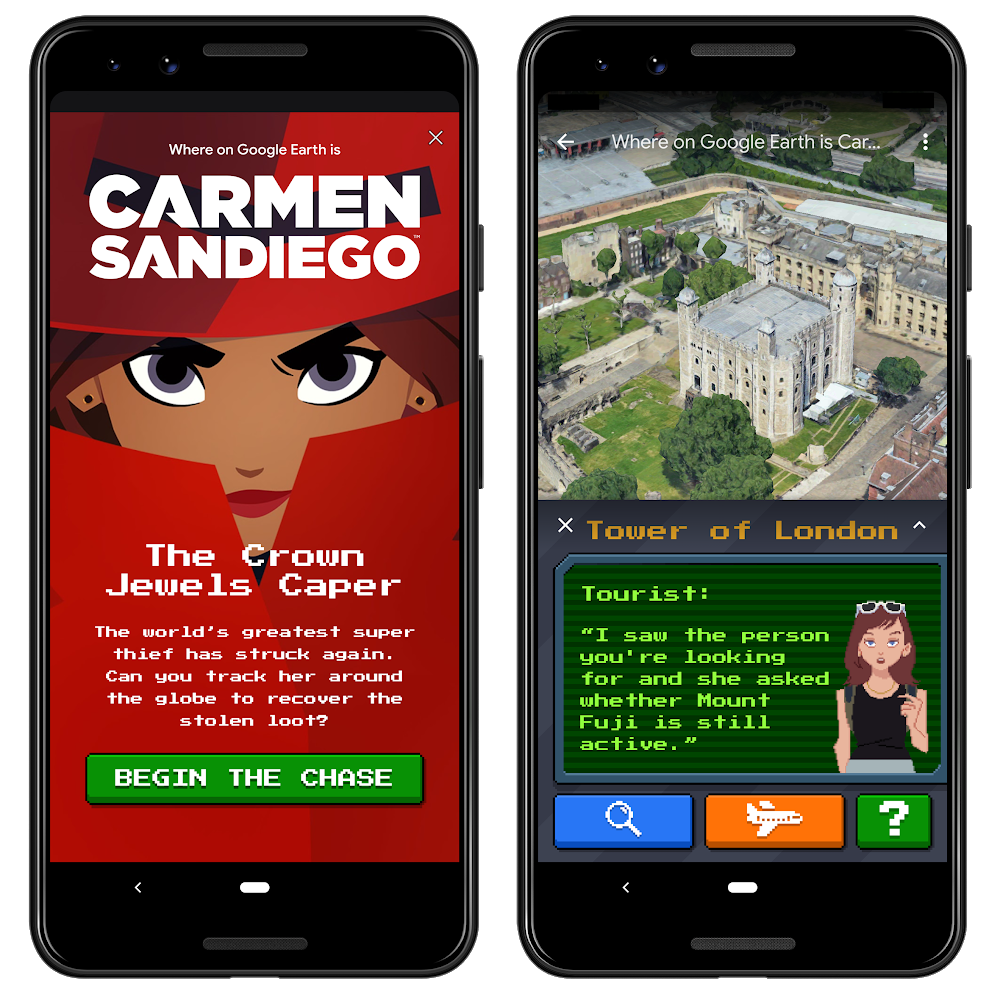
13. Catching (fictional) super thieves. People around the world followed the trail of Carmen Sandiego and the V.I.L.E. operatives by solving the three capers launched in Google Earth in 2019.
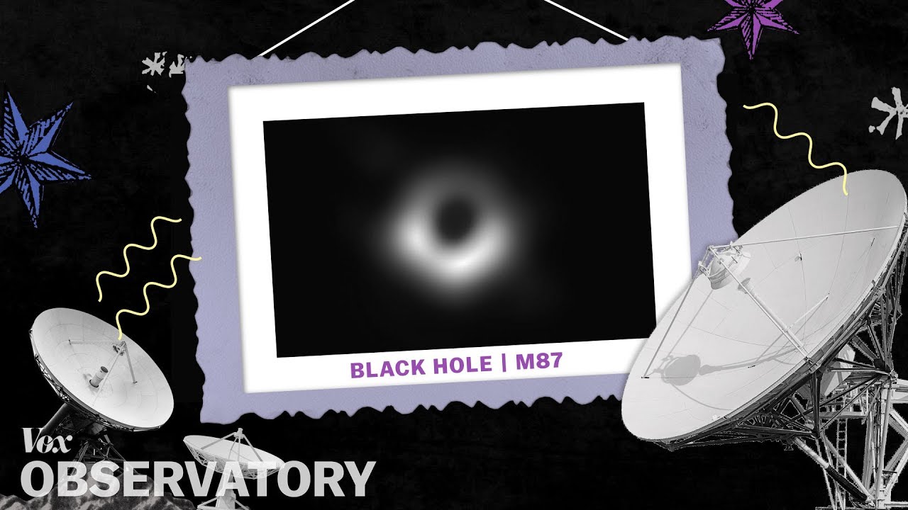
14. Telling more compelling news stories. Journalists have long used the rich imagery in Google Earth to create more engaging stories. Vox Video used Google Earth Studio to tell the story of how the Event Horizon telescope collected 54-million-year-old photons to take the first ever picture of a black hole.
15. Homecoming during COVID-19. During Golden Week in Japan, most people visit their hometowns, but this year that wasn’t possible due to COVID-19. To help homesick natives, a group from Morioka city developed a tour in Google Earth that let people virtually take the bullet train to Morioka station and visit beloved locations in the city.

Travel to charming Morioka, Japan in Google Earth, whether you're a traveller or native far from home.
A big thank you to everyone for being with us on this journey. Our hope is that Google Earth will continue to inspire curiosity and move us to care more deeply about our beautiful planet and all who live here. We look forward to seeing what the next 15 years brings!


