Tag Archives: Geo

New life for old photos: Mapping OldNYC


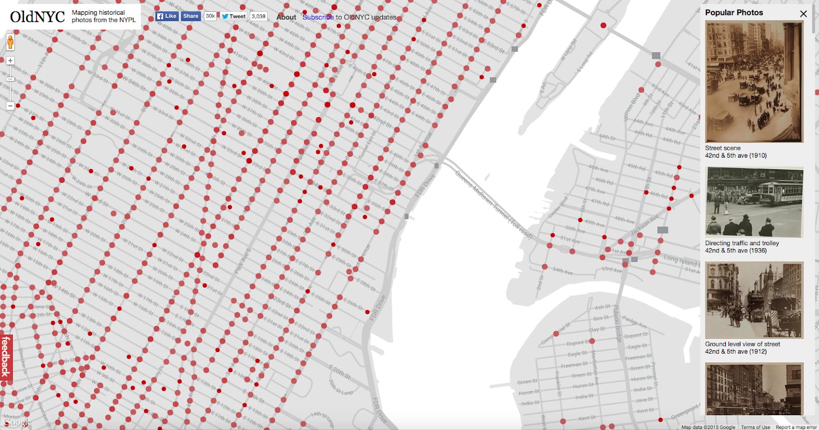
When Dan Vanderkam, a developer and self-confessed history lover, moved to New York in 2011, he found himself wondering what the city used to look like. He figured other people probably shared his curiosity, so he built a website, oldnyc.org, that overlays the city’s streets with more than 80,000 images from its past.

“I've always enjoyed historic photos because they capture so many details that you'd never write about,” Vanderkam says, guessing it’s something his father, a historian, passed down to him. “They really are a window into the past.”

Vanderkam approached Matt Knutzen, a geospatial librarian at the New York Public Library, whom he met a couple of years earlier at an event at the Google New York office.

At the time, Vanderkam was developing a website that mapped old pictures of San Francisco.

“We immediately began talking about historical photos and the possibility of overlaying images in 3D space,” Knutzen recalls.

For the San Francisco project, Vanderkam scraped photos from the San Francisco Public Library’s online archive, and only asked for permission to use them once he’d completed the site.

“I realized later how risky it was to ask them that late,” he says. “So, when I went to New York and started oldnyc, I did things differently by approaching the library first.”

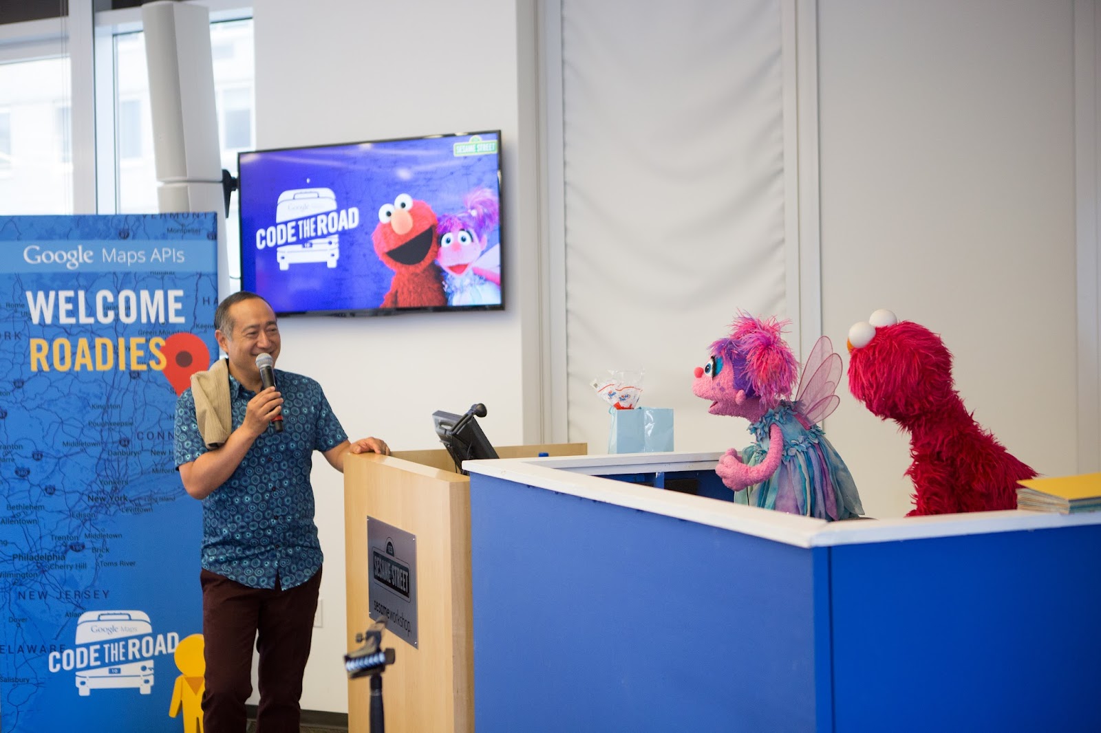
Starting Work on OldNYC

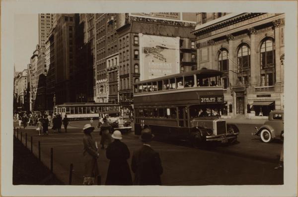
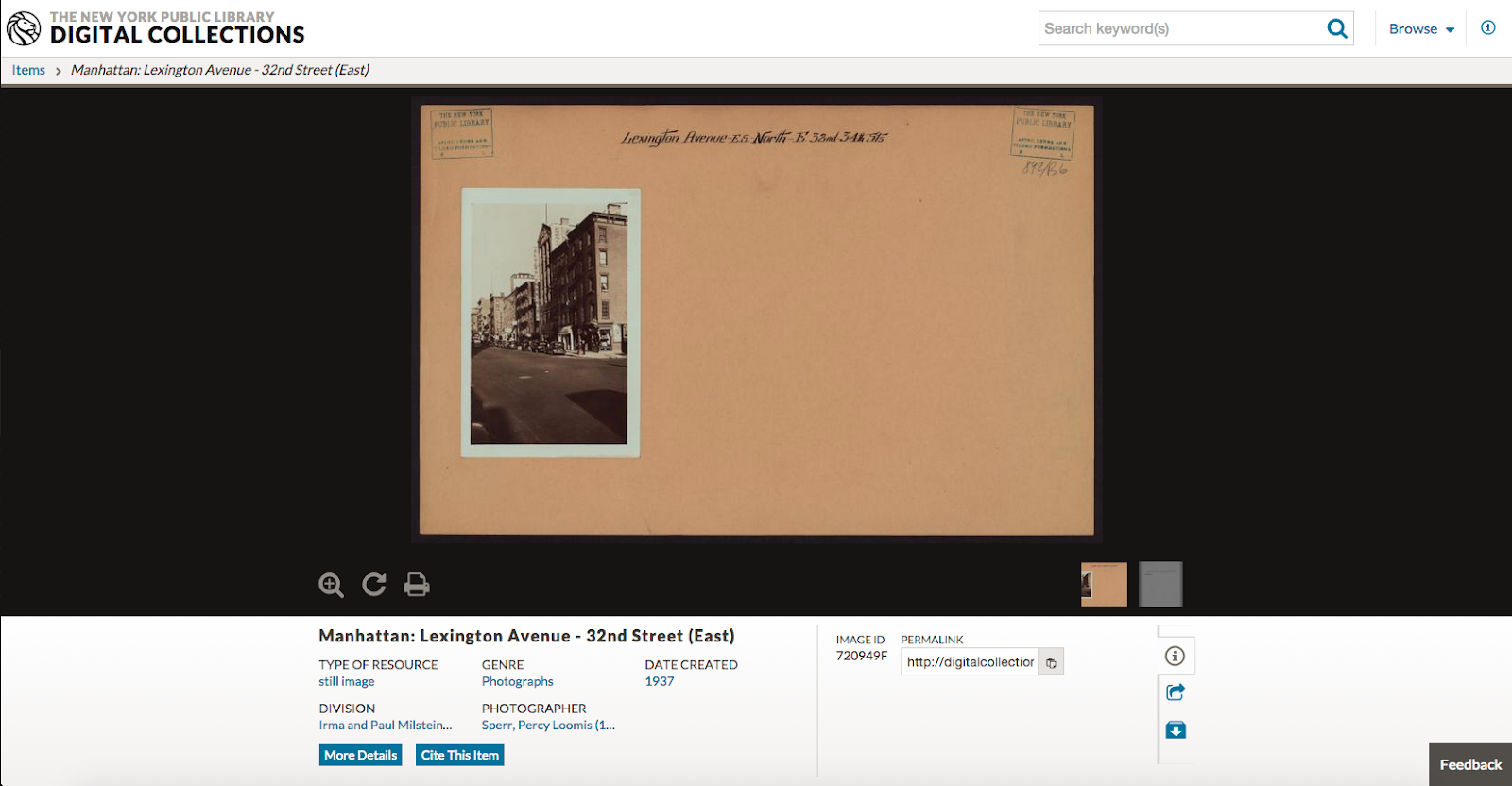
Knutzen, who studied geography and cartography in college, was immediately taken with the idea and knew exactly what resources to direct Vanderkam to. He introduced Vanderkam to the Milstein division of the library, which included a collection called Photographic Views of New York City, 1870s – 1970s.

The images, which are mounted on brown paper, include horse-drawn carts on barely developed dirt roads in the Bronx, skaters at Central Park in 1905, and a giant alligator balloon at Columbus Circle for Macy’s Thanksgiving Parade.
Old_Newyork_2.jpg

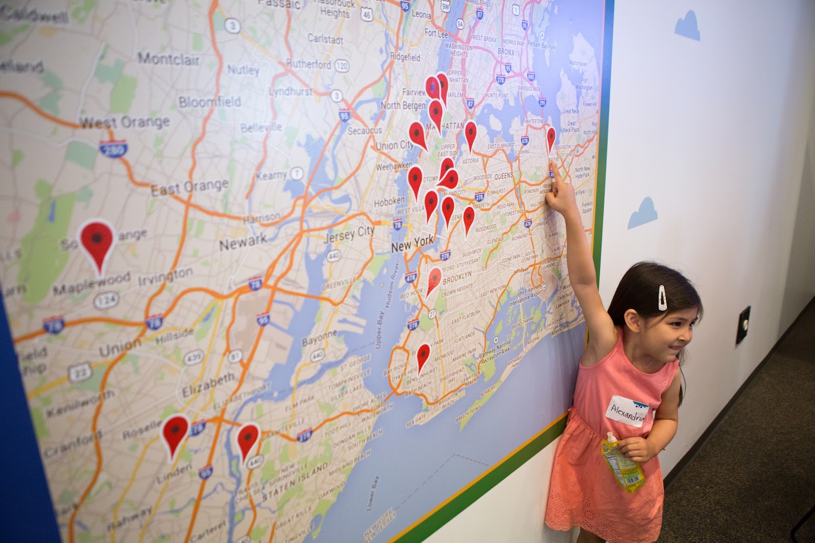
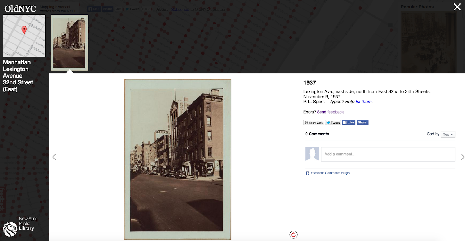
On oldnyc.org, clicking on a red dot marker will open a popup box containing photos of the location sorted from the earliest date to the most recent. Some of the images are undated. The site also shows the descriptions that Vanderkam says were written on the backs of some pictures.
Old_NY_1.png

Luckily for Vanderkam, Knutzen had already created a metadata spreadsheet containing unique identifiers for each photo corresponding to cross street locations.

“Plugging the data into Google Maps APIs was made easier because I didn’t have to scrape information or hunt for street names,” said Vanderkam.

To convert the addresses to latitudes and longitudes, Vanderkam used the Google Maps Geocoding API.

In order to customize his map, he used the Google Maps JavaScript API to create location markers, and adjust hue, lightness, saturation, gamma, invert lightness, and visibility. He also specified that his map only include roads and not other elements.
Old_NY_3.png

Vanderkam wanted other people to be able to engage with the pictures of the city, so he used a comments API from Facebook to allow site visitors to share their personal experiences.

Teaching Computers, Engaging Communities

Getting the photos on his site was also a challenge. Some of the photos were mounted individually, but others were mounted in pairs or more. To automate the task of matching an image with the coordinates in Knutzen’s spreadsheet and then uploading it to site, Vanderkam wrote code so that the computer could recognise the brown paper and isolate the photos. This was no simple task. To display them, Vanderkam used an expandable image grid library that enlarges a photo when it’s clicked on. The code is published on GitHub by danvk.
Old_NY_5.png

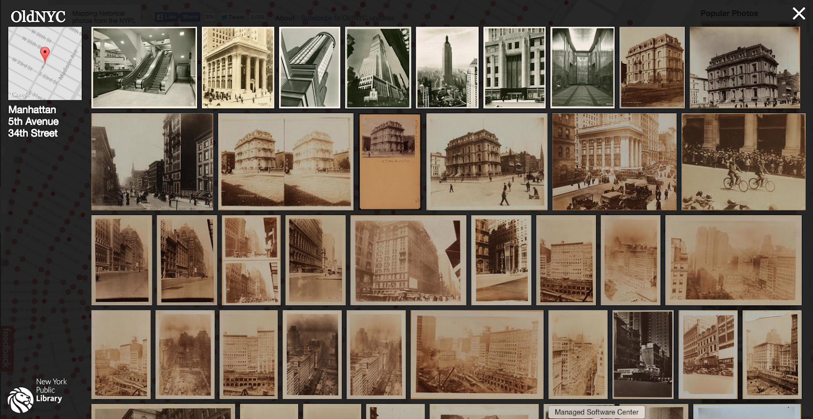
Vanderkam also created “rotate” and “improve this transcription” buttons to encourage site visitors to correct an image’s orientation or the transcription of the descriptive text on the backs of photos.
Old_NY_4.png

“Oldnyc is an incredibly valuable research tool. It’s now the best way into the photo collection,” says Knutzen. “Having the information of places aligned spatially combines information to give us new knowledge to make new discoveries.”

Vanderkam doesn’t have plans to work on maps for more cities, but hopes that someone else would be interested in picking up the baton. “The code for it is all open source, so if anyone is interested in building a version for their hometown, they should get in touch,” he says.

The Weather Channel brings real-time weather updates to users with Google Maps APIs


Editor’s note: Today’s guest blogger is Chris Huff, Vice President of Mobile Development at The Weather Channel. Read how The Weather Channel uses Google Maps APIs to power their popular Android app. The Weather Channel is just one of many customers who shared their story as part of our cross-country road trip, Code the Road.

We know from experience that the combination of weather, mapping and community input can result in ideas that keep people safe and informed. Our Android app goes far beyond basic weather forecasting, which is why we chose Google Maps. We use Google Maps Android API, Google Maps JavaScript API and ImageOverlays to place geodata, such as weather alerts, hurricanes, and storm tracks, and weather tiles, such as radar maps and clouds, on top of Google Maps.

Radar maps are one of the app’s main features, and we work hard to get them right. We get radar imagery from multiple sources and produce raster images from them. Then we take hundreds of the images and animate them in a frame-based animation sequence. The Google Maps Android API gives us overlays to place the animation on top of maps, and also lets us add additional objects such as pins and polygons to visualize lightning strikes or a storm’s direction. You can see an example below.

The more local weather reporting is, the more accurate it is; a thunderstorm may skip one neighborhood but hit another. So to improve accuracy and to build a community around our app, we’ve been working to make it more social. People send us information about weather near them, and we use the Google Maps Android API to add a pin to the map for each user-created report. Anyone can tap a pin to see the detailed report. Here’s an example of social weather reporting.
Social Weather Reports_The Weather Channel App for Android_framed.png

With more than 68 million downloads, the app has been a tremendous success. We get 2 billion requests for radar maps every year. There’s an old saying that everyone talks about the weather but no one does anything about it. We beg to disagree. With the Google Maps APIs we’re giving people detailed, useful, live information about the weather, and we believe that’s doing quite a bit.

As part of the Code the Road series we hosted the 24-hour hackathon event, “Storm the Road: Hack for Safety with The Weather Channel and Google Maps”, on June 23. The event gave developers an opportunity to come together to create a new app or feature for mobile or web that helps keep the public safe and informed.

Code the Road: A visit to Epcot with Tech Sassy Girlz Recap


We had a fantastic day on June 26 at Epcot where we hosted an event with the Disney team for 40 Tech Sassy Girlz, an Orlando-based non-profit program designed to provide girls in grades 6 through 12 exposure and access to STEM (Science, Technology, Engineering and Mathematics) fields and careers.
C11C3366.jpg

The day began with a private tour of the Code the Road bus where the girls were able to see technology first-hand, ask questions, and get a great team photo in front of our bus.
C11C3581.jpg

Rebecca Moore, computer scientist and longtime software professional at Google opened the day with a presentation and discussion about how engineering and technology has changed her life. At Google, she conceived and leads the Google Earth Outreach program, which supports nonprofits, communities and indigenous peoples around the world in applying Google's mapping tools to the world's pressing problems in areas such as environmental conservation, human rights and creating a sustainable society.
IMG_3953.JPG

The girls also heard from Disney engineer Dan Soto who introduced them to the My Disney Experience app and spoke about prototyping and everything that goes into building an app. James McGill, Engineering Manager for the Google Maps APIs gave a talk about being an engineer and how fun it is to work with code and technology every day.
C11C3571.jpg

The girls had a hand at and intro to coding with Made with Code where they learned the basics of iteration, counters, and more. Made with Code is a project that creates engaging tutorials to help women get interested in and learn how to code.
A050_C025_0626FF.0000344.jpg

Once the girls had learned all about engineering and the basics of coding, we went outside into the park for a technology-focused tour of Epcot. There were five stops on this science themed exploration: Spaceship Earth, Test Track, Soarin’, Journey Into Imagination, The Seas with Nemo and Friends, and the Google Liquid Galaxy.
C11C3814.jpg

Our final surprise was a visit from Mickey Mouse, himself, for a photo op and even a few hugs.

Although we’ve ended our 30 day journey and parked the bus, we’ll be sharing our Code the Road summary video and blog post soon.

Posted by Ashley Smith, Developer Marketing, Google Maps APIs

The place picker gets a new signal from Bluetooth beacons

In Google Play services 7.8, the place picker in the Places API for Android will use signals from beacons in determining the device’s current location.

The Place Picker is a great UI widget for helping your users communicate where they’re located in terms they understand: places, addresses, and locations on a map. With the launch of the Proximity Beacon API as part of Google’s beacon platform, Bluetooth low energy (BLE) beacons provide a new context signal to devices. When a user’s device is near a beacon that has been registered through the Proximity Beacon API, the beacon’s associated PlaceID is combined with other signals available to the device. This strong signal is used to rank the suggestions presented to the user in the place picker.

If you already use the place picker in your app, you’ll get this integration for free! Just so you know, there won’t be any additional permissions required from your users since you’ll already be requesting ACCESS_FINE_LOCATION to run the Place Picker, which includes using BLE technology to listen for beacons. The change will only influence the place inference for users who already have their device’s Bluetooth turned on; it won’t turn on Bluetooth or prompt users with it turned off to turn it on.

If you want to deploy your own beacons, visit the developer documentation for a brief tutorial.

Posted by Jen Harrington, Product Manager, Google Maps APIs

Code the Road: ‘Storm the Road’ Hackathon with The Weather Channel Recap


On Tuesday, June 23 we pulled the Code the Road bus into The Weather Channel HQ to co-host ‘Storm the Road’, a 24 hour hackathon dedicated to building apps for weather safety.
A046_C007_0623VN.0000437.jpg

While in Atlanta, we hosted 14 teams of developers tasked with creating a new app for mobile or web that helps keep the public safe and informed with the Google Maps APIs and The Weather Channel data layer. Natural and weather-related disasters happen far too frequently. They can strike anywhere—across the world or right in your own neighborhood. During these events safety preparedness, adequate response and an informed public are critical.
A048_C008_0623UE.0000076.jpg

During the all night hackathon, we enjoyed meals, snacks, and a few naps but we were overwhelmed by how much the developers in the room were able to accomplish in such a short amount of time.
A046_C029_0623YY.0000131.jpg

We kicked-off the hackathon with an introduction from Ruben Brown, Regional Communications Manager, American Red Cross of Georgia, and two quick tutorials from Ankur Kotwal, Head of Scalable Developer Advocacy, Google Maps and Chris Huff, VP, Mobile & Consumer App Development at The Weather Channel. Our developers immediately started forming teams and pitching ideas. Within 30 minutes, everyone was heads down and coding.
A047_C009_062358.0000000.jpg

Midnight Madness

After 9 hours of hacking, everyone jumped up to participate in our rock-paper-scissors tournament. Teams around the room played one round of rock-paper-scissors and the winner played the winner from the adjacent team. The loser had to become their opponent’s cheerleader in the next round.
A048_C001_0623RN.0005408.jpg

After an intense and loud round of rock-paper-scissors—we crowned our winner. We had prizes for the top four winners, the overall winner, and the best cheerleader who even lost his voice during the competition. Our top four winners received a private tour of The Weather Channel Studios.
A047_C019_0623IQ.0000288.jpg

Judges

Our judging panel included two team members from The Weather Channel, Cameron Clayton, President, Product and Technology, and Jen Carfagno, On-camera meteorologist. We were fortunate to also have two representatives from The American Red Cross, Sandy Smith, Regional Chief Development Officer, and Tim Downey, Strategic Partnerships & Development. Rounding out the panel was James McGill, Engineering Manager Google Maps APIs.
STR_Judging.JPG

Results

All of the teams embraced the challenge, but there could only be three finalists.

1st Place - BeForecast: Calvin Nix, Luis Lopez, Daniell Yancey, Zacchaeus Thomas
BeForecast is an Android application developed to help provide weather related information to people planning events. This application utilizes The Weather Channel API along with the Google Maps APIs. Our goal is to help keep people informed about weather conditions as it relates to their own personal agenda.


2nd Place - Watchtower: Raymond Hebard, Ocean Evers-Peete, Austin Evers-Peete, and Wren Howell
Watchtower is a preemptive response to natural disasters and national crises for people in a foreign environment. The web application works to match individuals/groups in need with volunteers (i.e. 'Beacons') and 'Samaritans' (certified helpers like the Red Cross) who meet the criteria of being willing to help the people in need, speaking the same language of the foreign travelers, and having the proper knowledge of safety precautions for events that may occur. The Weather Channel API displays a 10-day forecast of the desired location on the homepage, and the Google Maps APIs are utilized as a visual representation to display the location of 'Samaritans' or ‘Beacons’ alongside the listing of suitable matches.

3rd Place - Emergency Delivery Service: Jon Keller, Kelly Marble, Gene Chorba, and Saeid Motevalialamoti
Emergency Delivery Service handles inventory, routing, and delivery of necessary supplies to people in need following a natural disaster. It's an Android app which uses the Google Maps APIs, a source for weather tiles, and Parse.

Congratulations to our winners and to everyone who participated in the event. We were all so impressed by how much could be built for safety using Maps and Weather in such a short amount of time.
A047_C028_0623SX.0000673.jpg

We’ve ended our journey and parked the bus, but stay tuned for even more updates from our adventures on the road.

Posted by Ashley Smith, Developer Marketing, Google Maps APIs

Chicago Department of Transportation helps build a new Chicago using Google Maps APIs


Editor’s note: Today’s guest blogger is Lawrence Olzsac and William Cheaks, Jr. from the Chicago Department of Transportation. Read how the City of Chicago’s Department of Transportation uses Google Maps APIs to create a Web site that coordinates billions of dollars of infrastructure work. The City of Chicago is one of many customers sharing their story as part of our cross-country road trip, Code the Road.

When Chicago Mayor Rahm Emanuel set out to build a “New Chicago,” in 2011, he demanded that the City not only increase its investment in street paving projects, but also invest in those infrastructure projects more efficiently. The Chicago Department of Transportation (CDOT) Project Coordination Office (PCO), managed by Chicago-based and veteran-owned Collins Engineers, Inc. (Collins), set out to get city departments and utilities to collaborate on reducing conflicts between construction projects.

To do that, CDOT and Collins wanted a new GIS management software that could be used by the City and external utilities to better manage all the projects and meet the operational demands of the CDOT's Division of Infrastructure Management and Office of Underground Coordination.

In 2014, Collins turned to Google for Work Premier Partner SADA Systems to design and build an external and intuitive platform to assist in coordination. The application, dotMaps, is an interactive web mapping service built on Google Maps and Google Cloud Platform, and helps the city manage the work, cut down on conflicts, save taxpayer money, and improve quality of life by reducing unnecessary roadwork and easing traffic congestion. dotMaps, which provides collaborative tools that allow people to create projects and resolve overlapping ones using geolocation, all in real-time, solves a bedeviling problem for city officials and planners: Coordinating public and private construction projects to avoid duplicate work.
cdot-app.jpg
Within the dotMaps application, city engineers, officials, planners and agencies can access all permit, project, and special event data in one location and view relevant information about 30,000 current projects on a live interactive map. They can view and search for projects by type, agency, date of construction, address and other data. Soon they’ll be able to do the same thing for projects done by private companies that do construction work in the city, like Verizon, AT&T, Peoples Gas, Comcast and ComEd—making sure that private infrastructure work is being coordinated with public work.
dotMaps_CDOT.png
The Google Maps interface was a big selling point in getting dozens of agencies to buy into working with dotMaps. City workers were familiar with the Google Maps interface, and so were immediately comfortable with it. They didn’t need training because they already knew how to use Google Maps’ functionality.

A host of Google Maps APIs work together on dotMaps.The Google Maps JavaScript API displays the map on a Web page. The Google MapsGeocoding API plots points on the map, identifying each project, making it easy for city officials to get information about any project quickly. Google Maps Distance Matrix API allows someone to see every project within a given radius — a big help when checking for conflicting projects, or gauging the concentration of projects in a single area. The Google Places API validates addresses that people type in, and auto-completes as they type.
dotMaps_CDOT2.png

dotMaps for iOS (which uses the Google Maps SDK for iOS) and Android (Google Maps Android API) tap into the same Google Maps Web Services APIs that the Web site does. The mobile apps allow city employees to get information about nearby projects, report issues and search for information, including something as simple as finding out why there’s a hole in the sidewalk. Before dotMaps, it would have taken multiple phone calls to track down a city employee to answer the question. Now it just takes a few taps.

The city has already seen big benefits from dotMaps. It has helped the CDOT’s PCO partner with public and private entities to coordinate their work more efficiently, resulting in additional savings from duplicative work in 2014 of more than $24 million. This is a big win for taxpayers, making their money go further. Those savings can be applied to building more infrastructure and improving people’s daily lives. The city has big plans for dotMaps and hopes to make it even more useful in the near future with a powerful new mobile component on the way. Thanks to a partnership with Google, the City of Chicago is showing people that government can embrace innovative solutions, make their money go further and improve their lives.

We were excited to participate in the Google Maps Code the Road journey on June 11. We welcomed the bus in front of our building in downtown Chicago to let all passersby come into the bus to see how the we are executing the great infrastructure changes happening in our city with Google Maps.

Code the Road: A Visit with Hilton Recap

On Monday, June 22 we pulled into Hilton Worldwide Headquarters to see how they are developing an enhanced version of the Hilton HHonors app with Google for Work Premier Partner SADA Systems using the Google Maps APIs.
C11C2554.jpg

Hundreds of team members and hotel guests from Hilton McLean stopped by the bus to enjoy a cup of coffee and exciting demos of the HHonors iOS app. When launched, guests will be able to search for a hotel room and view floorplans overlayed onto Google Maps—providing guests richer context when selecting and booking a room.
C11C2583.jpg

Members of the HHonors App and supporting teams spoke with us about how integral Google Maps is in their continued efforts to improve the guest experience at Hilton.
A045_C034_06220Y.0000595.jpg

During our 30 day journey across the U.S., our team stayed at some of the Hilton brand properties including Hampton Inn, Hilton, Hilton Garden Inn, to see first-hand the benefits the HHonors program.
A045_C015_0622DR.0000537.jpg

It was great to visit with the team in McLean to see the exciting plans on the horizon using the Google Maps APIs. For now, we’ve parked the bus but, we’ll be sharing more of our adventures from the road soon.

Posted by Ashley Smith, Developer Marketing, Google Maps APIs

Code the Road: Teaching geo-literacy to children with Elmo, Abby, and Alan from Sesame Street


On June 17, we took our Code the Road bus to Sesame Workshop in New York City for a visit with Elmo, Abby, and Alan from Sesame Street. We partnered with Sesame Street to host a group of very excited children to start the journey to learning about geo-literacy. Two of our favorite Muppets, Elmo and Abby, went on a make-believe trip across town with their friend Alan while encouraging kids to explore.
IMG_1194.jpg

The morning started with a greeting from Scott Chambers, Senior Vice President, North America Media and Licensing Sesame Workshop who welcomed everyone to Sesame Street. Before Elmo, Abby, and Alan came out to play, Ankur Kotwal, Google Maps Developer Advocate, told the children about his journey all the way from Sydney, Australia to New York, New York to visit with Sesame Street. He also taught basic understanding of 10 steps being further than 5 steps away so we covered the basics of near and far. Our over-sized map puzzle was a hit! Children love maps almost as much as they love Sesame Street.
IMG_1536.jpg

We had a surprise visit from Elmo and Abby along with Alan who played the game Go!Go!Go! with the children. They chatted about exploring their neighborhood and how to get to the library, grocery store, and more in planes, trains, and automobiles. The kids really enjoyed singing songs and dancing with Elmo and Abby. There is something lasting and fun about learning something new through a song.
IMG_1580.jpg

While at Sesame Street the children were treated to Sesame Street coloring pages, took pictures with Cookie Monster and Elmo walkarounds, and even hung out in Oscar’s favorite place, his trash can.
IMG_1237.jpg

We were happy to be able to meet kids from all over the New York area. We had each child drop a pin where they lived on the map. Alexandra even traveled by train all the way from Bayside to see Abby and to learn about maps. We were amazed by how even the youngest of kids could find his or her neighborhood on a map. At the end of the day our map had over 150 pins from all over the New York metro area.
IMG_1342.jpg

With ten years of Google Maps comes ten years of exploration. Today, anyone can sit down with their iPad, phones, and computers and explore all over the world using Google Maps. A love for exploration and maps can be discovered at an early age and we were so happy to celebrate our 10th birthday with 3 to 5 year olds with an excitement for exploring. It is never too early to introduce the basics of exploration and maps to encourage geo-literacy.
IMG_1585.jpg

Posted by Ashley Smith, Developer Marketing, Google Maps APIs

Hilton helps guests book the perfect room with Google Maps APIs


Editor’s note: Today’s guest blogger is Virginia Suliman, Vice President of Digital Design and Development, Hilton Worldwide. Read how Hilton is experimenting with Google APIs to take the guess work out of the hotel booking and room selection process. Hilton is just one of many customers sharing their story as part of our cross-country road trip, Code the Road.

No one likes surprises when they reserve hotel rooms, so it’s crucial for Hilton that people see exactly what they’ll be getting before they arrive. Currently, Hilton’s HHonors guests can use the HHonors website and app as a one-stop tool to control their on-property experience – from finding the best hotels in the right neighborhoods and booking the most suitable one, to soon, using the app as a room key.
couple_sitting.jpg

With a spirit of constant innovation, we’re always looking for new ways to enhance the guest experience. One way we’re doing so is by experimenting with the Google Maps APIs through proof of concept iPhone app functionality we built to enhance the room selection process during digital check-in. The concept tests a the Street View panoramas, part of the Google Maps SDK for iOS, letting users see on the app the exact view they’ll experience when they get to their hotel room. For example, they could virtually look out their window on the app and select the room that overlooks a park or a quiet street corner.
Businesswoman2.jpg

People care not just about the hotel they stay in, but also about the neighborhood, including what kinds of food, entertainment and amenities are nearby. So in our concept, we also tested a controlled list of businesses and points of interest from the Google Maps Places API for IOS to highlight nearby destinations via the HHonors app, like Lincoln Center in New York City, a great fish restaurant in Boston, or the Centennial Olympic Park in Atlanta.

The full potential of Google APIs sets in when you combine them. If successful, the Maps and Street View panorama concepts could one day fully integrate into our HHonors app or global web portal, which already uses Google Maps Business View to offer panoramic virtual tours of our properties to guests.

We believe that happy travelers are repeat customers who become loyalists. If you feel connected to the experience you’ve had with us, you’re more likely to return and to tell others about it. Through technology, we’re hoping to make it easier for people to find the perfect room, have an unforgettable stay and come back for another adventure.

We were delighted to participate in the Code the Road trip. We hosted the Code the Road bus at our Hilton Chicago property on June 10 and are hosting it at Hilton Headquarters in McLean, Virginia on June 22. You can also see the Hilton HHonors app window-view proof of concept demo on the bus.

Code the Road: New York Developer Meetup Recap

For our last developer meetup of Code the Road, we were thrilled to be in New York City. We had a great time in the Big Apple visiting with over 200 local developers at our Google New York office on June 18 as well as all of the New York passersby who stopped to take a look inside the bus. We had everyone from a 5 year old boy who was very excited to see Street View imagery of the pyramids to developers joining us for the meetup tour our bus.
C11C1911.jpg

Ankur Kotwal, Developer Advocate at Google, kicked off the night with a great talk about using Google Maps APIs in your iOS or Android App, presenting Maps Zen patterns to help your apps shine.
A043_C006_06183I.0000651.jpg

We welcomed Chase Brammer, Head of iFit Product Development, back to the stage—coming all the way from Utah to give a talk about how Icon Fitness uses the Maps APIs to make workouts more interesting. He did this all while walking on a treadmill. Pretty impressive!
A043_C020_0618YF.0000320.jpg

Aurelia Moser, Map Scientist from CartoDB, delivered a presentation titled 'Hi-Res Human Maps: Google Maps APIs via CartoDB.' She gave us interesting insights on everything from designing maps to maps mashup.
C11C2016.jpg

David McClusky, Solutions Architect, Google Maps for Work, outlined how we can be best prepared for our Maps to go viral by building in them on Google Cloud Platform.
C11C2074.jpg
Rounding out the night, Kedar Sarmalker, Mobile Engineer at TripAdvisor, gave a great talk on how TripAdvisor uses custom markers, polygons, styling and Google Maps APIs in their mobile app.
C11C2088.jpg

After the presentations we had a great time speaking with and learning from all the developers who attended the meetup.
C11C2126.jpg

We'll be sharing more about our trip over the next few days including our visit to Epcot. The bus was parked at Future World West on Friday June 26.

Posted by Ashley Smith, Developer Marketing, Google Maps APIs