Editor’s note: ‘Map Tips’ are designed to answer frequently asked questions about Google Maps APIs. For important tips on how to deploy Google’s mapping tools, read more from Richard Coombes, Google Maps Solutions Architect at Google.
The number of transportation booking apps—taxi, rideshare, shuttle and limo to name a few, has exploded over the last few years primarily due to the increase in GPS enabled smartphones, fast and reliable mobile connectivity and simple, secure payment options. These apps offer real benefits to customers, drivers and taxi booking companies and location plays a critical role for all of them. Google Maps APIs enable many feature-rich capabilities that can provide the best location-based information and user experiences for booking and tracking the perfect ride.
Here are eight helpful tips for optimizing your taxi or rideshare services with the Google Maps APIs:
1. Use Places API Autocomplete for easy address entry. The type-ahead-search suggestions available with Places API Autocomplete makes it fast and easy for the customer to provide an accurate pick-up and drop-off location with minimal keystrokes. The Autocomplete feature is available in Android, iOS, Javascript and as a web service for flexible integration options.
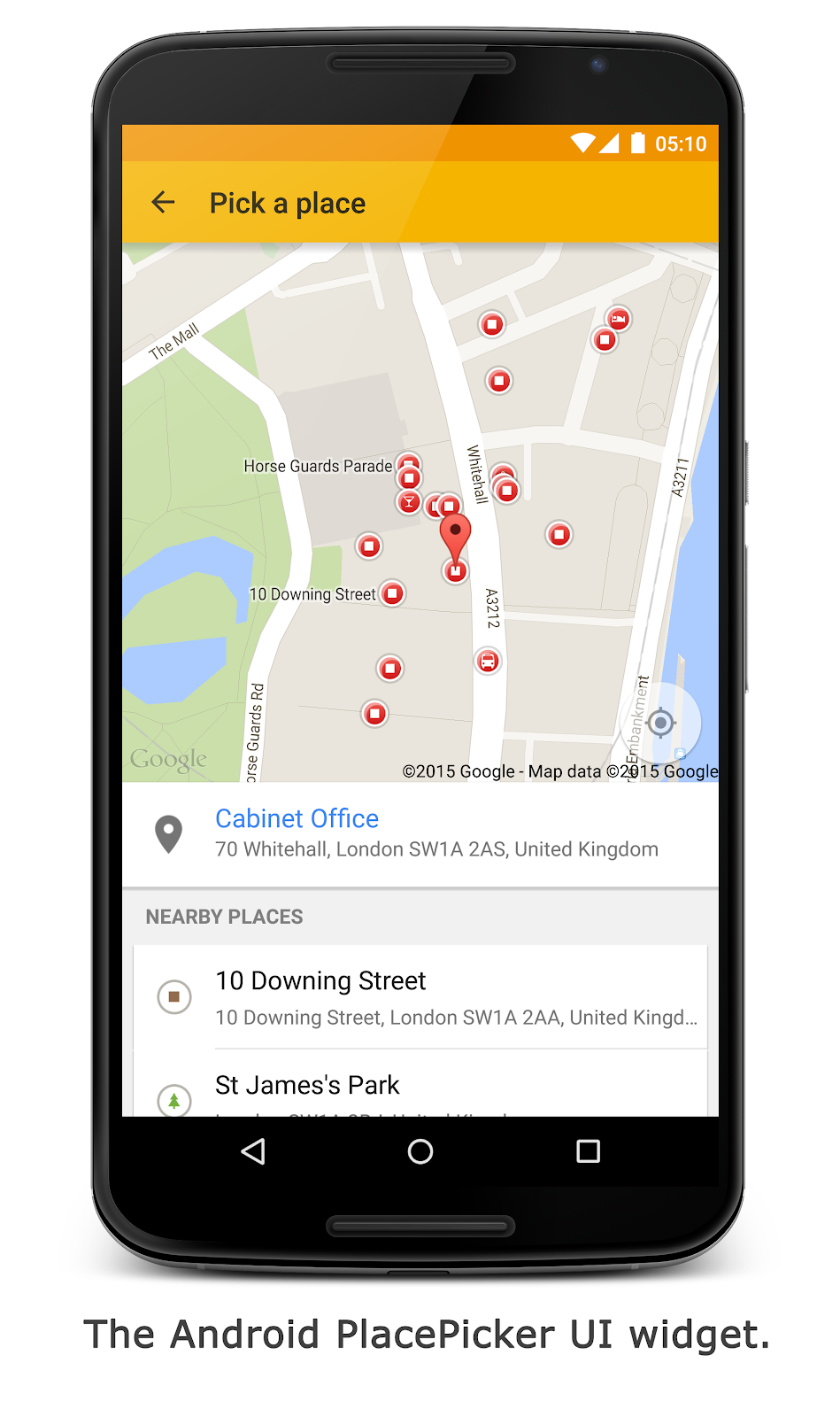
2. Automatically locate the customer for fast booking. If booking a taxi immediately, allow your customer to automatically communicate their current location using the location capabilities of their smartphone or browser. On Android and iOS make use of the Places API Place Picker UI widget so your customer can choose their location from a list of nearby places. Alternatively, the Geocoding API can provide the nearest address to their current location.
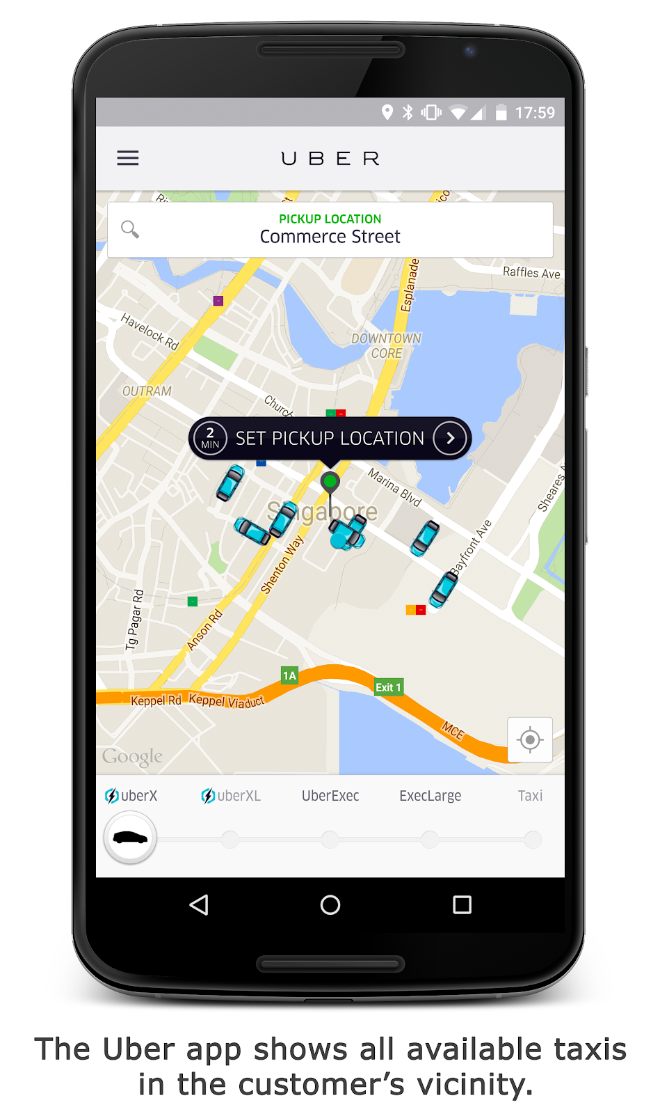
4. Show the real-time location of the customer and driver on a Google Map. Help reassure the customer that their ride is on the way by showing real-time location of the vehicle on a map—in relation to their position. If the driver is unfamiliar with the area this can also help guide her to the customer’s location. Google has global coverage so if you’re working in multiple countries we’ve got you covered. No need to work with multiple map providers. Asset tracking with Google Maps allows a taxi booking company to view the real-time location and status of all their taxis on a central map to help process offline bookings coming in via telephone calls. Need help storing and retrieving all of your taxi fleet locations? Take a look at our previous blog post on how to store your location data in the cloud with Firebase.
6. Provide an estimated fare and drop-off time to the customer. Before the journey starts, provide customers with an estimated fare based on the optimal route and traffic conditions. The Directions API can provide the route distance and duration in current traffic. Alternative routes can also be provided. These details can be used to estimate when the customer may arrive at their destination and how much it should cost.
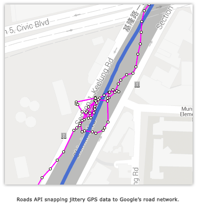
8. Better understand vehicle speed and safety. Oftentimes a taxi booking company is relying solely on information coming from the driver’s and customer’s smartphone and no in-car telematic devices are available. The Roads API can provide the posted speed limit along a road. This speed limit can be compared with the calculated actual speed of the vehicle (from GPS data) to determine if and where speeding occurs.
We hope you’re able to incorporate some of these ideas into your taxi booking systems. Learn more about what Google Maps APIs can do for your websites and applications.