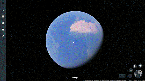
So much of what students learn in the classroom—from social studies to history, science and literature—relates to a geographic place on Earth. Recently, we announced a new version of Google Earth, and since then, educators have been telling us what a valuable tool Google Earth is for their students. They use the “I’m feeling lucky” feature to inspire writing exercises, do research exercises with Knowledge Cards, and explore satellite imagery and cloud strata with their students. Now, to make it even easier for teachers to use Google Earth in the classroom, we’ve created a new “Education” category in the Voyager section, which includes new stories—complete with classroom activities—from National Geographic Society, PBS Education, HHMI Biointeractive and Mission Blue.
The National Geographic Society stories take students on adventures following explorers through the Middle East, India, and coral reefs. To supplement the experience, National Geographic Society created idea for activities that highlight a range of geographical concepts, such as interpreting land forms and comparing map projections.
-
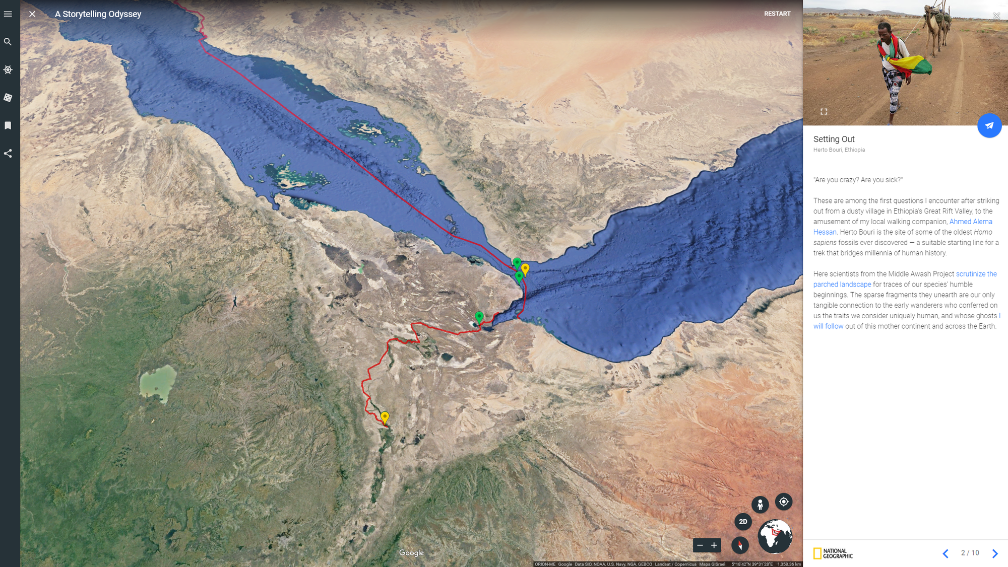 Join one leg of a 21,000-mile cultural journey with National Geographic Fellow Paul Salopek in Africa.
 -
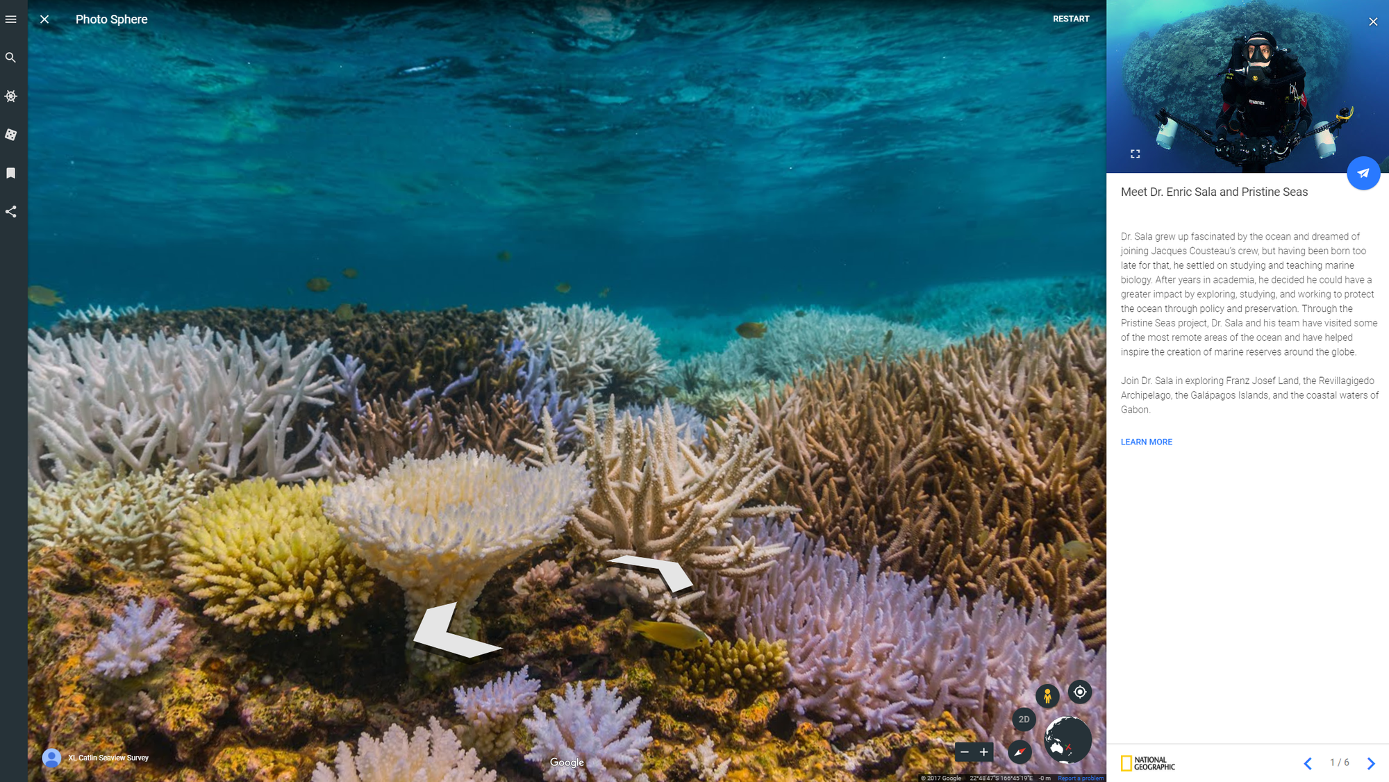 Explore the last Pristine Seas with Dr. Enric Sala as he works to restore the health and productivity of our planet's oceans.
 -
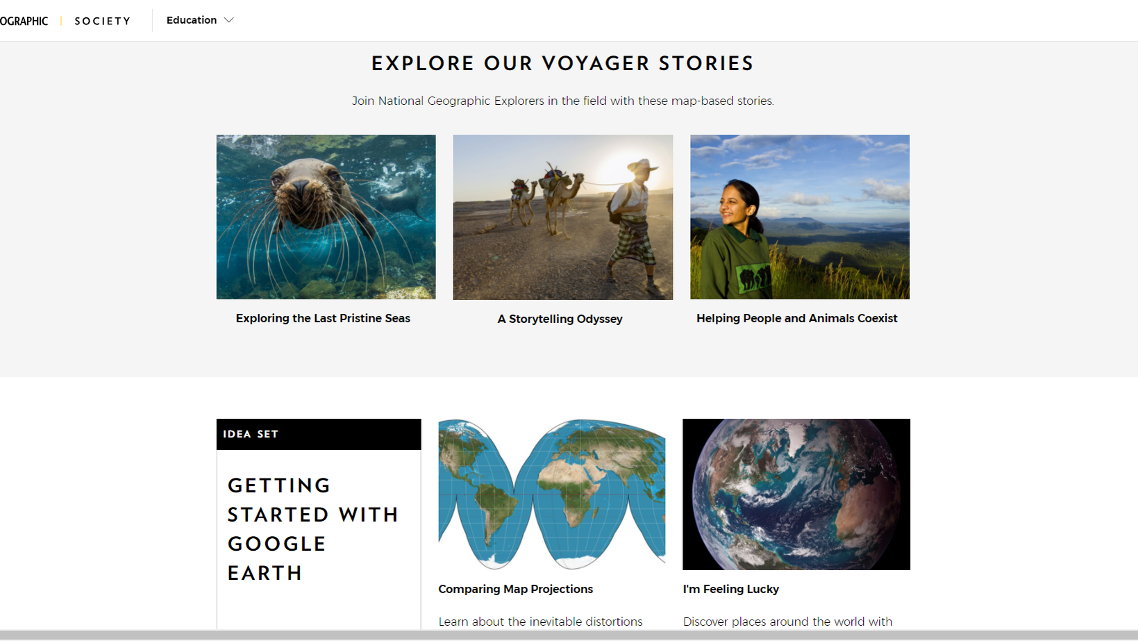 National Geographic Society created activities showing how Google Earth can be used in the classroom.
With PBS Education, classrooms can go back in time and track the paths of famous explorers, from Lewis and Clark to the Vikings. As students follow along, they, in turn, become modern-day explorers.
-
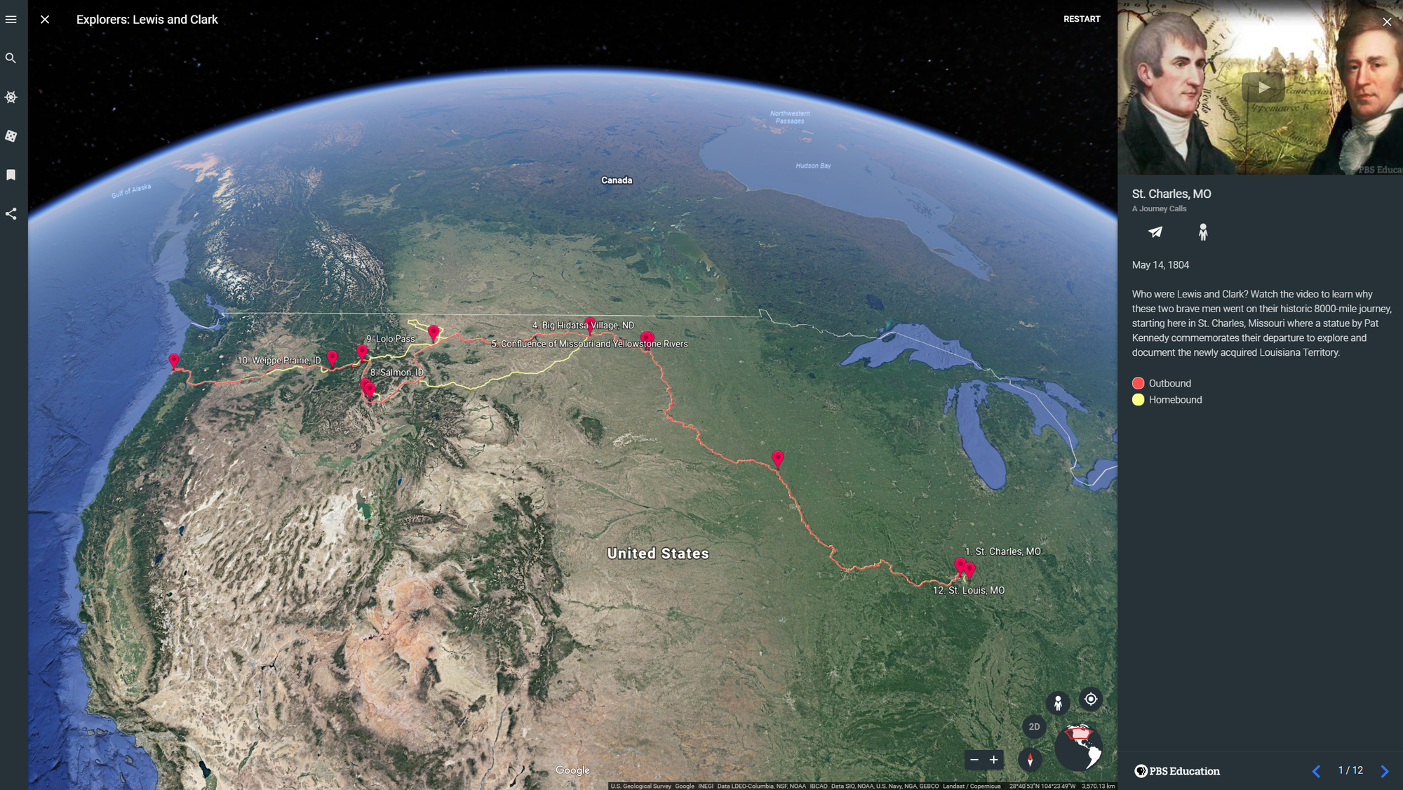 Trace the waterways of the American West with Lewis and Clark
 -
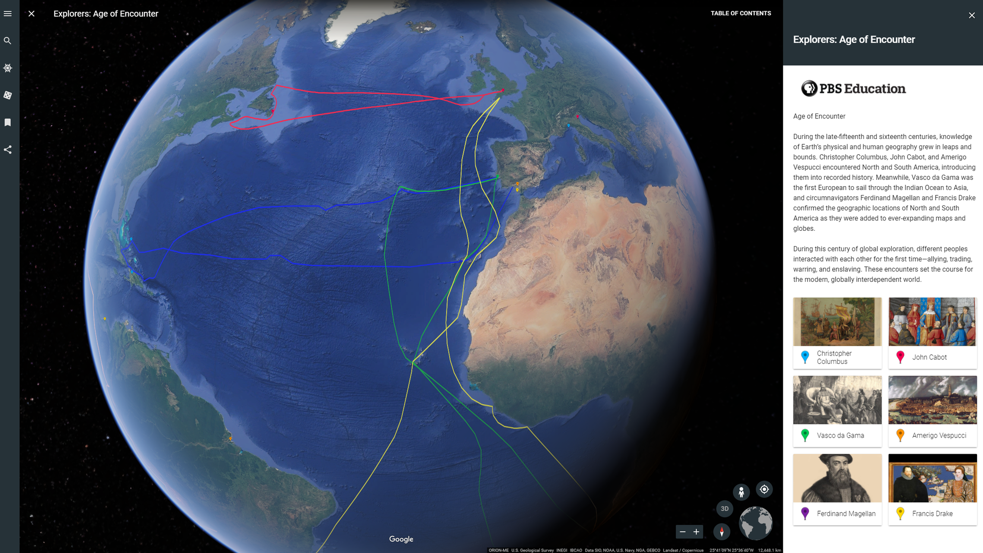 Teachers using PBS Education’s Age of Encounters can ask students: How do you think these ships chose their ocean routes?
 -
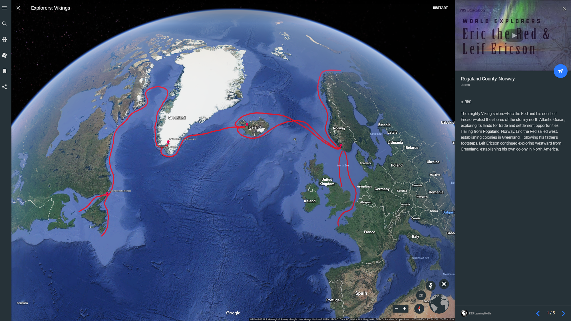 PBS Education’s Vikings teaches about the Vikings who were exploring the sea 500 years before Christopher Colombus
HHMI Biointeractive and Mission Blue created Voyager stories more geared towards science and math. With HHMI Biointeractive, students join “Scientists at Work” as they investigate important problems, from endangered coral reefs to the Ebola outbreak. And Mission Blue’s story teaches students about the unique oceanographic conditions of Costa Rica thermal dome. Short videos and questions embedded in the stories will help guide students with their own scientific research.
-
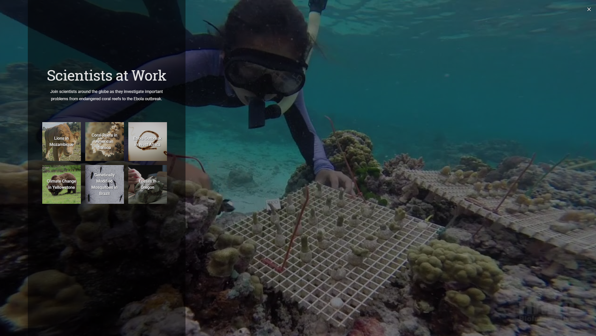 Spanning Oregon to Mozambique, students can learn about science in the field with HHMI Biointeractive
 -
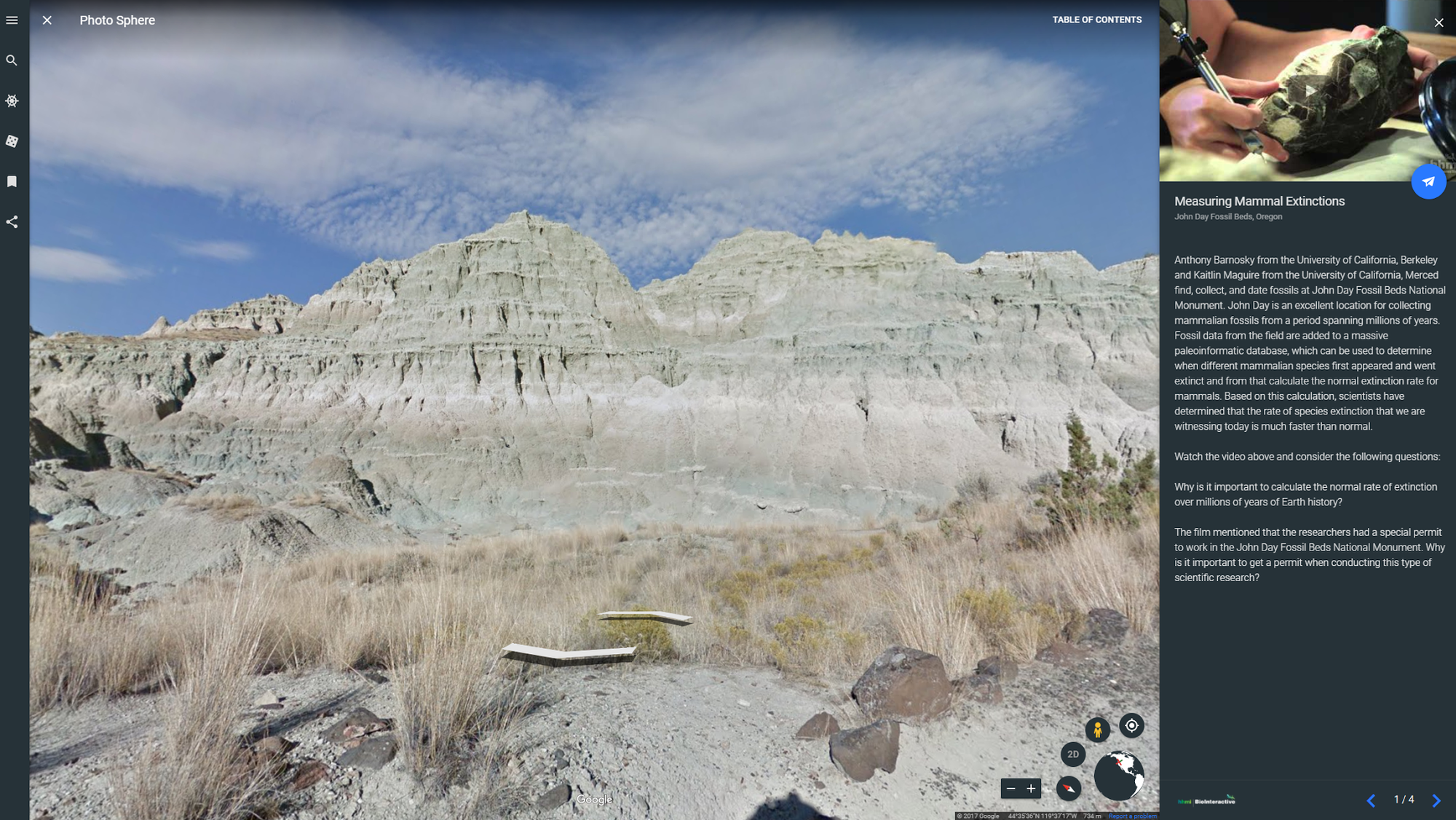 Students can learn how scientists measure mammal extinctions, using fossils spanning millions of years.
 -
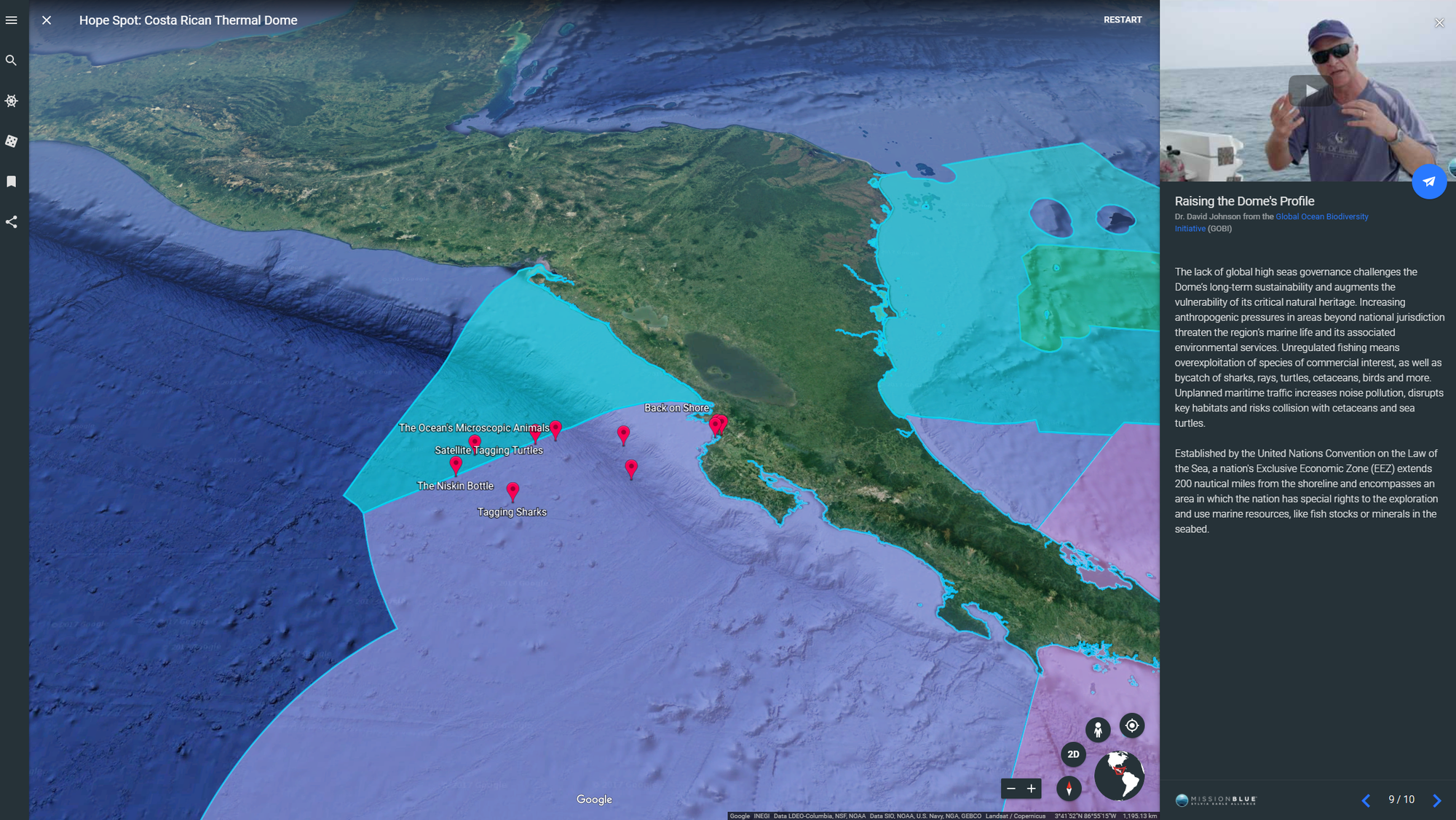 Explore the Costa Rica Thermal Dome Hope Spot where you can follow marine biologists in the field tagging turtles, tracking sharks and more.
Educators everywhere can find classroom activities (created by teachers, for teachers) at our new Google Earth Education website, and easily share locations and stories directly to Google Classroom. In addition, this week Google Earth will become an Additional Service for Google for Education users, which can be managed by IT administrators through the Google Admin console.
Google Earth was built to inspire curious minds to explore, learn and care about our vast, fragile planet. With these updates, we’re excited to make it easier for the next generation to see the world from a new perspective.