Category Archives: Google LatLong Blog

News and notes by the Google Earth and Maps team

Meet the couple that guides together


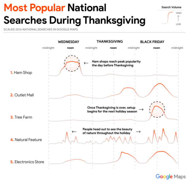
Local Guides come from all over the world, and they form a community of people who share their knowledge on Google Maps—everything from photos and reviews of local restaurants to accessibility information.

And for one long-distance couple, the Local Guides community helped bridge the miles between Malaysia and Bangladesh. Sumaiya Zafrin Chowdhury and Pavel Sawar got married in 2013 and became Local Guides in 2015. Nine months ago, Pavel moved to Malaysia to study information technology, and Sumaiya stayed in Bangladesh to pursue her career as an entrepreneur, community leader and social worker.

In honor of Valentine’s Day, we’re spotlighting this Local Guides love story. We spoke to Sumaiya and Pavel about how they enjoy the community together, and how Local Guides helps them stay connected while they’re apart.

Tell us where it all began: how did you meet?

Pavel: I first saw Sumaiya at a social work event in 2012…first look, fell in love. One day I went to visit a slum, and saw her there serving underprivileged people. I am fascinated by her work.

You’ve been apart for nine months. How do you make a long-distance relationship work?

Sumaiya: I went to Malaysia twice and we had great fun together. We discovered many places. We try to meet every three months. We manage our relationship through social media, especially via video call and chatting through Google Hangouts. We share songs and pictures also.

When you’re in the same place, what are your favorite things to do together?

Pavel:Sumaiya and I love to travel very much. As Local Guides, we also love to arrange meet-ups together and do social work and community activities.

So you connect over Local Guides together?

Sumaiya:Yes, we use Local Guides community and Maps to plan activities and date nights. Sometimes, we celebrate our special days through mapping. We plan to visit new places and compare our points. Mapping and meet-ups are our favorite part.

Pavel: Every day we discuss Local Guides. When Sumaiya arranges a meet-up, I try to help her. When I arrange one Sumaiya helps me lot. We discuss our contributions, photo views, quality reviews, etc. Local Guides helps us to spend more time together. Local Guides makes our relationship closer.

Why did you both decide to join Local Guides?

Pavel:Personally I love traveling, taking photos, and eating at different restaurants. As a traveler and explorer, I use Google Maps almost every day. I love to discover new places and I love to take photos. With Local Guides, I can help any other travelers also. I feel I am helping people in my community. Local Guides are like my family. It’s now part of my life.

Sumaiya: Pavel introduced me to Local Guides back in 2015. I joined in March 2015 because I love technology, traveling and photography. With Local Guides, I can do something positive for my society; that's why I was interested to join.

We recently did a post about seven kinds of Local Guides. Which ones do you identify with?

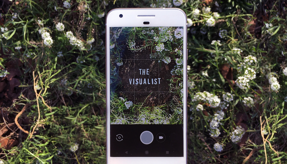
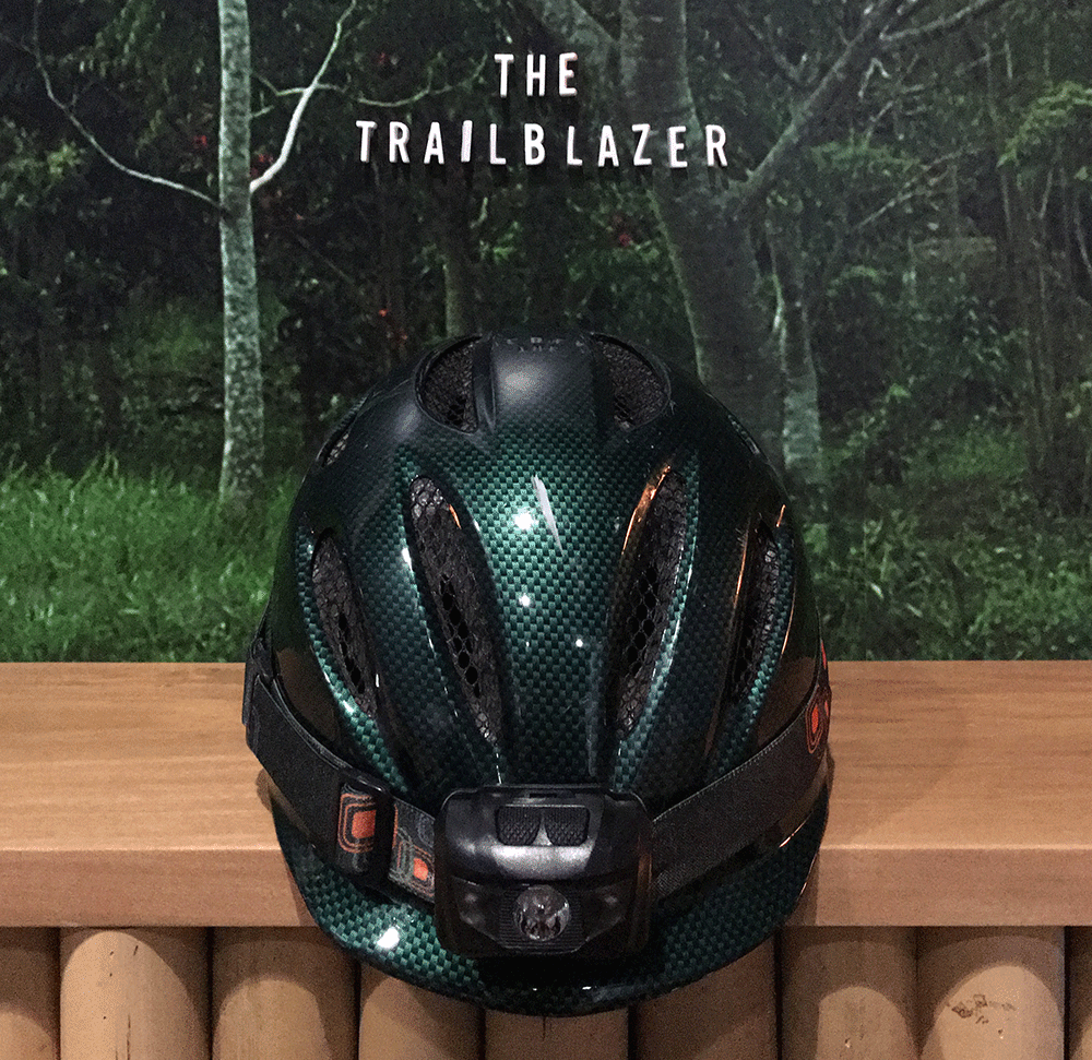
Pavel: The Visualist and the Trailblazer.

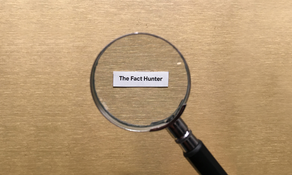
Sumaiya: I identify as a Fact Hunter because I want all to know real information about a place…and Trailblazer because I love to discover and add new places.

For those that are new to Local Guides, what advice do you have for someone just getting started?

Pavel: First, spend some quality time on Local Guides Connect. See how others in the community are doing. Arrange meet-ups. Please contribute on Local Guides to be a good citizen. Don’t focus on points.

Sumaiya:Upload proper pictures in proper places. Post useful and informative reviews that one can easily understand. Do meet-ups so that people can know about this community. And for the people of my own country, I want to advise them: please contribute more, add new places, and do your best reviews so that tourists can understand that our country is very beautiful.

What do you appreciate most about each other?

Sumaiya: Pavel is very punctual. This is the part of his character I like the most. He’s also a very trustworthy and hard-working person. He is very caring…he always supports me and appreciates my work.

Pavel: I can’t appreciate Sumaiya in a single sentence. Sumaiya is not only a good wife, she is also a good mentor for me. She gives support to me for my every good work. Without her I am nothing.

To discover a few beautiful (and unusual) places this Valentine's Day, check out these lists of romantic restaurants around the world, and film locations for famous love stories.

Source: Google LatLong


Seven kinds of Local Guides you might spot on Google Maps

What kind are you?

Satellites are famously effective for mapping, but they don’t take photos of must-have breakfast sandwiches, update hours of operation or tell families when places are wheelchair accessible. That’s Local Guides territory. Local Guides are people who share information on Google Maps to help others discover where to go—and there are more than 60 million of them in our global community, with the most prolific contributors hailing from the United States, India and Brazil. They guide worldwide users each day, rack up millions of views, support small businesses and literally put important, sometimes vital, information on the map for others to use.

Anyone can become a Local Guide—and once you do, you'll become part of a dynamic community. Each contributor is different, with specific passions and ways of sharing. Here are seven inspiring specialists we’ve spotted, with tips on how to do what they do.

1. The visualist

Local Guides love taking photos—in fact, they shared more than 300 million of them on Google Maps last year. If you’re a visualist, it’s your favorite way to contribute.

Loves: Seeking photogenic spots, finding the beauty in everyday places, making the most of golden hour.

Tip: You can share your shots of places right from Google Photos. Just tap the share icon on Android and select Add to Maps. Then select or update the location before you post it.

The Visualist.jpg

2. The fact hunter

In many parts of the world, essential information like where to find an ATM or a clinic may be hard to come by. Fact hunters uncover these details to share with others on Google Maps.

Loves: Accurate listings on Google Maps, adding missing info for small businesses, moving location pins so people can find places.

Tip: On Google Maps for mobile, go to Your contributions in the menu and tap Uncover missing info to see which places need your expertise.

The Fact Hunter.jpg

3. The trailblazer

If a friend has ever asked you for the hottest new restaurant in town, you might be a trailblazer. These Local Guides have the pulse of their cities and love being the first to try a new place.

Loves: Adding the first review or photo to a place, putting unlisted places on the map.

Tip: Check out restaurants and local shops opening this year so you can add their first photos and get those views.

The Trailblazer.gif

4. The sage

If a review has ever helped you choose whether to stay by the sea or by the bay, you can thank a sage. No matter where they go, these Local Guides write about all the inside tips, from the best exhibits to visit to the best instructors to take at a fitness studio.

Loves: Dropping knowledge and tips in reviews, answering yes/no questions about places that pop up on your screen, responding to others via the new Questions & answers feature that shows up on Google Maps for Android.

Tip: Turn on your Location History to easily review all the places you’ve been, and make lists of your favorites.

The Sage.jpg

5. The multimedia guru

Equipped with plenty of battery packs, this Local Guide helps you see a place from every angle with 360 photos and video contributions like visual tours and on-camera reviews. 

Loves: Adding 360 photos and videos of places, going to great lengths for the perfect shot.

Tip: If you take a video on your phone, you can add up to 30 seconds of it to a place the same way you’d add a photo to a place on Google Maps.

The Multimedia Guru.gif

6. The connector

This Local Guide’s contributions go beyond Google Maps. From hosting meet-ups with other community members to chiming in on Connect (the forum for Local Guides), the connector is a friendly face for newbies and gurus alike. 

Loves: Hosting meet-ups, making lists about places to go and sharing them with friends, liking other people’s reviews.

Tip: Find out if a Local Guides meet-up is happening near you.

Connector.gif

7. The advocate

Local Guides champion many causes, from helping small businesses to making it easier for wheelchair users to get around. The advocate keeps a cause top-of-mind while they share info, like whether a place has a wheelchair ramp.

Loves: Doing good in the world for locals and visitors alike, this handy accessibility guide for sharing helpful info, watching Local Heroes videos on Local Guides’ YouTube channel.

Tip: When you mark something as wheelchair-accessible, it helps families with strollers, too.

TheAdvocate.jpg

Which kind of Local Guide are you? However you want to contribute, check out your Local Guides status and places that need your knowledge by visiting Your contributions in the Google Maps menu. The more you share, the higher levels you reach as you earn points for each review, photo, and bit of info you add on Google Maps.

Source: Google LatLong


The making of “A Ride to Remember,” a film about BikeAround

Editor’s Note: Orlando von Einsiedel is the director of the Oscar-winning Netflix short documentary, “The White Helmets.” His first feature, “Virunga,” won more than 50 international awards including an EMMY, a Peabody, a Grierson and a duPont-Columbia Award for outstanding journalism. Last year, we had the opportunity to work with Orlando on a short film about Laila and Bengt Ivarsson. Bengt was recently diagnosed with Alzheimer’s and is testing an experimental technology that triggers memory using Google Maps. Orlando’s documentary is a powerful account of the couple and their experiences.


Like many people, I’ve experienced the sadness of seeing an older relative losing their memory. It's a strange and painful experience, to see someone you know and love become confused and disorientated—to see them lose their grasp on the world.


It makes you realize how our memories provide us with much of the context and structure for who we are today. The interactions we have with friends and family aren’t static, isolated in time and place. They are ever evolving, informed by what has happened in our shared and personal histories. To lose the context for those interactions must be terrifying.


That’s why I was excited to hear about the BikeAround project—which pairs a stationary bike with Google Street View to give patients a virtual visit to a place from their past—and the way it helps spark memories in people suffering from dementia.


I first worked with Google on the Moon Shot film in 2016. Then earlier this year they came to me with an idea to tell the story about the developing BikeAround technology and how it’s affecting individuals who suffer from dementia. Google released a short version of the film in September, and you can watch the full version now.
BikeAround

It's one thing to be shown a photo and to remember the place. It's quite another to feel that you are visiting a location, and to have that experience trigger memories that you thought had gone. But this is indeed what BikeAround does. We saw numerous people using the device, and each of them was able to travel to a time and place that they clearly hadn't visited for a long while. Just as importantly, it also allowed these men and women to take control. The elderly, and those with dementia, often lose autonomy and become isolated. But with BikeAround, they were not only free to explore the world—they were also in charge of the journey. They could revisit places they had been to decades before. They were able to take their husband or wife to the church where they were married. And they could show their grandchildren the places of their youth.


Bengt and Laila Ivarsson were so generous in candidly sharing their lives with us, and it was this experience that made working on this project so special. Their love and support for one another in the face of growing difficulty is something that has really stayed with me, and to see the memories BikeAround triggered for Bengt was incredibly moving. I hope you find the Ivarssons’ story as enriching to watch as it was for us to film.

Source: Google LatLong


Never miss your stop again – with step-by-step directions in transit navigation

Traveling on a bus or train is the time for you to do your best music-listening, news-reading, and social-media scrolling ... as long as you don't miss your stop.


A new feature on Google Maps for Android keeps you on track with departure times, ETAs and a notification that tell you when to transfer or get off your bus or train. And you can track your progress along the way just like you can in driving, walking or biking directions.

Image

To check out the new feature, head into Google Maps. Type your destination, select transit directions, then choose your preferred route. Tap the “Start” button to get on your way (and you won’t miss your stop this time).

Source: Google LatLong


A crabtivating journey: Street View joins a crab migration of millions on Christmas Island

From herds of elephants in Kenya to penguins in Antarctica and frogs in the Amazon, the Street View Trekker has met some charming characters on its journeys around the world.  This week, Street View is venturing to Christmas Island, a remote Australian territory in the Indian Ocean, to join more than 45 million local residents for their annual trip from the forests to seas. Christmas Island’s famous, endemic red crabs have begun their once-a-year migration

Crabs 1
Red crabs marching in the rainforest.

For most of the year, these land crabs stay burrowed in Christmas Island’s lush damp forests to preserve body moisture and protect themselves from harsh sunlight. But each year, they emerge from the forest shelter to march to the sea to spawn near the coastal waters. These bright red residents wait patiently for a precise alignment of the rains, moon cycle and tides to commence their journey. They’re starting to paint the town red and Dr. Alasdair Grigg on behalf of Parks Australia, is carrying the Street View Trekker to collect imagery of this yearly miracle for all to see. The migration concludes on the ocean shores when the highest density of crabs spawn and lay their eggs in the sand—a finale forecasted for December 13.

The volume of red crabs presents unprecedented conditions for the Street View image capture. As crabs crowd the roads, boardwalks and beaches, each step must be taken with care. Fortunately, crabs have right of way on Christmas Island, and Parks Australia has built walls and fencing along roads to direct the crossers to safety.

GIF

Whether you’re in Ballarat, Bogota or Berlin, soon you’ll be able to experience the Christmas Island crab migration, and its grand finale (the spawning) on Street View. We invite you to join this marvelous march—and see why Sir David Attenborough calls this phenomenon one of the “most astonishing and wonderful sights.” You can expect to see the imagery from this collection on Street View in early 2018.

Source: Google LatLong


It’s the most wonderful time of the year—Santa’s Village is back in business!

It’s that time of year again—Santa Claus is coming to town! We’re only 24 days away from takeoff, so Santa, Mrs. Claus, and all of the elves and reindeer are wrapping presents and readying the sleigh.

Devices

Join in the merriment, and visit Santa's Village every day through December 24 to uncover new games and holiday cheer. Learn to code the famous elf dance with Code Boogie, create original artwork in Santa's Canvas, and take part in what could be the world’s largest virtual snowball fight. (Shhh, we weren’t supposed to tell you about that one.)

games

With the new “Santa Snap” game, available only on the Android app, you can fly your jetpack-ed elf around the globe in Google Maps and take “elfies” with famous world landmarks. Use the accelerometer to focus the lens and take a pictures at just the right time.

phones

On December 24, grab hot chocolate and tune into Santa Tracker to follow the big guy and his trusty reindeer as they make their way around the globe. See where Santa’s going, the number of presents he’s delivered, and learn about different holiday traditions along the way. You can even ask the Google Assistant: “Ok Google, where is Santa?” Try it out with your Assistant on an Android phone, iPhone and Google Home to check in on old St. Nick.

Devices

If you’re a teacher or parent, we’ve added resources to our education page where you can easily download lesson plans with video tutorials and access all of the educational games.

edu

Join the residents of the North Pole for all of these adventures and games on Android, iOS, and Chrome and be sure to visit Santa’s Village each day to celebrate the most wonderful time of the year.

Source: Google LatLong


Google Maps gets a new look

The world is an ever-evolving place. And as it changes, Google Maps changes with it. As roads close, businesses open, or local events happen in your neighborhood, you’ll see it on Google Maps. When you schedule an event using Google Calendar, get a reservation confirmation in Gmail, or add a restaurant to your “Want to Go” list, Google Maps reflects that too. Now, we’re updating Google Maps with a new look that better reflects your world, right now.

First, we’ve updated the driving, navigation, transit and explore maps to better highlight the information most relevant to each experience (think gas stations for navigation, train stations for transit, and so on). We’ve also updated our color scheme and added new icons to help you quickly identify exactly what kind of point of interest you’re looking at. Places like a cafe, church, museum or hospital will have a designated color and icon, so that it’s easy to find that type of destination on the map. For example, if you’re in a new neighborhood and searching for a coffee shop, you could open the map to find the nearest orange icon (which is the color for Food & Drink spots).

1

We’ve created a cheat sheet of the new colors and icons to help you get acquainted with the new look:

You’ll see these changes over the next few weeks in all Google products that incorporate Google Maps, including the Assistant, Search, Earth, and Android Auto. Over time, the new style will also appear in the apps, websites and experiences offered by companies that use Google Maps APIs as well. 

1

So no matter how or where you’re using Google Maps, you’ll have the same consistent experience.

Source: Google LatLong


Spend more time around the table (not in traffic) this Thanksgiving

Many Americans will spend next Thursday surrounded by family and friends around a table full of turkey, stuffing, and cranberry sauce (or whatever your family favorites are). Because traveling for Thanksgiving can be stressful, we looked at historical Google Maps traffic data to identify the best and worst times for your Thanksgiving road trips. And just for fun, we took a peek at the places Google Maps users are most often getting directions to during the holiday week. To look at this a bit more closely, we’ve created an interactive experience where you can explore Thanksgiving trends in your area.


Tips for a traffic-free Turkey Day

Because many of us can’t or don’t take off extra days leading up to Thanksgiving, we looked at last year’s traffic trends the day before Thanksgiving through the Sunday after. As you might expect, Wednesday late afternoon is the busiest time to hit the road, but it’s pretty much smooth sailing the morning of Thanksgiving. So if you can wait until Turkey Day, you might be able to avoid the crowds on the road.


To make your travels as efficient as possible, don’t forget to share your trip with the in-laws so they’ll know exactly when you’ll arrive. And if you forgot the stuffing you promised to bring to the potluck, just search for an open supermarket along your route to quickly pick it up without adding a long detour—you can even see how much time you can expect to spend in the checkout line with our new wait times feature (now available on Google Maps for Android).


When the eating is all over and it’s time to head home, early morning on Saturday or Sunday are your best bets (just make sure to avoid the road when traffic heats up on Friday and Saturday in the late afternoon).

Screen Shot 2017-11-13 at 2.59.30 PM.png

Trending places over Thanksgiving  

Every family has their unique holiday traditions—like Dad’s dash to the tree lot the day after Thanksgiving. According to historical Google Maps search data, the most popular destinations over the Thanksgiving holiday period are ham shops, outlet malls, tree farms, natural features (think outdoor experiences), and electronics stores.

Screen Shot 2017-11-13 at 2.59.09 PM.png

When you’re not digging into your food, dig into the Turkey Day traffic and Google Maps search trends for your city in our interactive experience. Happy Thanksgiving!

Source: Google LatLong


Skip the line: restaurant wait times on Search and Maps

When it comes to a saucy bowl of pasta or a perfectly cooked steak, people are willing to wait in (long) lines for a taste of their favorite comfort foods. Rolling out soon, wait times on Google Search (and coming soon to Maps) shows you the estimated wait at your favorite restaurants. Now you can decide whether that cronut is really worth an hour wait or plan ahead to get your fix at a time when you can avoid a wait entirely.

WaitTimesGIF

To see wait times for nearly a million sit-down restaurants around the world that allow walk-ins, just search for the restaurant on Google, open the business listing, and scroll down to the Popular Times section. There you’ll see the estimated wait time at that very moment. And by tapping on any of the hour bars, you’ll see the estimated wait for that time period. You can even scroll left and right to see a summary of each day’s wait times below the hour bars–so you can plan ahead to beat the crowds.


Wait time estimates are based on anonymized historical data, similar to how we compute the previously launched Popular Times and Visit Duration features.

Source: Google LatLong


Getting hyper-local: Mapping street-level air quality across California

Most air pollution is measured at a city level, but air quality can change block by block, hour by hour and day to day. To better understand air quality on a more local level, we began working with our partner Aclima — to map air pollution across California using Google Street View cars—equipped with air quality sensors.  Earlier this year, we shared the the first results of this effort with pollution levels throughout the city of Oakland.

We're just beginning to understand what's possible with this hyper-local information and today, we’re starting to share some of our findings for the three California regions we’ve mapped: the San Francisco Bay Area, Los Angeles, and California’s Central Valley (the Street View cars drove 100,000 miles, over the course of 4,000 hours to collect this data!) Scientists and air quality specialists can use this information to assist local organizations, governments, and regulators in identifying opportunities to achieve greater air quality improvements and solutions.

Over 195 nations will gather in Bonn for the COP23 UN Climate Climate Change conference this week. Rising to the climate challenge will involve a  mix of policy, technology and international cooperation and we believe that insights about air quality at the community level can help support both local and global action on climate. Below we’ve highlighted some of our findings for these regions. 

CA

Over a three month period, our Street View cars mapped air quality in different areas of Los Angeles, ranging from urban to residential, inland to the Pacific Ocean, and areas near major freeways, ports, or refineries. The measurements indicate that traffic-choked freeways, traffic on local streets, and weather patterns that blow pollution inland all influence the patterns of air pollution.

Air quality measurements in Los Angeles region (Landsat / Copernicus, Data SIO, NOAA, U.S. Navy, NGA, GEBCO, IBCAO, Data LDEO-Columbia, NSF, Data USGS, Data CSUMB SFML, CA OPC)

Air quality measurements in Los Angeles region (Landsat / Copernicus, Data SIO, NOAA, U.S. Navy, NGA, GEBCO, IBCAO, Data LDEO-Columbia, NSF, Data USGS, Data CSUMB SFML, CA OPC)

Compared to Los Angeles, the San Francisco Bay Area, which we mapped over the past two years, is a higher density city. A large percentage of air pollution emissions comes from vehicles like cars, trucks, and construction equipment, and industrial sources like refineries and power plants added to the mix. The measurements here indicate street-level pollution patterns are affected by these local and distributed sources.

Air quality measurements in the San Francisco Bay Area region (TerraMetrics, Data CSUMB SFML, CA OPC, Data SIO, NOAA, U.S. Navy, NGA, GEBCO, Data LDEO-Columbia, NSF, Data MBARI, Landsat / Copernicus)

Air quality measurements in the San Francisco Bay Area region (TerraMetrics, Data CSUMB SFML, CA OPC, Data SIO, NOAA, U.S. Navy, NGA, GEBCO, Data LDEO-Columbia, NSF, Data MBARI, Landsat / Copernicus)

While much of California’s Central Valley is rural with a lot of agriculture, it’s also home to cities, such as Fresno, Bakersfield, Stockton, and Modesto. Interstate 5 and Interstate 99 are two major traffic corridors that run through the region, connecting Northern and Southern California. Interstate and regional traffic, along with industry and agriculture, are sources of air pollution in the region. Weather conditions and topography can trap air pollution between the coast and the Sierra Nevada mountains resulting in a chronic ozone and particulate matter levels that exceed public health standards.

Air quality measurements in California’s Central Valley region (Landsat / Copernicus, Data MBARI, Data SIO, NOAA, U.S. Navy, NGA, GEBCO, Data LDEO-Columbia, NSF, Data CSUMB SFML, CA OPC, Data USGS)

Air quality measurements in California’s Central Valley region (Landsat / Copernicus, Data MBARI, Data SIO, NOAA, U.S. Navy, NGA, GEBCO, Data LDEO-Columbia, NSF, Data CSUMB SFML, CA OPC, Data USGS)

So far, we’ve measured over one billion air quality data points but this is just the beginning—and now air quality scientists can request access to the data. Air quality impacts our planet and our health—and we hope this information helps us build smarter more sustainable cities, reduce climate changing greenhouse gases and improve air quality for healthier living.

Tune in to Aclima’s blog for more data stories from our California driving campaign in the coming days and weeks.

Source: Google LatLong