Category Archives: Google LatLong Blog

News and notes by the Google Earth and Maps team

Updates to Incognito mode and your Timeline in Maps

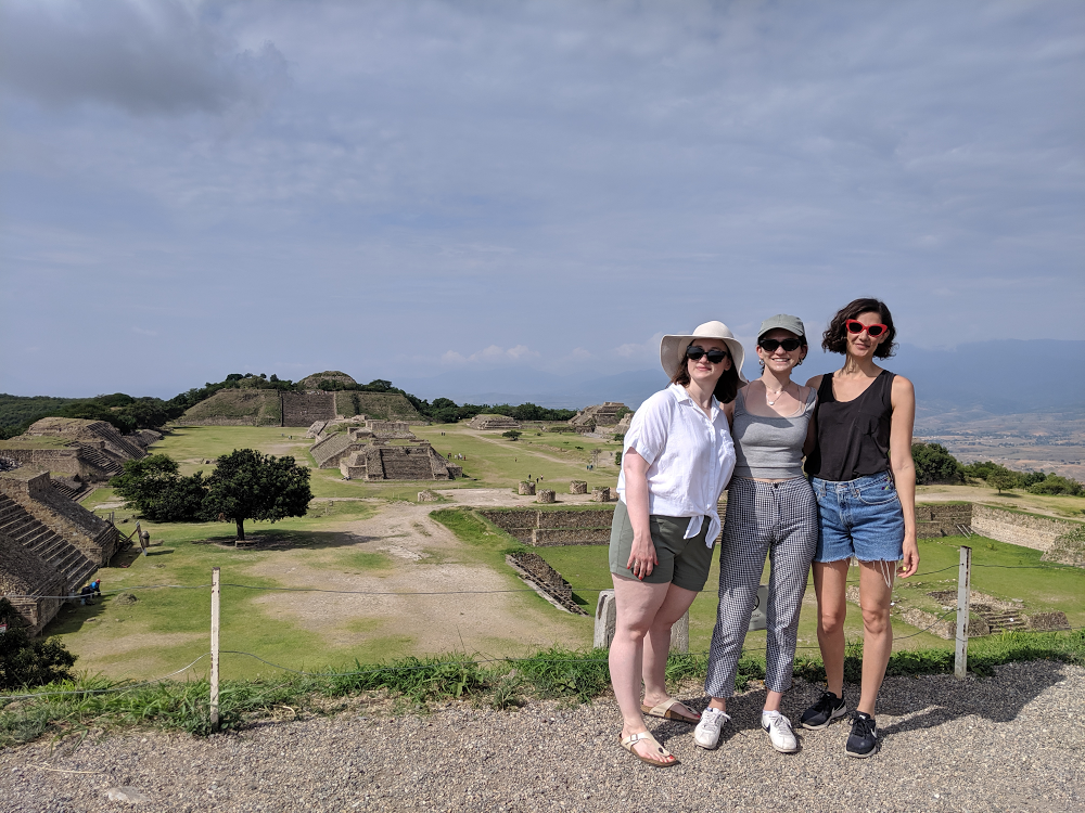
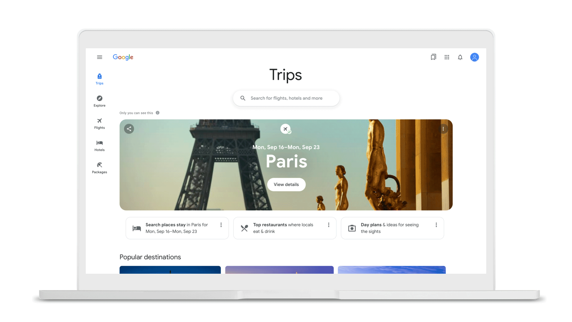
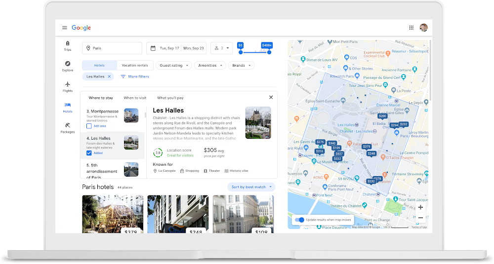
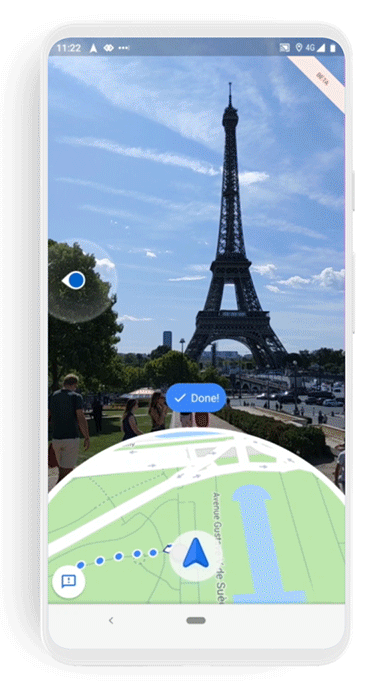
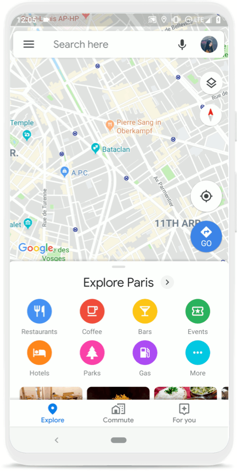
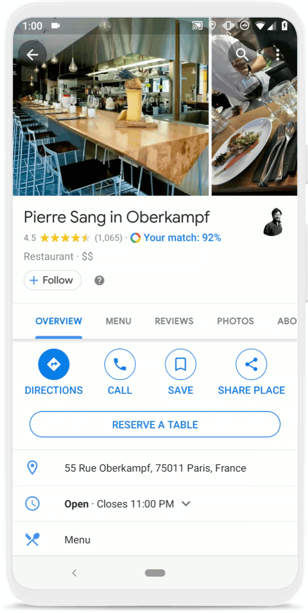
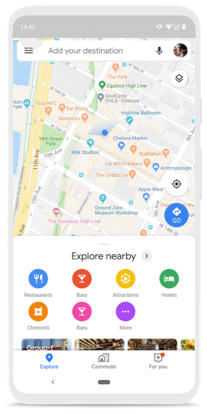
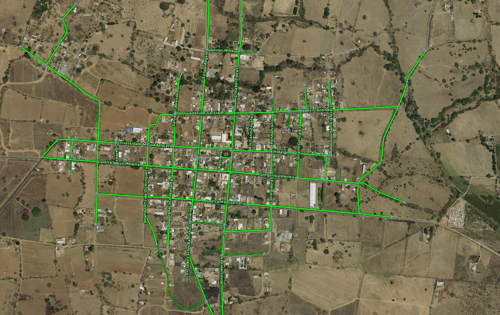
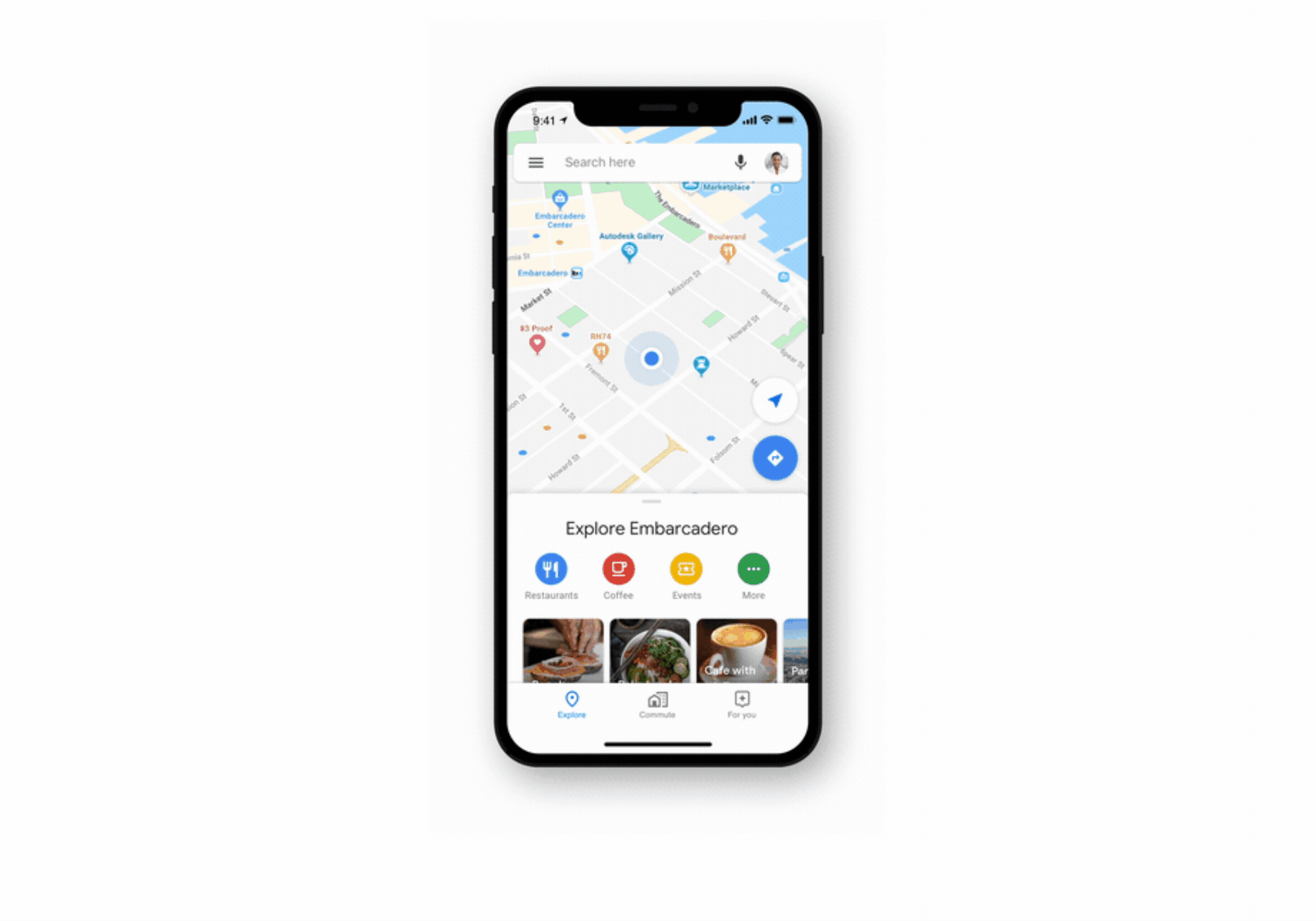
People turn to Google Maps to make their lives easier—whether it's getting tips and recommendations tailored to your daily commute, or knowing when your favorite restaurants, grocery stores and places may be the most crowded so you can avoid a long wait in line. Handy tools like this are improved by Location History–when you turn it on, this optional setting helps make Maps more useful for everyone, as well as personalized to your needs.


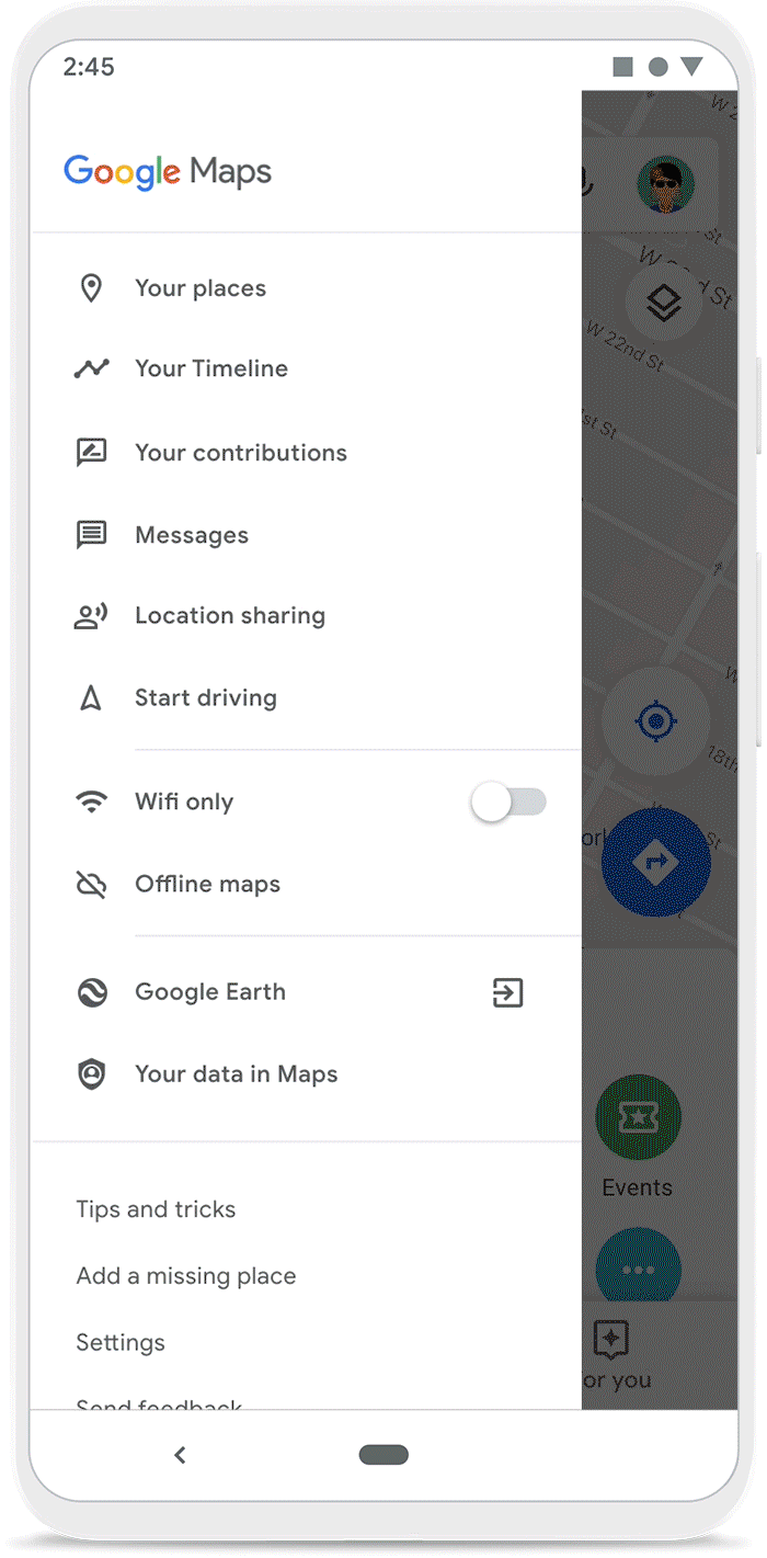
Throughout this year, we've focused on making it easier to control, manage and delete your Location History information. Location History is off by default, and you can choose to delete all or part of your history automatically when you turn it on. We introduced auto-delete controls so you can choose to keep only three or 18 months’ worth of data—anything older than that will be automatically deleted. Your Data in Maps lets you quickly access your Location History and other privacy controls with just a few taps. And on Android, Incognito mode on Google Maps stops searches or places you navigate to within Maps from being saved to your Google Account.


Today, we have two updates: Incognito mode is rolling out on Google Maps for iOS today, and bulk delete in Timeline will arrive on Android next month.


Incognito mode

Incognito mode on iOS works the same way it does on Android. While in Incognito mode, the places you search for or navigate to won’t be saved to your Google Account and you won’t see personalized features within Maps, like restaurant recommendations based on dining spots you’ve been to previously. Using Incognito mode on your phone will not update your Location History, so the places you go won’t be saved to your Timeline.


incognito_ios

Bulk delete in Timeline 

Your Timeline is a tool that uses your Location History to help you easily remember places and routes you’ve visited–and on Android, share them with friends. With bulk delete, you can quickly find and delete multiple places from your Timeline and Location History all at once. You’ll still have the ability to delete all or part of your Timeline by date range from your Location History settings. 


bulk_delete_v2

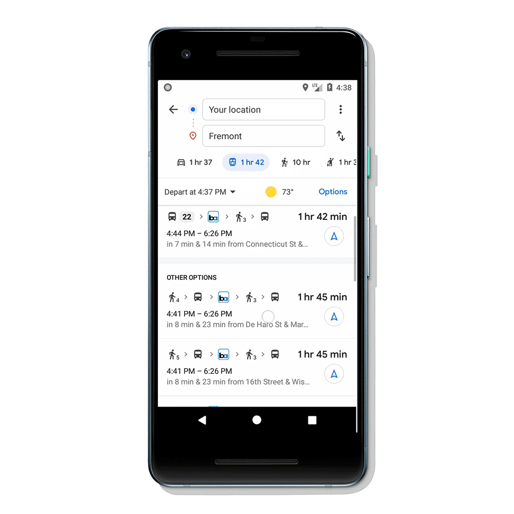
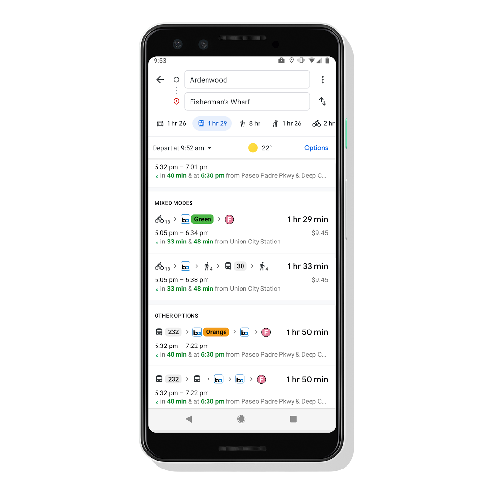
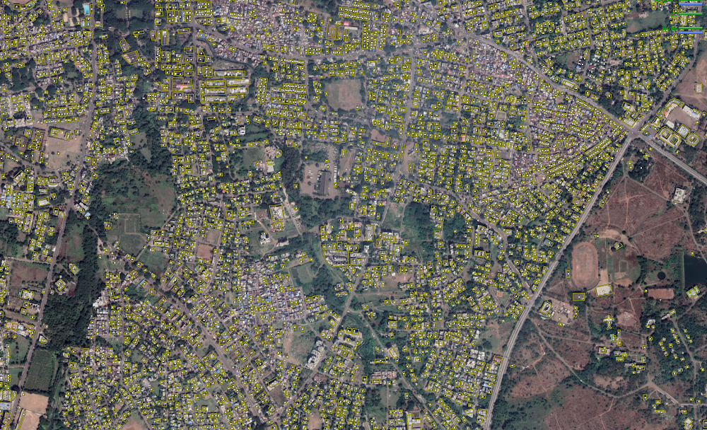
How Location History improves Google Maps

We’re committed to providing simple, easy-to-use tools to manage your Location History—as well as clearly explaining how it makes products more useful. Scroll through the images below to learn more about Google Maps features made more helpful by Location History.


Stay up to date on your Location History settings

It’s our goal to help you stay informed about your Location History. If you’ve chosen to turn Location History on, you’ll receive periodic email reminders that let you know what data you’re saving, and ways you can manage it. 


To learn more about Location History and how location works across Google, visit ourpolicy page


Source: Google LatLong


Making Pixel more helpful with the first Pixel feature drop

Your phone should get better over time. Your Pixel automatically updates regularly with fixes and improvements. Now, your Pixel will also get bigger updates in new Pixel feature drops.  Our first one, coming this month, includes a new way to capture portraits, easier Duo calls and automatic call screening. 

More photo controls

Now, you can turn a photo into a portrait on Pixel by blurring the background post-snap. So whether you took the photo years ago, or you forgot to turn on portrait mode, you can easily give each picture an artistic look with Portrait Blur in Google Photos. 


05_Add_Portrait_Blur_to_Photos_EN (1).gif

Put an end to robocalls

With our latest update to Call Screen on Pixel 4 in the US, the Google Assistant now helps you automatically screen unknown callers and filter out detected robocalls before your phone ever rings, so you’re not interrupted by them. And when it’s not a robocall, your phone rings a few moments later with helpful context about who is calling and why. Call Screen works on your device and does not use Wi-Fi or data, which makes the screening fast and the content private to you.


Call Screen.gif

Improved video calls on Duo 

Video calls are better on Pixel 4 with new Duo features that let you focus on conversations instead of logistics. Auto-framing keeps your face centered during your Duo video calls, even as you move around, thanks to Pixel 4’s wide-angle lens. And if another person joins you in the shot, the camera automatically adjusts to keep both of you in the frame.


06_Auto-framing_on_Duo_EN.gif

Now, the playback on your Duo calls is even smoother, too. When a bad connection leads to spotty audio, a machine learning model on your Pixel 4 predicts the likely next sound and helps you to keep the conversation going with minimum disruptions. Pixel 4’s Smooth Display also reduces choppiness on your video feed, refreshing up to 90 times a second.

When you make Duo video calls on Pixel 2, 3 and 4, you can now apply a portrait filter as well. You’ll look sharper against the gentle blur of your background, while the busy office or messy bedroom behind you goes out of focus.


08_Duo_Portrait_Mode_EN_var06_191115.gif

With the latest update to Pixel 4, you'll also get amazingly fast accuracy in Google Maps with improved on-device computing for much better location quality. 

More helpful features for more Pixels

In addition to new features for Pixel 4, we’re also bringing new apps and features to Pixel 2, 3 and 3a:

  • The Recorder app is now available on older generations of Pixel.
  • Pixel 3 and 3a users will get Live Caption. 
  • Digital Wellbeing is getting updates too. Focus mode is rolling out to help you stay productive and minimize distractions by pausing apps you've selected in a single tap. You can now set an automatic schedule, take a short break or end Focus mode early without disrupting your schedule.
  • Flip to Shhh will also join the Digital Wellbeing features on Pixel 2 and 2XL.
  • If you use a Pixel 4 in the UK, Canada, Ireland, Singapore and Australia, you’ll soon get the new Google Assistant (English only), which is even faster and more helpful.

A more efficient phone

In addition to these new experiences, all Pixel devices will also receive an update to its memory management in the feature drop. With this new enhancement, your phone proactively compresses cached applications so that users can run multiple applications at the same time -- like games, streaming content and more.


Pixel phones have always received monthly updates to improve performance and make your device safe. Now, feature drops will bring more helpful and fun features to users on a regular basis to continue to make your Pixel better than ever. 


These features are already rolling out, and will hit Pixel devices in the coming weeks. To get the new features, update to the latest version of Android and go to the Play Store to start downloading your updated apps.


Source: Google LatLong


How I’m making Maps better for wheelchair users like me

If you visit a city and don’t see anyone using a wheelchair, it doesn’t mean they’re not there. It means the city hasn’t been built in such a way as to let them be part of things. I know this firsthand: I’m one of 65 million people around the world who uses a wheelchair, and I see every day how a city’s infrastructure can prevent people like me from being active, visible members of society.

On July 29, 2009, I was taking my usual morning walk through New York’s Central Park when a dead tree branch snapped and fell on my head. The spinal damage partly paralyzed my lower body. I spent the next seven months in the hospital, where I got the first glimpse of what my life would be like from then on. I was going to use a wheelchair for the rest of my life—and my experience as a born and bred New Yorker was about to change forever.  

That’s because much of the city isn’t accessible for people like me. Fewer than one in four subway stations in New York City have wheelchair access. And plenty of places, from restaurants to schools, lack a way for me to even get inside. It was humbling to realize these  barriers had been there throughout my growing up in New York; I simply hadn’t noticed.

Those realizations were in my mind when I returned to work in 2011 as an engineer on the Search team, especially because I could no longer take my usual subway route to work. However, the more I shared with colleagues, the more I found people who wanted to help solve real-world access needs. Using “20 percent time”—time spent outside day-to-day job descriptions—my colleagues like Rio Akasaka and Dianna Hu pitched in and we launched wheelchair-friendly transit directions. That initial work has now led to a full-time team dedicated to accessibility on Maps.

I’ve also collaborated with another group of great allies, stretching far beyond Google. For the past several years, I’ve worked with our Local Guides, a community of 120 million people worldwide who contribute information to Google Maps. By answering questions like “Does this place have a wheelchair accessible entrance,” Local Guides help people with mobility impairments decide where to go. Thanks to them, we can now provide crowdsourced accessibility information for more than 50 million places on Google Maps. At our annual event last year and againseveral weeks ago, I met some amazing Guides--like Emeka from NigeriaandIlankovan from Sri Lanka--who have become informal accessibility ambassadors themselves, promoting the inclusion of people with disabilities in their communities around the world.

Today, on International Day of Persons With Disabilities, I hope our work to make Google Maps more inclusive underscores what Angela Glover Blackwell wrote so powerfully about in “The Curb-Cut Effect.” When we build with accessibility in mind, it doesn’t just help people with disabilities. It helps everyone. Curb cuts in sidewalks don’t just help me cross the street—they also help parents pushing strollers, workers with deliveries and tourists with suitcases. As Blackwell puts it, building equity is not a zero-sum game—everyone benefits.

The people in wheelchairs you don’t see in your city? They've been shut out, and may not be able to be a part of society because their environment isn't accessible. And that’s not merely a loss for them. It’s a loss for everyone, including friends, colleagues and loved ones of people with disabilities. I’m grateful to those who stay mindful of the issues faced by people like me to ensure that our solutions truly help the greater community.

Source: Google LatLong


Voice guidance in Maps, built for people with impaired vision

Think about the last time you walked to a new place. How many streets did you cross to get there? Which intersections were the most complex? How did you prepare before making a turn? And how did you know you weren’t lost?

Now think about making that same trip if you were one of the 36 million people who are blind worldwide, or one of the 217 million people more who have moderate-to-severe vision impairments.

As a legally blind woman living in Tokyo, I know that getting around unfamiliar environments can be a challenge. I can easily commute from my front door to my desk at work; it’s a trip I take regularly and know well. But going some place new and unfamiliar can be an intimidating experience without sight to guide you. In some cases, I’ll have a friend to join me on a trip, but in others I may decide not to take the journey at all.

Detailed voice guidance in Google Maps helps people with visual impairments

Starting today, World Sight Day, Google Maps is rolling out a new feature that gives people the ability to receive more detailed voice guidance and new types of verbal announcements for walking trips. This feature is the first in Google Maps to be built from the ground up by, and for, people with vision impairments. I feel fortunate to have had the opportunity to work closely with the Maps team on this project as an early advisor and tester—outside of my day job as a business analyst in the Tokyo office.

With this feature, I can navigate the streets of Tokyo with more comfort and confidence. As I take my journey, Google Maps proactively lets me know that I’m on the correct route, the distance until my next turn and the direction I’m walking in. As I approach large intersections, I get a heads-up to cross with added caution. And if I accidentally leave my route, I’ll get a spoken notification that I'm being re-routed. 

Frequent updates like these not only help a visually impaired person get from A to B, they can also give us more confidence and reassurance when we travel alone. With detailed voice guidance in Google Maps, my journey fades into the background and I can focus more on what I’ll do at my final destination. This may not sound extraordinary to those with sight, but for people who are blind or have low vision, this can help us explore new and unfamiliar places.

Googler Wakana Sugiyama talks about how detailed voice guidance in Google Maps helps everyone navigate with ease.

(Versions of this video with full audio descriptions for people with vision impairments are also available in English and Japanese.)

Building a more helpful Google Maps for everyone

I hope this new technology will give more people added confidence when navigating unfamiliar routes--after all, building for everyone is core to our work at Google. 

While this new feature can be enormously helpful to people with visual impairments, it can also help someone who wants a more screen-free experience on their next walking trip. Similar to the announcements you might hear at crosswalks or on a bus, everyone can benefit from it. Not everyone will need this level of assistance, but it’s great to know it’s available and only a tap away.

Detailed voice guidance for walking navigation starts rolling out today on Android and iOS. Right now, it’s available in English in the United States and Japanese in Japan, with support for additional languages and countries on the way.

To turn the feature on, go to your Google Maps settings and select “Navigation.” At the bottom of the list you'll find the option to enable "Detailed voice guidance," beneath the “Walking options” heading.

Source: Google LatLong


Travel your first and last mile with Google Maps

Google Maps has always helped you get from place to place, whether you’re driving, walking, biking or taking public transit. And we know that transit journeys can be complex–often involving multiple modes of transportation to help you get around town. Today, we’re making it easy to pair transit directions with biking and ridesharing options so you can travel that first or last mile with ease. 


Say you’re taking the subway home from a friend’s house, but your apartment is a bit too far from the station to get to on foot. Catching a ridesharing vehicle can help you travel that short distance quickly. Or, you’re headed to work at the peak of the busy back-to-school season so you need to ride your bike to the nearest bus stop to make that important 9 a.m. meeting on time. 

Here’s how it works:

Enter your destination in the search box, tap on “Directions” and then on the transit tab. From there, you’ll automatically see routes that feature ridesharing and cycling options paired with transit directions. If you’re taking a ridesharing vehicle, you’ll see helpful information about each leg of your trip: how much your ride will cost, how long the wait is, if there’s traffic on your ride, and when your bus or train departs. You can also choose your favorite rideshare provider and other available ride options like pool or economy. 


multimodal_ridesharing

If you’re biking, then you’ll see routes tailored for cyclists along with everything you need to know about the transit portion of your journey. All of this information is automatically factored into your total travel time and ETA so you can know exactly when you’ll get to your destination. 


multimodal_cycling

Transit directions paired with biking and ridesharing will start rolling out in the coming weeks on Android and iOS in 30 countries around the globe, with more coming soon.

Source: Google LatLong


Pixel 3a helped me see my vacation through a new Lens

When I was a kid, my mom would tell me on every birthday she wanted me to have a big goal in life: Travel to as many countries as my years on Earth. And though I'm far from that ambitious target, my mom did instill a major travel bug in me. 

Briana Feigon in Oaxaca

Settling in at the Casa Oaxaca hotel. 


But no matter where I travel, I struggle with the same issues many people face: pricey phone bills, subpar photos, a language barrier and, well, getting extremely lost.

So when I traveled to Oaxaca, Mexico last month, I sought out ways to combat these typical tourist problems. And thanks to my Pixel 3a, I was able to make real progress for the next time I visit more countries on my bucket list. Here’s how I did it. 

Navigating on Maps without pricey data fees

Even when I’m traveling, I like to be able to use my phone the same way I would at home. (Meaning, a lot.) For this trip, I decided to set my phone up with Google Fi so I could have unlimited international usage and great coverage. At the end of my trip, my phone bill netted out to be a fraction of my typical charge when I travel internationally.

Thanks to my cheaper data plan, I was also able to navigate with help from Maps. I’d never admit it myself, but some people might say I’m bad at directions. (Okay, a lot of people might say that.) In any case, I really leaned into using Live View in Google Maps, a tool that literally has a big blue arrow staring at me on my screen, pointing me exactly in the direction I should go. Even when in rural areas, outside of cell service, I was grateful to be able to use Google Maps in offline mode—like when I visited the Monte Alban ruins.

Taking in the beauty of Monte Alban with friends.

Taking in the beauty of Monte Alban with friends.

Lens translate

When ordering a juice from a mercado stand, I was able to use Translate in Lens to decipher many of the blends, opting for a juice that promised benefits for my skin. 

A new way to break down the language barrier 

I’m ashamed to say my Spanish isn’t great, so I put the Pixel 3a to the test. Could it magically help me speak a new language? 

Within the camera app, there’s a nifty feature in Google Lens that allows you to hover over text in another language for real-time translations. This came in handy in bustling markets, local restaurants and juice stands that only had menus in Spanish. Even if you don’t have a Pixel phone, you can download the Google Lens app on other Android or iOS devices to try it out yourself.  

The Google Assistant also came in handy when I needed language help. It was easy to ask the Assistant questions like, “Hey Google, how do you say ‘where is the bathroom’ in Spanish?” and get help converting costs from pesos to dollars.

Taking my vacation photos to the next level

In a city as beautiful as Oaxaca, I knew I’d be leaning heavily on the camera quality of the Pixel 3a. I snapped photos throughout a cooking demo making tortillas from scratch, and used features like portrait mode and Night Sight to make the most out of my vacation pics. Here are just a few highlights: 

My Pixel 3a was the ultimate tour guide

I know, I know, it’s just a phone, but I have to say I feel indebted to my Pixel 3a for showing me such a special time in Oaxaca. I think I’ll take it to my next dream travel destination: Japan. 

Source: Google LatLong


Want the best prices for your trip? Google can help.

We’re already a week into August, but there’s still time to book a trip before summer ends--or to get a jump start on holiday travel planning. After you’ve decided where to go for your next trip, these new features can help you get the best price and make travel planning a little simpler. 

Book flights with more confidence

When it comes to finding flights, it’s hard to know what the “right” price is--and even harder to know when to book. We already show you whether prices for a flight route are high, low or typical. Starting today you may see the same insights for your exact itinerary. Plus, for some flights we’ll show you how the price has changed over the past few months and notify you when we predict the price may go up soon or won’t get any lower. 


Flight price insights

On top of this, we’re taking an additional step to give you more confidence when booking a flight. When we predict the price won’t decrease for select itineraries booked between August 13 and September 2, we’ll guarantee the price won’t drop, and we’ll refund you the difference if it does. 

We’ll monitor the price for you and if the price drops any time before departure, we’ll send you an email letting you know once your flight takes off--so there’s no work on your end. This feature is available for select itineraries originating in the U.S. with domestic or international destinations.


Flights price guarantee

Get suggestions to continue planning your trip

If you book a flight and receive a confirmation in Gmail, you’ll see your upcoming trip when you go to google.com/travel. Starting this week, we’ll assist you with recommendations for next steps—such as searching for hotels, restaurants and things to do. When you click on your trip, you’ll see your flights have been automatically added to a timeline. If you haven’t received a confirmation in Gmail for some of your trip reservations, you can now easily add them to your timeline.

Trips Recommendations

Find the best neighborhood, and hotel, for you

When you’re booking a hotel, you may need intel on neighborhoods to stay in and what you’ll expect to pay. In the next few weeks, you’ll see helpful information about top neighborhoods, the best time to visit and typical hotel prices at the top of your hotel results on desktop at google.com/travel globally. 

Let’s say you’re planning a trip to Paris. Once you’ve searched for hotels for your destination and dates, click on “Where to stay” at the top of your hotel results. For each neighborhood you’ll see a description, the average price and more. You’ll be able to filter your results for hotels in a specific neighborhood. 


Hotels market insights

We’ll also help you pick the best place to stay by showing you personalized hotel results including places you’ve searched for or stayed at before, and hotels that are close to points of interest you’ve searched for. 

When you’re ready to go on your trip, you can now use Google Maps to access your travel reservations, explore the city you’re visiting or navigate from place to place. Read more about the new features that make Google Maps the perfect travel companion here. Whether you’re looking for the best flight prices and neighborhood for your stay, or you’re on-the-go during your trip, Google can help with your travel needs from start to finish.

Source: Google LatLong


Take off to your next destination with Google Maps

Not only does Google Maps help you navigate, explore, and get things done at home, but it’s also a powerful travel companion. After you’ve booked your trip, these new tools will simplify every step of your trip once you’ve touched down–from getting around a new city to reliving every moment once you’re home.


Get organized

Now, you can use Google Maps to see all of your flight and hotel reservations in one place–a lifesaver when you’re checking in at the airport or en route to the next hotel in your destination. Simply tap on the three gray lines at the top left corner of your screen, and then on “Your Places”. Then, hit the “Reservations” tab where you’ll see a list of your upcoming trips. Selecting your trip will instantly pull up your reservations, and you can even access them if you’re offline, so no need to worry if you’re off the grid with no service or traveling internationally without a data plan.


trip reservations

See your flight and hotels reservations right from Google Maps

Get around confidently 

There’s nothing like exploring a city on foot–it’s a great way to take in the sights and sounds of a new place. But it can be hard to know exactly which direction to go. With a beta feature called Live View, you can use augmented reality (AR) to better see which way to walk. Arrows and directions are placed in the real world to guide your way. We’ve tested Live View with the Local Guides and Pixel community over the past few months, and are now expanding the beta to Android and iOS devices that support ARCore and ARKit starting this week.

ARWN_Paris map.gif

Use Live View to see the way you need to go in a new city

Find amazing local food

Real talk: Food is one of the main highlights of any vacation. With Google Maps, you can quickly find restaurants tailored to your tastes with Your Match, see how long the wait is, and even book a reservation without ever leaving the app (and no, we’re not talking about delicious dinner apps). With the popular dishes feature, you can quickly find out what the must-try items on the menu are.


your match travel

Find restaurants with Your Match

reserve_topdish

See when a restaurant is most crowded, book a table, and find the most popular dishes


Soak in the memories and share them with friends

The best part about any life-changing trip? Reliving the memories, and sharing them with loved ones. If you’ve chosen to turn your Location History setting on, you can now use the updated version of Timeline to easily remember that amazing hole-in-the-wall restaurant you dined at or the cute vintage shop you popped into. You’ll also be able to see all of the places you went to in a country or a city, and even drill down to the categories of places you visited–including restaurants, shops, attractions, hotels and airports. So the next time someone asks you for trip recommendations, you can easily export the places you loved to a list, make notes about exactly what you liked (like the great picnic spot by the Louvre), and share that list with friends and family. 


timeline

Use Timeline to remember your trip and share recommendations with friends

You can expect to see flight and hotel reservations, Live View (in countries where Street View is available), and the new Timeline on your phones in the coming weeks. Reservations and Live View are coming to Android and iOS, and the new Timeline is available on Android. To learn more about Google Maps, check out our website.

Source: Google LatLong


Google Maps 101: how we map the world

The world is a beautiful, messy, constantly changing place—roads are added, buildings are built, and new businesses are opened all the time. Our role on the Google Maps team is to accurately model and reflect this ever-evolving world, and we’re often asked how we make a map that does that. The answer is, it takes a number of different steps, and the right mix of people, techniques and technology.

In a series of posts over the coming months, we’ll give you a closer look at how we build our map—diving deep into each of the elements we use to help more than one billion people navigate, explore and get things done. Today, we’ll start with an overview of the basics.

It all starts with imagery 

Street View and satellite imagery have long been an important part of how we’re able to identify where places are in the world—it shows us where roadways, buildings, addresses and businesses are located in a region, in addition to other important details—such as the town’s speed limits or business names. In 2007, Street View launched to help people virtually explore the entire world, from the depths of Antarctica to the top of Mount Kilimanjaro. In the 12 years since then, our Street View car and trekker operations have collected more than 170 billion images from 87 countries. Thanks to our newest trekker that is equipped with higher-resolution sensors and increased aperture, we’ve significantly improved the quality of imagery we capture. 


SV trekker

A Street View trekker

Then you add data

Authoritative data brings the map to life. Our data comes from more than 1,000 third-party sources from all over the world. Some, like the United States Geological Survey (USGS) and the National Institute of Statistics and Geography (INEGI) in Mexico, provide information about an entire country. Others are specific to smaller regions, like data from a local municipality, an NGO or a housing developer. Our teams carefully vet every authoritative data source to ensure that we have the most accurate and up-to-date data available. And recently, we introduced a new tool to make it easier for local governments to upload dataabout new roads and addresses in their area, right to Google Maps. 

data

Road outlines from one of our data partners, the National Institute of Statistics and Geography.


A human touch 

Data and imagery are key components of mapmaking, but they’re static and can’t always keep up with the pace of how quickly the world changes. This brings us to the third piece: the people that help us tie everything together. We have a data operations team staffed all over the world that plays a role in just about every aspect of mapmaking, from gathering Street View images and vetting authoritative data sources to correcting the map for inaccuracies and training machine learning models (more on that in a second). 

We also have our community of Local Guides and Google Maps users, whom we empower to correct the map via the Send Feedback button in Google Maps. Our team reviews the information and publishes it if we have a high degree of confidence that it matches the roads, businesses and addresses in the real world.

operator

Our data operations team at work


Speeding things up with machine learning 

Imagery, authoritative data and human input have gotten us to where we are, but we want to make our maps more useful to more people even faster. To increase the speed of our mapping, we turn to machine learning. Machine learning allows our team to automate our mapping processes, while maintaining high levels of accuracy. 

Let’s look at how we map building outlines as an example. Previously, an algorithm that tried to guess whether part of an image was a building or not resulted in what we dubbed “fuzzy buildings”—amorphous blobs that didn’t look like real buildings when you draw them on a map. And this was an issue—buildings are more than just buildings—they’re landmarks and a key part of how someone knows where they are when looking at a map. To fix this, we worked with our data operations team to trace common building outlines manually, and then used this information to teach our machine learning algorithms which images correspond with building edges and shapes. This technique proved effective, enabling us to map as many buildings in one year as we mapped in the previous 10. 

fuzzy

Fuzzy building outlines on Google Maps.

clear buildings

Clear building polygons outlined on the map.

We’re in it for the long haul 

Maps are critical to helping communities thrive. They connect people with each other, help grow economies as people discover new businesses and restaurants, and help people get things done. Although we’ve come a long way, with maps in more than 220 countries and territories to date, we know that our work is far from over. Different regions have different needs, and their own mapping challenges. In our next post, we’ll take a closer look at how one component—imagery—helps us overcome these challenges.


Source: Google LatLong


Transit crowdedness trends from around the world, according to Google Maps

Crowdedness predictions come from optional feedback directly from the people who use Google Maps. In fact, you may have received notifications asking about how crowded your subway, train, or bus ride was after navigating in transit mode. To learn more about how crowdedness levels vary around the world, we analyzed aggregated and anonymized reports of crowdedness from Google Maps users from October 2018 to June 2019 during peak commuting hours (6am - 10am), and identified which lines had the highest number of crowdedness reports. Here’s what we found: 


ranked_crowded cities
  • When it comes to the most-crowded transit lines, Buenos Aires and Sao Paulo dominate the rankings–each city has 3 lines in the top 10.

  • New York’s famed L train–which, until recently, was on the verge of closing for repair– is the only U.S. transit line to make it into the top 10.

Among many U.S. cities, the most-crowded public transit routes are buses. In Los Angeles, for example, bus routes 152, 105, and 704 are among the most-crowded.

Source: Google LatLong