Category Archives: Google LatLong Blog

News and notes by the Google Earth and Maps team

A look back at 15 years of mapping the world

Fifteen years ago, we launched Google Maps as a useful way to help people get around. Working on Google’s geo efforts for more than 15 years, watching Maps grow into what it is today has been an unbelievable experience. As we’ve added features and capabilities, Google Maps has evolved into much more than a website that gives you turn-by-turn directions. Today, it’s a gateway to exploring the world—both digitally and in real life, on foot or by car, via public transit or a wheelchair. 

Pardon the pun, but it’s been a long road! And in honor of Google Maps’s birthday, we’re looking back at some of the most important and exciting moments along the way. 

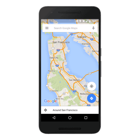
1. Google Maps is born. On Feb 8, 2005, Google Maps was first launched for desktop as a new solution to help people “get from point A to point B.” Today, Google Maps is used by more than 1 billion people all over the world every month.
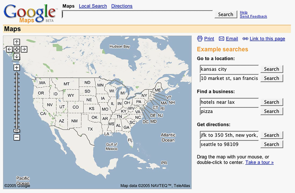
Google Maps 2005

Google Maps in 2005

2. Introducing Google Earth.Just a few months later, Google Earth landed, bringing 3D views of the planet to desktops. Imaging technology has improved significantly since then, and now Google Earth features more than 36 million square miles of high-definition satellite images for digital explorers to journey through.

3. Delivered to developers. It’s difficult to imagine a time when sites all over the web didn’t embed Google Maps into their pages—but it wasn’t until mid-2005 that the Google Maps API was announced. Today, more than 5 million websites and apps use Google Maps Platform every week.

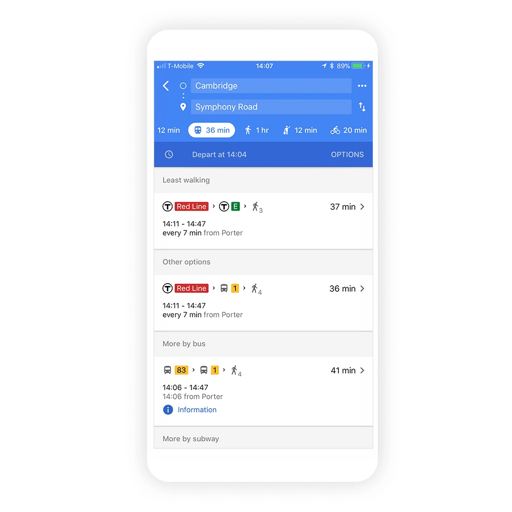
4. Google Trip Planner takes on Portland.In December 2005, Portland, Oregon became the first city to use Transit Trip Planner, helping commuters see public transit schedules and routes. It started as a standalone product but was eventually folded into Google Maps. Over the years, the feature made its way to cities across the globe.

Transit_on_Google_Maps.gif

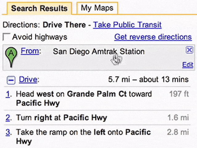
A clip from a 2008 video showing a public transit trip

5. Real-time traffic news. Nobody likes traffic—but traffic updates are another story. About two years after launching Google Maps, we introduced real-time info on traffic conditions for more than 30 U.S. cities. And so the phrase “there’s a lot of red...” was born.

Traffic in Maps

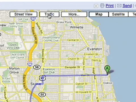
An early version of traffic conditions in Maps (on desktop!)

6. Take it to the Street View. May 29, 2007 marked the debut of Street View, which has become a much-beloved part of Google Maps. To collect imagery for Street View, we’ve strapped cameras to everything from snowmobiles to camels, and in total, captured more than 10 million miles.

Street View launch video

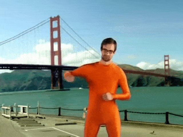
 Street View might win the award for Google’s quirkiest launch video ever.

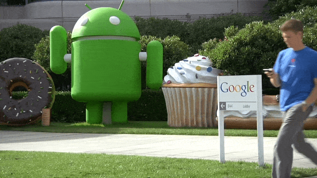
7. Maps goes mobile.Yes, there was a time before smartphones could direct you anywhere and everywhere. In November 2007, Google Maps made the leap from desktop to mobile phones and was first available for Blackberry and Palm devices. In 2008, our first Android app launched, followed by the iOS app in 2012. 

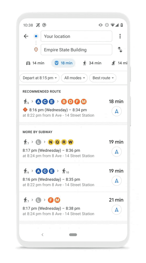
8. Navigation gets the green light. In 2009, a welcome update to Maps brought turn-by-turn navigation to the app. No more getting lost after you missed a turn!

Maps_Beta.gif

A clip from a 2009 launch video for turn-by-turn navigation. Groovy.

9. Street View Trekker takes us to new heights—literally. You might have thought Street View was already capturing unusual places, but in 2012 we introduced the Street View Trekker, bringing all the high-tech equipment needed to capture imagery into a backpack. We first took the Trekker out to explore the Grand Canyon, and since then it’s captured imagery from hard-to-reach places like the Amazon rainforest and the top of the Eiffel tower.

trekker.jpeg

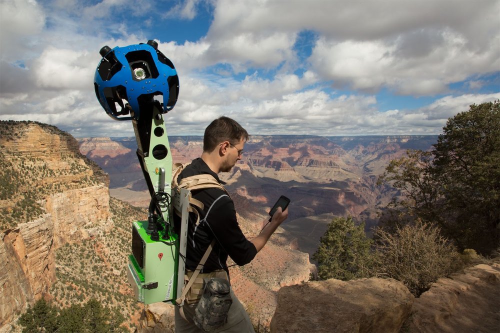
The Street View Trekker’s first stop? The Grand Canyon.

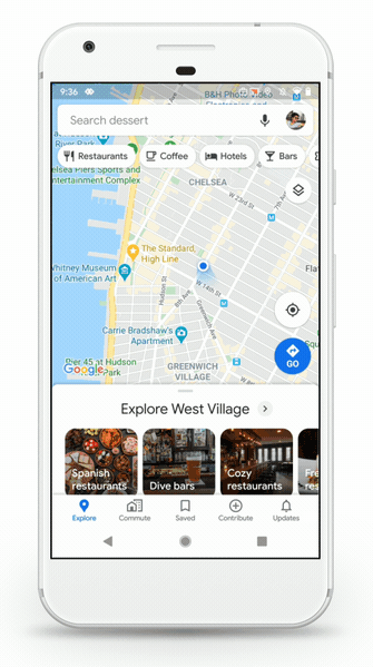
10. Say hello to hidden gems. Google Maps isn’t only about exploring the globe; we’ve also loved helping people find out what’s in their own neck of the woods. Building on our longstanding work to provide relevant local information, in 2014, we made it easier to browse information like hours, ratings and prices about restaurants, bars and hotels. Today, you can see these sorts of details for about 200 million businesses and places worldwide—right from your Explore tab.

11. Taking care of businesses. We’ve always made it a priority to help businesses share relevant information on Google, and in June 2014, we made that even easier with Google My Business. It’s a one-stop-shop for business owners to manage their presence on Google Maps and Search by updating their business info, adding photos, responding to reviews and more. 

12. No connection? No problem. In November 2015, we launched offline maps, so that even when you don’t have connectivity, you can still get turn-by-turn driving directions, search for specific destinations and find useful information about places.

Offline Maps 2015

A GIF from 2015 showing offline access

13. Meet your Local Guides. In the same month, we introduced the Local Guides program, a passionate community of users (now 120 million Local Guides strong!) who share reviews, photos and knowledge about places around the world. 

14. Have wheelchair, will travel. In March 2018, we brought wheelchair-accessible routes to Google Maps to make transit and navigation easier for those with mobility needs. Today, Google Maps includes accessibility info like wheelchair-friendly entrances and restrooms for more than 50 million places around the world.

Access

A 2018 GIF showing wheelchair accessible information in Maps

15. And we’re live—with Live View. Last February, we announced Live View, which uses augmented reality to help you understand which way to walk, with arrows and directions clearly overlaid on your view of the world.

The world is constantly changing, and so is the way we get around in it. And as it does, Google Maps will be there every step of the way, building new tools that help you navigate, explore and get things done, wherever you are.

Source: Google LatLong


Charting the next 15 years of Google Maps

It’s easy to take for granted how much information about the world is now available at our fingertips. But it wasn’t long ago that traveling to a new place meant fumbling through sheets of turn-by-turn instructions while trying to keep one hand on the steering wheel, with no way to anticipate how bad traffic would be or find a restaurant along the way. It was around that time, 15 years ago, that Google Maps set out on an audacious goal to map the world. 

I remember seeing early versions of Google Maps and being amazed at how easily you could scroll, zoom and search the world. One of my earliest memories of working on Google Maps was as a member of our user experience team, which designs and improves the usability of our products. In a world before smartphones, one of the biggest questions that we agonized over was where to put the Print button on the page so that people could easily take their directions on the go. 

Needless to say, a lot has changed. Google Maps has mapped more than 220 countries, surfaced information for about 200 million places and businesses, and helped billions of people get from point A to point B with confidence. In the beginning, we focused on answering the question: “How do I get from here to there?” Over time, our mission has expanded from helping you navigate to also helping you discover the best places to go and things to do once you’re there. As we celebrate our birthday this week, we’re reflecting on how the definition of what a map can do has broadened, and how machine learning will propel us forward from here. 

Navigating the world: From simple directions to Live View 

Fifteen years ago, printing out directions was considered state-of-the-art. So the idea of getting turn-by-turn driving navigation from your phone while on the road seemed revolutionary. In 2009, Google Maps pioneered turn-by-turn mobile navigation, and we’ve since added directions and navigation for walking, transit, bicycles, two-wheelers, and more—all with the goal of helping you with every trip across every mode of transportation. Since people increasingly use a mix of transportation options in a single trip—like walking to the train station and then taking a rideshare to their final stop—one of our next challenges involves stitching together these navigation options and ETAs for a more seamless experience.


Directions alone aren’t enough. We’re also helping you get there faster and more comfortably by arming you with relevant real-time information like live traffic alerts, predictions for how crowded your bus will be and which bike-sharing locations have available bikes. And we’ve used technology like augmented reality (AR) to help bring the map to life in helpful ways. Last year we introduced Live View, which uses AR, AI and your smartphone camera to show you your surroundings with the directions overlaid. It solves the real pain point of walking halfway down the block toward a place only to realize you’re going the wrong way (I’ve definitely been there!).

Exploring the world once you get there

We’ve always fundamentally believed that a map is much more than masses of land and sea, that a city is more than a web of streets. After all, the things that make my hometown shine are the brunch spot with my favorite veggie scramble, the pet salon that keeps my dog happy while he gets a trim, and the pizza spot with the foosball table that keeps my kids entertained while we wait. A truly helpful map reflects all of those local insights and helps you find places and experiences that are right for you—so that’s been a big focus for us over the last few years. 


Until recently, if you were looking to grab a slice of a pizza, you’d get a list of 20 nearby pizza joints. (And way before that, you’d have to search in advance on a desktop to get the list, or if you were already out of the house you had to roam streets seeking the smell of melted cheese!) Now, we can help you find all of the pizza spots nearby, when they're open, how crowded they’ll be, and which one has the best toppings. Once you’ve decided where to go, you can easily make a reservation or call the restaurant. 


Doing this well at scale requires a deep understanding of businesses and places—which is where our active community of users comes in. Every day, people contribute more than 20 million pieces of content to Google, like photos, reviews and ratings. These contributions continually make our map richer and more helpful for everyone. They also power features like popular dishes at restaurants, up-to-date road closures and wheelchair accessible routes. We’re also making it easy for you to get things done at these places within Google Maps—so you can go from finding a yoga studio to booking a class. 

The technology propelling the future of Maps

The world is always changing—new roads are added, bus routes are changed and natural disasters alter accessible routes. That’s why a map needs to be updated, comprehensive and accurate. Major breakthroughs in AI have transformed our approach to mapmaking, helping us bring high-quality maps and local information to more parts of the world faster. 


For instance, we worked with our data operations team to manually trace common building outlines, then trained our machine learning models to recognize building edges and shapes. Thanks to this technique, we’ve mapped as many buildings in the last year as we did in the previous 10. Elsewhere, machine learning helps us recognize handwritten building numbers that would be hard even for a passerby in a car to see. This is especially important when mapping areas where formal street signs and house numbers are uncommon. In Lagos, Nigeria alone, machine learning has helped us add 20,000 street names, 50,000 addresses, and 100,000 new businesses—lighting up the map with local places and businesses where there once was little detailed information. 

The map of the next 15 years 

As we celebrate our birthday and look ahead to the next 15 years, we’re rolling out a few new updates, including a refreshed look for the app and more information about your transit rides. And we’ve updated our Google Maps icon to reflect our journey.


When we set out to map the world, we knew it would be a challenge. But 15 years in, I’m still in awe of what a gargantuan task it is. It requires building and curating an understanding of everything there is to know about the physical world, and then bringing that information to people in a way that helps you navigate, explore and get things done in your world. The real world is infinitely detailed and always changing, so our work of reflecting it back to you is never done.

Source: Google LatLong


Street View’s 15 favorite Street Views

The past 15 years of Google Maps have been an incredible journey, and Street View has been along for much of the ride. To celebrate Google Maps turning 15, we’re sharing a list of our 15 favorite Street Views from over the years. 


Street View started as a project to help people explore different places from their computers, and launched in 2007 with the quirkiest product launch video ever. Today, Street View has become a key part of how we map the world in more than 220 countries and territories.


Of the 170 billion Street View images we’ve collected, these are some of our favorites. They transport people to amazing places, foster cultural awareness, encourage conservation and make our planet more accessible to all. Take a look and enjoy the view with us.

1. Scale Yosemite’s El Capitan with a famous climber

Go mountaineering in Yosemite without having to take a 3,000-foot climb up El Capitan. Some people did incur risk to bring you up the wall, but trust us, they’re professionals.
1_yosemite.jpg

2. Float through the International Space Station in Space View

All but one of our Street View image collections have something in common: gravity. But with the right stuff and a collaboration with NASA, we were able to overcome truly unique obstacles to bring everyone a taste of what it’s like to be an astronaut.
2_space.jpg
3. Horse around with us at Mongolia’s Lake Khövsgöl Ice Festival

How do you spend a bone-chilling winter in Mongolia? By going outside and having a festival on an ancient frozen lake, of course! We took Street View to the party and hopped on a horse-drawn sleigh for the sweetest of rides across a glacial playground.

3_Khövsgöl.jpg

4. Climb the monarch of mountains: Mont Blanc in the Alps

If you’re ready for dramatic views of snow-tipped mountain tops, take a journey 16,000 feet up Mont Blanc. We partnered with world-renowned alpine photographers, skiers, mountaineers, climbers and runners to collect Street View of Western Europe’s highest peak so that you can run on a summit, ice climb up a serac and ski knee-deep in some of the best powder on Earth.
4_Mont-Blanc.jpg

5. Take in Tokyo's cherry blossom season 

Japan’s sakura, or cherry blossom season is world famous. Take a casual stroll with Street View during Tokyo’s spring time and be sure to look left to catch a glimpse of the famous Zōjō-ji Temple, located in the Shibakoen neighborhood near Tokyo Tower.

5_tokyo.jpg
6. Bathe in La Sagrada Familia’s lights without the crowds

Let your jaw drop as you enter the main chamber of La Sagrada Familia. This might be your only chance to witness the church’s famous tree-like columns, shimmering lights and vertigo-inspiring views without having to join a herd of gawking visitors.

6_Sagrada.jpg

7. Scuttle with crabby company on Christmas Island 

Head over to Christmas Island, a remote tropical territory of Australia, to shellebrate the island’s annual red crab migration. Along with a sweeping sunset view you can see millions of crabs march from the forest and right into the sea.
7_ChristmasIsland_2.jpg
8. Stroll through the majestic Sheikh Zayed Grand Mosque in Abu Dhabi

See architectural styles from Muslim civilizations in the Sheikj Zayed Grand Mosque, one of the world’s largest. Able to accommodate 40,000 worshippers, the mosque has an open-door policy, inviting visitors from around the world to see its intricate domes, reflective pools and mesmerizing prayer hall.

8_Sheikh-Zayed.jpg

9. Drift with the Ilulissat Icefjord in Greenland

Feel the chill as you peer at Greenland’s Ilulissat Icefjord, where a glacial ice cap meets the ocean. Named a UNESCO World Heritage site in 2004, it’s imagery like this that reminds us both of our planet’s beauty and of how climate change is impacting the natural world.

9_Ilulissat.jpg

10. Meet the world’s only flightless parrot: the endangered kākāpō

Virtually step into the home of the kākāpō and explore prehistoric New Zealand just as it was millions of years before the first boat ever landed on its shores. Join Street View on an exclusive tour of windswept sanctuaries and pristine reserves that are off-limits to visitors.
10_kakapo.jpg

11. Cruise through the Amazon on the Rio Negro River

With Street View, you can ferry down the Rio Negro River and see images taken across more than 30 miles of remote and diverse shore, forest and village.
11_amazon.jpg

12. Visit the floating homes of the Uros in Lake Titicaca

Cultures, countries and climates may differ, but we all have a place to call home. See how the Uros people of Lake Titicaca in Peru make their homes on floating reed islands that entire villages rest on top of.
12_uros.jpg
13. Take in the Eiffel Tower

Whether you suffer from crippling vertigo or just haven’t had the chance to see the iconic Eiffel Tower, Street View has you covered. You can take a tour of the top of Paris right from home, catching a glimpse of attractions like the Arc de Triomphe, Montmartre and the river Seine.

13_paris.jpg
14. Gaze up at the Northern Lights

You don’t have to travel to the most northern corners of the world to see the natural phenomenon that is the Northern Lights. It took our team six nights in the snow before finally being able to capture the elusive Aurora Borealis on the frozen Pitkäjärvi Lake in Finland.

14_lights.jpg

15. Meander through Machu Picchu

After waiting years to secure permission to collect imagery from this world wonder, we methodically zig-zagged through the ancient site’s terraces and temples with Google Arts & Culture over seven days to make this world heritage site accessible to all.
15_machupicchu.jpg

Source: Google LatLong


Google Maps is turning 15! Celebrate with a new look and features

In 2005, we set out to map the world. Since then we’ve pushed the limits of what a map can do: from helping you easily navigate from point A to B, to helping you explore and get things done in the world. With more than 1 billion people turning to Google Maps to see and explore the world, we're celebrating our 15th birthday with a new look and product updates based on feedback from you.

A fresh look from the inside out

Starting today, you'll see an updated Google Maps app for Android and iOS that gives you everything you need at your fingertips with five easy-to-access tabs: Explore, Commute, Saved, Contribute and Updates.

  • Explore: Looking for a place nearby to grab lunch, enjoy live music or play arcade games? In the Explore tab, you’ll find information, ratings, reviews and more for about 200 million places around the world, including local restaurants, nearby attractions and city landmarks. 

  • Commute: Whether you’re traveling by car or public transit, the Commute tab is there to make sure you’re on the most efficient route. Set up your daily commute to get real-time traffic updates, travel times and suggestions for alternative routes. 

  • Saved: People have saved more than 6.5 billion places on Google Maps—from the new bakery across town to the famous restaurant on your upcoming vacation. Now you can view all of these spots in one convenient place, as well as find and organize plans for an upcoming trip and share recommendations based on places you've been. 

  • Contribute: Hundreds of millions of people each year contribute information that helps keep Google Maps up to date. With the new Contribute tab, you can easily share local knowledge, such as details about roads and addresses, missing places, business reviews and photos. Each contribution goes a long way in helping others learn about new places and decide what to do. 

  • Updates: The new Updates tab provides you with a feed of trending, must-see spots from local experts and publishers, like The Infatuation. In addition to discovering, saving and sharing recommendations with your network, you can also directly chat with businesses to get questions answered.

2. Five Tabs.gif

Our five tabs provide easier access to everything you need in Google Maps.

We’re also updating our look with a new Google Maps icon that reflects the evolution we’ve made mapping the world. It’s based on a key part of Google Maps since the very beginning—the pin— and represents the shift we’ve made from getting you to your destination to also helping you discover new places and experiences.

And because we can’t resist a good birthday celebration, keep an eye out for our celebratory party-themed car icon, available for a limited time when you navigate with Google Maps.

Made for you, on the go

We’re constantly evolving to help you get around—no matter how you choose to travel. Our new transit features in the Google Maps app help you stay informed when you’re taking public transportation.


Last year, we introduced crowdedness predictions to help you see how crowded your bus, train or subway is likely to be based on past rides. To help you plan your travels, we’re adding new insights about your route from past riders, so you’ll be able to see important details, such as: 

  • Temperature: For a more comfortable ride, check in advance if the temperature is considered by past riders as on the colder or warmer side. 
  • Accessibility: If you have special needs or require additional support, you can identify public transit lines with staffed assistance, accessible entrance and seating, accessible stop-button or hi-visible LED. 
  • Women’s Section: In regions where transit systems have designated women's sections or carriages, we'll help surface this information along with whether other passengers abide by it. 
  • Security Onboard: Feel safer knowing if security monitoring is on board—whether that’s with a security guard present, installed security cameras or an available helpline.
  • Number of carriages available: In Japan only, you can pick a route based on the number of carriages so that it increases your chances of getting a seat.

These useful bits of information come from past riders who've shared their experiences and will appear alongside public transit routes when available. To help future riders, you can answer a short survey within Google Maps about your experience on recent trips. We’ll start rolling this out globally in March, with availability varying by region and municipal transportation agency.

trip_attributes_narrow-BINKEDITED.gif

New trip attributes help you make informed decisions about your travel plans.

A sense of direction

Last year, we introduced Live View to help you quickly decide which way to go when you start a walking route with Google Maps. By combining Street View’s real-world imagery, machine learning and smartphone sensors, Live View in Google Maps shows you your surroundings with the directions overlaid in augmented reality. 


Over the coming months, we’ll be expanding Live View and testing new capabilities, starting with better assistance whenever you’re searching for a place. You’ll be able to quickly see how far away and in which direction a place is.

6. Live View.gif

Live View will soon help you get oriented in the right direction in new ways.

A big thank you to everyone for placing your trust in us and for being with us on this wild ride over the last 15 years. See you out there on the journey!

Source: Google LatLong


Charting the next 15 years of Google Maps

It’s easy to take for granted how much information about the world is now available at our fingertips. But it wasn’t long ago that traveling to a new place meant fumbling through sheets of turn-by-turn instructions while trying to keep one hand on the steering wheel, with no way to anticipate how bad traffic would be or find a restaurant along the way. It was around that time, 15 years ago, that Google Maps set out on an audacious goal to map the world. 

I remember seeing early versions of Google Maps and being amazed at how easily you could scroll, zoom and search the world. One of my earliest memories of working on Google Maps was as a member of our user experience team, which designs and improves the usability of our products. In a world before smartphones, one of the biggest questions that we agonized over was where to put the Print button on the page so that people could easily take their directions on the go. 

Needless to say, a lot has changed. Google Maps has mapped more than 220 countries, surfaced information for about 200 million places and businesses, and helped billions of people get from point A to point B with confidence. In the beginning, we focused on answering the question: “How do I get from here to there?” Over time, our mission has expanded from helping you navigate to also helping you discover the best places to go and things to do once you’re there. As we celebrate our birthday this week, we’re reflecting on how the definition of what a map can do has broadened, and how machine learning will propel us forward from here. 

Navigating the world: From simple directions to Live View 

Fifteen years ago, printing out directions was considered state-of-the-art. So the idea of getting turn-by-turn driving navigation from your phone while on the road seemed revolutionary. In 2009, Google Maps pioneered turn-by-turn mobile navigation, and we’ve since added directions and navigation for walking, transit, bicycles, two-wheelers, and more—all with the goal of helping you with every trip across every mode of transportation. Since people increasingly use a mix of transportation options in a single trip—like walking to the train station and then taking a rideshare to their final stop—one of our next challenges involves stitching together these navigation options and ETAs for a more seamless experience.


Directions alone aren’t enough. We’re also helping you get there faster and more comfortably by arming you with relevant real-time information like live traffic alerts, predictions for how crowded your bus will be and which bike-sharing locations have available bikes. And we’ve used technology like augmented reality (AR) to help bring the map to life in helpful ways. Last year we introduced Live View, which uses AR, AI and your smartphone camera to show you your surroundings with the directions overlaid. It solves the real pain point of walking halfway down the block toward a place only to realize you’re going the wrong way (I’ve definitely been there!).

Exploring the world once you get there

We’ve always fundamentally believed that a map is much more than masses of land and sea, that a city is more than a web of streets. After all, the things that make my hometown shine are the brunch spot with my favorite veggie scramble, the pet salon that keeps my dog happy while he gets a trim, and the pizza spot with the foosball table that keeps my kids entertained while we wait. A truly helpful map reflects all of those local insights and helps you find places and experiences that are right for you—so that’s been a big focus for us over the last few years. 


Until recently, if you were looking to grab a slice of a pizza, you’d get a list of 20 nearby pizza joints. (And way before that, you’d have to search in advance on a desktop to get the list, or if you were already out of the house you had to roam streets seeking the smell of melted cheese!) Now, we can help you find all of the pizza spots nearby, when they're open, how crowded they’ll be, and which one has the best toppings. Once you’ve decided where to go, you can easily make a reservation or call the restaurant. 


Doing this well at scale requires a deep understanding of businesses and places—which is where our active community of users comes in. Every day, people contribute more than 20 million pieces of content to Google, like photos, reviews and ratings. These contributions continually make our map richer and more helpful for everyone. They also power features like popular dishes at restaurants, up-to-date road closures and wheelchair accessible routes. We’re also making it easy for you to get things done at these places within Google Maps—so you can go from finding a yoga studio to booking a class. 

The technology propelling the future of Maps

The world is always changing—new roads are added, bus routes are changed and natural disasters alter accessible routes. That’s why a map needs to be updated, comprehensive and accurate. Major breakthroughs in AI have transformed our approach to mapmaking, helping us bring high-quality maps and local information to more parts of the world faster. 


For instance, we worked with our data operations team to manually trace common building outlines, then trained our machine learning models to recognize building edges and shapes. Thanks to this technique, we’ve mapped as many buildings in the last year as we did in the previous 10. Elsewhere, machine learning helps us recognize handwritten building numbers that would be hard even for a passerby in a car to see. This is especially important when mapping areas where formal street signs and house numbers are uncommon. In Lagos, Nigeria alone, machine learning has helped us add 20,000 street names, 50,000 addresses, and 100,000 new businesses—lighting up the map with local places and businesses where there once was little detailed information. 

The map of the next 15 years 

As we celebrate our birthday and look ahead to the next 15 years, we’re rolling out a few new updates, including a refreshed look for the app and more information about your transit rides. And we’ve updated our Google Maps icon to reflect our journey.


When we set out to map the world, we knew it would be a challenge. But 15 years in, I’m still in awe of what a gargantuan task it is. It requires building and curating an understanding of everything there is to know about the physical world, and then bringing that information to people in a way that helps you navigate, explore and get things done in your world. The real world is infinitely detailed and always changing, so our work of reflecting it back to you is never done.

Source: Google LatLong


Street View’s 15 favorite Street Views

The past 15 years of Google Maps have been an incredible journey, and Street View has been along for much of the ride. To celebrate Google Maps turning 15, we’re sharing a list of our 15 favorite Street Views from over the years. 


Street View started as a project to help people explore different places from their computers, and launched in 2007 with the quirkiest product launch video ever. Today, Street View has become a key part of how we map the world in more than 220 countries and territories.


Of the 170 billion Street View images we’ve collected, these are some of our favorites. They transport people to amazing places, foster cultural awareness, encourage conservation and make our planet more accessible to all. Take a look and enjoy the view with us.

1. Scale Yosemite’s El Capitan with a famous climber

Go mountaineering in Yosemite without having to take a 3,000-foot climb up El Capitan. Some people did incur risk to bring you up the wall, but trust us, they’re professionals.
1_yosemite.jpg

2. Float through the International Space Station in Space View

All but one of our Street View image collections have something in common: gravity. But with the right stuff and a collaboration with NASA, we were able to overcome truly unique obstacles to bring everyone a taste of what it’s like to be an astronaut.
2_space.jpg
3. Horse around with us at Mongolia’s Lake Khövsgöl Ice Festival

How do you spend a bone-chilling winter in Mongolia? By going outside and having a festival on an ancient frozen lake, of course! We took Street View to the party and hopped on a horse-drawn sleigh for the sweetest of rides across a glacial playground.

3_Khövsgöl.jpg

4. Climb the monarch of mountains: Mont Blanc in the Alps

If you’re ready for dramatic views of snow-tipped mountain tops, take a journey 16,000 feet up Mont Blanc. We partnered with world-renowned alpine photographers, skiers, mountaineers, climbers and runners to collect Street View of Western Europe’s highest peak so that you can run on a summit, ice climb up a serac and ski knee-deep in some of the best powder on Earth.
4_Mont-Blanc.jpg

5. Take in Tokyo's cherry blossom season 

Japan’s sakura, or cherry blossom season is world famous. Take a casual stroll with Street View during Tokyo’s spring time and be sure to look left to catch a glimpse of the famous Zōjō-ji Temple, located in the Shibakoen neighborhood near Tokyo Tower.

5_tokyo.jpg
6. Bathe in La Sagrada Familia’s lights without the crowds

Let your jaw drop as you enter the main chamber of La Sagrada Familia. This might be your only chance to witness the church’s famous tree-like columns, shimmering lights and vertigo-inspiring views without having to join a herd of gawking visitors.

6_Sagrada.jpg

7. Scuttle with crabby company on Christmas Island 

Head over to Christmas Island, a remote tropical territory of Australia, to shellebrate the island’s annual red crab migration. Along with a sweeping sunset view you can see millions of crabs march from the forest and right into the sea.
7_ChristmasIsland_2.jpg
8. Stroll through the majestic Sheikh Zayed Grand Mosque in Abu Dhabi

See architectural styles from Muslim civilizations in the Sheikj Zayed Grand Mosque, one of the world’s largest. Able to accommodate 40,000 worshippers, the mosque has an open-door policy, inviting visitors from around the world to see its intricate domes, reflective pools and mesmerizing prayer hall.

8_Sheikh-Zayed.jpg

9. Drift with the Ilulissat Icefjord in Greenland

Feel the chill as you peer at Greenland’s Ilulissat Icefjord, where a glacial ice cap meets the ocean. Named a UNESCO World Heritage site in 2004, it’s imagery like this that reminds us both of our planet’s beauty and of how climate change is impacting the natural world.

9_Ilulissat.jpg

10. Meet the world’s only flightless parrot: the endangered kākāpō

Virtually step into the home of the kākāpō and explore prehistoric New Zealand just as it was millions of years before the first boat ever landed on its shores. Join Street View on an exclusive tour of windswept sanctuaries and pristine reserves that are off-limits to visitors.
10_kakapo.jpg

11. Cruise through the Amazon on the Rio Negro River

With Street View, you can ferry down the Rio Negro River and see images taken across more than 30 miles of remote and diverse shore, forest and village.
11_amazon.jpg

12. Visit the floating homes of the Uros in Lake Titicaca

Cultures, countries and climates may differ, but we all have a place to call home. See how the Uros people of Lake Titicaca in Peru make their homes on floating reed islands that entire villages rest on top of.
12_uros.jpg
13. Take in the Eiffel Tower

Whether you suffer from crippling vertigo or just haven’t had the chance to see the iconic Eiffel Tower, Street View has you covered. You can take a tour of the top of Paris right from home, catching a glimpse of attractions like the Arc de Triomphe, Montmartre and the river Seine.

13_paris.jpg
14. Gaze up at the Northern Lights

You don’t have to travel to the most northern corners of the world to see the natural phenomenon that is the Northern Lights. It took our team six nights in the snow before finally being able to capture the elusive Aurora Borealis on the frozen Pitkäjärvi Lake in Finland.

14_lights.jpg

15. Meander through Machu Picchu

After waiting years to secure permission to collect imagery from this world wonder, we methodically zig-zagged through the ancient site’s terraces and temples with Google Arts & Culture over seven days to make this world heritage site accessible to all.
15_machupicchu.jpg

Source: Google LatLong


Google Maps is turning 15! Celebrate with a new look and features

In 2005, we set out to map the world. Since then we’ve pushed the limits of what a map can do: from helping you easily navigate from point A to B, to helping you explore and get things done in the world. With more than 1 billion people turning to Google Maps to see and explore the world, we're celebrating our 15th birthday with a new look and product updates based on feedback from you.

A fresh look from the inside out

Starting today, you'll see an updated Google Maps app for Android and iOS that gives you everything you need at your fingertips with five easy-to-access tabs: Explore, Commute, Saved, Contribute and Updates.

  • Explore: Looking for a place nearby to grab lunch, enjoy live music or play arcade games? In the Explore tab, you’ll find information, ratings, reviews and more for about 200 million places around the world, including local restaurants, nearby attractions and city landmarks. 

  • Commute: Whether you’re traveling by car or public transit, the Commute tab is there to make sure you’re on the most efficient route. Set up your daily commute to get real-time traffic updates, travel times and suggestions for alternative routes. 

  • Saved: People have saved more than 6.5 billion places on Google Maps—from the new bakery across town to the famous restaurant on your upcoming vacation. Now you can view all of these spots in one convenient place, as well as find and organize plans for an upcoming trip and share recommendations based on places you've been. 

  • Contribute: Hundreds of millions of people each year contribute information that helps keep Google Maps up to date. With the new Contribute tab, you can easily share local knowledge, such as details about roads and addresses, missing places, business reviews and photos. Each contribution goes a long way in helping others learn about new places and decide what to do. 

  • Updates: The new Updates tab provides you with a feed of trending, must-see spots from local experts and publishers, like The Infatuation. In addition to discovering, saving and sharing recommendations with your network, you can also directly chat with businesses to get questions answered.

2. Five Tabs.gif

Our five tabs provide easier access to everything you need in Google Maps.

We’re also updating our look with a new Google Maps icon that reflects the evolution we’ve made mapping the world. It’s based on a key part of Google Maps since the very beginning—the pin— and represents the shift we’ve made from getting you to your destination to also helping you discover new places and experiences.

And because we can’t resist a good birthday celebration, keep an eye out for our celebratory party-themed car icon, available for a limited time when you navigate with Google Maps.

New Google Maps icon

Google Maps icon evolution

Made for you, on the go

We’re constantly evolving to help you get around—no matter how you choose to travel. Our new transit features in the Google Maps app help you stay informed when you’re taking public transportation.


Last year, we introduced crowdedness predictions to help you see how crowded your bus, train or subway is likely to be based on past rides. To help you plan your travels, we’re adding new insights about your route from past riders, so you’ll be able to see important details, such as: 

  • Temperature: For a more comfortable ride, check in advance if the temperature is considered by past riders as on the colder or warmer side. 
  • Accessibility: If you have special needs or require additional support, you can identify public transit lines with staffed assistance, accessible entrance and seating, accessible stop-button or hi-visible LED. 
  • Women’s Section: In regions where transit systems have designated women's sections or carriages, we'll help surface this information along with whether other passengers abide by it. 
  • Security Onboard: Feel safer knowing if security monitoring is on board—whether that’s with a security guard present, installed security cameras or an available helpline.
  • Number of carriages available: In Japan only, you can pick a route based on the number of carriages so that it increases your chances of getting a seat.

These useful bits of information come from past riders who've shared their experiences and will appear alongside public transit routes when available. To help future riders, you can answer a short survey within Google Maps about your experience on recent trips. We’ll start rolling this out globally in March, with availability varying by region and municipal transportation agency.

trip_attributes_narrow-BINKEDITED.gif

New trip attributes help you make informed decisions about your travel plans.

A sense of direction

Last year, we introduced Live View to help you quickly decide which way to go when you start a walking route with Google Maps. By combining Street View’s real-world imagery, machine learning and smartphone sensors, Live View in Google Maps shows you your surroundings with the directions overlaid in augmented reality. 


Over the coming months, we’ll be expanding Live View and testing new capabilities, starting with better assistance whenever you’re searching for a place. You’ll be able to quickly see how far away and in which direction a place is.

6. Live View.gif

Live View will soon help you get oriented in the right direction in new ways.

A big thank you to everyone for placing your trust in us and for being with us on this wild ride over the last 15 years. See you out there on the journey!

Source: Google LatLong


Let Google be your holiday travel tour guide

When it comes to travel, I’m a planner. I’m content to spend weeks preparing the perfect holiday getaway: deciding on the ideal destination, finding the cheapest flights and sniffing out the best accommodations. I’ve been dreaming about a trip to Greece next year, and—true story—I’ve already got a spreadsheet to compare potential destinations, organized by flight length and hotel perks.

But the thing I don’t like to do is plot out the nitty-gritty details. I want to visit the important museums and landmarks, but I don’t want to write up a daily itinerary ahead of time. I’m a vegetarian, so I need to find veggie-friendly restaurants, but I’d prefer to stumble upon a good local spot than plan in advance. And, since I don’t speak Greek, I want to be able to navigate transportation options without having to stop and ask people for help all the time.

So I’ve come to rely on some useful Google tools to make my trips work for the way I like to travel. Here’s what I’ve learned so far.

Let Maps do the talking

Getting dropped into a new city is disorienting, and all the more so when you need to ask for help but don’t know how to pronounce the name of the place you’re trying to get to. Google Maps now has a fix for this: When you’ve got a place name up in Maps, just press the new little speaker button next to it, and it will speak out a place's name and address in the local lingo. And if you want to continue the conversation, Google Maps will quickly link you to the Google Translate app.

gif of Google Translate feature in Google Maps

Let your phone be your guidebook

New cities are full of new buildings, new foods and even new foliage. But I don’t want to just see these things; I want to learn more about them. That’s where Google Lens comes in as my know-it-all tour guide and interpreter. It can translate a menu, tell me about the landmark I’m standing in front of or identify a tree I’ve never seen before. So whenever I think, “I wonder what that building is for,” I can just use my camera to get an answer in real time. 

using Google Lens to identify a flower

Photo credit: Joao Nogueira

Get translation help on the go

The Google Assistant’s real-time translation feature, interpreter mode, is now available on Android and iOS phones worldwide, enabling you to have a conversation with someone speaking a foreign language. So if I say, “Hey Google, be my Greek translator,” I can easily communicate with, say, a restaurant server who doesn’t speak English. Interpreter mode works across 44 languages, and it features different ways to communicate suited to your situation: you can type using a keyboard for quiet environments, or manually select what language to speak.

gif of Google Assistant interpreter mode

Use your voice to get things done

Typing is fine, but talking is easier, especially when I’m on vacation and want to make everything as simple as possible. The Google Assistant makes it faster to find what I’m looking for and plan what’s next, like weather forecasts, reminders and wake-up alarms. It can also help me with conversions, like “Hey Google, how much is 20 Euros in pounds?”

Using Google Assistant to answer questions

Photo credit: Joao Nogueira

Take pics, then chill

When I’m in a new place, my camera is always out. But sorting through all those pictures is the opposite of relaxing. So I offload that work onto Google Photos: It backs up my photos for free and lets me search for things in them . And when I want to see all the photos my partner has taken, I can create an album that we can both add photos to. And Photos will remind me of our vacation in the future, too, with story-style highlights at the top of the app.

photo of leafy old town street

Photo credit: Joao Nogueira

Look up

I live in a big city, which means I don’t get to see the stars much. Traveling somewhere a little less built up means I can hone my Pixel 4 astrophotography skills. It’s easy to use something stable, like a wall, as a makeshift tripod, and then just let the camera do its thing.

a stone tower at night with a starry sky in the background

Photo credit: DDay

Vacation unplugged

As useful as my phone is, I try to be mindful about putting it down and ignoring it as much as I can. And that goes double for when I’m on vacation. Android phones have a whole assortment of Digital Wellbeing features to help you disconnect. My favorite is definitely flip to shhh: Just place your phone screen-side down and it silences notifications until you pick it back up.

someone sitting on a boat at sunset watching the shoreline

Photo credit: Joao Nogueira

Source: Google LatLong


How we power climate insights and action

This week, governments and NGOs from across the globe are convening at COP25, the United Nations climate conference in Madrid, to discuss the latest efforts to fight climate change. Addressing this pressing issue on a global scale requires urgent action from countries, communities and businesses. At COP25 we shared how Google is focused on building sustainability into everything that we do and making it possible for everyone to build a more sustainable world.

As cities now account for more than 70 percent of global emissions, we believe that empowering city governments with comprehensive, climate-relevant data and technology can play a critical role in igniting action. 

One way we are doing this is with partners like the Global Covenant of Mayors for Climate and Energy. We’ve brought our online tool, the Environmental Insights Explorer (EIE),to cities across the world, providing high-resolution data to measure greenhouse gas emissions (GHG) and take informed action to reduce CO2 emissions.  As of today, EIE has now expanded to more than 100 cities worldwide.

Environmental Insights Explorer: Now available in 100+ cities worldwide

Empowering local action in cities worldwide

As we look beyond our latest efforts to equip cities with more comprehensive data, we’re also exploring how we can help communities turn these insights into action at the local level.

To further accelerate climate action, Google.org is launching a new $4 million fund in collaboration with ICLEI - Local Governments for Sustainability.Grants from the fund will support nonprofits and academic institutions in Europe and Latin America that are leading data-driven climate action efforts.

The first grantee is Iniciativa Climática de México (ICM), a Mexico-based nonprofit organization that catalyzes international climate policy at the national and city levels to reduce emissions of GHGs and promotes low carbon growth in Mexico. Grant funds will be allocated to their “Hogar Solar” program. This program channels government spending on electricity towards the installation of solar panels to help increase access to power for those facing energy poverty, provide cleaner energy sources and reduce overall electricity costs. 

Data-driven initiatives like this are essential to addressing climate change and are needed at a global scale. As we fund more grantees, we will share what we learn on how to best engage in data-backed sustainability planning and action.


Translating global insights

EIE relies on anonymous, highly aggregated mapping data and standard GHG emission factors to estimate city building and transportation carbon emissions, as well as solar energy potential. We’re already seeing the early impacts of cities putting the power of EIE data behind climate plans, from bike-friendly initiatives to solar programs.

While EIE has officially published data for 100 cities, the EIE team has processed climate-relevant data across an initial sample of 3,000 cities to produce emission insights from approximately 95 million buildings and nearly 3 trillion kilometers traveled. 

Our analysis found that cities can have a huge impact in protecting our climate:

Making environmental information available will continue to be critical as cities, communities and companies worldwide band together to address climate change. We’re committed to doing our part, and want to extend our thanks to the forward-looking city officials and climate leaders collaborating with us on this project.

If you’d like to request EIE data for your city, let us know. And learn more about Google’s other sustainable efforts at sustainability.google.

Source: Google LatLong