Category Archives: Google LatLong Blog

News and notes by the Google Earth and Maps team

Create your own Street View imagery with new 360 cameras

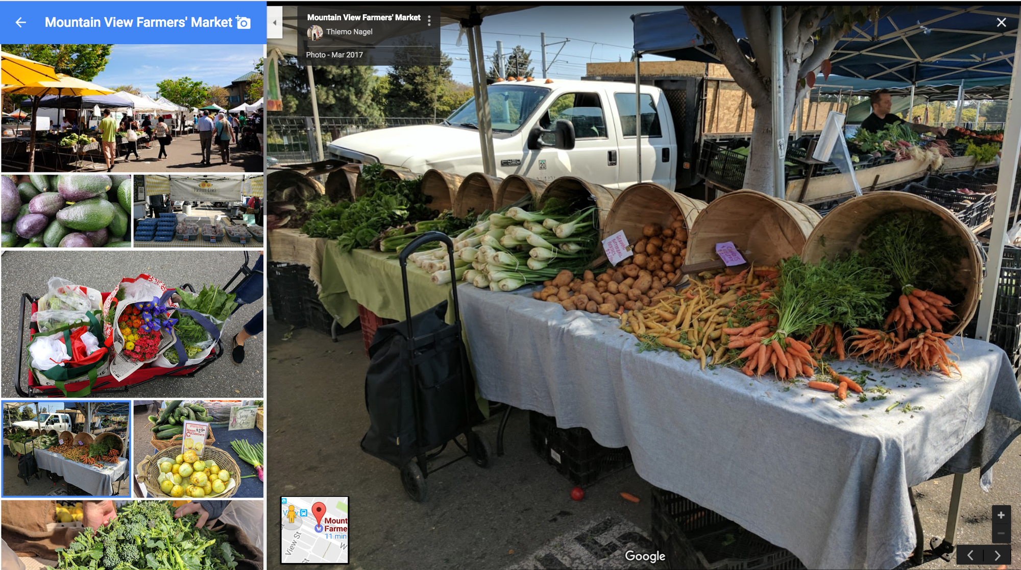
Spring is my favorite time of year. The flowers are blooming and my local farmers market begins to buzz with smiling faces and seasonal produce. On my recent trip, I took a bunch of pictures and was eager to invite my family who lives on the other side of the globe to wander through my local farmers market. Flipping through static photos doesn’t quite bring it to life—you really want others to feel what it was like to shop perfect produce in the sunshine.

Famers Market
Farmers Market - Mountain View, California

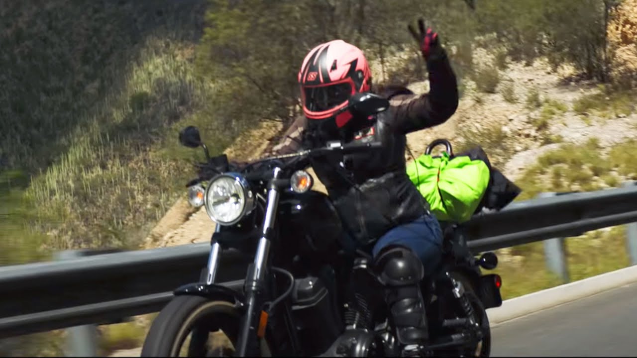
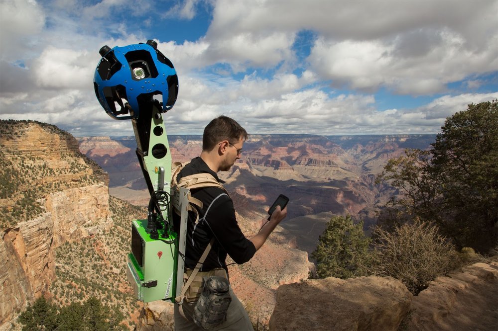
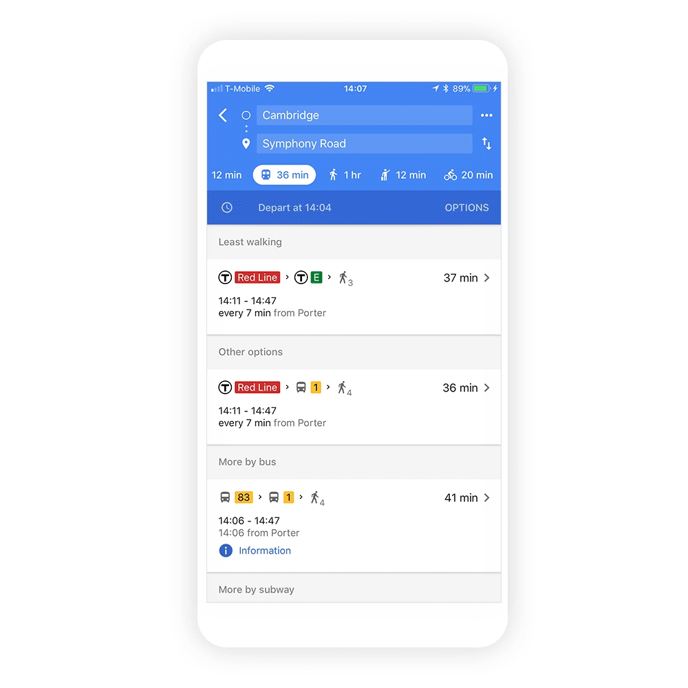
Today we're announcing a simple way to share your perspective, with a new "street view ready" certification standard integrated with 20 new 360-degree cameras coming to market in 2017. Whether you’re sharing your experience at a local market or on your recent vacation, publishing high-quality, interactive imagery no longer requires significant time and effort—all you have to do is get one of the cameras, download the Street View app and start creating. You can walk, run, bike, drive—even ride a horse—while we do the heavy lifting of connecting each frame of your video into a traditional, interactive Street View experience.

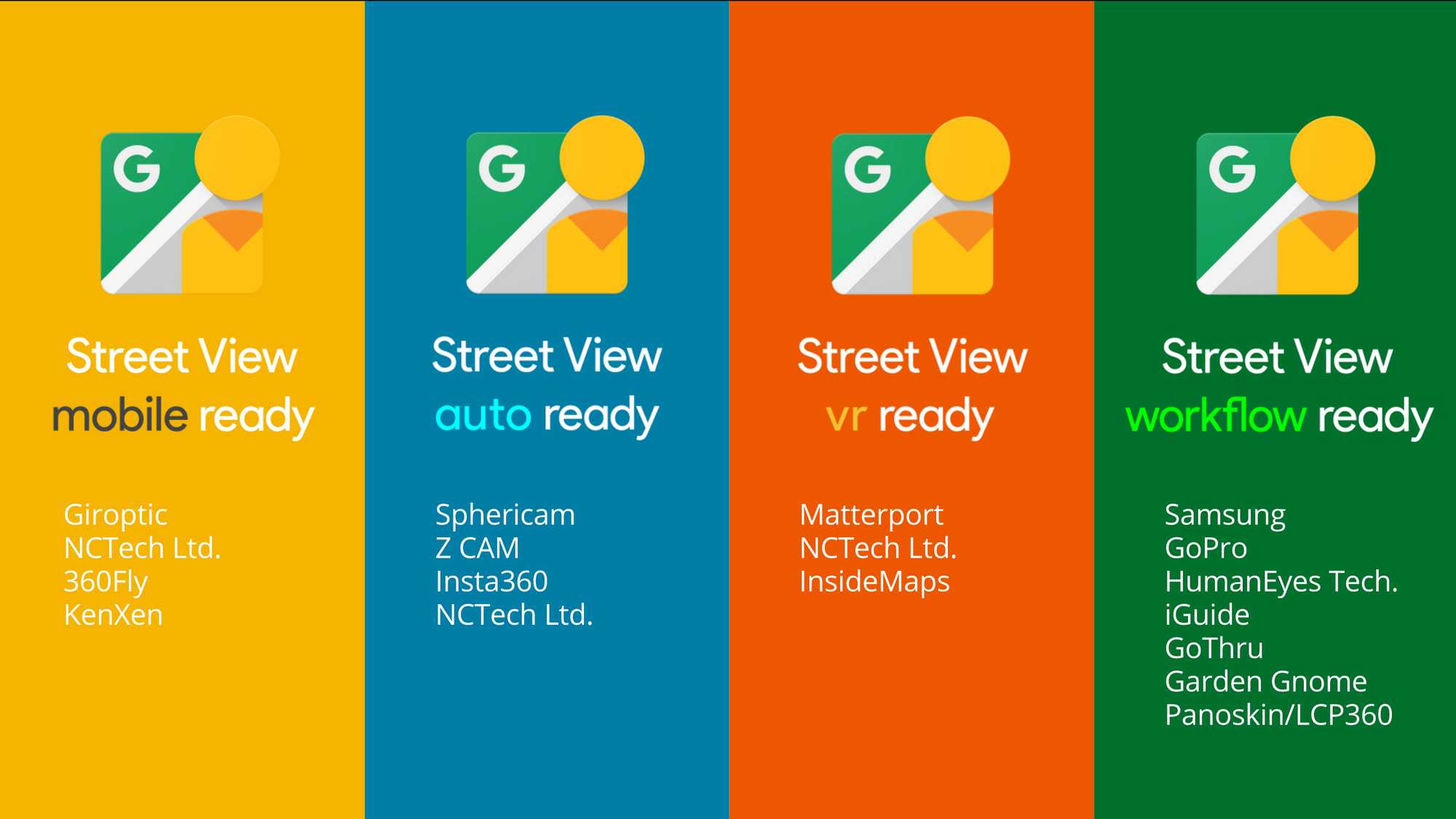
The cameras, which will be released over the coming months, all meet one of four new “Street View ready” standards, giving you the flexibility to choose the best way to upload imagery based on your interests.

  • Street View mobile ready: 360 cameras that can publish Street View directly from a mobile app—without requiring a desktop workflow

  • Street View auto ready: 360 cameras tailored for vehicle-based collection with the highest accuracy

  • Street View vr ready: 360 cameras or systems that collect geometry in addition to generating sets of connected 360 photos

  • Street View workflow ready: Publishing tools (sometimes bundled with cameras) that can upload to Street View accounts

To learn more about each of our Street View ready standards, visit our developer website. In addition, many industry partners will be debuting their Street View ready hardware and desktop applications this week at our Street View Summit in Tokyo, Japan.
Street View Ready Partners
Cameras and publishing apps are being prepared for certification under any of our four new standards

These tools are for anyone. Whether you’re an avid traveler or a professional photographer enrolled in our Street View trusted photographer program, Street View ready will give you what you need to recreate a place or space and invite others in.

Source: Google LatLong


Helping public health officials combat COVID-19

As global communities respond to the COVID-19 pandemic, there has been an increasing emphasis on public health strategies, like social distancing measures, to slow the rate of transmission. In Google Maps, we use aggregated, anonymized data showing how busy certain types of places are—helping identify when a local business tends to be the most crowded. We have heard from public health officials that this same type of aggregated, anonymized data could be helpful as they make critical decisions to combat COVID-19. 

Starting today we’re publishing an early release of our COVID-19 Community Mobility Reports to provide insights into what has changed in response to work from home, shelter in place, and other policies aimed at flattening the curve of this pandemic. These reports have been developed to be helpful while adhering to our stringent privacy protocols and policies

The reports use aggregated, anonymized data to chart movement trends over time by geography, across different high-level categories of places such as retail and recreation, groceries and pharmacies, parks, transit stations, workplaces, and residential. We’ll show trends over several weeks, with the most recent information representing 48-to-72 hours prior. While we display a percentage point increase or decrease in visits, we do not share the absolute number of visits. To protect people’s privacy, no personally identifiable information, like an individual’s location, contacts or movement, is made available at any point. 

We will release these reports globally, initially covering 131 countries and regions. Given the urgent need for this information, where possible we will also provide insights at the regional level. In the coming weeks, we will work to add additional countries and regions to ensure these reports remain helpful to public health officials across the globe looking to protect people from the spread of COVID-19.

Global_Blogpost_Search_Spain.gif

Navigate and download a report for your region of interest

In addition to other resources public health officials might have, we hope these reports will help support decisions about how to manage the COVID-19 pandemic. For example, this information could help officials understand changes in essential trips that can shape recommendations on business hours or inform delivery service offerings. Similarly, persistent visits to transportation hubs might indicate the need to add additional buses or trains in order to allow people who need to travel room to spread out for social distancing. Ultimately, understanding not only whether people are traveling, but also trends in destinations, can help officials design guidance to protect public health and essential needs of communities.

Global_Blogpost_LA_Report_zoom.png

A Community Mobility Report example for State of Louisiana, United States

In addition to the Community Mobility Reports, we are collaborating with select epidemiologists working on COVID-19 with updates to an existing aggregate, anonymized dataset that can be used to better understand and forecast the pandemic. Data of this type has helped researchers look into predicting epidemics, plan urban and transit infrastructure, and understand people’s mobility and responses to conflict and natural disasters.

Privacy protections

The Community Mobility Reports are powered by the same world-class anonymization technology that we use in our products every day. For these reports, we use differential privacy, which adds artificial noise to our datasets enabling high quality results without identifying any individual person. 

The insights are created with aggregated, anonymized sets of data from users who have turned on the Location History setting, which is off by default. Users who have Location History turned on can choose to turn the setting off at any time from their Google Account, and can always delete Location History data directly from their Timeline

These are unprecedented times and we will continue to evaluate these reports as we get feedback from public health officials, civil society groups, local governments and the community at large. We hope these insights will add to other public health information that will help people and communities stay healthy and safe.

Source: Google LatLong


Porsche Taylor puts women in the driver’s seat

Porsche Taylor’s first time riding a motorcycle alone could have gone better. “That first ride, I had absolutely nothing on right: My helmet was too big, I didn’t own a jacket. I might have had on some baseball gloves; everything was just totally upside-down wrong,” she says. “But I wasn’t afraid, it was exhilarating. It was trying something new, being in control. It was that initial feeling of the freedom of the wind.”

Porsche was one of the participants in the Women Riders World Relay, a relay ride that spanned the globe, beginning in February 2019 in Scotland and ending February 2020 in London. WRWR organizers used Google products like Maps, Sheets and Translate to make sure riders not only had constant, up-to-date access to their routes, but also were able to explore and connect with one another along the way. 

Video showing women riding motorcycles across the world.

“The whole team did phenomenally with the amount of time they had to put together the route and figure out the baton passes,” says Porsche. Google Maps was particularly useful for creating Porsche’s route. She and her fellow riders rode from Sept. 25 to Oct. 14, starting in Maine and heading west across the Canadian border, then down through the Southwest to the Mexican border in Texas. They crossed the country, occasionally riding through snowstorms and dropping temperatures. “When you consider the seasons we were riding through, it was a definite challenge for organizers to find routes that weren’t closed down.” 

While Google Maps could help the riders along their journey, it couldn’t do anything about inclement weather. “I quit about four times,” laughs Porsche. “Riding in the cold is not my favorite thing to do. But it was a positive experience all the way around; I don’t know that I would ride in the freezing cold again, but I would do a ride with those women again for sure. I always say the bonds are built on the ground: You’re going to love the folks you ride with to death or you won’t be so cool, and I’m happy to say I love those ladies to death.”

Porsche is vocal about the need for more representation for women in the motor sports community, and she says that things like social media visibility and technical tools like Google Hangouts have helped women who may have felt alone in their shared passion find each other. This idea is in part what inspired her to found Black Girls Ride, a magazine and community originally launched as a place for women of color who ride, which has since grown to include all women. What inspired her to launch Black Girls Ride was the lack of representation she saw when she first started riding—especially in long-distance riding. Traditionally, women filled support roles during these cross-country expeditions, taking a literal backseat to men. In fact, Porsche’s first experience on a bike was sitting behind a man, on the back of her cousin’s bike. “I didn’t so much like the feeling of being a passenger...but I loved the feeling of riding.” 

Thanks to women like Porsche and the WRWR riders, the world of motor sports is changing. “Women have become fearless and bold enough to take long distance biking trips on their own. We’re witnessing the explosion of the all-female long distance ride, where women take it upon themselves to create rides that cater to them instead of being a subset of an all-male ride. It’s where we get to take our power back.” 

Talking about these rides and seeing women taking them via social media and internet communities are crucial, says Porsche, who also mentions using Google Hangouts to connect with riders across the country. “You’re able to see the growth of female riders; women taking these long distance trips and riding solo have always been there—there are women riding today who have been doing this since the 60s—but social media is now shining a light on them.” 

That increased visibility is part of Porsche's work with Black Girls Ride. “I knew from riding in LA that there were more of us than the community would admit to. There was no representation in mainstream media, even for women who were riding professionally, there was very little to nothing,” Porsche says. Now "women all over the world are connecting to the Black Girls Ride brand. We have readers in London, Nigeria, France, just about every country you can name. I’m motivated by these women.” Black Girls Ride has become more than a publication, hosting trainings, workshops and events. And while both men and women are included, it’s Porsche’s focus to make sure women riders are invited to the table and that they are given the same representation, advertising and sponsorship opportunities. 

Most of all, she just wants women to feel welcome in this world. “It’s always been my goal to create safe spaces for women to ask questions and get the help they need without fear of ridicule,” she says. “And I’m glad I can be a part of creating that.” 

Learn more about the women behind WRWR and how they planned their relay at goo.gle/womenriders.


Source: Google LatLong


Connecting people with COVID-19 information and resources

Since the beginning of the year, search interest in COVID-19 has continued to climb around the world. Right now the disease is the largest topic people are looking for globally, surpassing even some of the most common and consistent queries we see in Search.

Search Interest COVID

As this public health crisis has evolved into a pandemic, information needs are continuing to change, differing from region to region. When COVID-19 was declared a public health emergency by the World Health Organization (WHO) in late January, we launched an SOS Alert with resources and safety information from the WHO, along with the latest news. The alert has launched in 25 languages across dozens of countries, and people in more than 50 countries can access localized public health guidance from health authorities. 

Expanding our COVID-19 Search experience
Now, as we continue to see people’s information needs expanding, we’re introducing a more comprehensive experience for COVID-19 in Search, providing easy access to authoritative information from health authorities alongside new data and visualizations. This new format organizes the search results page to help people easily navigate information and resources, and it will also make it possible to add more information over time as it becomes available.

Search COVID GIF

In addition to links to helpful resources from national and local health authorities, people will also find a carousel of Twitter accounts from local civic organizations and health authorities to help connect them with the latest local guidance as it’s shared. We’ve also introduced a feature to surface some of the most common questions about the pandemic, with relevant snippets sourced from the WHO and the Centers for Disease Control and Prevention (CDC). 

To help people track the latest information about the spread of the disease, we’re adding modules with statistics and a map showing COVID-19 prevalence in countries around the world. This new COVID-19 experience on Search will roll out in the coming days in English in the U.S., and we plan to add more information and expand to other languages and countries soon.

A website dedicated to help and resources
In addition to launching new features on Google Search that provide easy access to more authoritative information, we’ve worked with relevant agencies and authorities to roll out a website—available at google.com/covid19—focused on education, prevention and local resources. People can find state-based information, safety and prevention tips, search trends related to COVID-19, and further resources for individuals, educators and businesses. Launching today in the U.S., the site will be available in more languages and countries in the coming days and we’ll update the website as more resources become available. Along with our other products and initiatives, we hope these resources will help people find answers to the questions they’re asking and get the help they need.

Guidance around local health services
We’re also looking for more ways we can help people follow authoritative public health guidance and locate appropriate health services through our products. Right now in the U.S., people seeking out urgent care, hospitals and other medical services in Search or Maps will see an alert reminding them of the CDC’s recommendation that symptomatic individuals call ahead in order to avoid overwhelming health systems and increasing the risk of exposure.

Urgent Care COVID

As coronavirus becomes a challenge in more communities and as authorities around the world develop new guidance and tools to address the pandemic, we’ll continue to find more opportunities to connect people with key information to keep themselves, their families, and their communities safe.

Source: Google LatLong


How a Local Guide helps women achieve financial freedom

Three years ago, my world changed completely. Three different surgeries after a road accident left me bedridden and confined to one room for a year and a half. I wondered if I would ever fully recover. I wondered if my career would suffer. I wondered if I would be able to do what I loved—traveling, eating out, and meeting new people. I wondered if I would be happy again. 

Thankfully, an optimistic friend planted an idea in my head: “Why don't you leave Google Maps reviews for places you have already visited?” I had no idea this was a possibility. I began to write Google Maps reviews without ever leaving my room in my hometown of Vapi, India—starting with a local restaurant I adore called Sam's Alive Again. I sensed my mood changing daily; I was helping people make better decisions about places to go and things to do. 

Quickly, my numbers added up; I contributed more than 700 reviews and 2,000 photos that have been seen more than 3 million times. In 2018, I was selected to attend Google’s annual meet-up of Local Guides, where top Google Maps contributors from around the world come together in San Francisco. I made new friends and learned about the amazing things they do for their communities, like adding accessibility information on Google Maps to help people with disabilities and arranging volunteer events. I felt helpful and inspired for the first time in a long time.

20200305_222038.jpg
Being financially independent frees you from the opinions of others. Priyanka Upadhyay

My growing involvement with Local Guides taught me that photos are powerful. Reviews can transform a business. And technology gives a voice to women. I’ve seen this firsthand. My cousin runs a cake shop called Baker's Love out of her home in Vapi. Now that I’ve added her to Google Maps, she receives orders from far away places online. (She makes the most amazing chocolate cake, by the way.) 

And I loved teaching Urmila, the owner of Dimple Beauty Parlor, how to claim her business on Google Maps, maintain her photos, and respond to reviews. Urmila told me that she saw a jump in her weekly customers, and her business is doing fine. As Urmila says, “It’s essential to be able to stand on your own feet.”

There are so many social and economic hurdles to start a business—and I believe these multiply when you’re a woman. Financial independence frees you from the opinions of others, and I get excited when a woman is motivated to do her own thing. Through Local Guides Connect, our online forum where Local Guides swap tips and network from around the world, I run a group called “Empowered Women of Vapi, India.” Together, we identify stories about women in Vapi; in 2020, we’re organizing 28 meet-ups in all 28 states of India (yes, all!). At each meet-up we will visit the state capital, gather women business owners, improve their Google Maps place pages, and forge connections between Local Guides.

This is my way of encouraging women to keep going—no matter the obstacle. Women are strong, inspiring, and resilient. Today, I’m fully recovered, and looking back, I’m so grateful I didn’t allow my surgeries to stop me.

Source: Google LatLong


Google Maps 101: how contributed content makes a more helpful map

Recently, we gave you a behind-the-scenes look at how we map the world and use imagery to capture the meaningful details around us. Now we’re diving into how content contributed by our user community makes Google Maps a more helpful tool for everyday decision making, whether you’re looking for the best burrito in a new city or trying to find a local car mechanic in your neighborhood. 

Contributions create a more helpful map

When we look at the places around us, it’s clear that not all the information we see is online. Store hours get updated, new businesses open and menus rotate.

To ensure that our map reflects the real world, we enable anyone with a Google account to contribute their local knowledge to approximately 200 million points of interest in Google Maps. In fact, everyday people submit more than 20 million contributions to Google Maps, from reviews and ratings to photos, answers to other users' questions, address updates and more. Ultimately, this helps people everywhere make better decisions about where to eat and shop, or things to do and see.

At a new restaurant and don’t know what to order? We can show you the most popular dishes for more than a million restaurants worldwide, made possible by photos and reviews other diners have added to the map. Looking for things to do nearby? In the “Explore” tab you can find recommended lists created by local experts and trusted publishers. 

Hundreds of millions of people each year contribute information that helps keep Google Maps up to date. We recently added a new “Contribute” tab to the app so people can more easily share their local knowledge. Each contribution goes a long way in helping others learn about new places and decide what to do.

Contribute tab in Google Maps

Use the new Contribute tab to easily share your local knowledge on Google Maps

It’s not just personal recommendations people are adding to the map. Each month, community contributions help us update factual information for businesses, roads and addresses around the planet. And thanks to contributions from the global Google Maps community, we’ve been able to add accessibility information, like wheelchair-friendly entrances and restrooms, for more than 15 million places around the planet, helping people with disabilities better navigate and explore their cities.

One of our most passionate groups of contributors is the 120 million Local Guides across 24,000 cities and towns who are committed to making information about their communities on Google Maps more helpful and accurate. See how one of these Local Guides, Adriano Anjos in São Paulo, is making a difference in people's lives by sharing information about blood donation centers on Google Maps:

Local Guide Adriano Anjos contributes information to Google Maps about blood donation centers in his city.

Ensuring the content you see is reliable

Like any platform that welcomes user-generated content, we have to remain vigilant against inappropriate content—the vast majority of which is removed before anyone actually sees it. And as more people contribute to Google Maps, we continue to crack down on the bad actors who violate our policies, using a combination of people and technology to tackle unwelcome content. 

For example, we use automated detection systems, including machine learning models, that scan the millions of contributions we receive each day to detect and remove policy-violating content. In the case of fake reviews, our systems check every single review before it gets published to Google Maps, looking for signs of fake content. Our machine learning models watch out for specific words and phrases, examine patterns in the types of content an account has contributed in the past, and can detect suspicious review patterns. 

While we’re constantly improving our automated systems, we know they’re not perfect as fake reviews can slip through from time to time. So we also deploy teams of trained operators and analysts who audit reviews, photos, business profiles and other types of content both individually and in bulk. And we provide a way for anyone to flag reviews, inappropriate content and misleading places for removal. 

Sorting through the 20 million contributions we receive each day (that’s more than 7 billion contributions a year), in 2019 alone, our technologies and teams:

  • Removed more than 75 million policy-violating reviews and 4 million fake business profiles thanks to refinements in our machine learning models and automated detection systems which are getting better at blocking policy-violating content and detecting anomalies for our operators to review
  • Took down more than 580,000 reviews and 258,000 business profiles that were reported directly to us, as we make it easier for people to flag inappropriate content 
  • Reviewed and removed more than 10 million photos and 3 million videos that violated our content policies, as our operators and automated systems get better at catching policy-violating content, such as off-topic photos
  • Disabled more than 475,000 user accounts as we improve our machine learning detection capabilities and develop expanded policies and training for our operators

The vast majority of contributions made to Google Maps are authentic, with policy-violating content seen less than one percent of the time. And we’ll continue to develop new tools and techniques to fight against bad actors. 

Contributed content is an indispensable part of how we’re making Google Maps richer and more helpful for everyone. With people’s contributions, we’ve been building a truly helpful map that not only gets you from A to B, but also helps you find the places and experiences that are right for you, whether you need to tackle last-minute gift shopping or have a craving for pizza.

Source: Google LatLong


One man’s mission to add civil rights history to Google Maps

“I think in another life, I would have been a private investigator,” says Paul Kang. The Nashville resident is a paralegal for an immigration law firm, but it’s his hobby as a Local Guide on Google Maps that’s brought out his inner detective, turning him into something of a historian.

Paul and his family moved to Tennessee in 2012, and it was out of necessity that he was first introduced to Google Maps and soon after Local Guides, the community of everyday people who are passionate about sharing their experiences on Google Maps with reviews, photos, videos and more. Their efforts end up making Maps better for everyone. “My wife wanted to know where the post office near her work was, so I looked it up and sent her the map listing,” he says. “And when she went there, she told me it was all closed up.” The post office wasn’t open for business anymore. This sort of thing happened a few more times, and after becoming slightly frustrated, Paul realized he could use Google Maps to edit information. “I started closing things down, replacing duplicate listings,” he says. Eventually, Paul was doing much more than correcting listings. In 2017, the 1955 murder of Emmett Till resurfaced in the news when an interview with the woman who’d accused Till of harassing her—which led her husband and an accomplice to murder Till—admitted it wasn’t true. The tragic, senseless killing of the 14-year-old boy had been a catalyst in the civil rights movement, and the confession reignited interest in the story for Americans everywhere. 

Paul first learned about what happened to Emmett Till when he was a young adult. “I think one of the things I still remember is that the jury acquitted Till’s murderers in 59 minutes, but that they would have [done it] faster if they hadn’t all gone together to get a bottle of pop before rendering the verdict.” 

When he used Google Maps to try and find the site where Till’s body was found, a listing appeared—but didn’t seem like it was in the right spot according to what Paul had read. After using historical resources to learn more about the location, he was able to find it himself on Google Maps—and he decided that everyone else should be able to as well, so he loaded up his wife and kids and started the two-hour road trip south. 

“I just thought, you know what, I’m going to do this, I’m doing to drive my whole family down there,” Paul says. When they got there, he says they discovered a museum dedicated to Emmett Till, but it was only open by appointment--information that hadn’t been listed in Google Maps. Fortunately, the museum was holding an event, and Paul’s family was able to go in. What Paul didn’t realize is how important the experience was for his wife, who was learning about Emmett Till for the first time. “We talked about it as she was going through it. It was shocking to her. It was a big download of information for her, and I know it’s stuck with her and informs her when she’s reading the news today, too.”

Using a 360-degree camera, Paul also took Street View photos of the site where Till’s body was found, and updated the Google Maps data so others can find it. He was even able to find the barn where Till was tortured and added that information to Maps.

Paul's gone on to add more historical information to Google Maps; he thinks he’s added some 50 historic landmarks, give or take. In 2018, for the 50th anniversary of Dr. Martin Luther King, Jr.’s assassination, various sites and memorials in Memphis were being constructed. “I waited to see if the city or some nonprofit maybe was going to add them to Google Maps, but I didn’t see anything,” he says. “So I just started adding them.” 

He also made a point to update information about other memorials to Dr. King, including “I Have Been to the Mountaintop,” a sculpture unveiled in 1976 that was moved to a more prominent part of downtown Memphis. I AM A MAN plaza, an open air installation that opened in 2018 and dedicated to the sanitation workers’ strike of 1968, also wasn’t on Google Maps; Paul made sure both of these sites would surface, complete with historic information. Once when he went to take photos for Street View with his 360-degree camera, a few police officers acting as security at a site asked what he was doing. “I was like, ‘I’m making sure this gets on Google Maps, so people can find it!’” 

News archives and web research power Paul’s exploration of the history of his new state and  he says there’s work to be done to make sure this information remains accessible for future generations. “A lot of the websites cataloging information about these kinds of places with descriptions and photos are volunteer-led,” he says. “What if they decide not to or forget to renew their domain? Those websites could go away.”

Fortunately, Paul’s work won’t be going anywhere. “Even if all these websites go away, Google Maps will still be here.”

Source: Google LatLong


A look back at 15 years of mapping the world

Fifteen years ago, we launched Google Maps as a useful way to help people get around. Working on Google’s geo efforts for more than 15 years, watching Maps grow into what it is today has been an unbelievable experience. As we’ve added features and capabilities, Google Maps has evolved into much more than a website that gives you turn-by-turn directions. Today, it’s a gateway to exploring the world—both digitally and in real life, on foot or by car, via public transit or a wheelchair. 

Pardon the pun, but it’s been a long road! And in honor of Google Maps’s birthday, we’re looking back at some of the most important and exciting moments along the way. 

1. Google Maps is born. On Feb 8, 2005, Google Maps was first launched for desktop as a new solution to help people “get from point A to point B.” Today, Google Maps is used by more than 1 billion people all over the world every month.

Google Maps 2005

Google Maps in 2005

2. Introducing Google Earth.Just a few months later, Google Earth landed, bringing 3D views of the planet to desktops. Imaging technology has improved significantly since then, and now Google Earth features more than 36 million square miles of high-definition satellite images for digital explorers to journey through.

3. Delivered to developers. It’s difficult to imagine a time when sites all over the web didn’t embed Google Maps into their pages—but it wasn’t until mid-2005 that the Google Maps API was announced. Today, more than 5 million websites and apps use Google Maps Platform every week.

4. Google Trip Planner takes on Portland.In December 2005, Portland, Oregon became the first city to use Transit Trip Planner, helping commuters see public transit schedules and routes. It started as a standalone product but was eventually folded into Google Maps. Over the years, the feature made its way to cities across the globe.

Transit_on_Google_Maps.gif

A clip from a 2008 video showing a public transit trip

5. Real-time traffic news. Nobody likes traffic—but traffic updates are another story. About two years after launching Google Maps, we introduced real-time info on traffic conditions for more than 30 U.S. cities. And so the phrase “there’s a lot of red...” was born.

Traffic in Maps

An early version of traffic conditions in Maps (on desktop!)

6. Take it to the Street View. May 29, 2007 marked the debut of Street View, which has become a much-beloved part of Google Maps. To collect imagery for Street View, we’ve strapped cameras to everything from snowmobiles to camels, and in total, captured more than 10 million miles.

Street View launch video

 Street View might win the award for Google’s quirkiest launch video ever.

7. Maps goes mobile.Yes, there was a time before smartphones could direct you anywhere and everywhere. In November 2007, Google Maps made the leap from desktop to mobile phones and was first available for Blackberry and Palm devices. In 2008, our first Android app launched, followed by the iOS app in 2012. 

8. Navigation gets the green light. In 2009, a welcome update to Maps brought turn-by-turn navigation to the app. No more getting lost after you missed a turn!

Maps_Beta.gif

A clip from a 2009 launch video for turn-by-turn navigation. Groovy.

9. Street View Trekker takes us to new heights—literally. You might have thought Street View was already capturing unusual places, but in 2012 we introduced the Street View Trekker, bringing all the high-tech equipment needed to capture imagery into a backpack. We first took the Trekker out to explore the Grand Canyon, and since then it’s captured imagery from hard-to-reach places like the Amazon rainforest and the top of the Eiffel tower.

trekker.jpeg

The Street View Trekker’s first stop? The Grand Canyon.

10. Say hello to hidden gems. Google Maps isn’t only about exploring the globe; we’ve also loved helping people find out what’s in their own neck of the woods. Building on our longstanding work to provide relevant local information, in 2014, we made it easier to browse information like hours, ratings and prices about restaurants, bars and hotels. Today, you can see these sorts of details for about 200 million businesses and places worldwide—right from your Explore tab.

11. Taking care of businesses. We’ve always made it a priority to help businesses share relevant information on Google, and in June 2014, we made that even easier with Google My Business. It’s a one-stop-shop for business owners to manage their presence on Google Maps and Search by updating their business info, adding photos, responding to reviews and more. 

12. No connection? No problem. In November 2015, we launched offline maps, so that even when you don’t have connectivity, you can still get turn-by-turn driving directions, search for specific destinations and find useful information about places.

Offline Maps 2015

A GIF from 2015 showing offline access

13. Meet your Local Guides. In the same month, we introduced the Local Guides program, a passionate community of users (now 120 million Local Guides strong!) who share reviews, photos and knowledge about places around the world. 

14. Have wheelchair, will travel. In March 2018, we brought wheelchair-accessible routes to Google Maps to make transit and navigation easier for those with mobility needs. Today, Google Maps includes accessibility info like wheelchair-friendly entrances and restrooms for more than 50 million places around the world.

Access

A 2018 GIF showing wheelchair accessible information in Maps

15. And we’re live—with Live View. Last February, we announced Live View, which uses augmented reality to help you understand which way to walk, with arrows and directions clearly overlaid on your view of the world.

The world is constantly changing, and so is the way we get around in it. And as it does, Google Maps will be there every step of the way, building new tools that help you navigate, explore and get things done, wherever you are.

Source: Google LatLong