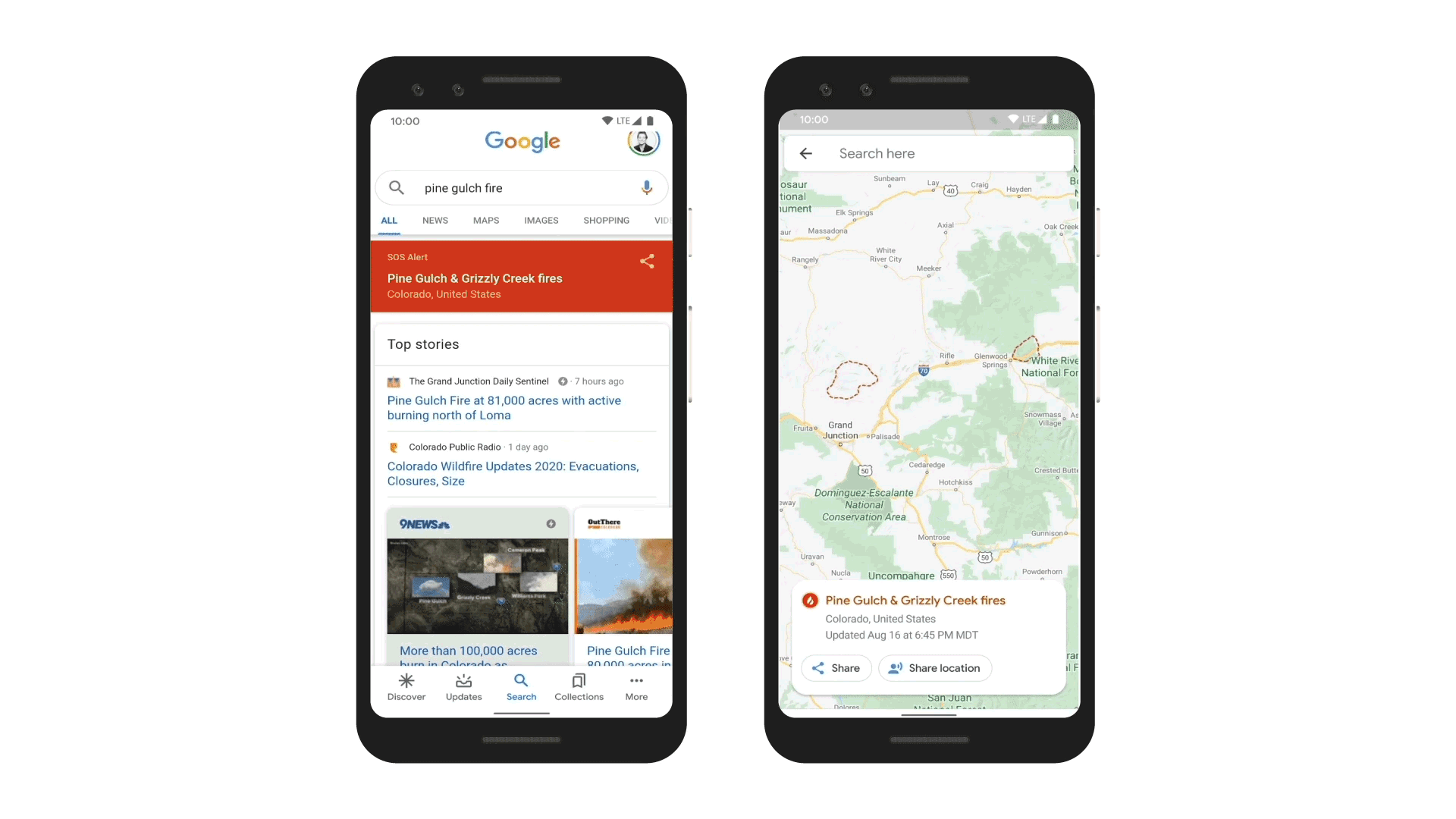
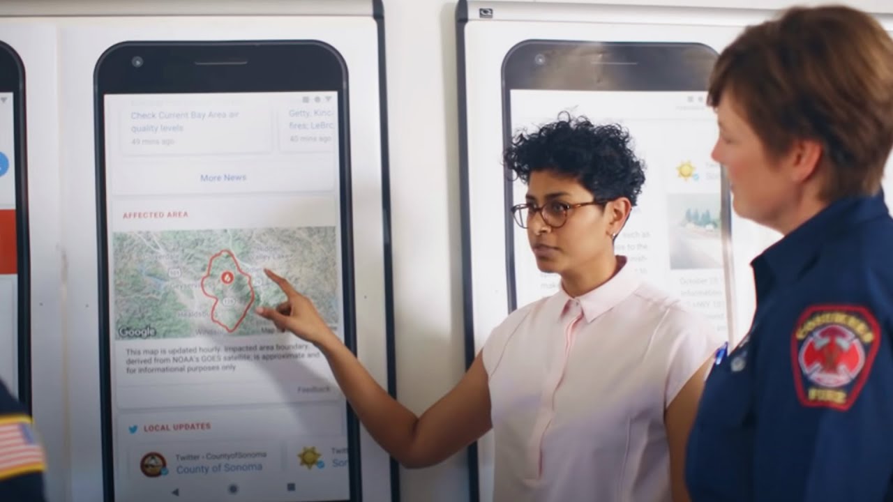
Connecting people to critical information during active wildfires
Today we’re launching a new wildfire boundary map in Search and Maps SOS alerts in the U.S. to provide deeper insights for areas impacted by an ongoing wildfire. In moments like a growing wildfire, knowing exactly where a blaze is underway and how to avoid it is critical. Using satellite data to create a wildfire boundary map, people will now see the approximate size and location right on their phone or desktop.
When people look for things like “wildfire in California” or a specific fire like “Kincade fire” in Search, they will be able to see a wildfire’s approximate boundary of the fire, name and location, as well as news articles and helpful resources from local emergency agencies in the SOS alert.
On Google Maps, people will have access to the same details, including the fire boundary, and receive warnings if they’re approaching an active blaze. If someone is exploring an area near a wildfire on Google Maps, they’ll get an ambient alert that will point them to the latest information.
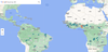
 Last week at the inaugural Africa Climate Summit (ACS) in Nairobi, Kenya, we joined African leaders and shared our commitment to advance AI solutions to address the clim…
 Google’s Yossi Matias and WMO Director of Infrastructure Anthony Rea discuss the Early Warnings For All Initiative.
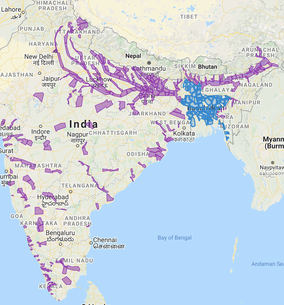
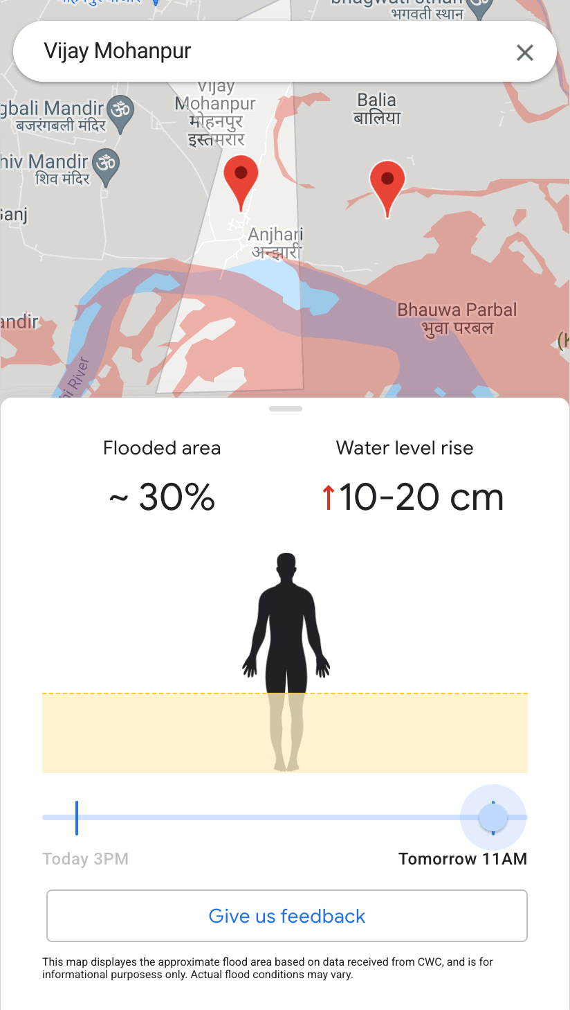
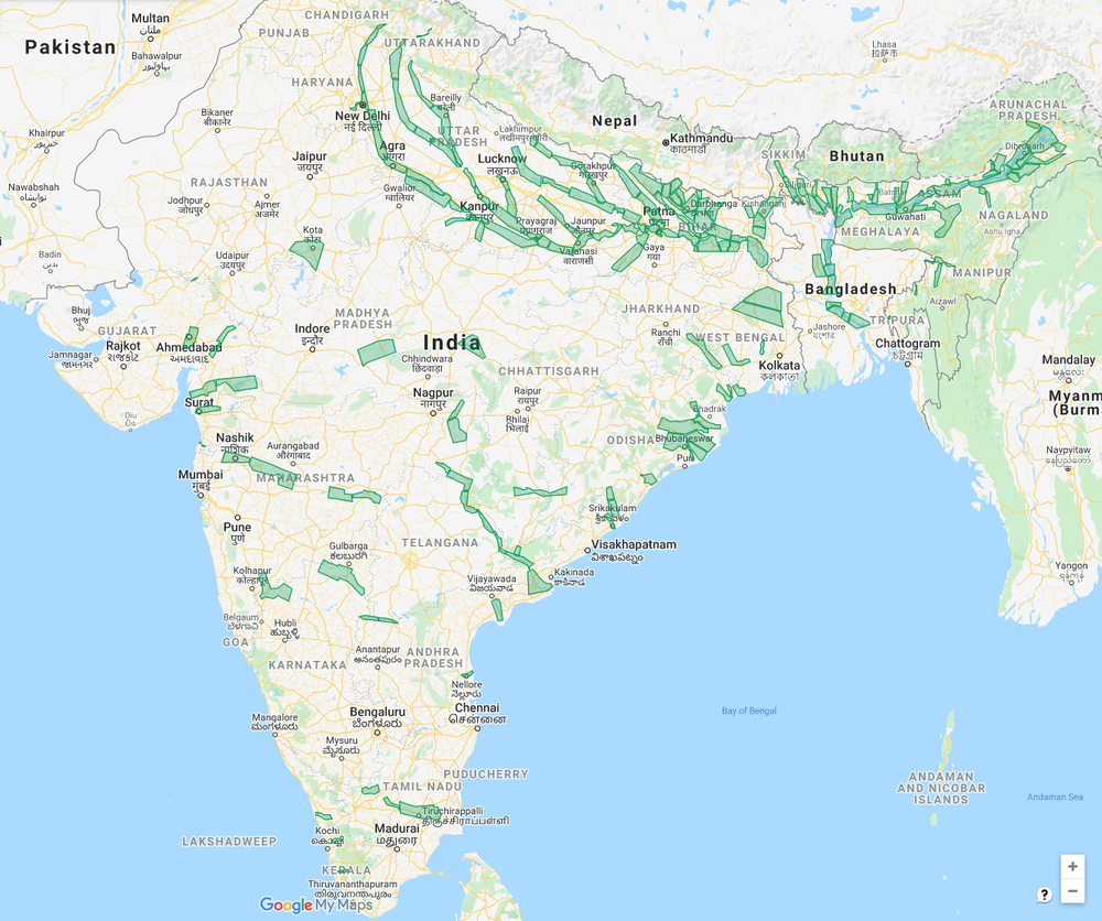
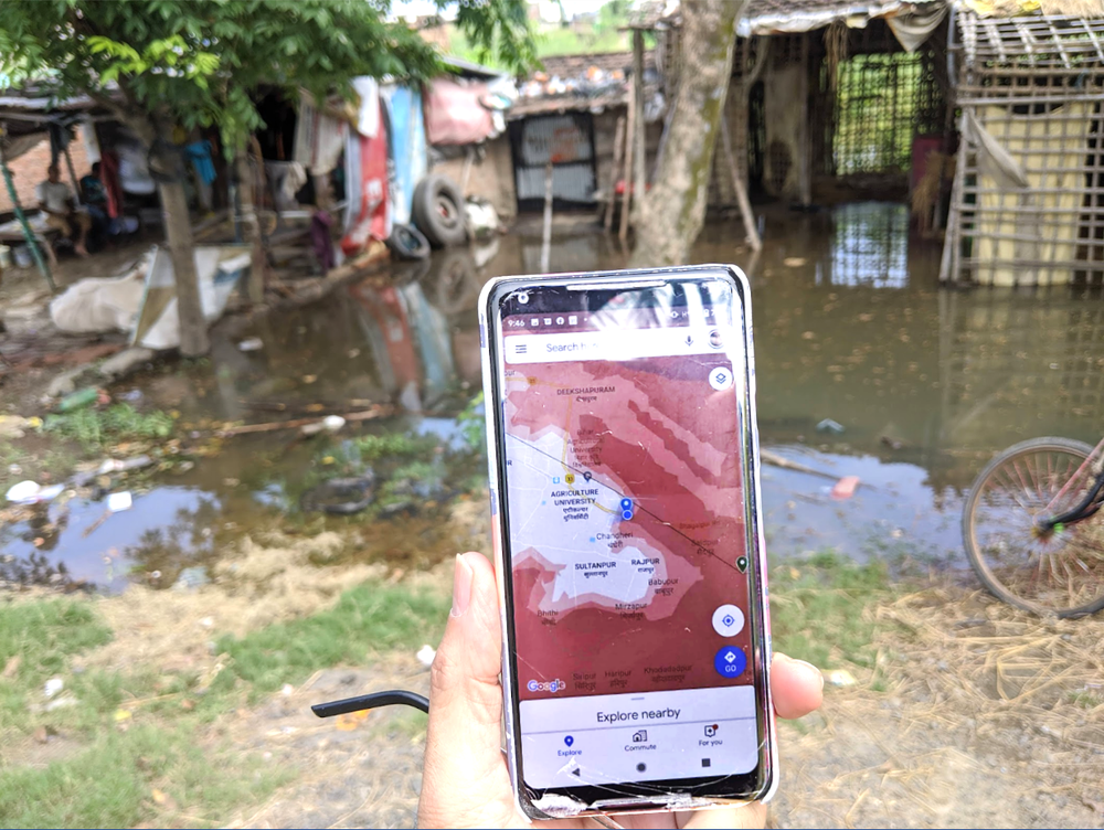
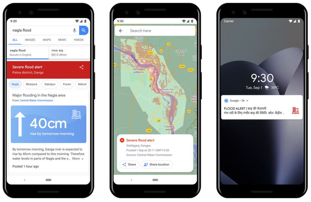
 AI-powered Flood Hub is expanding to nearly 80 countries worldwide.
 At The Check Up, we shared updates on our medical LLM research, partnerships and new ways AI can help with disease detection.
 Google's Startups for Sustainable Development program supports impact-driven startups who are building a more sustainable future.