Author Archives: Lat Long

Introducing the new Street View app from Google Maps

For all the Street View fans out there: exploring the world just got even easier. Today we are introducing the new Street View app for Android and iOS, which allows you for the first time, to tour immersive 360-degree imagery and instantly contribute your own — right to Google Maps. Find a great hiking trail, check out restaurant and hotel interiors, and snap and share your own photo spheres (360-degree panoramas) to Google Maps for others to explore and enjoy. All in one place.
 
The new Street View app for Android (left) and iOS (right)


Explore
In one gallery, you can explore Street View collections and content from Google Maps alongside photo spheres contributed from people around the globe. So whether you want to track the Loch Ness monster in Scotland, scale the famed rock wall El Capitan in Yosemite, or hike Mt. Fuji, the Street View app has you covered.


2.png   4.png
Explore Google Maps and user galleries in the Street View app


Contribute
Now you can publish photo spheres of your favorite places from around the world (or around the block!) to Google Maps instantly. The Street View app allows you to shoot photo spheres directly from your Android phone or iPhone or connect to spherical cameras like the Ricoh Theta S, or NCTech iris360.


iSV-3.jpg   iSV-4.jpg
Publish photo spheres directly to Google Maps in the Street View app


Starting today, the Street View app will replace the Photo Sphere Camera app for iPhones and the Street View from Google Maps app on Android phones. It is available for download on iTunes and Google Play.

Posted by Charles Armstrong, Product Manager at Google Maps

Source: Google LatLong


Discover deliciousness with “explore” in Google Maps

Whether you’re a tourist looking for a casual dinner or a local trying to find a new neighborhood watering hole, Google Maps for mobile provides the most detailed and useful information so you can make the best decision on where to go. Starting today in Google Maps for Android in the US and UK, you’ll be able to uncover the best your city has to offer with our updated explore feature. And in NYC, San Francisco and London, you’ll enjoy curated recommendations from Google Maps. Now you can discover what is unique (and delicious!) about the neighborhood you’re in -- whether it’s pre-theater dining in the Theater District in NYC, Dolores Park picnic fare in the Mission in San Francisco or centuries-old pubs in The City in London.

Having the best local guide is great, but what’s better: having the best local guide for you. To do that, you’ve got to know where you’re going, the time of day for your meal, and what vibe you want. After all, the best spot for a quick bite alone may not be your top pick for a dinner with friends. With today’s Google Maps update, no matter the occasion — think Lunch nearby right now or Best spots for dinner with kids this weekend you can be confident that Google Maps has you covered.

Screenshot_2015-08-26-21-49-35.png     Screenshot_2015-09-02-07-54-25.png

Once you pick the category that suits your craving, you can see in-depth details about each location. Swipe through photos, get details (family-friendly? quick bite?), and check out ratings and reviews from Google and other diners. And for select spots, you also discover why it may be particularly relevant to you: for example, Google Maps may recommend a place that’s popular with other diners who visited a place you’ve been to in the past.  

Screenshot_2015-09-02-09-03-20.png     Screenshot_2015-09-01-15-34-23 (1).png

While Google Maps may offer a suggested list, such as lunch or dinner based on your location and time of day, sometimes a change of scenery is in order! Never fear, all options for nearby neighborhoods, categories and cuisines are all just one tap away. And if you don’t find the perfect place at first glance, you can choose to load more places from the area, expand the area or switch to a different category.

Now enjoy, and eat up!

Posted by Murali Viswanathan, Senior Product Manager

Source: Google LatLong


Walking in the footsteps of Galápagos giants: Wild tortoises in Google Maps

The giant tortoises of the Galápagos Islands have been stalwart survivors for centuries, but the last few hundred years have been rough. Once so numerous that sixteenth century explorers actually named the archipelago “galápago” for the old Spanish word for tortoise, the rats and hungry sailors that followed them caused the tortoises’ numbers to dwindle almost to extinction. Today, thanks to the establishment of tortoise breeding centers and invasive species eradication programs carried out by the Government of Ecuador, the Directorate of the Galápagos National Park and the Charles Darwin Foundation, the giant tortoise is back. And now, you can follow the giant tortoises all around the Galápagos with Street View in Google Maps.

Screen Shot 2015-08-20 at 2.31.00 PM.png

In 2013, we partnered with the Charles Darwin Foundation and Galápagos National Park to collect 360-degree imagery of the landscapes and wildlife of the Galápagos. Last year, we extended our partnership to our loan program and sent the Street View Trekker back to the Galápagos Islands so that our partners could collect more imagery to support ongoing conservation and scientific studies. Thanks to the conservation effort that saved them, you can now view the tortoises in their natural habitats on islands like Pinzón and Isabela, happily traversing the wild terrain or just enjoying a morning meal.

IMG_9250.jpg
The Street View Trekker collecting imagery along a lava shoreline

Similar to Charles Darwin’s exploration in 1835 that inspired his theory of evolution, scientists and park managers continue to study and protect these majestic creatures. Most people think of tortoises as very sedentary animals, but in fact, they’re frequently on the move. Global Positioning System (GPS) technology allows observers to track the movements of giant tortoises across the different islands. For example, the data shows that on Alcedo volcano, the tortoises undergo long distance, annual migrations related to the seasons and availability of water.


To explore more of the sites from today’s Galápagos release, or imagery from our previous trip in 2013, take a look at the Galápagos Street View Gallery. And remember: you’re with the tortoises, not the hares, so take your time and enjoy!

Posted by Raleigh Seamster, Program Manager for Google Earth Outreach

Source: Google LatLong


Plus codes: A new way to help pinpoint places on the map

The Adventure Crafts Glassmart in Kibera, Kenya, has the address: Stall No. 164, Makina Stalls, Kibera Drive, Located close to the Toi Market. There is no traditional address system in Kibera, so no easy number-and-street identifier. Nothing easy to plug into your phone. So, say you wanted to visit the shop: How would you go about finding it?

Last April we released a new system to help provide an address for every location in the world, called Open Location Code (OLC, also known as “plus codes”). Today, plus codes are now searchable on Google and Google Maps. Plus codes are a useful way of representing locations that don’t have specific street addresses. But it’s not just in less developed places like Kibera.  For example, an area the size of a few beach blankets on Atlantic Beach would have the plus code 87G8H7P8+FH. If you’re hoping to tell some friends where to meet you on the beach -- and they are near Atlantic Beach or looking up the specific location in Google Maps while zooming in over it -- you can give them just the last four digits “P8+FH” to help them find you. You can find the plus code for your location at http://plus.codes.
Using plus codes to locate friends at the beach is one example, but these codes become extremely helpful in places with high population density but poor data accuracy or coverage, or those that lack a specific addressing system altogether. Kathmandu, Nepal, has a population of around 1 million people, but most roads have no names and houses have no street numbers. Being able to precisely navigate without local knowledge is difficult. Plus codes will now let you easily specify your destination.
7MV7P8R9+W2, or P8R9+W2 if you or your viewport are already in Kathmandu.

These codes can help many different people, in many parts of the world: Small businesses rely on customers being able to find them. Crisis response organizations rely on accurate location information--often long distances from established roads and buildings--to provide aid and save lives.  
As we continue to make Maps as accurate and comprehensive as possible, we hope plus codes become a useful way to pinpoint the places that might be harder to find -- whether you’re looking for your friends’ beach towels, or some glassware in Kenya.

Rasťo Šrámek, Software Engineer, Google Maps

Source: Google LatLong


A journey of 5,000km begins with a single steppe

With more than 250 sunny days a year (that’s about 100 more than you’d get in bright Portland), Mongolia is known by many as the "land of the eternal blue sky.” Now you can take in some of these beautiful Mongolian blues with new Street View imagery, which takes you across 5,000km of the country’s steppes, deserts, icy lakes and rushing rivers.

Last fall we strapped a Street View camera onto a four-wheel drive pickup truck to begin capturing 360-imagery from rugged Mongolian roads. Since then we’ve also gone off-road to capture images of the country’s most beautiful places with Ariuntuul, our Mongolian Trekker operator, who carried the 18-kg Street View Trekker into the wild expanses of Mongolia’s diverse countryside.

Say hi or “Сайн байна уу” to our Mongolian Trekker operator, Ari

Take a tour of the placid frozen blues of Khuvsgul Lake, onto the Eastern Highway for a look at Mongolia’s winter sunshine, over rainbows painted across the Selenga River, across the vast and clouded horizon over the Gobi desert, and even towards the gers on the outskirts of the rapidly growing capital city, Ulaanbaatar.

.

Sled across the Khuvsgul Lake, the second largest freshwater lake in Asia, with Street View

Experience the winter sunset from Mongolia’s Eastern Highway

Spot the rainbow over the shadow of our Street View truck near Selenga River

Sand, sky and clouds as far as you can see near Tsogt-Ovoo

A glimpse at the round rooftops of Ulaanbaatar

Although adventurers will spend weeks exploring the hidden treasures of Mongolia, you can now join us on a whirlwind tour in just a few clicks. Until then…have a nice journey, on Street View and beyond!

Posted by Cynthia Wei, Street View Program Manager, Google Maps

Source: Google LatLong


Your Timeline: Revisiting the world that you’ve explored

Have you ever wanted a way to easily remember all the places you’ve been -- whether it’s a museum you visited during your last vacation or that fun bar you stumbled upon a few months ago? Well, starting today, Google Maps can help. We’re gradually rolling out Your Timeline, a useful way to remember and view the places you’ve been on a given day, month or year. Your Timeline allows you to visualize your real-world routines, easily see the trips you’ve taken and get a glimpse of the places where you spend your time. And if you use Google Photos, we’ll show the photos you took when viewing a specific day, to help resurface your memories.

side_menu_timeline.png 2015-07-15 13_47_42.gif

Your Timeline is private and visible only to you; and you control the locations you choose to keep. This means you can easily delete a day or your full history at any time. You can edit any place that appears in Your Timeline, including removing a specific location or giving a frequented spot a private name like -- Mom’s House or My Favorite Running Spot. This spot will then appear right in Google Maps when you’re logged in.


Available on desktop and Android, you can access Your Timeline if you’ve opted-in to store your Location History with Google. If you have this setting enabled, you may already be familiar with the useful experiences it can offer across our products, such as providing Now notifications when there are traffic incidents along your commute or reminding you where you parked your car.  With Your Timeline, you have even more ways to view and control your location data. And with last month’s launch of My Account, you can easily access and manage your Location History setting and all your Google settings in one place.

We hope you find Your Timeline a valuable and helpful tool as you explore the world around you.

Posted by Gerard Sanz, Product Manager

Source: Google LatLong


The Trekker Loan Program turns two!

Two years ago, we started the Trekker Loan Program, where we invite partners to help us gather Street View imagery of many breathtaking places around the world. Since then, we've added imagery from a vast variety of locations -- from natural wonders right in organizations backyards to hard-to-reach sites we would never have been able to access by ourselves.

Now with a tap of your finger or the click of your mouse, you can hike through the glorious mountainside in Spain with Generalitat de Catalunya, walk the pilgrimage route of Kumano Kodo in Japan with the Mie Kumano-kodo Society of Commerce and Industry, explore the Canadian Arctic with Polar Bears International, and even venture with the Hawaii Visitors and Convention Bureau across dried volcanic lava.  


If you like to take the road less travelled, we’ve got just the thing for you. Thanks to our partner Visit Greenland, you can visit the viking ruins and ice fjords in Greenland, or go with Blue Ventures on a journey to Madagascar, the world’s oldest island, chock full of unique views and vegetation. And for those of you looking for an extra thrill, journey to the Amazon Rainforest in Brazil to soar down a zipline with our partners, the Amazonas Sustainable Foundation.


Seeing the hundreds of stunning sites collected by our partners makes it hard not to envy all the amazing locations they’re lucky enough to call home. Check out the jaw-dropping beauty of Colorado National Monument taken by Grand Junction Visitor & Convention Bureau, the impressive view of the cityscape from Sydney Harbor National Park courtesy of New South Wales National Parks & Wildlife Service, and the meandering waters of England’s Bradford-on-Avon Wharf collected by our friends at the Canal & River Trust.


To see more highlights from our 200 Trekker Loan Partners to date, see all the collections in our Street View Gallery, including those for U.S. Highlights, the Dolomites, Kyoto by the Sea, Ticino Switzerland, remote islands and many more. The world awaits your exploration!

And if you’re a nonprofit, tourism board, government agency, university or other entity interested in borrowing our camera equipment to share your favorite places with the world, apply now to be the next Trekker.

Posted by Deanna Yick, Street View Program Manager

Source: Google LatLong


California dreamin’ with Street View

What better place to venture this summer than sunny California? Starting today, you’ll be able to explore hundreds of new locations across the Golden State with Street View in Google Maps. So whether you’re sipping cabernet sauvignon in Napa, dipping in the Pacific Ocean, or hiking through the redwoods, you’ll get a peek of what awaits you along Route 101.

California boasts more than three thousand wineries across the state, and is known for its varietals ranging from buttery chardonnays to big-time zins. Aspiring sommeliers, wine enthusiasts or just those who love a good view can now take a virtual tour of wineries across the state. Enjoy the sunny elegance and wonderful scenery at wineries like William Hill and Wolff Vineyards (we recommend you grab a glass while you browse). Explore the drums where wine is aged at Quintessa Winery before enjoying the open air patios that overlook the green hillsides of northern California.


Nature lovers and camping enthusiasts alike can travel the winding trails through Big Basin Redwoods State Park and Portola Redwoods State Park, and gaze at glorious trees that rise hundreds of feet overhead. Meanwhile, the vistas at Angel Island State Park, Mendocino Headlands State Park and Glen Canyon Park may leave you breathless.


Surf’s up! The Pacific Ocean may be chilly in person, but it sure looks warm under the Street View sun at Silver Strand State Beach. Looking out at the wide, expansive coastline at Robert W. Crown Memorial State Beach, the clouds seem to sit right on the California horizon.


You can see conservation of these amazing landscapes happening right before your eyes by visiting several nature preserves, guided by Trekker loan partner, The Nature Conservancy of California (TNC). See Kammerer Ranch Preserve, where TNC is studying blue oak trees in a protected watershed, or Gonzales Farm Preserve, where you can go back in time to watch plants grow in an effort to build a wildlife corridor. Or jump over to Santa Cruz Island Preserve, in the Channel Islands, where TNC is mapping bishop pines to understand why the trees are dying and what they can do about it, all in the effort to preserve California’s diversity and beauty for generations to come.


With Google’s headquarters nestled alongside the San Francisco Bay in Mountain View, Calif., this imagery of our great state is especially close to our hearts. We hope it inspires you to take a trip out and explore the west coast!

Posted by Deanna Yick, Street View Program Manager

Source: Google LatLong


Google Earth turns 10 today

When Google Earth was first introduced 10 years ago, it immediately stole my heart. Beyond the freedom to fly anywhere in the world, I was captivated by the ability to paint and visualize geographic data on this incredible global canvas.

Drawn to datasets backed by real human stories, I started making my own maps with 
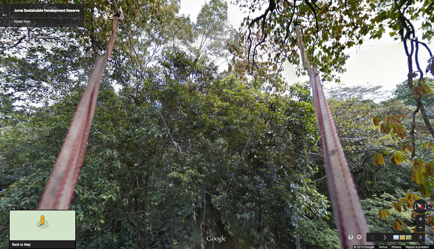
KML a few weeks after Earth’s release in 2005. For my master’s degree, I used Google Earth to build a virtual representation of a high-tech biological research reserve. Vint Cerf saw my work, which eventually led to a job on the Google Earth Outreach team, turning my passion for telling stories with maps into a career.

2005 was the beginning of Google Earth’s evolution, as well. In August of that year, Hurricane Katrina showed us how useful mapping tools like Earth could be for crisis response efforts. Rescue workers compared before and after Satellite imagery in Google Earth to better locate where people were stranded. And in the years after, with more than 2 billion downloads by people in nearly every country in the world, Earth has enabled people to discover new coral reefs, journey to the Moon and into deep space, find long-lost parents, clear landmines and much more.
Google Earth images of Gulfport, Mississippi's shoreline before and after Hurricane Katrina

The ability to empower groups as diverse as school children and NASA scientists to learn more about the world is what I love about Google Earth. It has the potential to make the planet a far more connected place, if you take the time to explore, discover and share what you learn. So to celebrate how far Google Earth has come and our leap into the next 10 years, we’ve created a few new ways to help you better see places from around (and above) the world.
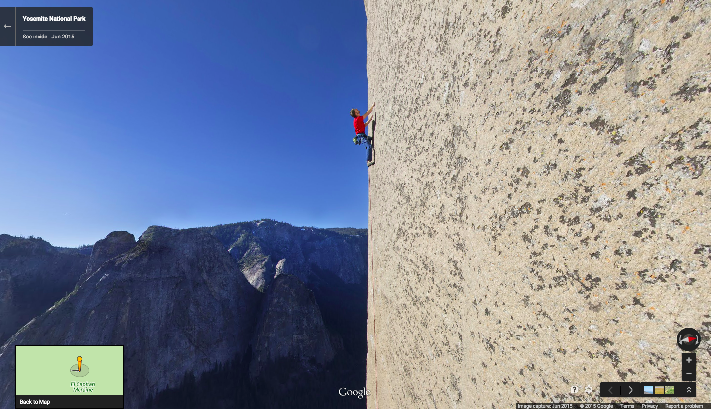
Voyager
The world is a big place, and it can be hard to know where to begin your virtual journey. Now you can jump straight to the newest and most interesting imagery around the globe with a new layer, Voyager, available in desktop versions of Google Earth.
Different imagery types in Voyager are shown by color

In this first edition of Voyager, you’ll find five sections to explore:
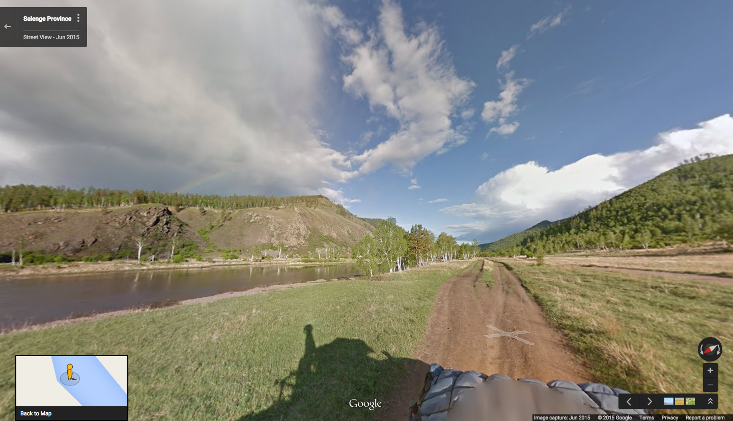
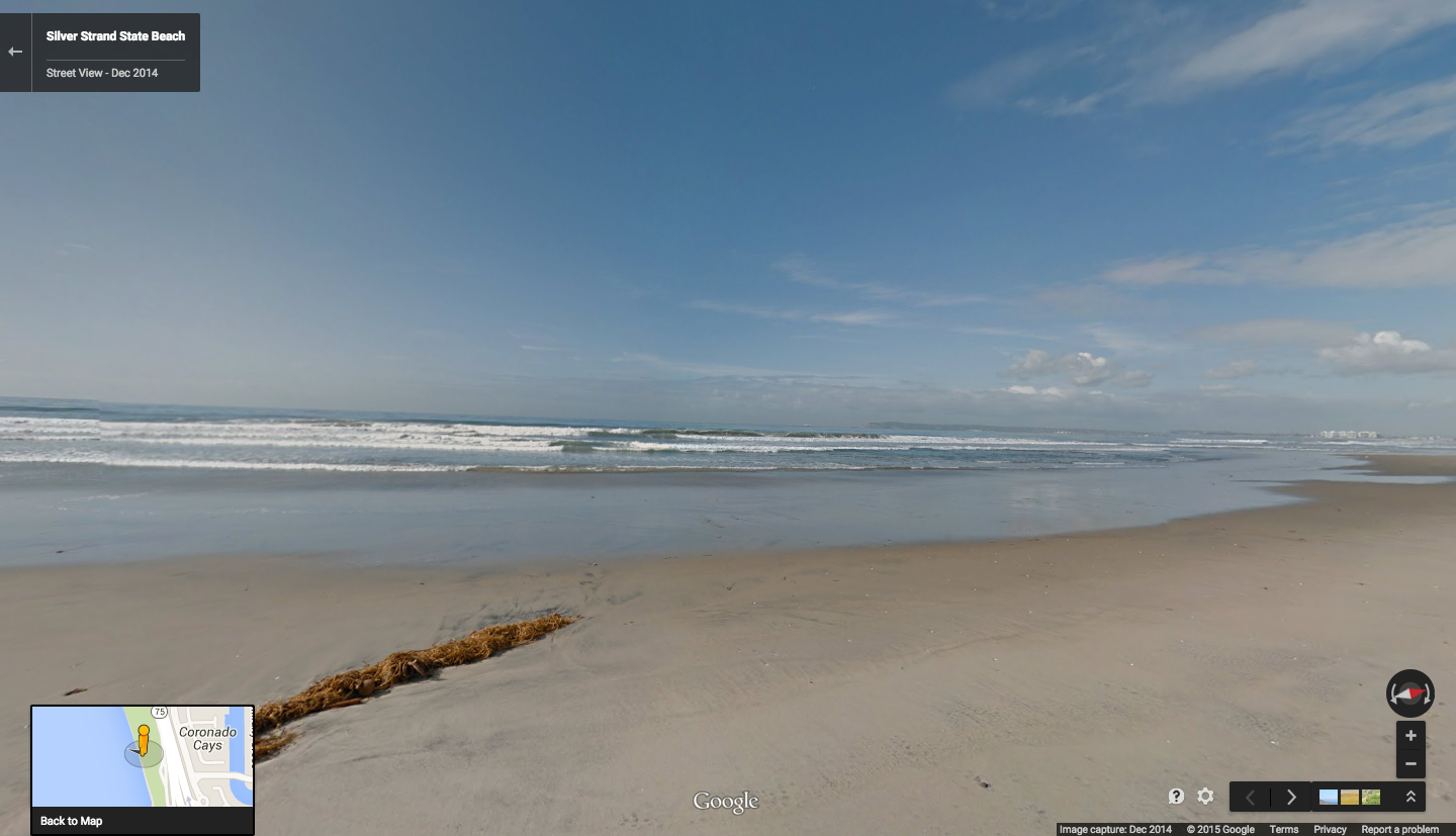
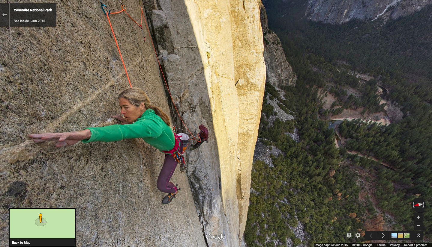
  • Street View: highlights from Street View, including the Taj Mahal and the Grand Canyon
  • Earth View: striking landscapes around the globe as seen from space (more below)
  • 3D cities: a showcase of cities and towns available in photorealistic 3D (don’t forget to tilt!)
  • Satellite imagery updates: a map of our most recently published satellite imagery
  • Highlight tour: with thousands of Voyager locations to choose from, take a quick tour of a few to whet your appetite
The Kemgon Gompa—available in the Street View layer—is a Buddhist monastery in Lukla, Nepal

Earth View
Looking at our planet from above is not only a reminder of how interdependent our human and natural ecosystems are—it also lays bare the Earth’s staggering and often surreal beauty.
The Hammar Marshes of Iran are an uncharacteristic yet beautiful wetland feature in the otherwise arid climate

Earth View is library of some of the most striking and enigmatic landscapes available in Google Earth. It started as a 20 percent project last year by a few Googlers who enjoyed scouring satellite imagery for these gems. These images soon made their way onto Android phones, Chromecast and Chromebooks as a distinctive kind of wallpaper.
Islands surrounding Cuba seen in the Earth View Chrome Extension

For Earth's 10th birthday, we're expanding the Earth View collection to 1,500 landscapes from every continent and ocean and making it accessible to even more people. The new imagery is available with an updated version of our Chrome extension and a new web gallery. Download high-resolution wallpapers for your mobile and desktop devices, or better yet, print them up for your walls!
The coastline near Ningaloo, Australia in the new Earth View web gallery

Thank you for the last 10 years exploring your world with Google Earth. We hope Voyager and Earth View will unlock a new perspective on our planet. We look forward to seeing what the next decade brings!

Source: Google LatLong


Vertical Street View of the world’s most iconic rock wall: Yosemite’s El Capitan

Today we’re launching our first-ever vertical Street View collection, giving you the opportunity to climb 3,000 feet up the world’s most famous rock wall: Yosemite’s El Capitan. To bring you this new imagery, we partnered with legendary climbers Lynn Hill, Alex Honnold and Tommy Caldwell. Read more about the project from Tommy Caldwell, who completed the world’s hardest climb in Yosemite in January of 2015. -Ed.

“That is awesome. I definitely have to be a part of that.”

Maybe it was the sheer exhaustion from being in the middle of a 19-day climb of the Dawn Wall, but when the guys at Google Maps and Yosemite National Park asked if I wanted to help them with their first-ever vertical Street View collection of El Capitan in Yosemite, I didn’t hesitate. Yosemite has been such an important part of my life that telling the story of El Capitan through Street View was right up my alley—especially when it meant working with the Google engineers to figure out some absurd challenges.

Climbing is all about flirting with the impossible and pushing the boundaries of what you think you can be done. Capturing Street View imagery 3,000 feet up El Capitan proved to be an extension of that, especially when you take a camera meant for the inside of a restaurant and mount it thousands of feet up the world’s most iconic rock wall.
Brett Lowell and Corey Rich capturing Street View of Alex Honnold on the King Swing

Doing anything thousands of feet high on a sheer granite face is complicated, but everyone up there had spent years of their lives on a rope and knew exactly what they were doing. After some testing, we used our tried-and-true climbing gear like cams and ropes to make sure the camera wouldn’t fall to the ground in the middle of our Street View collection.

Once we figured out how to keep the camera on El Cap, we created two sets of vertical Street View. First, we collected Street View of legendary Yosemite climbers—and my good friends—Lynn Hill and Alex Honnold in iconic spots up the sheer vertical face.

Lynn Hill’s ascent of El Capitan changed the paradigm of climbing, and she had an extraordinary effect on my climbing career. I’ll never forget when she became the first person, man or woman, to free-climb (using only her hands and feet) “The Nose” back in 1993. Now, you can see her navigate these epic moves— like climbing sideways on tiny holds of the Jardine Traverse, inventing a “Houdini” maneuver on the Changing Corners and traversing under the Great Roof.

Any story of El Capitan had to include my good friend Alex Honnold. He holds the speed record for climbing the Nose at 2 hours and 23 minutes - most people take 3-5 days. His unwavering confidence in himself is contagious; when I’m with him, I feel like the mountain has shrunk to half its size. As you make your way around Yosemite in Street View, you’ll see Alex doing what he does best: chimneying up the “Texas Flake,” racing up the bolt ladder, or getting dinner ready in the solar-powered van he calls home.

You’ll also see a glimpse of yours truly on the Dawn Wall. I spent some of my rest days during my January climb of the Dawn Wall testing out the Street View technology the Google team had sent me that month. El Cap is an intimidating environment for experimentation, but years of setting ropes proved pretty helpful in figuring out how to get the equipment rigged and ready to collect Street View.

Then, we really put Alex to work to collect the second set of Street View: the entire vertical route of “The Nose” on El Capitan. One of the few people that could do this efficiently and quickly, Alex took the camera and pretty much ran 3,000 feet up with photographer partner Brett Lowell. Now, anyone can get the beta (climbing speak for insider advice) before they climb the entire route.

Lynn, Alex and I also helped create a new Yosemite Treks page, where you can take a tour up El Cap and learn more about climbing, from what a “hand jam” is to why we wear such tiny shoes. And as a father, I’m excited kids will learn more about Yosemite when Google brings students to the park through NatureBridge later this year as a part of this project. Plus, its pretty awesome that students who can’t make it to Yosemite yet will be go on a virtual reality field trip to the Park with Google Expeditions.

Yosemite’s driven so much of my life that I’m excited to be able to share it with the world through my eyes. These 360-degree panoramic images are the closest thing I’ve ever witnessed to actually being thousands of feet up a vertical rock face—better than any video or photo. But my hope is that this new imagery will inspire you to get out there and see Yosemite for yourself… whether you travel up a rock wall or just down the trail.

Source: Google LatLong