Author Archives: Lat Long

Navigate and search the real world … online or off

Roughly 60 percent of the world is without Internet today, and even where online access is available, it can still be spotty. That means that quick and easy access to information is still not possible for a majority of the population. This is a huge problem, especially as people attempt to navigate and explore the world around them, so Google Maps is taking steps to help people across the globe find directions and get where they’re going, even when they don’t have an Internet connection.

Now you can download an area of the world to your phone, and the next time you find there’s no connectivity—whether it’s a country road or an underground parking garage—Google Maps will continue to work seamlessly. Whereas before you could simply view an area of the map offline, now you can get turn-by-turn driving directions, search for specific destinations, and find useful information about places, like hours of operation, contact information or ratings.
You can download an area by searching for a city, county or country, for instance, and tapping "Download" on the resulting place sheet, or by going to "Offline Areas" in the Google Maps menu and tapping on the “+” button. Once downloaded, Google Maps will move into offline mode automatically when it recognizes you’re in a location with spotty service or no connectivity at all. When a connection is found, it will switch back online so you can easily access the full version of Maps, including live traffic conditions for your current route. By default, we’ll only download areas to your device when you are on a Wi-Fi connection to prevent large data fees.

We first previewed these new capabilities during Google I/O in May, and today we’re gradually rolling out the first set of these improvements with the latest version of Google Maps on Android (coming soon to iOS). Over time, we’ll be introducing even more offline features to help you find your way—even when you can’t find a connection.

Posted by Amanda Bishop, Product Manager, Google Maps

Source: Google LatLong


‘Tis the season: Google brings holiday hours to Maps and Search

Ever trekked all the way to your favorite restaurant just to realize it’s closed for the holidays? Well, we have. Now Google Maps and Google Search will help you avoid that common holiday mistake. We've added holiday hours to Maps and Search, so when you search for a business and a major holiday is within the next seven days, you’ll see whether the business has a special holiday schedule. Not only will you avoid showing up to find the doors locked, but you’ll save time by not having to call the business or check the website for hours.

If you want to find out what’s open as the holiday draws close, just search for a place and if the holiday hours are listed, you’ll see them.


If you search for a business and the holiday hours aren’t listed, you’ll see a warning message alerting you that the actual hours may be different because of the holiday.


And if you want to find a nearby open coffee shop, restaurant or bakery, just use the “Open Now” filter and we’ll show you places that are open on these days.

We’ve got you covered pretty much everywhere you search and anywhere you go. Because holiday hours and warnings are available globally, if you happen to be celebrating Boxing Day in the UK or New Year’s Eve in Sweden, you’ll see info specific to the country you’re in. How’s that for traveling like a local?

Posted by Jonathan Sidi, Product Manager, Google Maps & Local Search

Source: Google LatLong


Take a walk on the wild side with Street View in New Zealand

From the lush waterfalls of the Milford Track to the alpine peaks of the Kepler Track, you can now explore some of the most stunning parts of New Zealand’s wilderness with the launch of seven of the world-renowned ‘Great Walks’ on Google Street View. Known for the beauty of their remote multi-day treks, the Great Walks are a favourite destination for hikers around the world, and are now available in 360-degree panoramic imagery right from your smartphone or computer, with Google Maps.

Collected with help from our friends at New Zealand’s Department of Conservation using the Google Trekker, this new imagery shows off New Zealand’s natural beauty while inspiring hikers around the world to plan a trip.
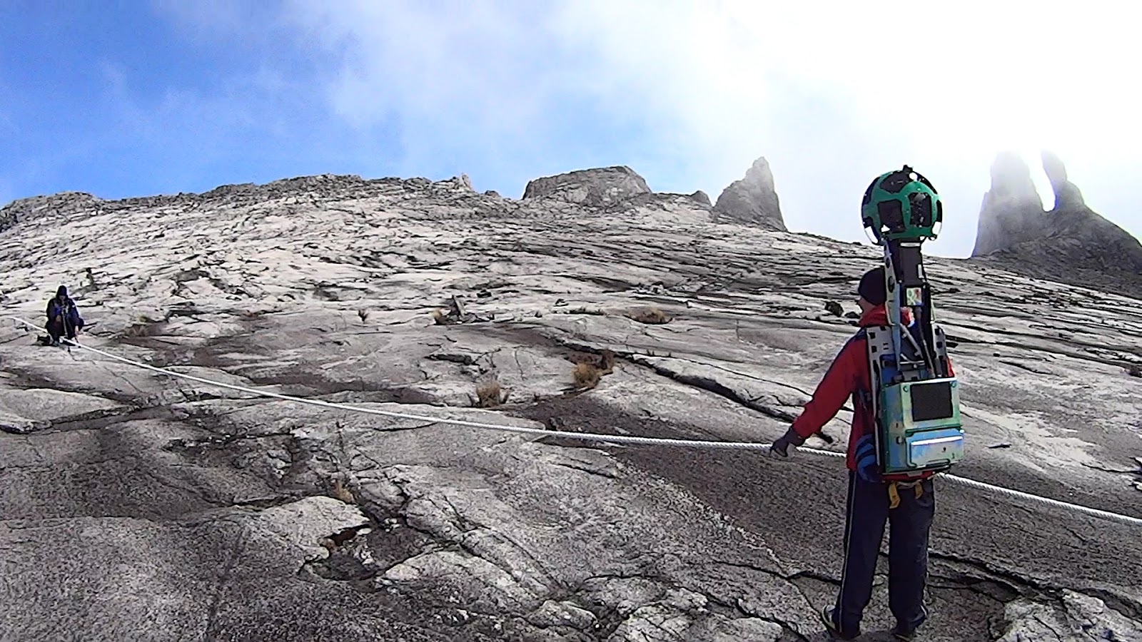
Our intrepid trekker collector Matt checks the lenses of the Google Trekker at Lake Te Anau on the Kepler Track

Take in the view of Lake Waikaremoana from Panekire Bluff, look down at the Hollyford Valley from Conical Hill, or check out the tallest waterfall in New Zealand — all without breaking a sweat.
Panekire Bluff looks over Lake Waikaremoana which translates to ‘sea of rippling waters’ in te reo.

Conical Hill on the Routeburn Track is quite a hike at 1,515 meters. (It’s easier to get to from your phone).

Dropping 580 meters from Lake Quill, the Sutherland Falls on the Milford Track are bigger than Eiffel Tower.

Emerging from the Enchanted Forest on the Heaphy Track you might not see hobbits, but if you’re very lucky you can sometimes spot baby seals. They’re even more common at Separation Point which is a fur seal breeding ground.

Wander through an Enchanted Forest on the Heaphy Track. (Eat your heart out, Peter Jackson).

Say hi to baby seals on the Heaphy Track

Even without seals, Separation Point knows how to put on a good show.

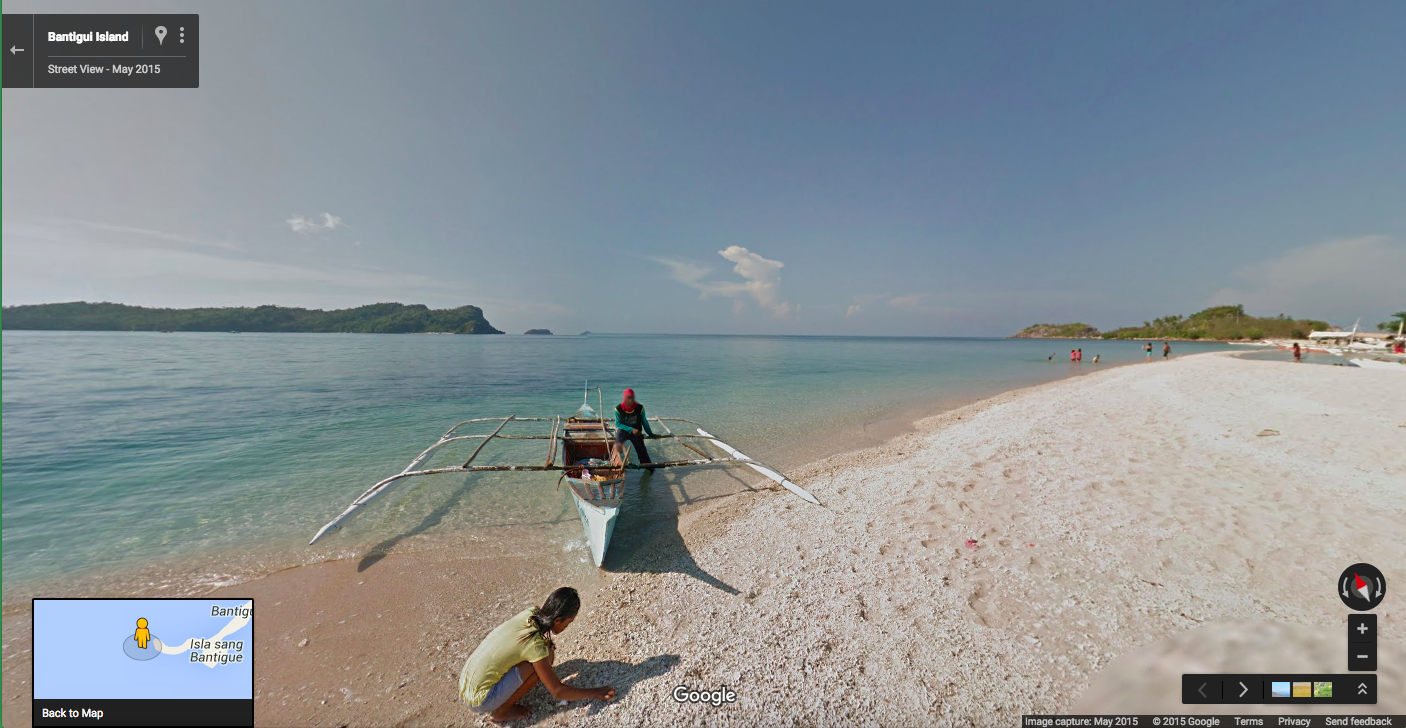
If you’re enjoying the coast, why not head south to the Golden Beaches on Stewart Island? Once you’ve explored that, you can head north again to the Abel Tasman Track and cross The Falls River suspension bridge or the Swing Bridge over the Kohaihai River.

An impressive 47-meter long suspension bridge takes you over Falls River

It’s just a hop, step and a swing bridge over the Kohaihai River on the Abel Tasman Track

New Zealand’s Great Walks have long been on the bucket list of keen outdoors people from all around the world. We hope by bringing the Milford, Kepler, Abel Tasman, Lake Waikaremoana, Heaphy, Routeburn and Rakiura / Stewart Island tracks to Street View, these images will not only help people who are about to trek them prepare, but give anyone who wants to virtually roam the beauty of the Great Walks an opportunity to do so. And you can view more Street View collections from around New Zealand here.


Source: Google LatLong


Catch your breath and take in the best views of Sabah on Street View

Malaysia’s most eastern state of Sabah sits just south of a typhoon belt. Seafarers used to call it the "Land Below The Wind," as it provided refuge from the raging storms of the north. From today you too can catch your breath, in awe, at the beauty of Sabah with the launch of new Street View imagery from 23 islands and nature reserves from the area.

Sabah is home to the highest mountain in Malaysia, so you can now scale the Mount Kinabalu peak from the couch. A UNESCO world heritage site, Mount Kinabalu sits in Kinabalu Park which teems with unique flora and fauna — including the gigantic Rafflesia plant and orangutans.


Scaling the Mount Kinabalu peak is even tougher with an 18kg Trekker on your back

Or take a quiet cruise down the Kinabatangan River. The longest river in Sabah, Kinabatangan winds through a forest-covered floodplain which is home to Proboscis monkeys, Sumatran rhinos and Asian elephants. If you like wildlife, try and catch a glimpse of the orangutans at Sepilok Orang Utan Reserve:


Two orangutans having a tête-à-tête at the Sepilok Orang Utan Reserve

Once you’ve explored the jungle, why not go island hopping and visit Mabul or Mataking? The clear turquoise waters of the Celebes Sea are teeming with sea life and gentle sloping reefs which makes them diving hotspots.


Take a virtual dip at Mabul Island


The tiny Mataking Island can be walked around in an hour. We bet you could go even faster with Street View.

Sabah is home to incredibly unique natural diversity. We hope you enjoy scaling the peaks of Kinabalu, going deep into the jungle, or lazing around on the many island beaches with this new Street View collection.

Posted by Nhazlisham Hamdan, Street View Operations Lead Malaysia, Indonesia & Thailand


Source: Google LatLong


Boo! Hide n’ Street…View

Are you seeking a Halloween fright without hopping on a flight? Look no further than our creepy crop of spooky sites in Street View. Just in time for All Hallows’ Eve, you can go on a virtual journey to see the world’s most petrifying places—from safely behind your screen. 

Few places have more history (or horrors!) than Bran Castle in Romania. On the border of Transylvania, “Dracula’s Castle” is home to Bram Stoker’s infamous bloodsucker. Walking through the castle, with sun streaming in the windows, you may feel a false sense of confidence...but beware what awaits you after night falls.


For another shiver up your spine, visit the Isla de las Muñecas Xochimilco in Mexico, where a young girl died mysteriously years ago. For the last 50 years, the trees have been adorned with decaying dolls, which people have left behind in memory of the tragedy.


Next on your tour of terror: Bodie State Historic Park in northern California. An abandoned town from the gold rush, you can tour one of the gold mines from the early 1900s and walk the deserted streets. Preserved in a state of arrested decay, the eerie silence feels ominous to its visitors.


If you’re feeling adventurous, why not stop by Gunkanjima or “Battleship Island” in Japan? The set for the villain’s lair in James Bond’s Skyfall, the decaying industrial wasteland used to be a booming coal mining town until the 1970s, when the island was abandoned. Now you take your life in your hands as you walk beneath the deteriorating concrete structures as the wind blows in from the ocean.


If haunted houses are more your speed, the zombie apocalypse at the 13th Gate Haunted House in Baton Rouge, Louisiana may be for you. Or stop for a drink at The Stanley Hotel, the site of Stanley Kubrick’s classic film The Shining, where you can ponder the meaning of “redrum.”


One thing’s for sure: This tour of spooky places on Google Maps is sure to get your cauldron bubbling. Happy Halloween!

Posted by Susan Cadrecha, Google Maps Zombie Bride

Source: Google LatLong


Google Maps making stressful times easier

You’re running late for an interview, but that little gas light on your dash has been on... for well... too long. You reroute Google Maps to the nearest gas station and start to fill up—and that’s when you notice the gas across the street is 25 cents cheaper. When you finally close the tank, re-type the original address into your phone and get on the road again, you’re short 15 minutes and $5.

Over the next few weeks, we’re rolling out an update to Google Maps on Android that will make your next gas stop more convenient and affordable. Now you can check out gas prices and add detours to your route, without having to exit out of navigation.
When you're driving in navigation mode and you get that call from your spouse to pick up some more milk on your drive home or if you're on a road trip and want to find a great restaurant option along your route, simply tap the magnifying glass at the top right corner of the screen. You’ll see a drop-down menu with helpful options, like gas stations, grocery stores, or restaurants. If the drop-down options aren’t what you need, you can always add a detour to your favorite coffee shop by tapping the search icon or by using voice commands.
                                                     
Whether you're low on fuel, forgot that bottle of wine for the dinner party, or just really need a coffee to get through your next appointment, Google Maps is here to help make stressful times easier.

Posted by Aditya Dhanrajani, Google Maps Product Manager

Source: Google LatLong


From sea to shining sea with Street View

Across the U.S., you can tour beautiful parks, historic sites, stunning city views and breathtaking beaches with Street View in Google Maps. Many of these sights come from our partners participating in the Trekker Loan Program, who are adding imagery from their region for the world to explore. Today, we invite you to discover five new collections across the country, from California all the way to New York.

Starting our journey in NorCal, hike through the Armstrong Redwoods State Natural Reserve with the Stewards of the Coast and Redwoods, who work to preserve some of the state’s most beautiful parks and nature refuges. On your Street View stroll, you can see the old growth redwoods—the largest forest stand in Sonoma County open to the public—as well as countless beautiful meadows and vistas.


Making our way east to Kansas City with Visit Kansas City, virtual visitors can ascend to the top of the Liberty Memorial Tower, one of the largest war memorials in the world at 217 feet tall. If heights aren’t your thing, check out the 22-acre lawns of Donald J. Hall Sculpture Park, which is home to Kansas City’s iconic installation Shuttlecocks.


Journeying to Kentucky with Sheltowee Trace, stop by Cane Creek, a vast wildlife management area within the Daniel Boone National Forest. Covering more than 6,000 acres, Cane Creek is the principal hiking, biking and horseback riding trail in the area.


Next up: the great state of Pennsylvania with Visit Bucks County. In Ringing Rocks County Park, it’s said a hammering of the rocks gives off sound like a bell’s chime. Also stop by the Sand Castle Winery, where guests are invited to sip their way through hundreds of acres of vineyards with expansive views.


Ending our Street View tour the Hudson River in New York, you can experience the scenic beauty of a daytime excursion on a NYC steamboat. Thanks to the Hudson River Foundation, in partnership with the SS Columbia Project, you can now virtually float 130 miles of the Hudson River—a glorious trip through one of the most culturally, historically and environmentally important regions in America.


Let Street View be your guide across the great US of A—whether you’re planning a weekend getaway, an afternoon hike or a cross-country road-trip. To see more Street View sites, explore our U.S. Highlights Gallery.

Posted by Deanna Yick, Google Maps Street View Program Manager

Source: Google LatLong


Never be late for a very important date

8:30am: You just hopped in your car for a quick dash across town to make that 9am appointment.
9:15am: You are still sitting in bumper to bumper traffic, watching as pedestrians hurry past and cursing the decision to pick up the car keys.
9:25am: Finally arriving at your appointment, you reflect that maybe hopping on a bike was a smarter option.

Anyone who has been stuck in city traffic knows that the fastest way from A to B is not always by car, and that public transit, biking or even walking can be a better choice. Well, now you can stop playing transportation roulette and start navigating with confidence. Starting today on iOS (already available on Android), Google Maps will show you travel times for all transportation types on just one screen so you can easily compare your options and get where you’re going as quickly as possible.

With live traffic and public transit information reflecting delays and cancellations, Google Maps will quickly compare transport options in real-time to give you the right information, right when you need it. Once you've selected your mode of transportation, Google Maps goes the extra mile to provide you with alternate routes directly on the map.


All you need to know is where you want to go. Google Maps for mobile will provide you with the most detailed and useful information so you can make the best decision—whether that means picking up your keys, bike helmet or bus pass.


Post By: Florian Goerisch, Product Manager, Google Maps

Source: Google LatLong


Islands of the Philippines now on Street View

Starting today, you can virtually explore downtown Manila, wander the historic streets of Vigan, and see where boxing legend Manny Pacquiao grew up and trained, with the launch of new Street View imagery in the Philippines. Thanks to the support of the Philippines Department of Tourism, 37 cities and 35 historic locations—including eight UNESCO world heritage sites—are now available for the world to explore in 360-degree panoramic views with Street View.


From the beautiful baroque churches of Miag-ao and Paoay, to Bantigui Island’s stunning beaches, or Pulag peaks, this new imagery showcases some of the archipelago’s most important historical sites and natural beauty. This imagery expands on existing Street View collections in the Philippines, including underwater views from Apo Island and images of Manila’s historic walled city of Intramuros.


In addition to seeing the Philippines’ famous beaches and churches, you can take an insider's tour of Manny Pacquiao’s hometown of General Santos City. Glimpse the Pacman Wildcard Gym that Manny owns, named after the gym in Los Angeles where he used to train, or wander around his farm.


For those looking for something truly unique, head to Baguio for some inspiration and see the Cemetery of Negativism at Camp John Hay, a place where people can bury bad thoughts and vibes in humor, which was established in the early 80’s, or stop by Dinosaur Island in Benguet to experience the dinosaur era with life-size animatronic sauruses.  


Mapping an archipelago with 7,000+ islands is no small undertaking. Since kicking off imagery collection last January, we’ve driven well over 10,000 miles across the country.  


We’ll continue to bring Street View to new places across the Philippines, so people around the world can see even more of the beauty and diversity of the country for themselves. Pinoys who would like to share their corner of the world with the world can also use our new Street View app to create and share your own panoramic images.

Posted by Ken Lingan, Country Manager, Google Philippines

Source: Google LatLong


Walk alongside the elephants of the Samburu National Reserve in Street View

Today for the first time, we’re releasing Street View imagery of Kenya—including the Samburu National Reserve, Lewa Wildlife Conservancy and the David Sheldrick Wildlife Trust—in partnership with Save the Elephants and with the support of the Samburu County Government. We'll let Save the Elephants' David Dabellen take it from here. -Ed.


It’s a wild life at the Save the Elephants research camp in Samburu, in the heart of northern Kenya’s wilderness. For the last 15 years at Save the Elephants, I’ve spent my days among the elephants, working alongside my fellow Samburu people to study and protect them. Research shows that 100,000 elephants across Africa were killed for their ivory between 2010-2012, but thanks to our work in the Samburu National Reserve their numbers are now slowly increasing. Today, a visit to Samburu is a chance not only to see these magnificent creatures in their natural habitat, but also discover a uniquely beautiful landscape where people’s live are interwoven with the landscape’s wildlife. It’s my honour to invite you on a journey to my homeland with Street View in Google Maps.  


Every time I drive into the Reserve, I can see the trust on the elephants’ faces and feel a warm welcome. When I’m out and about, I never know which of my fellow citizens I’ll bump into next. It could be some of the 600+ elephants I can recognize—like the Hardwood family—frolicking together, a group of Samburu warriors walking along the Ewaso Nyiro River, a pride of lions enjoying a bit of shade, or a leopard crossing the path. While you make your journey through Street View, you may be surprised what awaits.


South of Samburu, up into the hills of Kenya, the Lewa Wildlife Conservancy awaits exploration. In this greener landscape, you can cross the open savannah, where animals like zebras and rhinoceroses live protected from poachers and hunters. Every day, the Lewa radio command center plots the movements of elephants (and other GPS-collared wildlife) onto Google Earth to help rangers determine where elephants are and when they might be in danger. If an elephant’s GPS collar sends an alert to indicate the elephant has stopped moving, a team of rangers and tracking dogs will investigate. Save the Elephants was one of the first organizations to use this technology, having collared 266 elephants across Africa since 1998.


Visiting the David Sheldrick Wildlife Trust, you can see the devastating effect of poaching and other causes of elephant deaths in Kenya. Founded in 1977, the Trust provides lifesaving assistance to wild animals in need, including orphaned elephants and rhinos. At their Elephant Orphanage in Nairobi, elephant caretakers stand in for an elephant’s lost family, providing 24/7 care and specially formulated milk. As the orphans grow, they are gradually reintegrated back into the wild, where they are protected by the charity’s Anti-Poaching and Aerial Surveillance Teams. To date, the David Sheldrick Wildlife Trust has hand-raised more than 180 orphaned infant elephants, including little Sokotei, who I helped to rescue in Samburu after his mother died of natural causes when he was six months old. He’s just one elephant amid thousands that have been lost across the continent, but when you're up against a challenge of this scale, every elephant counts.


I hope this glimpse into life in Samburu has inspired you to learn more about elephants’ plight and how you can help. Samburu is my home and is full of life. To ensure it remains that way, please consider supporting the research of Save the Elephants, making a donation to the anti-poaching efforts of Lewa Wildlife Conservancy, or fostering an orphaned elephant at the David Sheldrick Wildlife Trust. After exploring in Street View, come and see us here in Kenya in person—we’d love to have you!


Posted by David Daballen, Head of Field Operations at Save the Elephants

Source: Google LatLong