Author Archives: Lat Long

Maps Minutes Hack #3: save time with up-to-date holiday business hours

Part of our series on how to save time this holiday season with Google Maps.

Whether you’re looking for restaurants open on Christmas Eve, trying to avoid crowds at the gym for a year-end workout, or wondering if you’ll make it before the store closes to grab that last minute gift–Google Maps has you covered.

This year we launched a few updates to the Google Maps app on both Android and iOS that give you up-to-date information about millions of businesses, saving you time both on your holiday to-do list and in your everyday tasks.


Here are some of our favorites:

  • Holiday hours. Not only does Google Maps provide up-to-date open hours for businesses, but it also now shows special holiday hours. When you search for a place and a major holiday is within the next seven days, Google Maps tells you whether it has a special schedule.


  • Popular times. Avoid long lines at the store by checking out how busy it is before you leave. For many businesses–from restaurants to shops to museums–you can scroll down on the business information page to find the days a place is most popular, and the busiest times on those days.


  • “Closing soon” alerts. Google Maps can help save you a wasted trip. When you search for and navigate to a place, Google Maps will show an alert if your destination is closed, or will be by the time you arrive.


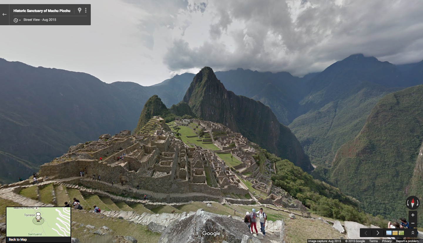
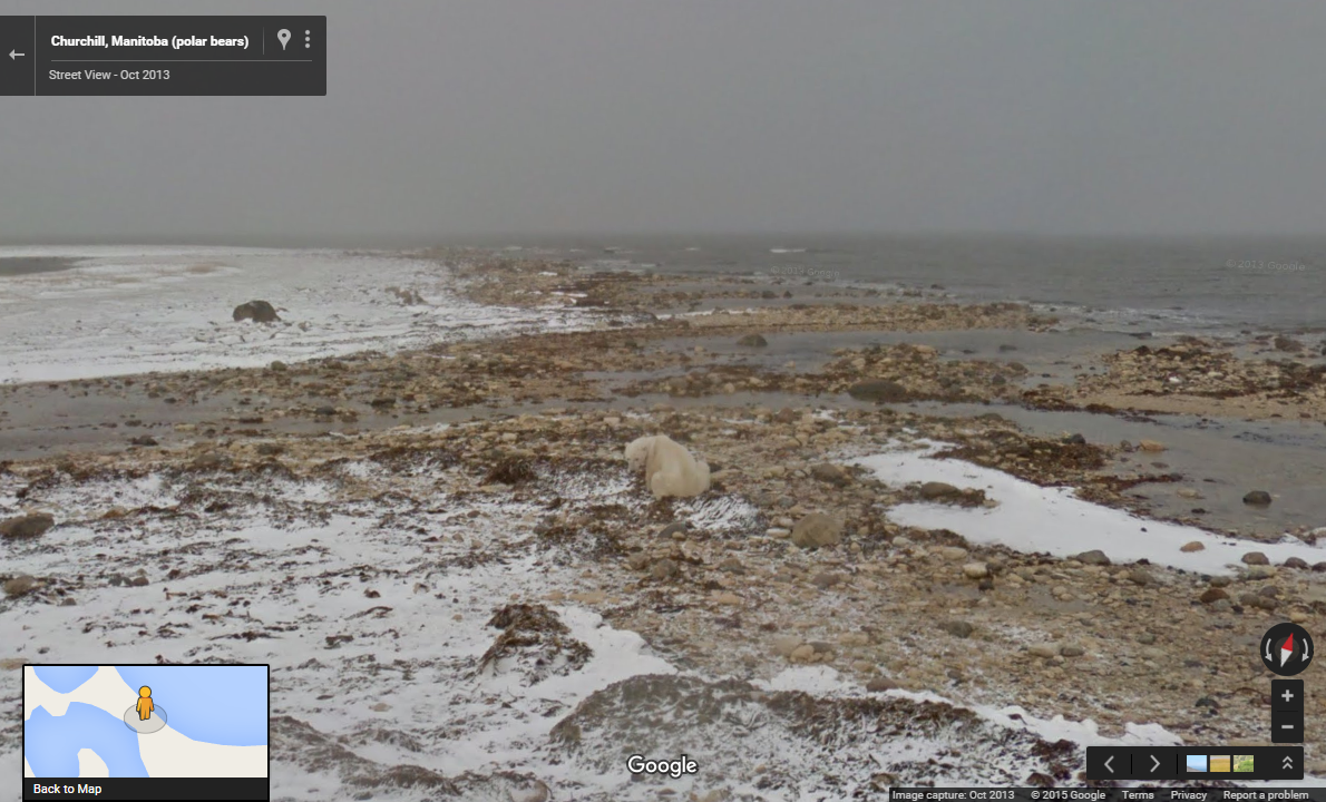
Make the most of your time with Maps Minutes hacks. Next up: finding your way through the crowds with Street View by just dropping a pin.

Posted by Olga Suvorova, Product Marketing Manager, Google Maps

Source: Google LatLong


Take a snowmobile with Google Maps to the sea ice habitats of the Arctic Eider duck

Editor’s note: Today’s post is guest authored by Joel Heath, Executive Director of the Arctic Eider Society


The Arctic Eider isn’t just any duck. The feather of this sea-ice dweller is the warmest in the world—a marvel of nature that allows the Eider duck to spend its winters in one of the most remote and frozen habitats on the planet. And now—thanks to Google Maps, the Inuit community of Sanikiluaq and our small environmental charity the Arctic Eider Society—people from around the world can explore this extraordinary and fragile part of Canadian geography that the Arctic Eider calls home.


photosphere_arcticeider_v1_r1.png
The Trekker collects Street View imagery of a Polynya


Last winter, in -50 degree celsius winds, the Google Maps team traveled to the Belcher Islands in Hudson’s Bay and helped the Arctic Eider Society mount the Trekker on a snowmobile to collect stunning Street View imagery from nearby “polynyas”—bodies of open water that form in the sea ice. The polynyas act as an oasis of sorts, providing a habitat for wildlife like eiders who dive under the ice to feed on shellfish and sea urchins.


You’ll see from the images that it’s not just ducks up here in the cold. The Inuit of the Belcher Islands have also lived here for centuries. This community, a hamlet of just 850 people, has an important relationship with the eider duck—aside from providing them a traditional source of warmth and food, the bird’s feathers are ingrained in their history, used to create traditional parkas unique to the Inuit of this region.


Screen Shot 2015-12-07 at 10.29.23 AM.png


But this is an ecosystem under threat.  The region has suffered from a lack of environmental stewardship, and the sensitive sea-ice—critical to the eiders and Inuit– is suffering as a result of hydroelectric development around Hudson Bay.  Large die-off events of eiders and beluga whales have been occurring as changing ice conditions trap the animals until they starve or run out of air.


Our partnership with Google Maps is helping to support research programs designed to preserve these winter sea ice habitats. We’re combining imagery captured by the Trekker with data and knowledge from the local Inuit and Cree communities and mapping by the Arctic Eider Society to create a platform where we can all track and report on the local wildlife, together. This mix of new and old, combining indigenous knowledge with Google Street View and the Arctic Eider Society’s mapping, may be just what’s needed to address the impacts hydroelectricity heating is having on the bird that produces winter’s warmest feather.


Take a moment to visit Google Maps to better understand this amazing bird and the community who relies on it. Take an icy walk down the streets of Sanikiluaq, climb onto a snowmobile and explore the amazing sea-ice the Arctic Eider calls home. Eider down parka not required.


Posted by Joel Heath, Arctic Eider Society

To learn more about the unique relationship between the community of Sanikiluaq and the Arctic Eider, be sure to watch the critically acclaimed award winning film People of a Feather that started it all.

Source: Google LatLong


Maps Minutes Hack #2: Save time navigating inside, not just outside

Part of our series on how to save time this holiday season with Google Maps.

The holiday season often means rushing around—both out on the roads and inside malls, airports and stores. Did you know that Google Maps can help you navigate both? Many malls, airports, museums and stadiums have indoor maps and floorplans in Google Maps so you can quickly find your way around and get to where you want to go.

Whether you want to locate that toy store in the mall, find the men's shoe section in a department store, or track down a coffee shop on the way to your gate at the airport, indoor maps can help save you precious minutes.

Just zoom in to see the indoor floor plan of a building and search for places inside. Use the level switcher in the bottom left-hand corner to move from floor to floor.


During the hectic holiday season, indoor Google Maps can help you get the lay of the land and save time and hassle inside airports, malls, museums and sports venues. Check out locations with indoor floor plans, available on Android and iOS.

Minutes count. Save more with Google Maps hacks. Next up: running errands in no time with up-to-date information about businesses.

Posted by Dai Pham, Head of Geo and Google Maps Marketing

Source: Google LatLong


Walk the ruins of Peru’s most historic site: Machu Picchu

Take a train ride through the Andes, above the sacred valley and atop the mist of the mountains, to the most historic site of the Inca Empire. Machu Picchu, a UNESCO World Heritage Site and one of the New 7 Wonders of the World, is one of the most famous, mythical and spiritual sites in the world. Now for the first time, in partnership with the Peruvian Ministry of Culture, people across the globe can go on a journey to Machu Picchu directly in Google Maps, uncovering its temples, terraces and plazas that have remained intact since the 15th century. People can also explore rare Inca artifacts and expert insights on the Google Cultural Institute.


Gazing at the Historic Sanctuary of Machu Picchu more than 2,400 meters above sea level, the site below is a lasting tribute to the power of the Inca Empire. It’s still unclear how the structure composed of behemoth stones was so precisely built without the use of mortar or modern day machinery, but its walls, terraces and stairways weave effortlessly into the mountainside and natural landscape.

Screen Shot 2015-11-23 at 3.23.38 PM.png

Standing in the Templo Principal, you can imagine how many people have stood at this central gathering place before you. Located at the highest position of the city, this site holds great spiritual meaning to the people of the Citadel. And touring the vast Plaza Principal allows you to virtually walk one of the most sacred ceremonial grounds on the site, which once hosted social and religious celebrations for the Inca.

Screen Shot 2015-11-23 at 3.31.47 PM.png

Within the long and narrow compounds, called kanchas, you can also explore the Observatorio Astronómico (Intiwatana), Templo del Sol, and Templo de las Tres Ventanassites dedicated to Inti, the Inca Sun godor marvel at the architectural complexity of structures like the Grupo de las Tres Puertas, whose doors lead to the main square.

Screen Shot 2015-11-23 at 11.00.30 PM.png

After virtually touring these sacred and ceremonial spaces, discover more Wonders of Machu Picchu on the Google Cultural Institute. You can explore more than 130 Inca artifacts online thanks to the Museo Macchupicchu at Casa Concha. In three new online exhibits, the museum's curators share their expert insights on the Inca's daily life and rituals - which are still a subject of great mystery and fascination over 500 years later.

Highlights include a perfectly preserved pair of plates decorated with butterflies, and an ingenious device of strings and cords used for record keeping and accounting. We invite you to see these rare objects in the context of the museum by taking a virtual tour.


Whether you visit Machu Picchu via a train or hike up the Inca Trail, we’d be honored to be your virtual guide through this sacred space. And while in the area, enjoy exploring still more archaeological treasures from this ancient civilization at the Museo Machupicchu at Casa Concha, which holds the largest collection of Inca artifacts in the world.

Machu Picchu, a true wonder of the world, is now just a click away.

Posted by Daniel Filip, Google Maps Tech Lead

Source: Google LatLong


The North Pole is Back in Session

Santa doesn't spread cheer across the globe all by himself. As soon as the first frost is on the mistletoe, hundreds of helpful elves work day and night to make sure jolly old St. Nick is ready for flight. Santa’s Village is a hub of activity as the elves code algorithms to tune Santa’s sleigh, translate “Happy Holidays” into Elvish and Danish, and practice their cartography with Dancer, Prancer, Donner and Vixen... all to get Santa ready for his trip around the world on December 24.

And you can join in. Visit the brand-new Santa’s Village every day to prep alongside the elves, test weather conditions with Rudolph, skydive with Santa, learn about holiday traditions like kallikántzari—little creatures from Greece that eat Christmas cookies—and much more. A new experience will appear each morning leading up to December 24. Here’s a peek at what you’ll unwrap in Santa’s Village:


Join the elves on all screens as they get ready for Santa’s big night—with Chromecast, Wear, App for Android, and more


Brush up on your computer skills with new coding games throughout the month


Get into the spirit of giving - learn about charitable organizations and discover how SolarAid is working to make the season brighter with renewable energy

Take a study break to jam out with friends to elf-made holiday tunes
For those on the ho-ho-go, get the Santa Tracker App for Android to check out new games on the phone or through Cardboard

Now before Santa flies like the dawn of a thistle, pay his village a visit—and help him and his elves get ready for the day Santa hits the clouds.


Posted by Sandy Russell, Santa Launch Strategist

Source: Google LatLong


Holiday Maps Minutes Hack #1: Save time beating bumper-to-bumper traffic

This post is the first in a series about how you can use Google Maps to save time this holiday season.

Your time is finite. But what if you could save all the minutes you waste in traffic, standing in lines, or shopping and spend them on what you love?

In December when things sometimes get a tad bit crazier, make the most of the time you do have. In the next few weeks we’ll share simple Google Maps hacks you can use to save time during the holidays.

We’re starting with…traffic. Why? Because no one likes traffic. Whether you’re driving to your once-a-year family gathering or trying to get to the mall in time for last-minute shopping, beating bumper-to-bumper traffic just might be one of the best holiday gifts you receive this year.


Google Maps gives you the best route, based on real-time traffic and historic traffic information. All you need to do is hit the navigation button and Google Maps takes care of the rest. You’ll even get an explanation for why it's the fastest route and updates when your ETA changes.

If you find yourself in a jam caused by an accident or construction, Google Maps lets you know how long you'll be at a standstill and automatically re-routes you if there’s a faster path.

Every minute counts, so hit the road and enjoy the ride—Google Maps has your back this holiday season.

Stay tuned for more Maps Minutes hacks. Next up: flying through airports with indoor Google Maps.

Posted by Olga Suvorova, Product Marketing Manager, Google Maps

Source: Google LatLong


Street View gives you a window into climate change

From polar bears in the Canadian Arctic, to communities in the Brazilian Amazon, to blue oak trees in Central California, the impacts of climate change is being felt by plants, animals and people across the planet. As world leaders gather for the COP21 conference in Paris this week to discuss our changing climate, we want to take this opportunity to show you how to explore its impact yourself. With Street View, you can get a window into some of our world’s changing ecosystems, and learn how nonprofit and other organizations are working to keep our planet healthy.

Polar bears are in trouble because of the melting sea ice, on which they depend to survive. That’s why Polar Bears International (PBI) borrowed the Street View Trekker to map polar bears in their fragile sea ice habitat around Churchill, Manitoba, to share the remote ecosystem with people all over the world. And to educate classrooms, PBI created a lesson plan and activity for schools to do their own exploration of this precious habitat.

PBI.png
Polar bear on the edge of Hudson Bay, waiting for the sea ice to freeze (see more here)

Ever wonder how plants are faring in a changing climate? Scientists at the Nature Conservancy-California do, too. To help them learn more, they borrowed the Trekker earlier this year to monitor the health of blue oak trees in Central California, which have declined due to stress from changing temperatures. Scientists predict that blue oaks may lose up to 41% of their population by 2100 because of climate change, so they plan to capture Street View imagery again in the future so they can keep a digital record, log their changes, and design conservation strategies to protect the life of these blue oak trees.

TNC-CA.png

Experts agree that one way to slow climate change is to protect the standing forests that we have now, as these trees remove and stock carbon dioxide from our atmosphere. The Brazilian nonprofit Amazonas Sustainable Foundation (FAS) borrowed the Trekker to show people exactly what the Amazon forest looks like on the ground and put isolated local communities on the map. They captured imagery from three different reserves in the Brazilian Amazon, including hundreds of kilometers walking through pristine forests and floating down Amazon river tributaries. The nonprofit is using the imagery to educate the world about rainforest protection and sustainable ecosystem management.

FAS.png
Pristine Amazon rainforest in Juma Sustainable Development Reserve (see more here)

Street View is great for visualizing the impacts of climate change, but we’re also using our Street View platform to measure climate data, which can be used by scientists, policymakers, businesses and citizens to drive better decisions.

For the past few years, Google Earth Outreach has worked with the Environmental Defense Fund (EDF) to map thousands of methane leaks from natural gas lines under select U.S. city streets using Street View cars equipped with methane analyzers. Recently, one of the largest U.S. utilities, PSE&G announced that they will use data and maps from our Street View mapping effort to prioritize the replacement of hundreds of miles of gas mains and thousands of service lines for their newly approved multi-million dollar pipeline replacement program.

Google Earth Outreach has also partnered with Aclima to measure many more pollutants with Street View cars, including particulate matter, black carbon, and carbon dioxide—pollutants that are harmful to both our climate and our health. Essentially, we’re turning Street View cars into environmental sensing platforms, and plan to map California communities in the San Francisco Bay Area, Central Valley, and LA regions through 2016.

We hope this post has opened your eyes to the ways the world is being impacted by climate change. If you’re interested in getting involved, consider submitting an application to the Trekker Loan Program, which allows nonprofit and other organizations to borrow the Trekker to capture 360-degree imagery of the places they care about on our changing planet.

Posted by Karin Tuxen-Bettman, Google Earth Outreach Program Manager

Source: Google LatLong


Discover Jordan’s past and present in Google Maps

Starting today you can explore more than 30 historical sites throughout Jordan in Google Street View. To tell you more, read today’s guest blog post, by Her Majesty Queen Rania Al Abdullah of Jordan. -Ed.


What a great day for Jordan and Jordanians! Thanks to Google Street View, we can now share the rich, proud and varied history of our country with anyone who has an Internet connection. With more than 30 historical sites available to explore virtually, people all over the world now have a window into our beautiful Kingdom in the heart of the Middle East.


Throughout the ages, ancient civilizations have left their footprints in Jordan. Reminders of the Silk Road which linked the regions of the world in commerce. Ancient cities, such as the Romans’ Jerash and the Nabateans’ Petra. Significant religious sites, like Mount Nebo and the River Jordan. And, to this day, we continue to discover such footprints.
With Google Street View, would-be visitors, or those just curious to learn more about our ancient lands, can explore Jordan’s unique historical heritage online. That’s one of the reasons I love this technology. Not only does it connect millions of people from all corners of the world, it provides a lens on the past. And when we understand more about each other’s stories and cultures and histories, we realize that we are more alike than we are different. That’s why we must preserve these treasures for future generations. They’re a doorway to our shared narrative.


To this day, after too many trips to count, Jordan’s ancient archeological site, the Rose-Red city of Petra, still fills me with awe. Concealed in majestic mountain gorges, visitors can wander through the entire city of Petra, imagining what life was like in the thriving trading center and capital of the Nabataean kingdom. Carved by hand into vibrant red, white and pink sandstone cliffs, it has, miraculously, survived earthquakes to withstand the test of time. Film buffs might recognize it from Indiana Jones and the Last Crusade when Harrison Ford and Sean Connery joined forces in their quest to find the Holy Grail. Now, you can step back in time and take a narrated tour of this hidden gem, exploring the tombs, sites and amphitheater that span an area the size of lower Manhattan.
The Treasury in Petra is estimated to be over 2,000 years
Jerash is the second most visited site outside Petra. It’s considered one of the best preserved examples of Roman architecture outside Italy. With one click, you can stroll through its ruins, walk its streets, sing in its theaters and contemplate life in its baths and temples. Before you leave, remember to send a message through the city’s ancient whispering columns!
Jerash Roman South Theater can fit more than 3000 people
Colonnaded Street - Jerash, Jordan
Mount Nebo, located 10 km west of the Roman Byzantine town of Madaba, is one of the most revered holy sites in Jordan.. While you’re close to Madaba, step into its historic church to view the Madaba Mosaic Map, the oldest known geographic floor mosaic in art history. The Madaba Mosaic Map, created in 6th century AD, originally contained over two million tesserae!
The Madaba Mosaic Map in church of Saint George - Madaba, Jordan
What could be more relaxing than a float in the world’s saltiest waters? A visit to the Dead Sea, the lowest point on earth, is known to be a very therapeutic experience, thanks to its oxygen-rich water and mineral-mud.
Dead Sea Panorama -  Dead Sea, Jordan
While you’re exploring, don’t be surprised if you find a medieval castle right in the middle of the desert. We’ve got many—from crusader castles like Al Karak, to Ajlun Castle built by Saladin, to Umayyad desert castles Qasr Amra and Qasr Al Kharana.
Qasr Kharana - Jordan
Jordan remains a haven of peace and moderation in the Middle East. So, please, come and visit us. Meet and talk with our warm and hospitable people. Taste our cuisine. Learn some Arabic. Relax in the therapeutic waters of the Dead Sea and the Ma'in Springs. Marvel at the rich colors of Wadi Rum, the spectacular desert backdrop to "The Martian". Walk in the footsteps of our forebears. There’s so much to see and experience.
There’s something for everyone in Jordan. And I couldn’t be happier that now, thanks to Google Maps, we can share our rich cultural heritage with the world. Visit g.co/JordanHighlights to start your tour. My Jordan is now your Jordan too. As we say to all our visitors: ahlan wa sahlan. Hello and welcome.

Posted by Her Majesty Queen Rania Al Abdullah of Jordan

Source: Google LatLong


Get ahead this Thanksgiving with Google Maps

It’s that time of year again. Next week, tens of millions of us will hit the roads, consume millions of pounds of turkey, and then spend billions on Black Friday deals. Google Maps looked at Thanksgiving trends from the last three years to uncover the most useful information to make your holiday plans go a little bit easier. Whether you’re traveling, doing some last-minute grocery shopping, or Black Friday deal-dashing, here’s our day-by-day guide to braving the holiday crowds.


Tuesday: No travel day leading up to the holiday is going to be a breeze, but if you can, start driving Tuesday rather than Wednesday. Yes, it’s still the second-worst travel day of the week, but according to Google Maps searches, for the last three years Wednesday has been the worst travel day—with the exceptions of Boston (Tuesday), and Honolulu, Providence and San Francisco (all Saturday).


Wednesday: Americans are pretty predictable when it comes to the holidays: for the third year in a row, “ham shop” was the #1 trending destination search on Google Maps the day before Thanksgiving. Whether you’re running out to a ham shop, pie shop (#2), or liquor store (#3), make sure you don’t head all the way there just to find it closed. This year Google Maps and Google Search have added holiday hours, so when you search for a business, you’ll see its updated holiday schedule.


Thanksgiving Day: Maybe folks were put off by the trauma of last year’s burnt turkey? Nationwide, “buffet restaurants” were the #1 trending Google Maps term on Thanksgiving Day. But locally, folks were heading in other directions. In Houston, “doughnut shops” were trending on Thanksgiving. It was “bars” in Chicago— maybe people needed a break from their families. And Miami residents were interested in looking their holiday best—”beauty salons” were among the trending searches by the South Beach crowd.


Black Friday: The top Black Friday Google Maps trends nationwide were predictably of the “electronics store” and “outlet mall” variety—with “Christmas tree farms” not far behind as people looked ahead. Digging into local trends, however, things get more surprising. New Yorkers were on the hunt for tattoo shops, among other things, Angelenos for hookah bars, and people in Detroit spent their Black Friday on the lookout for hamburgers. Whether you’re in the market for a Christmas tree tat or shopping deals, here’s a tip: use the Explore feature on Google Maps to discover the stores, restaurants and local entertainment around you.

The weekend: Traffic patterns show that you’re better off driving home from a long weekend on Sunday rather than Saturday—traffic can be up to 40% worse on Saturday. And Google Maps will be with you all the way home, helping you check out gas prices and add detours to your route, without having to exit out of navigation.


Posted by Pierre Petronin, Google Maps

Source: Google LatLong


Get your favorite places on the map with Local Guides

Picking the right place to go can be tough—whether you’re looking for a night out with friends, a quiet weekend away with family, or just a neighborhood coffee shop. To help make these decisions easier, we’re expanding the Local Guides program in Google Maps, which gives you the chance to share your discoveries directly to the map, making it more useful for everyone.


Local Guides is a global community that helps you explore the world while earning perks. Once you sign up, every place you contribute to in Google Maps earns you points towards unlocking something new—from early access to new products to exclusive contests and events, bonus Drive storage, and more.

You can earn points and level up by writing reviews, uploading photos, adding new places, fixing outdated information, and answering simple questions. Each contribution type is worth one point, so you can earn up to five points per place.


The more you contribute as a Local Guide, the more benefits you’ll enjoy. Here’s an overview of what you’ll unlock at each level:
  • Level 1 (0 - 4 points): Enter exclusive contests (think new Google devices!) in select countries. 
  • Level 2 (5 - 49 points): Get early access to new Google products and features. 
  • Level 3 (50 - 199 points): Show up in the Google Maps app with your official Local Guides badge. 
  • Level 4 (200 - 499 points): Receive a free 1 TB upgrade of your Drive storage, allowing you to keep all the stories, photos, and videos from your travels in one safe place. 
  • Level 5 (500+ points): The very top Local Guides will become eligible to apply to attend our inaugural summit in 2016, where you’ll be able to meet other top Guides from around the world, explore the Google campus, and get the latest info about Google Maps. Look out for details early next year.


Once you sign-up, download the latest Google Maps update on Android and iPhone to follow your progress on the new Contributions tab. Your total points, level, and to-do list—suggestions for places to contribute to—conveniently appear together in one place. And when you share photos, you'll now see view counts, giving you an idea of how many people your image may have helped. To learn more about how to contribute and unlock benefits, visit our website or Help Center.


Posted by Mara Chomsky, Local Guides Community Management Lead

Source: Google LatLong