Author Archives: Google LatLong

Special delivery with Google Maps APIs

Customers care about convenience and expect fast responses, so a company’s ability to provide “last mile delivery”—quick, on-demand delivery service—can make or break its relationship with a customer. Asia-Pacific companies that rely on last-mile service are tapping into the cloud’s ability to amass and analyze data–specifically, using Google Maps to route drivers to the fastest path to a customer’s front door.

Committing to delivery windows

Swiggy, a local food delivery service based in India, delivers meals from restaurants in major cities like Bangalore and Delhi within a 40-minute delivery window. To make sure drivers can meet this commitment, Swiggy worked with Google partner Media Agility to integrate Google Maps APIs. Their application uses the Google Maps Distance Matrix API and Google Maps Places API to find and display only those restaurants that are within four to five kilometers of the customer. Once the customer places an order from one of the local restaurants, Swiggy uses the Google Maps Directions API to help drivers find directions to restaurants and customers.

special-delivery-1

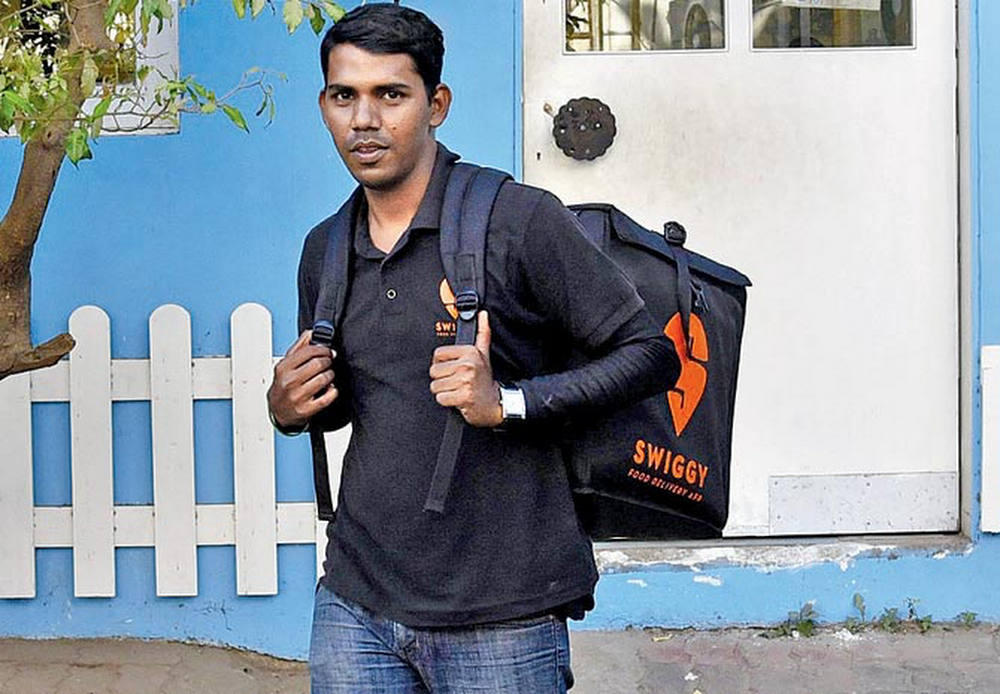
Business is booming for Swiggy as a result of leveraging location data and the cloud to meet its delivery time commitment. Business has grown 25 percent per month, and nearly 80 percent of orders come from repeat customers.

Providing online estimates for delivery times

Bigbasket, India’s largest online food and grocery store, relies on mapping data too, but allows customers to choose a time window for delivery. For those who need their deliveries pronto, the company also offers an express service that delivers orders within 90 minutes.

When customers place orders on Bigbasket’s mobile app, they set their location on a Google map. The location determines the menu of products they are shown, as well as prices. Bigbasket used the Google Maps Javascript API and worked with Google partner Media Agility to build a web-based app for the company’s backend that tracks all orders and delivery progress. Dispatchers use the Google Maps Directions API to match drivers with orders and customers, and the Google Distance Matrix API to estimate the time of arrival for deliveries.  The delivery recipe is working: Bigbasket has grown to four million customers, with more than one million orders every month.

Improving driver productivity and efficiency

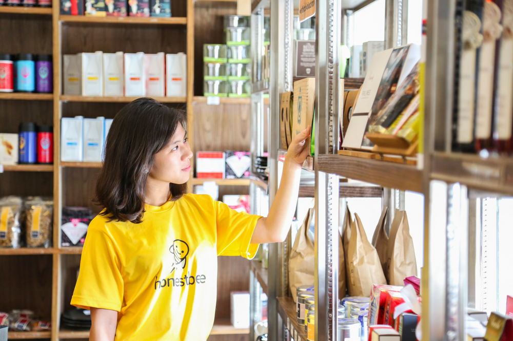
For honestbee, an online concierge and delivery service based in Singapore, the last-mile goal was to improve driver and dispatcher efficiency. Using Google Maps, honestbee created a web-based map that shows the locations of drivers and their pickup and dropoff destinations.

The company uses the Google Distance Matrix API to build a batching engine, which automates dispatching drivers, and optimizes pickup and dropoff points. In instances where deliveries are too complex to be automatically handled by the batching engine, dispatchers match drivers with customers using a web-based map built with the Google Maps Javascript API.

special-delivery-2

Timely and speedy delivery plays a key role in customer satisfaction in today’s on-demand world. With accurate cloud-based mapping resources, merchants are finding ways to shave off precious minutes from last-mile delivery routes so customers keep coming back.

Source: Google LatLong


How Google Maps APIs are fighting HIV in Kenya

In 2015, the Joint United Nations Programme on HIV/AIDS (UNAIDS) and mobile analytics solutions provider iVEDiX  came together to create the HIV Situation Room, a mobile app designed to help fight the HIV epidemic in Kenya. The app uses Google Maps APIs to create a comprehensive picture of HIV prevention efforts, testing and treatment — and make this programmatic data accessible both to local staff in clinics and others on the front lines, as well as to policy makers.

We sat down with Taavi Erkkola, senior advisor on monitoring and evaluation for UNAIDS, and Brian Annechino, director of government and public sector solutions for iVEDiX, to hear more about the project and why they chose Google Maps APIs to help them in the fight against HIV.

How did the idea for the UNAIDS HIV Situation Room app come about?

Taavi Erkkola: As of 2015, UNAIDS estimates a total of 36.7 million people living with HIV globally. Of those, 2.1 million are newly infected, with approximately 5,700 new HIV infections a day. Sixty-six percent of all infected by HIV reside in sub-Saharan Africa, and approximately 400 people infected per day there are children under age 15. To effectively combat HIV, we need access to up-to-date information on everything from recent outbreaks and locations of clinics, to in-country educational efforts and inventory levels within healthcare facilities. UNAIDS has a Situation Room at our headquarters in Geneva that gives us access to this kind of worldwide HIV data. But we wanted to build a mobile app that provided global access to the Situation Room data, with more detail at a national, county and facility-level.

We tested out the app in Kenya because the country has a strong appetite for the use of technology to better its citizens’ health. Kenyan government agencies, including the National AIDS Council, encouraged organizations like Kenya Medical Supplies Authority (KEMSA) and the Ministry of Health to contribute their disease control expertise and data to the Situation Room solution. Kenya's President Uhuru Kenyatta was an early advocate, and has demonstrated his government’s commitment to making data-driven decisions, especially in the fight against HIV and AIDS.

UNAIDS-1

Why did UNAIDS and iVEDiX choose Google Maps, and how did you use Google Maps APIs to build the HIV Situation Room app?

Brian Annechino: In Kenya, more than 80 percent of adults own a cell phone, and Android is by far the most popular operating system. Google Maps APIs are available across all platforms, including native APIs for Android, and Google Maps also offers the kind of fine-grained detail we needed — for example, the locations of more than 7,500 Kenyan healthcare facilities servicing the HIV and AIDS epidemic. Using data from multiple sources along with Google Maps, we can map things like a clinic’s risk of running out of antiretroviral medicine.

Onix,aGoogle Premier Partner, identified the right Google Maps components to build the app and helped us procure the licensing we needed. We used the Google Maps Android API to build the main interface. Since it was important to have the most accurate and up-to-date map data for Kenya to support the effort, we used the Street View feature of the Google Maps Android API to let people zoom into the street level and see clinics that offer HIV services in locations where Street View imagery is available.

TE: These mapping capabilities are critical because we need to give our county-level users as much insight as possible on service delivery at health facilities. Decision-makers in HIV response are at national and county-level. In this app, we’re able to combine multiple data sources to get a more comprehensive picture of HIV prevention efforts, testing and treatment across these levels.

What kind of data does the HIV Situation Room app display?

TE: The app taps into three data sources. The first is UNAIDS data set about country-by-country HIV estimates. The second is Kenya’s District Health Information System, which has detailed information from all 47 Kenyan counties — everything from the number of people treated at a specific hospital for HIV, to the number of HIV+ pregnant women attending clinics for visits, to the number of condoms distributed by each facility. The third data set will include community level data, which can also contain survey responses from clients about the quality of service they receive.

UNAIDS-2

How does the HIV Situation Room use the data?

TE: By overlaying our inventory data and field notes on a map, we can see patterns and identify trends that help us respond quickly and plan efficiently. For example, if we see breakouts occurring in a particular area, we can monitor HIV test kits in that area or increase educational efforts for target communities.

Have you seen signs that your efforts are making a difference in Kenya?

TE: One of our biggest successes in Kenya is that the app is used by the highest-level decision-makers in the country — President Kenyatta uses the app — as well as people on the front lines fighting HIV, such as program managers. Using the app, policy makers have more information than ever before, and as a result, are able to devise more effective solutions by combining insights at the local and program coordination levels. We see it as an extremely powerful tool for fighting HIV — and we’re looking to bring this tool to other countries in Africa soon.

Source: Google LatLong


Let your loved ones know you’re safe with our new personal safety app

Whether it’s hiking alone or walking down a street after dark — sometimes you want to know someone's got your back. To help you feel safe and give your friends and family peace of mind, today we're launching Trusted Contacts. This new personal safety app lets you share your location with loved ones in everyday situations and when emergencies arise — even if your phone is offline or you can’t get to it. 

Here’s how it works: Once you install the Android app, you can assign “trusted” status to your closest friends and family. Your trusted contacts will be able to see your activity status — whether you’ve moved around recently and are online — to quickly know if you're OK. If you find yourself in a situation where you feel unsafe, you can share your actual location with your trusted contacts. And if your trusted contacts are really worried about you, they can request to see your location. If everything’s fine, you can deny the request. But if you’re unable to respond within a reasonable timeframe, your location is shared automatically and your loved ones can determine the best way to help you out. Of course, you can stop sharing your location or change your trusted contacts whenever you want.

TrustedContactsGIF

Here’s a little more detail on how Trusted Contacts might work, starring Elliot and Thelma:

personalsafety app_contacts.png

Get help even if your phone’s offline

Elliot heads out for a hike on his own, telling Thelma he’ll meet her for coffee later. About an hour in, Elliot realizes he’s strayed off the path and lost service. When Elliot doesn’t show up at the coffee shop, Thelma starts to worry. Because Trusted Contacts works even if a phone is offline, Thelma requests Elliot’s location and in five minutes can see that his last known location was in the middle of the canyon. Thelma calls the nearest ranger station, they send out a rescue party, and find Elliot in a few hours.

personalsafety app_2.png

Invite a trusted friend to virtually walk you home if you feel unsafe

Elliot stayed at the office later than normal and notices it’s awfully dark out. He opens Trusted Contacts and shares his location with Thelma. Now Thelma can walk him home — virtually. When Elliot gets home, he simply taps the banner at the top of the screen or from the lockscreen and stops sharing his location.


screen_sharing_notif.height_800.png

Whether you just need a little reassurance or you’re actually in an emergency, Trusted Contacts helps connect you with the people you care about most — at the times you need them most. Download Trusted Contacts today from the Play Store and visit the help center for more info. If you're an iOS user, click here to get notified when the iOS app is available

Source: Google LatLong