Author Archives: Google LatLong

Cruising around a supervolcano lake in Street View

Around 75,000 years ago (give or take a couple of millennia), a supervolcano erupted on the island of Sumatra in Indonesia, throwing out so much ash that it created a volcanic winter lasting several years. The eruption was so massive that the volcano collapsed under its own power, creating the caldera we now call Lake Toba.


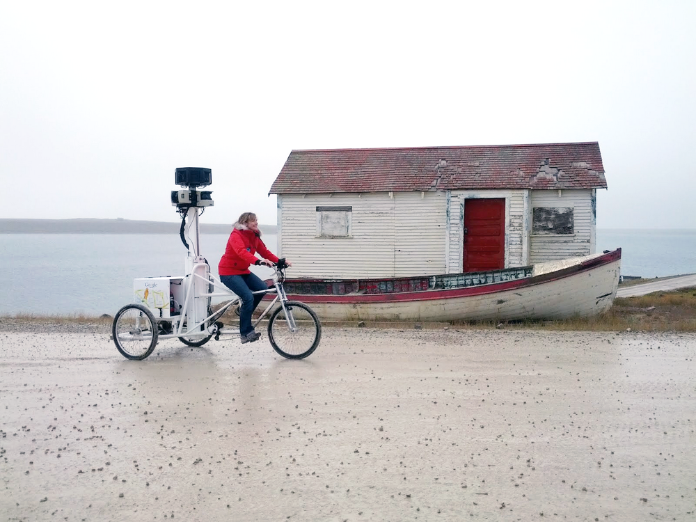
At over 100 kilometers long and 30 kilometres wide, Lake Toba is the largest volcanic lake in the world. A small team of Googlers spent the last two months scouring every meter of its coastline, using a Street View Trekker mounted on a boat,  to collect gorgeous 360-degree imagery around this former supervolcano.


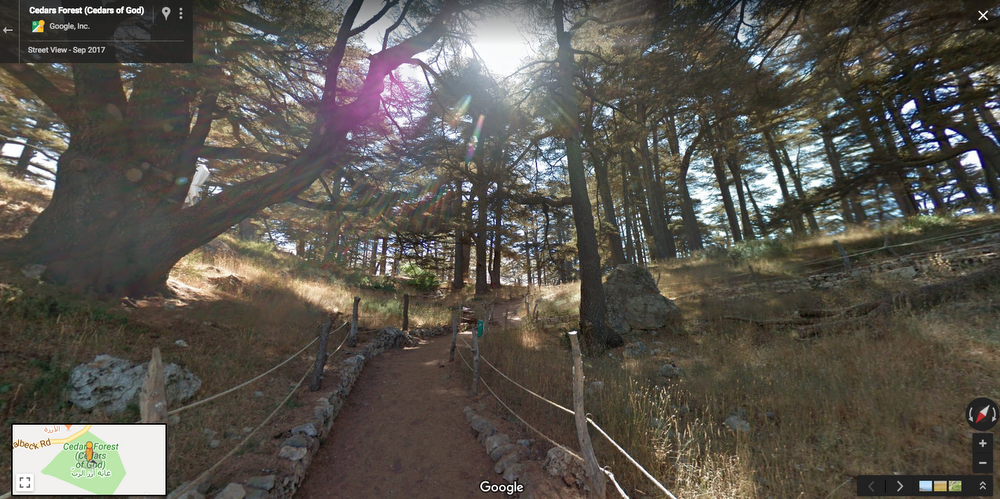
It may have been a fiery pit of lava in the distant past, but today, Lake Toba is a lush Indonesian rainforest, home to an abundance of native animals like orangutans and tapirs. We weren’t able to catch any of these creatures in the imagery, but we did get a lot of other natural attractions.

Lake Toba looms large in the imagination of the Batak, the people who have inhabited the area for centuries. According to Batak legend, a fisherman caught a fish that turned into a beautiful princess. She married him on the condition that he never reveal her true origin. One day, in a fit of impatience at their son, the fisherman called him a son of a fish. When the princess heard her husband had broken his oath, she told her son to climb to the highest peak in the area. She prayed and it began to rain so hard that the resulting flood created a huge lake. The peak, which her son was on became the island of Samosir, revered by the Batak in the area as their original home. The princess? She went back to being a fish!


Today we invite you to explore Lake Toba, now part of our Street View collection of other amazing places in Indonesia like Borobudur and the sites for the 2018 Asian Games.

Source: Google LatLong


Tackle your bucket list with Reserve with Google

The next time you're looking for something fun to do, Google can help you take that surfing class you’ve been dreaming of or visit that amazing museum you’ve been thinking about. You can now book top attractions, activities, and more, directly from Google Search, Maps, and the Assistant via Reserve with Google. From the UNESCO World Heritage Site Casa Batllo in Barcelona to urban kayaking in Chicago, booking an activity is easier than ever before.


Just look for the “Find tickets” button on a place listing (or the “Schedule” button on the Assistant) and tap it. From there you can explore your options, select the number of tickets you need, prepay, and be on your way.


These bookings are possible thanks to integrations with partners like Peek and Tiqets. Additional activities with more businesses will become available as we add new partners like Accesso, Checkfront, CourseHorse, Fareharbor, Musement, Rezdy, and TripAdvisor Experiences.


If you aren’t ready to fly to Paris to visit the Eiffel Tower just yet, don’t worry! You can also book at hundreds of thousands of restaurants, salons, and fitness studios (and more!) in your own backyard right from Google Search, Maps, and the Assistant.


Source: Google LatLong


5 ways to use Google Maps on Apple CarPlay

Google Maps is now supported by Apple CarPlay, which means that iPhone users can navigate with Google Maps right from their car’s built-in display. Read on to learn how to get the most out of the new experience:


Real time information when you need it: Google Maps on CarPlay features the same navigation experience found in the app. Search for places, see alternative routes and get live, up to date  information about traffic jams and delays happening right now. See an up to the minute ETA so you know exactly when you’ll be at your destination.


Never miss a beat.You know the drill. You’re rushing out the door, and you immediately start navigating on your iPhone to see how long it’ll take you to get to your destination. Google Maps on CarPlay lets you start navigation from your iPhone and immediately pick up where you left off once you’ve connected to CarPlay - because we know that minutes matter when you’re pressed for time.


No data? No problem.You can still find your way even if you have spotty reception or an expensive data plans. Whether you’re camping in the wilderness or traveling abroad, you can use downloaded maps of an area  so you can see directions and use turn by turn navigation even when you can’t get online.


These are a few of our favorite things:If you’re obsessed with creating lists likewe are, you’re in luck. You can access any of your saved lists from Google Maps on CarPlay, and quickly navigate to all of your favorite places with a single tap.


Save time when commuting: If you've set up your commute within the app, you can quickly navigate to home or work. While en route, you’ll see real time traffic updates about your journey so you can be prepared for whatever the ride has in store.


Google Maps is now available to use with CarPlay on all CarPlay supported vehicles and devices globally.

https://www.apple.com/ios/carplay/

To get started, make sure your iPhone is running iOS 12, update your app to Version 5 in the App Store and connect your iPhone via CarPlay. Have an Android phone? Make sure to check out Google Maps onAndroid Auto.

.

Source: Google LatLong


Building the map of Canada’s north

In the winter, the sun barely scrapes the horizon in Canada’s high north. The average lows hover in the -30s, roads are covered in snow and polar bear sightings aren’t uncommon. For those who call Canada’s arctic home, winter is a way of life. And the only way to truly understand it, as one resident put it to us, is to see it for yourself.

In 2012, teams from Google Canada and Google Earth Outreach touched down in the tiny fly-in community of Cambridge Bay, Nunavut, beginning an ambitious program to map the towns, wildlife and parks of Canada’s arctic. At the time, the digital maps of Canada’s north needed work. When you searched for a shop, a hospital or a school, the map pins would all land on the same spot: the post office, because that’s where every person and every business had a PO Box. While traditional cartography had captured the inlets and tundra of the north’s physical geography, there were no digital maps that accurately reflected the world of the people living there.

Street-View-Trike_CambridgeBay.png

Trike in Cambridge Bay

In addition to collecting Street View imagery of the town and surrounding landscape using an oversized tricycle, we worked with the nonprofit, Nunavut Tunngavik, to conduct a “map up” in the local community center. The people of Cambridge Bay, a hamlet of 1,500 people north of the arctic circle, added streets, places of worship and homes directly to the Google Map. This was about more than simply making an accurate and useful map—it was about building a virtual bridge between the communities of Canada’s north and the world.

Anna Nahogaloak is an Inuit elder and renowned seamstress in Cambridge Bay. “People are always asking how we live, how we survive,” she said the first time she saw the map zoom in on her village in Google Maps. “I think that it is important for all people to see Nunavut. This will help them understand and learn more about Nunavut. I think that it is important for Inuit people to contribute to the maps. It is important for everybody. The land is everybody’s land. We all share it.”

After Cambridge Bay, our work in Canada’s north expanded, and the newly developed Trekker allowed us to bring our Street View cameras to even more remote spots. Our teams traveled to Iqaluit, collecting Street View imagery from the frozen streets of Nunavut’s capital, conducting another map up and exploring the frozen landscape from the back of a dogsled. We also partnered with Parks Canada to collect Street View imagery from Canada’s northern parks, including Quttinirpaaq National Park. Located just 500 miles (800 kilometers) from the north pole, it remains the most northern Street View imagery on Google Maps.

To support the conservation efforts of Canada’s arctic wildlife, over the past several years we worked with Polar Bears International and the Arctic Eider Society to take the Street View beyond the towns and onto the arctic’s tundra and ice flows. PBI strapped the trekker to a “tundra buggy” to capture polar bears in their natural environment. And we climbed on board a snowmobile to travel onto the ice of Hudson’s Bay to the small open pools of water where the eider ducks of Canada’s far north spend their winters. The Canadian arctic remains ecologically fragile, vulnerable to the impacts of climate change. Street View provides a window for Google Maps users worldwide to explore these fragile habitats.

Bringing Street View to Canada’s arctic gets us closer to our ultimate goal of creating the world’s most comprehensive, accurate and usable map. But it’s also more than that. For any community's sense of place in the digital age, they need to be on the map—that’s as true in Toronto as it is in Sanikiluaq (look it up). Chris Kalluk, who lives in Nunavut and helped us collect the Street View imagery of Canada’s north, thinks about it this way: “Our home is a place with a vast amount of local knowledge and a rich history. By putting these tools in the hands of our people, we will tell Nunavut’s story to the world.”

As we reflect on Google’s 20th birthday this month, we think the story of Canada’s arctic is a story worth being told.

Source: Google LatLong


Air View is ready to expand to more places around the globe

Clean air is critical to life on Earth, yet over90 percent of the world’s population breathes polluted air. Over the past few years, we’ve been using a handful of Street View vehicles to gather air quality measurements, which can produce insights at the neighborhood level and can help cities become smarter and healthier.


Along with Aclima, we've been testing air quality equipment with the goal of fine-tuning their mobile-friendly air sensors to a point where they deliver accuracy comparable to laboratory-grade instruments.  After years of effort we’ve now achieved this goal. Today, we’re announcing that we will expand our air quality mapping to more Street View cars in more places around the globe. The locations are to be determined, but we have 50 air quality sensor-equipped Street View cars ready to hit the road.

During our initial research phase, Google and Aclima tested air quality equipment on a few Street View cars. Each car was installed with two sets of instruments: the first set contained laboratory-grade air quality reference instruments that are typically used for government air quality monitoring. This equipment is expensive and big, so it’s hard to deploy on a large number of vehicles. The second set had Aclima’s smaller, more mobile-friendly, air sensors that enable us to deploy in higher numbers. With both sets of equipment side-by-side, we've been able to validate their performance, and we’re now confident that the smaller Aclima sensors are ready to be deployed in 50 Street View cars.

Air View 1

Aclima’s sensor node in a Street View car.

This expansion builds upon work we’ve done in California over the past year. Our partners at the Environmental Defense Fund (EDF), University of Texas-Austin, and Aclima published a study showing that our mobile measurements can produce a map of air quality changing block by block. Scientists with Kaiser Permanente and EDF used the data to show a link between street-level air pollution and heart disease among the elderly. We began sharing the validated scientific air quality measurements with researchers, and will continue to make all of the street-level air quality data captured to date accessible with over 250 million measurements over four years and more to come with this expansion. Scientists and researchers are invited to request access to this data for air quality studies here.

Air View 2

Left: Black carbon particles come from burning fuel, especially diesel, wood and coal. Air quality data from Google and Aclima; analysis by Apte et al/EDF. Right: Air quality measurements in the San Francisco Bay Area region. Air quality data from Google and Aclima.

The measurements captured by these specially-equipped Street View cars around the world will show a snapshot of air quality at a moment in time, and can be used by scientists to combine with other data to develop air quality models. With this data, cities will be able to make more informed decisions and accelerate effort in their transition to a healthier city.

Source: Google LatLong


Bringing the magic of Lebanon to the world

If it was up to me, everyone would get to visit my home country, Lebanon (and they’d have a long list of things to do and sites to see). But for those who can’t get to experience it in person, we’ve just added 41 iconic sites—from ancient temples to heritage sites and natural forests—to Street View.

Screen Shot 2018-09-02 at 10.56.55 AM.png

The National Museum of Beirut was constructed between 1930 and 1937. As a result of the Lebanese Civil War, the museum had to close for over two decades but re-opened in 2016.

Lebanon is beautiful and diverse. If you were visiting in person, I’d suggest starting the tour with a manoushe on the go—it’s a flatbread with Zaatar (a thyme herb mix) you can get from the corner baker’s oven on Hamra street, one of the busiest districts in Beirut.  But if you’re doing the tour virtually, let’s begin.

l2

Rock of Raouché, also known as Pigeons' Rock. The rock formations will leave you feeling inspired.

Thanks to Street View, you can now discover one of the 14 worldwide landmarks and greatest natural wonders, the breathtaking Jeita Grotto. Discovered in 1836, the caves were used as an ammunition store during the civil war. With a length of 9 kilometers (5.6 miles), Jeita Grotto is the longest cave system in the Middle East, split into two sections. You can now virtually visit the underground river, and then watch the dazzling rock formations at the upper cave.

Screen Shot 2018-09-02 at 12.55.59 PM.png

Jeita Grotto, also known the Pearl Nature in Lebanon

Take in some culture and explore the rich history of Lebanon by heading East to Baalbek, one of the mysterious ruins of the Roman Empire, also called City of the Sun. There’s something special about this modern city with all the Roman structures at its heart.

Screen Shot 2018-09-12 at 12.29.42 AM.png

Head to Byblos, one of the 20 world’s oldest cities and the first city of Phoenicia. Byblos today bridges the ancient with the modern, and with Street View, you can virtually stroll the street markets in Byblos and enjoy the coastal view during sunset.

Screen Shot 2018-09-07 at 10.52.41 PM.png

Established in 5,000 B.C., Byblos is considered as one of the oldest continuously inhabited settlements in the world.

Just 37 miles (60 kilometers) from the capital Beirut, visit Shouf Cedar Reserve,  the largest nature reserve in Lebanon, and home to the Cedar tree, the emblem of the Lebanese national flag. There are many trails for hiking—each will unveil a new layer of natural beauty.

Cedars Forest (Cedars of God).png

Al Shouf Cedar Nature Reserve encloses 3 Cedar forests and is home to 200 unique birds.

My trips to Beirut are never complete without stopping to revisit  the American University of Beirut, one of the oldest universities in the Arab world.   Located in the city of Hamra, the campus sits on a hill overlooking the Mediterranean Sea, spread across 61-acres of beautiful landscape.

Issam Fares Institute - AUB - Street View.png

The Issam Fares Institute for Public Policy and International Affairs building by late architect Zaha Hadid at the American University of Beirut.

I encourage you to also check Google Arts & Culture and see a special showcase. And whether you continue your journey on Google Maps or get inspired to visit in person, I hope you’ll get a deeper appreciation for this small but magical country in the Middle East.

Source: Google LatLong


The more you know: Turning environmental insights into action

This week, thousands of leaders from cities, states, businesses, investors, and environmental organizations—including representatives from Google—will gather in San Francisco, CA at theGlobal Climate Action Summit to commit to raising the level of ambition in the fight against climate change. National governments around the world have committed to take action, but cities and businesses have an equally critical role to play in reaching a zero-carbon future. That's one reason we're excited about today's announcement of a new tool aimed at helping cities lower emissions.


Cities as diverse as New York, Berlin, Oslo, and Rio de Janeiro have committed to reducing their carbon footprint by 80 percent within the next 30 years. These cities rely on huge carbon data sets as a measuring stick to help identify where they may be able to cut emissions.  But many cities lack the resources to gather data such as building emissions, making it hard for them to set firm carbon commitments of their own.

The Environmental Insights Explorer (EIE), a new online tool we created in collaboration with the Global Covenant of Mayors for Climate & Energy (GCoM), is designed to make it easier for cities to access, and act upon, new climate-relevant datasets.  By analyzing Google’s comprehensive global mapping data together with standard greenhouse gas (GHG) emission factors,  EIE estimates city-scale building and transportation carbon emissions data, as well as renewable energy potential, leading to more globally-consistent baselines from which to build policies, guide solutions, and measure progress.

Introducing The Environmental Insights Explorer

To date, more than 9,000 cities have made commitments to comply with the Paris Agreement, which presents a formal plan and timeline to phase out reliance on fossil fuels. But less than 20% have been able to complete, submit or monitor greenhouse gas inventories.

The process for building out a baseline emissions inventory can take hundreds of thousands of dollars and months or even years. “The vast majority of cities aren’t in the position to finance a process that will take time and might be cost prohibitive, especially the small to medium cities in developing areas of the world. And that’s where most of the action will take place in relation to the Paris Agreement on climate change,” explains Amanda Eichel, the executive director for the global secretariat at GCoM, an international alliance of nearly 10,000 cities and local governments committed to fighting climate change.

With EIE, data sets that once required onsite measurements and many months to compile can now be assessed virtually, reducing cost and time investment that prevents cities from taking action.

Data packaged to prompt action

On the EIE site, data is freely available in four categories: building emissions, transportation emissions, energy offset potential, and 20-year climate projections. Clicking on “Building emissions,” for example, brings up detailed maps visualizing the emissions impact for both homes and non-residential buildings.

In each category, you can drill down into more specific statistics, including percentage breakdowns of emissions, the time period from which the data was culled, key assumptions made. You can also find links to other critical information, such as ways to reduce emissions.

BA

Emissions data gets more specific the deeper you get into the site.“This tool will provide us with much more precise data on the flow of transport emissions and the potential of the City to generate solar energy,” says Buenos Aires Mayor Horacio Rodríguez Larreta. “It is a key input to design policies that reduce emissions and make Buenos Aires a smarter, greener and more sustainable and resilient city.”

In addition to helping policy makers, planners, and researchers set city-wide emissions policies, the data can inform specific projects like new investments in solar, public transit, or mobility alternatives to reduce vehicle traffic. For example, a city could track a new transportation line’s potential impact on the city’s emissions profile before deciding whether to move forward and scale the project. Or a city could explore how transitioning some percentage of short car trips to bicycle trips would lower the overall carbon footprint. "Now we can bring data analytics to conversations about renewable energy and show people that they’re able to generate enough solar power for their entire city," says Brad Petry, Head of Data Analytics, Victorian Centre for Data Insights. Victoria's state government has set targets for 25 percent renewable energy by 2020 and 40 percent renewable energy by 2025.

Melbourn

EIE estimates total solar potential for rooftops to show how much renewable power could be generated, helping cities evaluate ways to reduce overall building energy emissions.

Filling an information gap, collaboratively

EIE arose from a decade’s worth of climate-related projects at Google, including Project Sunroof, a tool that measures rooftop solar energy potential, and Earth Engine, a platform for geospatial analysis. Collectively these projects in conjunction with other Google data sources like building and transportation data, were pulled together to reveal valuable insights about cities' carbon impact—information that we realized could play a critical role in encouraging action by policy makers, city officials, and others.  But to be effective, the information needed to be packaged for easier absorption and more importantly, action.

We started by partnering with GCoM, founded by global city networks and supported by Bloomberg Philanthropies and the European Union,  which has been gathering the same comprehensive data we wanted to surface in our tool through other sources and methodologies. GCoM also has detailed knowledge of the intricacies of environmental policy and the political hurdles hindering change and action.

We shared our data inventories with one another, and GCoM helped connect us to different cities around the world to get their input on what they’d find most useful to help reach their emission goals. The methodology used to source, aggregate and distill the EIE data sets can be reviewed on the site. To ensure quality, we initiated a rigorous quality-assurance process months before launch.

Building

A work in progress

We're introducing EIE in beta today, covering a handful of pilot cities including Melbourne, Australia; Buenos Aires, Argentina; Victoria, Canada; Pittsburgh, Pennsylvania; and Mountain View, California. But in time, we plan to make this environmental information available to thousands of cities, towns, and regions around the world. As more cities use this data, and as science evolves, we plan to iterate and expand on the tool, methodologies and datasets.  

Even providing thousands of cities with comprehensive, action-oriented datasets is just one piece of the emissions mitigation puzzle. Still, we’re excited to take this first step today with GCoM and pilot cities on a journey to accelerate global ambition and action toward a low-carbon future.

Learn more about Google’s other sustainability efforts in our 2018 Environmental Report and on sustainability.google.


Source: Google LatLong


Take a spin around the Indianapolis Motor Speedway in Google Maps

I was eight years old when my dad took me to my first Indianapolis 500, one of the most prestigious car races in the world. It was unlike anything I’d ever experienced before—the track was buzzing with hundreds of thousands of loyal fans overshadowed only by the sound of the cars speeding by. The excitement was contagious and the sheer power of the race cars is otherworldly. From then on, I’ve attended nearly every race with my Dad. As a “Hoosier,” born and raised in Indiana, I’ve always felt a connection to this event—steeped in tradition and alive with fans like me who return every year and sing “Back home again in Indiana.”

While the true feeling of the Indy 500 can only be experienced in person, I wanted to bring a taste of it to people who have never been and to those who want to revisit their past experiences there. I work in the Global Business Organization at Google, so I reached out to our Street View team to see if we could bring the track to Google Maps. They sent a Street View Camera around the track just moments before the green flag was waved, and 3 months later, it’s on Street View for all to enjoy. Starting today, you can take a spin around the infamous Indianapolis Motor Speedway and get closer to the action on your phone or computer.

Start your engines and take a spin around the track in Google Maps. For a higher speed look, check out IMS.com/RaceView.

Source: Google LatLong


#ThisisFamily: how we’re celebrating Pride

It’s the middle of the middle month of a choppy year and I’m thinking about how we stay steady. I’m thinking about ballasts, the heavy things—weighty, substantive—employed in ships to lend balance. My ballast is my family, and I’m lucky enough to have a few. There’s the family of my blood, those mad geniuses who share my last name; the family of my friends, wild spirits exploring the limits of what’s possible; and, last but not least, the family I walked into when I came to Google.

This Pride, Google and Google’s LGBTQ+ community are celebrating families big and small, chosen or inherited, as part of #ThisIsFamily. We encourage you to post on social media about the people who make up your family (no matter how you define it) and to donate to nonprofits like PFLAG, It Gets Better and GLAAD. Google.org has pledged to match up to $100,000 in total in donations to these three organizations during the month of June.

That’s not the only way we’re celebrating Pride. In typical Google fashion, we’re helping you connect with the world around you (and having a bit of fun) across our products:

  • In Google Maps, this year's parade routes are paved with rainbows.
  • You'll find rainbow "easter eggs" scattered through Google Search and G Suite, and you can join the fun from your desktop by switching your Gmail to a Pride theme for the month of June.
  • Google Play Newsstand has a special feature page for Pride-related coverage.
  • On YouTube, we're celebrating the LGBTQ+ creators who are #ProudToCreate a better future with their imagination, creativity, talent, and truth through our YouTube Spotlight Channel, Twitter, and Instagram.
  • We continue to help businesses declare their establishments "LGBTQ+ Friendly" or "Transgender Safe Space" on their business listings in Google Maps and Google Search.
  • One year on from our initial donation to the LGBT Center of New York in collaboration with the National Parks Foundation, Google.org is contributing another $500,000 (for a total of $1.5 Million) to the Center to help with the digitization of LGBTQ+ history. The project is called Stonewall Forever, and we need your help to find, preserve, and share the untold stories of LGBTQ+ history.
  • Google Arts & Culture has a dedicated Pride collection celebrating LGBTQ+ history, with 20 exhibits and over 2,700 artifacts, part of which comes from the Stonewall Forever project. 

Ballasts, like families, help us stay steady amidst commotion. Paradoxically, maybe, these heavy things also lift us up.

Celebrating Pride, from our families to yours.

Source: Google LatLong


Google for Brazil: Technology that serves people’s needs, wherever they may be

It's a constant challenge to ensure that technology works well for people with different needs around the world, especially where connectivity is limited and basic smartphones are the main gateway to the internet. Today, at our second annual Google for Brazil event in São Paulo, we shared updates on how we're making our products work better for people in Brazil—and elsewhere in the world. We also gave an update on our efforts to make the internet more inclusive, highlighting a new initiative in Brazil to empower women to succeed in a digital world.

Google for Brasil.jpg

New soccer experience on Search

Given Brazil's passion for soccer, we couldn't think of a better place to kick off an enhanced experience for football fans on Search, just in time for the World Cup. For this year's tournament in Russia, fans everywhere will be treated to a new immersive experience that includes group tables, stats, trending players and a host of other features that let you follow matches in real time and see highlights on your phone. For more about all that we've prepared for soccer fans, check out our World Cup post.

World Cup Search on Google

Android Go coming to Brazil

As an open source platform, Android has helped democratize access to the internet in places like Brazil. But for more people to come online, they need affordable smartphones that offer a smooth experience when browsing the web and using apps. That's why we developed Android Go, a lighter version of our OS optimized for entry-level devices. Android Oreo (Go edition) is now coming to Brazil on new devices made by our partners Positivo, Multilaser and Alcatel—an important step in our efforts to give more people access to computing.
Android Go

Brazil elections on Search

2018 is an election year in Brazil, and we want to connect voters with useful and reliable information as they prepare to vote in October. In that spirit, we're planning features on Search that will allow Brazilians to stay up to speed on key dates, the candidates and other critical information about the election. We're also adding the option for presidential candidates to post statements directly on Google about where they stand on key issues. And on election day, you'll be able to keep track of the results on Search.


When the campaign kicks off in August, we'll roll out a Google Trends hub for Brazil that offers an overview of the race through the lens of Search. The hub will be a one-stop shop for data about search interest in candidates and their parties, the most searched questions and other related queries, all in real time.

Eleições - Celular - João Android - Painel do Conhecimento.png

More local Actions on the Assistant

We launched the Google Assistant in Brazilian Portuguese less than a year ago, and Brazil is now among the top three countries in daily active users. Portuguese is also the second most popular language for Assistant usage on smartphones.


Brazilians already use the Assistant to send WhatsApp messages, play music on Spotify, and watch videos on YouTube or Netflix. Now we’re working with more than 30 local partners to bring more Actions to the Assistant. In the next few months, Brazilians will be able to order a pizza with iFood, book a table with Restorando, hail a ride with 99 and do much more by using nothing but their voice.


Enhancing Maps for Brazilians

A new feature on Maps will help Brazilians navigate a São Paulo law that restricts motorists from driving in designated parts of the city during peak traffic hours one day a week. All they need to do is give the last number of their license plate and Maps will provide customized directions to avoid restricted areas.


We’ve also more than doubled the number of Brazilian cities on Maps with real-time transit information, to 15 from six. The list now includes cities like Campinas, Caxias do Sul, Uberaba and Campina Grande.
Google Maps - Rodízio São Paulo.png

Art Selfie debuts in Brazil

Remember those fun selfies resembling famous artworks that went viral earlier this year? Well, now the Art Selfie is making its Latin American debut in Brazil. Brazilians can find an artistic match for their selfie in Google Arts & Culture's vast collection, which includes masterpieces from institutions such as São Paulo's Pinacoteca and Rio de Janeiro's Museu Nacional de Belas Artes. Give it a try on the Arts & Culture app.


Grow with Google

Grow with Google offers free training sessions, tools and events to help people grow their skills, career or business. We've taken Grow with Google to four cities in Brazil already, training 17,000 people, and plan to hit four more states by year-end.
Cresça com o Google - Brasília.jpg

A Grow with Google session for 3,000 people in Brasilia in May

Technology can also play a key role in helping to reduce gender inequality. That’s the thinking behind Womenwill, which aims to create economic opportunities for women. We brought Womenwill to Brazil in March, and since then more than 2,500 women have undergone training in leadership, negotiation techniques, personal finance and digital marketing.


While that's a promising start, there is much more to do. Today we announced a Google.org grant of $1 million for Instituto Rede Mulher Empreendedora, a Brazilian nonprofit that promotes and supports entrepreneurship among women. The grant will help them train up to 135,000 women in Brazil over the next two years.


We hope that each of the announcements we made today will have an impact on people's lives in one way or another. And we remain committed to bringing the transformational power of technology to people everywhere.

Source: Google LatLong