Partners have already started using Global Fishing Watch and have committed to providing additional data sources for greater impact:
- Indonesia’s Minister of Fisheries and Marine Affairs, Susi Pudjiastuti, has committed to making the government’s Vessel Monitoring System (VMS) public in Global Fishing Watch in 2017. Ibu Susi has been a progressive leader for transparency in fisheries with other governments now expressing similar interest to collaborate.
- Food and Agriculture Organization of the United Nations will collaborate on new research methodologies for reporting spatial fishery and vessel statistics, building on Global Fishing Watch and developing transparency tools to support their member states in improving the monitoring, control and surveillance of fishing activities.
- Trace Register, a seafood digital supply chain company, has committed to using Global Fishing Watch to verify catch documentation for its customers such as Whole Foods.
- Bali Seafood, the largest exporter of snapper from Indonesia, has teamed up with Pelagic Data Systems, manufacturers of cellular and solar powered tracking devices to bring the same transparency for small scale and artisanal fishing vessels, into Global Fishing Watch as part of a pilot program.
We’ve also developed a Global Fishing Watch Research Program with
10 leading institutions from around the world. By combining Google tools, methodologies, and datasets in a collaborative environment, they’re modeling
economic, environmental, policy, and climate change implications on fisheries at a scale not otherwise possible.
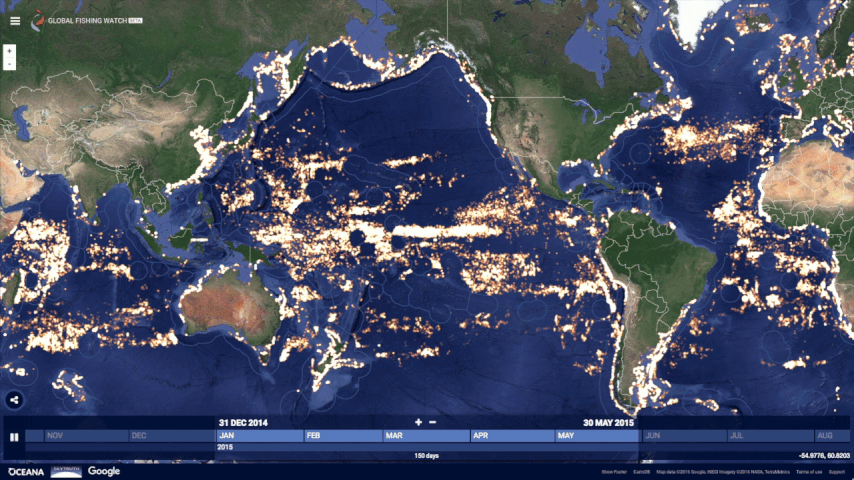
Global Fishing Watch was not possible five years ago. From a technology perspective, satellites were just beginning to collect vessel positions over the open ocean, and the "global coverage" was spotty. There has been tremendous growth in machine learning with applications in new fields. Policy and regulatory frameworks have evolved, with the United States, European Union, and other nations and Regional Fishery Management Organizations now requiring that vessels broadcast their positions. Market forces and import laws are beginning to demand transparency and traceability, both as a positive differentiator and for risk management. All of these forces interact and shape each other.
Today, Global Fishing Watch is an early preview of what is possible. We’re committed to continuing to build tools, partnerships, and access to information to help restore our abundant ocean for generations to come.
Go explore your ocean at
www.globalfishingwatch.org.
 Global Fishing Watch is releasing AI-powered datasets that map global ocean infrastructure and vessels not broadcasting on public systems.